close
-
Layers w
- Weather Layers
- Pro
- Pro
- Pro
- Pro
- Pro
- Pro
- More Layers
- Pro
- Pro
- Pro
- Pro
-
Upgrade to

3D
Trail Conditions
- Unknown
- Snow Groomed
- Snow Packed
- Snow Covered
- Snow Cover Partial
- Freeze/thaw Cycle
- Icy
- Prevalent Mud
- Wet
- Variable
- Ideal
- Dry
- Very Dry
Trail Flow (Ridden Direction)
Trailforks scans users ridelogs to determine the most popular direction each trail is ridden. A good flowing trail network will have most trails flowing in a single direction according to their intension.
The colour categories are based on what percentage of riders are riding a trail in its intended direction.
The colour categories are based on what percentage of riders are riding a trail in its intended direction.
- > 96%
- > 90%
- > 80%
- > 70%
- > 50%
- < 50%
- bi-directional trail
- no data
Trail Last Ridden
Trailforks scans ridelogs to determine the last time a trail was ridden.
- < 2 days
- < 1 week
- < 2 weeks
- < 1 month
- < 6 months
- > 6 months
Trail Ridden Direction
The intended direction a trail should be ridden.
- Downhill Only
- Downhill Primary
- Both Directions
- Uphill Primary
- Uphill Only
- One Direction
Contribute Details
Colors indicate trail is missing specified detail.
- Description
- Photos
- Description & Photos
- Videos
Trail Popularity ?
Trailforks scans ridelogs to determine which trails are ridden the most in the last 9 months.
Trails are compared with nearby trails in the same city region with a possible 25 colour shades.
Think of this as a heatmap, more rides = more kinetic energy = warmer colors.
- most popular
- popular
- less popular
- not popular
ATV/ORV/OHV Filter
Max Vehicle Width
inches
US Cell Coverage
Legend

Radar Time
Activity Recordings
Trailforks uses anonymized public activity data.
?
Activity Recordings
Trailforks uses anonymized public activity data.
?
Personal Heatmap
▶
Activity Types
all
/
none
▶
Options
2
Date range
month
–
Winter Trails
Warning
A routing network for winter maps does not exist. Selecting trails using the winter trails layer has been disabled.
Missing Trails
Most Popular
Least Popular
Trails are colored based on popularity. The more popular a trail is, the more red. Less popular trails trend towards green.
Jump Magnitude Heatmap
Heatmap of where riders jump on trails. Zoom in to see individual jumps, click circles to view jump details.
BC Backroad Status
![map legend]()
Service Road Atlas is a free to use, community-driven service for viewing and creating reports on the numerous back-country service roads around B.C. and Alberta.

Slope Aspect
Direction the slope faces
Trails Deemphasized
Trails are shown in grey.
Only show trails with no bike usage.
Suggested Layers
Based on selected activity type
Save the current map location and zoom level as your default home location whenever this page is loaded.
Save
No description for Mullan has been added yet!
Login or register to submit one.
Activities Click to view
- Mountain Bike
37 trails
- E-Bike
16 trails
- Gravel Bike
5 trails
- Adaptive Bike
2 trails
- Winter Fat Bike
0 trails
- Horse
11 trails
- Hike
36 trails
- Trail Running
36 trails
- Dirtbike/Moto
64 trails
- ATV/ORV/OHV
45 trails
- Snowshoe
3 trails
- Downhill Ski
70 trails
Region Details
- 5
- 5
- 12
- 4
Region Status
Caution as of Jun 23, 2026Local Trail Association
Stats
- Avg Trail Rating
- Trails (view details)
- 144
- Trails Mountain Bike
- 38
- Trails E-Bike
- 16
- Trails Gravel Bike
- 5
- Trails Adaptive Bike
- 2
- Trails Horse
- 11
- Trails Hike
- 36
- Trails Trail Running
- 36
- Trails Dirtbike/Moto
- 64
- Trails ATV/ORV/OHV
- 45
- Trails Snowshoe
- 3
- Trails Downhill Ski
- 74
- Total Distance
- 276 miles
- Total Descent
- 77,765 ft
- Total Vertical
- 4,379 ft
- Highest Trailhead
- 7,530 ft
- Reports
- 44
- Photos
- 28
- Ridden Counter
- 7,842
Sub Regions
-
Lookout Pass Bike Park
- 3
- 4
Popular Mullan Mountain Biking Trails
• 95 ★ 3.9 • 11 miles • 3,459 ft • 941 •
The mountain bike or hike trail is 15 miles long with 10 train tunnels and 7 sky-high trestles. The ride starts with a ride through the 1.66 mile long St. Paul Pass Tunnel, also know as the Taft Tunnel. It is a highlight of the trail...
• 90 ★ 4.8 • 2 miles • 19 ft • 826 •
Popular green difficulty singletrack. This mountain bike primary trail can be used downhill primary. On average it takes 19 minutes to complete this trail.
• 100 ★ 1.0 • 794 ft • 0 ft • 23 •
Popular green difficulty dirt/gravel road. This mountain bike primary trail can be used downhill only and has a easy overall physical rating. Trail visibility is always easy to follow. On average it takes 1 minutes to complete this trail.
• 5 ★ 2.0 • 1,010 ft • 0 ft • 20 •
Bet You Can't is a relatively short singletrack that can be accessed at the final switchback of that features 8 unsupported switchbacks.
• 5 ★ 3.5 • 1 mile • 0 ft • 19 •
A very fun, albeit somewhat short, flowy single track. Approximately .5 miles into the ride it connects to a gravel service road that will take you back to the base lodge. You can really really rip down this service road and it gives...
• 5 ★ 3.5 • 1 mile • 0 ft • 16 •
Fast and flowy, through the woods and out into the clearings, with bermed switchbacks. will connect you to Bet You Can't or you can ride it to its conclusion when it intersects White Tail.
• 5 ★ 1.0 • 4,124 ft • 0 ft • 12 •
Less popular green difficulty dirt/gravel road. This mountain bike primary trail can be used downhill only. Trail visibility is always easy to follow. On average it takes 5 minutes to complete this trail.
Mullan Mountain Bike Routes
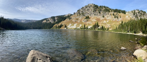
4 miles • 1,635 ft • 2 • Out & Back •
A moderate out-and-back hike to Lone Lake under the gaze of Stevens Peak.
5 miles • 1,918 ft • 1 • Out & Back •
Challenging out-and-back hike to the Stevens Lakes.
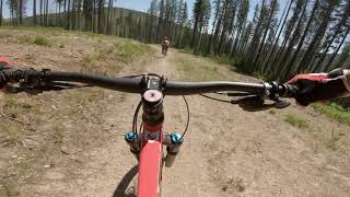
Videos of Mullan Mountain Bike

trail: Route of the Hiawatha
4:14 |
325 |
Dec 3, 2023 , Mullan
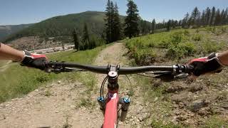
trail: White Tail
259 |
Jul 3, 2021 , Mullan
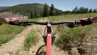
trail: Cruising
4:29 |
284 |
Jul 3, 2021 , Mullan
trail: Hell Roaring
3:35 |
458 |
Jul 3, 2021 , Mullan
Recent Trail Reports
| status | trail | date | condition | info | user |
|---|---|---|---|---|---|
| Route of the Hiawatha | Jun 23, 2026 @ 11:47am (America/Creston) Jun 23, 2026 | Ideal | kyjensen | ||
| NF-506 / Route Of The Hiawatha | Jun 23, 2026 @ 11:47am (America/Creston) Jun 23, 2026 | Ideal | kyjensen | ||
| Route of the Hiawatha | Jun 23, 2026 @ 11:47am (America/Creston) Jun 23, 2026 | Ideal | kyjensen | ||
| Stevens Lake | Nov 11, 2025 @ 10:17am (America/Creston) Nov 11, 2025 | Snow Cover Partial | Jhays79 | ||
| Idaho Centennial Trail | May 29, 2025 @ 5:41am May 29, 2025 | Dry | delmue | ||
| Ward Peak | Sep 11, 2024 @ 10:16am Sep 11, 2024 | Dry | elsquatcho | ||
| Bet You Can't | Jul 3, 2021 @ 2:58pm Jul 3, 2021 | Dry | ridethepiggy | ||
| White Tail | Jul 3, 2021 @ 2:57pm Jul 3, 2021 | Dry | ridethepiggy | ||
| Hell Roaring | Jul 3, 2021 @ 2:55pm Jul 3, 2021 | Dry | ridethepiggy | ||
| Stateline | Jul 23, 2018 @ 10:23am Jul 23, 2018 | Dry | imalwaysriding |
National Scenic Trails & Official Routes
-
Idaho Centennial Trail
- Mountain Bike
- Hike
- Trail Running
Activity Feed
| username | action | type | title | date |
|---|---|---|---|---|
| DerekI6F5jm | ridden | trail | activity #98410463 | Jul 4, 2026 @ 6:45am 4 hours |
| xlaymor | add | photo | activity #98348682 and 18 more | Jul 3, 2026 @ 10:27am 24 hours |
| xlaymor | ridden | trail | activity #98347818 and 2 more | Jul 3, 2026 @ 10:16am 1 day |
| kyjensen | add | report | activity #97673514 and 2 more | Jun 23, 2026 @ 8:58pm Jun 23, 2026 |
| Erincathmeyer | wishlist | trail | activity #97421406 | Jun 20, 2026 @ 12:12pm Jun 20, 2026 |
Recent Comments
| username | type | title | comment | date |
|---|---|---|---|---|
| trail | Dont bike it you will probably regret.Great... | Jul 26, 2025 @ 3:38pm Jul 26, 2025 | ||
| trail | I don’t know what this section of trail is... | May 28, 2025 @ 3:28pm May 28, 2025 | ||
| trail | What is shown on the map in purple is not the... | May 28, 2025 @ 3:21pm May 28, 2025 | ||
| trail | Pretty excellent tech trail for downhilling,... | Sep 10, 2024 @ 2:17pm Sep 10, 2024 | ||
| trail | August 2022, rode west from Stevens Lake... | Aug 13, 2022 @ 10:36pm Aug 13, 2022 |
Local Badges
-

Epic Ride Climb 2k98 awarded -

Climbing 10k Badge2 awarded -

Climbing 100k Badge0 awarded -

Epic Ride Descent 2k113 awarded -

Descent 10k Badge1 awarded -

Descent 100k Badge0 awarded
Bike & Skill Parks
| name | type | city | rating |
|---|---|---|---|
| Lookout Pass Bike Park | bike park | Mullan |
Activity Type Stats
| activitytype | trails | distance | descent | descent distance | total vertical | rating | global rank | state rank | photos | reports | routes | ridelogs |
|---|---|---|---|---|---|---|---|---|---|---|---|---|
| Mountain Bike | 37 | 115 miles | 27,434 ft | 58 miles | 4,311 ft | #2,895 | #1,028 | 11 | 43 | 3 | 1,609 | |
| E-Bike | 16 | 28 miles | 7,999 ft | 14 miles | 3,737 ft | #3,993 | #1,328 | 21 | 37 | 78 | ||
| Gravel Bike | 5 | #688 | #1,157 | 3 | 29 | |||||||
| Adaptive Bike | 2 | #641 | #1,861 | 2 | ||||||||
| Horse | 11 | 5 miles | 75 ft | 968 ft | 1,788 ft | #2,501 | #1,377 | 4 | 2 | |||
| Hike | 36 | 106 miles | 25,098 ft | 54 miles | 4,068 ft | #1,014 | #461 | 43 | 2 | 177 | ||
| Trail Running | 36 | 106 miles | 25,098 ft | 54 miles | 4,068 ft | #2,044 | #655 | 43 | 2 | 39 | ||
| Dirtbike/Moto | 64 | 150 miles | 34,249 ft | 77 miles | 3,425 ft | #179 | #109 | 4 | 1 | |||
| ATV/ORV/OHV | 45 | 104 miles | 15,446 ft | 48 miles | 2,336 ft | #279 | #91 | 4 | 1 | |||
| Snowshoe | 3 | 12 miles | 5,384 ft | 7 miles | 2,205 ft | #772 | #347 | 1 | 11 | |||
| Downhill Ski | 70 | 25 miles | 21,388 ft | 23 miles | 1,634 ft | #331 | #132 | 1 | 929 |
Frequently Asked Questions About Mullan
▼
What are the best places to ride in Mullan?
Mullan has 2 areas to explore for mountain biking. The top rated areas are:
▼
What are the highest rated mountain biking trails in Mullan?
The highest rated mountain biking trails in Mullan are:
- Route of the Hiawatha (4.3/5)
- Route of the Hiawatha (4.2/5)
- Ward Peak (4/5)
- Stateline (4/5)
- Hellar Simmons Divide (4/5)
▼
What is the best time of the year to ride in Mullan?
Based on ride log data, the most popular months to ride in Mullan are:
- July (38 activities)
- August (33 activities)
- September (18 activities)
▼
Where can I park to ride in Mullan?
There are 6 parking locations listed in Mullan. The most popular parking spots are: View all parking and trailhead locations on the map to plan your visit.
Activities
Trails
- By MONTANABIKERMAN
 FTF & contributors
 - Admins: apply
- #16283 - 3,009 views
- mullan activity log | embed map of Mullan mountain bike trails | mullan mountain biking points of interest
Downloading of trail gps tracks in kml & gpx formats is enabled for Mullan.
You must login to download files.