close
-
Layers w
- Weather Layers
- Pro
- Pro
- Pro
- Pro
- Pro
- Pro
- More Layers
- Pro
- Pro
- Pro
- Pro
-
Upgrade to

3D
Trail Conditions
- Unknown
- Snow Groomed
- Snow Packed
- Snow Covered
- Snow Cover Partial
- Freeze/thaw Cycle
- Icy
- Prevalent Mud
- Wet
- Variable
- Ideal
- Dry
- Very Dry
Trail Flow (Ridden Direction)
Trailforks scans users ridelogs to determine the most popular direction each trail is ridden. A good flowing trail network will have most trails flowing in a single direction according to their intension.
The colour categories are based on what percentage of riders are riding a trail in its intended direction.
The colour categories are based on what percentage of riders are riding a trail in its intended direction.
- > 96%
- > 90%
- > 80%
- > 70%
- > 50%
- < 50%
- bi-directional trail
- no data
Trail Last Ridden
Trailforks scans ridelogs to determine the last time a trail was ridden.
- < 2 days
- < 1 week
- < 2 weeks
- < 1 month
- < 6 months
- > 6 months
Trail Ridden Direction
The intended direction a trail should be ridden.
- Downhill Only
- Downhill Primary
- Both Directions
- Uphill Primary
- Uphill Only
- One Direction
Contribute Details
Colors indicate trail is missing specified detail.
- Description
- Photos
- Description & Photos
- Videos
Trail Popularity ?
Trailforks scans ridelogs to determine which trails are ridden the most in the last 9 months.
Trails are compared with nearby trails in the same city region with a possible 25 colour shades.
Think of this as a heatmap, more rides = more kinetic energy = warmer colors.
- most popular
- popular
- less popular
- not popular
ATV/ORV/OHV Filter
Max Vehicle Width
inches
US Cell Coverage
Legend

Radar Time
Activity Recordings
Trailforks uses anonymized public activity data.
?
Activity Recordings
Trailforks uses anonymized public activity data.
?
Personal Heatmap
▶
Activity Types
all
/
none
▶
Options
2
Date range
month
–
Winter Trails
Warning
A routing network for winter maps does not exist. Selecting trails using the winter trails layer has been disabled.
Missing Trails
Most Popular
Least Popular
Trails are colored based on popularity. The more popular a trail is, the more red. Less popular trails trend towards green.
Jump Magnitude Heatmap
Heatmap of where riders jump on trails. Zoom in to see individual jumps, click circles to view jump details.
BC Backroad Status
![map legend]()
Service Road Atlas is a free to use, community-driven service for viewing and creating reports on the numerous back-country service roads around B.C. and Alberta.

Slope Aspect
Direction the slope faces
Trails Deemphasized
Trails are shown in grey.
Only show trails with no bike usage.
Suggested Layers
Based on selected activity type
Save the current map location and zoom level as your default home location whenever this page is loaded.
Save
No description for Naches has been added yet!
Login or register to submit one.
Activities Click to view
- Mountain Bike
117 trails
- E-Bike
105 trails
- Gravel Bike
3 trails
- Adaptive Bike
0 trails
- Winter Fat Bike
0 trails
- Horse
112 trails
- Hike
190 trails
- Trail Running
187 trails
- Dirtbike/Moto
93 trails
- Observed Trials
14 trails
- ATV/ORV/OHV
21 trails
- Snowshoe
19 trails
- Downhill Ski
83 trails
- Backcountry Ski
9 trails
- Nordic Ski
28 trails
Region Details
- 66
- 7
- 31
- 11
- 1
Region Status
Caution as of 1 hoursStats
- Avg Trail Rating
- Trails (view details)
- 284
- Trails Mountain Bike
- 117
- Trails E-Bike
- 105
- Trails Gravel Bike
- 3
- Trails Horse
- 112
- Trails Hike
- 190
- Trails Trail Running
- 187
- Trails Dirtbike/Moto
- 93
- Trails Observed Trials
- 14
- Trails ATV/ORV/OHV
- 21
- Trails Snowmobile
- 1
- Trails Snowshoe
- 19
- Trails Downhill Ski
- 86
- Trails Backcountry Ski
- 9
- Trails Nordic Ski
- 28
- Total Distance
- 750 miles
- Total Descent
- 135,265 ft
- Total Vertical
- 6,093 ft
- Highest Trailhead
- 7,759 ft
- Reports
- 215
- Photos
- 254
- Ridden Counter
- 13,576
Sub Regions
-
Little Bald Mountain
- 1
- 1
-
Little Naches
- 3
- 26
- 10
- 1
-
Tieton River Trail
- 3
- 1
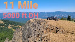
Popular Naches Mountain Biking Trails
• 90 ★ 3.9 • 10 miles • 633 ft • 73 • • moto
Just northwest of Naches, WA is a great mountain bike ride with a classic long fire road climb and sweet singletrack descent. It's a steady 11-mile climb (2900 ft. gain) up toward with a varied return trip on rugged singletrack with...
• 100 ★ 5.0 • 4 miles • 541 ft • 33 •
The trail parallels the starting at the Oak Creek feeding station. It begins as double-track but changes to single-track quickly once you pass the the climbers' trail to the Royal Columns climbing area. The trail is relatively flat...
• 75 ★ 4.2 • 7 miles • 405 ft • 26 • • moto
The best downhill in the area. A stout climb on the roads, a flying decent interrupted by 4 mini climbs along the way. The first two climbs are small, the 3rd is short but has a steep climb section what will test you, the 4th climb has...
• 100 ★ 4.5 • 4 miles • 5 ft • 23 •
Multi use trail open to motorcycle, bike, horses and hikers. Super fun decent that starts as a rough rocky trail in the forest and ends in a clay based moonscape that has many unique features. Trail is very easily damaged in the wet and...
• 100 ★ 4.0 • 5 miles • 226 ft • 20 • • moto
Mt Clifty trail is a super fun motorized trail that provides an awesome shuttle option in the area. Only the bottom half is shuttlable with the top half being an awesome side trip if your willing to work for it. There are several road...
• 80 ★ 0.0 • 968 ft • 0 ft • 17 •
Popular green difficulty singletrack. This mountain bike primary trail can be used both directions. On average it takes 1 minutes to complete this trail.
• 80 ★ 4.0 • 6 miles • 95 ft • 16 • • moto
A mix of fun and challenging downhill with several climbing sections and some very challenging decent sections over rock strewn trail churned up by motos.
• 90 ★ 5.0 • 3 miles • 114 ft • 16 • • moto
Amazingly fun, fast, rowdy motorized trail. Lots of natural berms, jumps, and rock gardens keep this descent interesting all the way to the bottom. This trail can be shuttled with a high clearance vehicle or can be ridden as part of a...
Naches Mountain Bike Routes
11 miles • 2,095 ft • 1 • Loop •
Milk Creek Loop. Easy road climb to fun singletrack descent
22 miles • 3,702 ft • 4 • Loop •
Loop using closed gravel roads to access . Road ride offers some great views of Rimrock Lake and...
★ 1.0 • 9 miles • 1,653 ft • 2 • Loop •
This route uses forest roads and double track for the climbs and allows you to descend on singletrack....
8 miles • 1,245 ft • 2 • Loop •
A short lap thru the lower part of the Little Bald mt trail. A nice view point at the end of the road part...
★ 4.0 • 27 miles • 4,544 ft • 0 •
Just northwest of Naches, WA is a great mountain bike ride with a classic long fire road climb and sweet...
9 miles • 1,981 ft • 4 •
Fun route that makes for a relatively easy climb for the 946 South Fork descent. Climb can be shuttled in...
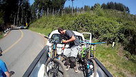
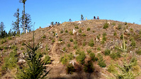
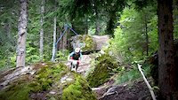
Photos of Naches Mountain Bike
Videos of Naches Mountain Bike

trail: Singletrack
2:46 |
6088 |
Jun 28, 2019
trail: Singletrack
5:11 |
298 |
Apr 19, 2015
trail: Singletrack
2:39 |
653 |
Jan 27, 2014
trail: Singletrack
26:26 |
553 |
Nov 17, 2013

trail: Singletrack
6:04 |
731 |
Mar 20, 2013

trail: Singletrack
3:17 |
92 |
Jan 18, 2013

trail: West Quartz Creek N
3:49 |
115 |
Jan 10, 2025 , Naches
trail: Little Bald Mountain
39:28 |
162 |
Jan 5, 2025 , Naches
Current Trail Warnings
| status | trail | date | condition | user | info |
|---|---|---|---|---|---|
| South Fork | Jul 10, 2026 @ 8:36pm (America/Los_Angeles) 1 hours | Dry | i-g-o-r | A big tree at least a two footer blocking... | |
| FS Road 1703 | Jun 28, 2026 @ 6:25pm (America/Los_Angeles) Jun 28, 2026 | Dry | i-g-o-r | A bridge is out a couple miles from the... |
Recent Trail Reports
Activity Feed
| username | action | type | title | date |
|---|---|---|---|---|
| i-g-o-r | add | report | activity #98900701 and 1 more | Jul 10, 2026 @ 8:34pm 1 hours |
| scottbcaldwell | wishlist | trail | activity #98743484 and 2 more | Jul 8, 2026 @ 3:44pm 2 days |
| i-g-o-r | add | trail | activity #98445861 and 1 more | Jul 4, 2026 @ 12:46pm Jul 4, 2026 |
| i-g-o-r | add | trail | activity #98445860 | Jul 4, 2026 @ 12:46pm Jul 4, 2026 |
| i-g-o-r | vote | trail | activity #98175600 and 1 more | Jun 30, 2026 @ 8:06pm Jun 30, 2026 |
Recent Comments
| username | type | title | comment | date |
|---|---|---|---|---|
| trail | Great adventure loop, rowdy on a gravel bike! | Jun 22, 2026 @ 3:21pm Jun 22, 2026 | ||
| trail | Gigantic tree down in the first 1000 feet or so. | Jun 18, 2026 @ 5:55pm Jun 18, 2026 | ||
| trail | Not a blue on a dirt bike. Also, don't even... | Jun 18, 2026 @ 5:53pm Jun 18, 2026 | ||
| trail | Definitely a cross country ride. 1706 to the... | Jun 13, 2026 @ 12:12pm Jun 13, 2026 | ||
| trail | Yep agree with you, not worth it, descent did... | Aug 8, 2025 @ 4:56pm Aug 8, 2025 |
Local Badges
-

Epic Ride Climb 2k28 awarded -

Climbing 10k Badge8 awarded -

Climbing 100k Badge0 awarded -

Epic Ride Descent 2k51 awarded -

Descent 10k Badge15 awarded -

Descent 100k Badge0 awarded
Activity Type Stats
| activitytype | trails | distance | descent | descent distance | total vertical | rating | global rank | state rank | photos | reports | routes | ridelogs |
|---|---|---|---|---|---|---|---|---|---|---|---|---|
| Mountain Bike | 117 | 461 miles | 71,575 ft | 180 miles | 4,678 ft | #582 | #216 | 243 | 209 | 7 | 1,456 | |
| E-Bike | 105 | 425 miles | 70,272 ft | 173 miles | 4,304 ft | #116 | #656 | 2 | 170 | 5 | 116 | |
| Gravel Bike | 3 | #805 | #1,216 | 2 | 3 | |||||||
| Horse | 112 | 404 miles | 59,255 ft | 154 miles | 4,613 ft | #40 | #331 | 54 | 1 | |||
| Hike | 190 | 708 miles | 111,260 ft | 269 miles | 6,093 ft | #123 | #71 | 2 | 211 | 17 | 554 | |
| Trail Running | 187 | 702 miles | 108,537 ft | 264 miles | 6,093 ft | #103 | #49 | 206 | 1 | 27 | ||
| Dirtbike/Moto | 93 | 396 miles | 66,168 ft | 163 miles | 4,160 ft | #40 | #22 | 2 | 97 | 113 | ||
| Observed Trials | 14 | 55 miles | 8,383 ft | 25 miles | 4,075 ft | #191 | #35 | 3 | ||||
| ATV/ORV/OHV | 21 | 83 miles | 15,135 ft | 39 miles | 3,793 ft | #368 | #106 | 30 | 9 | |||
| Snowmobile | 1 | 3,360 ft | 3 ft | 633 ft | 16 ft | 5 | ||||||
| Snowshoe | 19 | 17 miles | 1,001 ft | 5 miles | 3,510 ft | #920 | #441 | 5 | 39 | |||
| Downhill Ski | 83 | 28 miles | 22,631 ft | 27 miles | 1,995 ft | #208 | #84 | 5 | 4 | 2,082 | ||
| Backcountry Ski | 9 | 5 miles | 331 ft | 1 mile | 3,169 ft | #564 | #172 | 4 | 1 | 225 | ||
| Nordic Ski | 28 | 19 miles | 1,568 ft | 7 miles | 1,854 ft | #618 | #208 | 2 | 386 |
Frequently Asked Questions About Naches
▼
What are the best places to ride in Naches?
Naches has 7 areas to explore for mountain biking. The top rated areas are:
▼
What are the highest rated mountain biking trails in Naches?
The highest rated mountain biking trails in Naches are:
- Tieton River Trail (4.2/5)
- South Fork (4.2/5)
- Cow Canyon DH (4.2/5)
- Frost Mountain Trail (4.1/5)
- West Quartz Creek N (4.1/5)
▼
What is the best time of the year to ride in Naches?
Based on ride log data, the most popular months to ride in Naches are:
- June (30 activities)
- July (21 activities)
- August (20 activities)
▼
Where can I park to ride in Naches?
Activities
- Naches Mountain Biking Trails
- Naches E-Biking Trails
- Naches Horseback Trails
- Naches Hiking Trails
- Naches Trail Running Trails
- Naches Dirtbiking Trails
- Naches Observed Trials Trails
- Naches ATVing/Offroading Trails
- Naches Snowshoeing Trails
- Naches Skiing Trails
- Naches Backcountry Skiing Trails
- Naches Nordic Skiing Trails
Trails
Points of Interest
- By boxxerace
 TRAILFORKS EMBA-BOD & contributors
 - Admins: apply
- #17028 - 6,590 views
- naches activity log | embed map of Naches mountain bike trails | naches mountain biking points of interest polygons
Downloading of trail gps tracks in kml & gpx formats is enabled for Naches.
You must login to download files.