close
-
Layers w
- Weather Layers
- Pro
- Pro
- Pro
- Pro
- Pro
- Pro
- More Layers
- Pro
- Pro
- Pro
- Pro
-
Upgrade to

3D
Trail Conditions
- Unknown
- Snow Groomed
- Snow Packed
- Snow Covered
- Snow Cover Partial
- Freeze/thaw Cycle
- Icy
- Prevalent Mud
- Wet
- Variable
- Ideal
- Dry
- Very Dry
Trail Flow (Ridden Direction)
Trailforks scans users ridelogs to determine the most popular direction each trail is ridden. A good flowing trail network will have most trails flowing in a single direction according to their intension.
The colour categories are based on what percentage of riders are riding a trail in its intended direction.
The colour categories are based on what percentage of riders are riding a trail in its intended direction.
- > 96%
- > 90%
- > 80%
- > 70%
- > 50%
- < 50%
- bi-directional trail
- no data
Trail Last Ridden
Trailforks scans ridelogs to determine the last time a trail was ridden.
- < 2 days
- < 1 week
- < 2 weeks
- < 1 month
- < 6 months
- > 6 months
Trail Ridden Direction
The intended direction a trail should be ridden.
- Downhill Only
- Downhill Primary
- Both Directions
- Uphill Primary
- Uphill Only
- One Direction
Contribute Details
Colors indicate trail is missing specified detail.
- Description
- Photos
- Description & Photos
- Videos
Trail Popularity ?
Trailforks scans ridelogs to determine which trails are ridden the most in the last 9 months.
Trails are compared with nearby trails in the same city region with a possible 25 colour shades.
Think of this as a heatmap, more rides = more kinetic energy = warmer colors.
- most popular
- popular
- less popular
- not popular
ATV/ORV/OHV Filter
Max Vehicle Width
inches
US Cell Coverage
Legend

Radar Time
Activity Recordings
Trailforks uses anonymized public activity data.
?
Activity Recordings
Trailforks uses anonymized public activity data.
?
Personal Heatmap
▶
Activity Types
all
/
none
▶
Options
2
Date range
month
–
Winter Trails
Warning
A routing network for winter maps does not exist. Selecting trails using the winter trails layer has been disabled.
Missing Trails
Most Popular
Least Popular
Trails are colored based on popularity. The more popular a trail is, the more red. Less popular trails trend towards green.
Jump Magnitude Heatmap
Heatmap of where riders jump on trails. Zoom in to see individual jumps, click circles to view jump details.
BC Backroad Status
![map legend]()
Service Road Atlas is a free to use, community-driven service for viewing and creating reports on the numerous back-country service roads around B.C. and Alberta.

Slope Aspect
Direction the slope faces
Trails Deemphasized
Trails are shown in grey.
Only show trails with no bike usage.
Suggested Layers
Based on selected activity type
Save the current map location and zoom level as your default home location whenever this page is loaded.
Save
No description for Sechelt has been added yet!
Login or register to submit one.
Activities Click to view
- Mountain Bike
355 trails
- E-Bike
312 trails
- Gravel Bike
0 trails
- Adaptive Bike
0 trails
- Winter Fat Bike
0 trails
- Horse
13 trails
- Hike
322 trails
- Trail Running
301 trails
- Dirtbike/Moto
180 trails
- Observed Trials
152 trails
- ATV/ORV/OHV
54 trails
- Snowshoe
7 trails
- Nordic Ski
14 trails
Region Details
- 84
- 3
- 62
- 121
- 56
- 8
- 1
Region Status
Open as of Jun 27, 2026Stats
- Avg Trail Rating
- Trails (view details)
- 383
- Trails Mountain Bike
- 357
- Trails E-Bike
- 312
- Trails Horse
- 13
- Trails Hike
- 322
- Trails Trail Running
- 301
- Trails Dirtbike/Moto
- 181
- Trails Observed Trials
- 152
- Trails ATV/ORV/OHV
- 54
- Trails Snowmobile
- 1
- Trails Snowshoe
- 7
- Trails Nordic Ski
- 14
- Total Distance
- 223 miles
- Total Descent
- 42,839 ft
- Total Vertical
- 3,675 ft
- Highest Trailhead
- 3,678 ft
- Reports
- 2,980
- Photos
- 1,537
- Ridden Counter
- 72,741
Articles
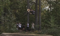
Video: The 2024 Backwoods Jam by Ride or Die
Oct 8, 2024 from pinkbike.com
Paul Genovese's recap of the 10th annual Backwoods Jam hosted by Logan Peat at the Coast Gravity Park.
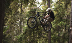
Video: 'New School' Style with Graham Benson at the Coast Gravity Bike Park
Sep 20, 2024 from pinkbike.com
Graham Benson gives us a taste of that new school style as his surfs the Coast Gravity Bike Park.
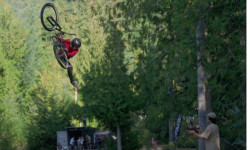
Video: Highlights & Huge Tricks From The Backwoods Jam 2023
Sep 14, 2023 from pinkbike.com
Absolutely no fun was had.
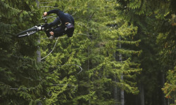
Video: The We Are One Team at The Backwoods Jam 2023
Sep 14, 2023 from pinkbike.com
Slopestyle riders descend on the Coast Gravity Park for a weekend of pristine jumps and all-out good times.
Sub Regions
-
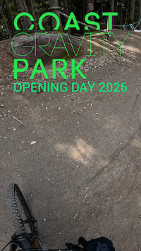
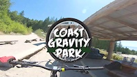
Coast Gravity Park
- 1
- 5
- 5
- 6
- 1
-
Connor Park
- 13
- 11
-
Halfmoon Bay
- 1
- 10
- 36
- 2
-
Kinnikinnick Park
- 1
- 15
- 1
-
Porpoise Bay
- 2
- 8
- 5
- 4
-
West Sechelt
- 1
- 19
- 58
- 45
- 3
Popular Sechelt Mountain Biking Trails
• 85 ★ 4.7 • 1,201 ft • 0 ft • 1,715 •
Riders are challenged to rail each corner back and forth to keep their momentum and flow up with a mix of big turns, rollers and high speeds.
• 95 ★ 4.6 • 781 ft • 0 ft • 1,678 •
A favourite trail by many, maximum flow and fun is achieved at Dogger's with tabled jumps, hips and mage berms as seen in Ryan Howard's segment in "Arrival".
• 85 ★ 4.7 • 2,966 ft • 53 ft • 1,657 •
This trail is full of giant berms and tons rollers that teach riders to maintain momentum by pumping to get faster with every lap.
• 65 ★ 4.8 • 1,056 ft • 10 ft • 1,629 •
Riders Experience natural forming ruts, jump options and gap opportunities to ride faster and further on the edge with every lap down this downhill trail.
• 50 ★ 4.6 • 1,132 ft • 3 ft • 1,553 •
offers a natural feel in a narrow corridor with many line options hidden on the loam and roots. The more you ride this trail, the more the lines speak to you.
• 55 ★ 4.8 • 1,401 ft • 25 ft • 1,443 •
Once harnessed, is one of our best trails to let loose on with roller jumps and turns that offer interpretive options for how you want to shred them.
• 80 ★ 4.9 • 991 ft • 3 ft • 1,316 •
Highly rated popular black difficulty machine groomed. This mountain bike primary trail can be used downhill only. It features berm and jump. Trail visibility is always easy to follow. On average it takes 1 minutes to complete this trail.
Sechelt Mountain Bike Routes
★ 4.7 • 8 miles • 1,063 ft • 16 •
This route was recommended to us by a local trailbuilder, and it proved to be a lot of fun. Without it,...
★ 5.0 • 7 miles • 965 ft • 29 • Loop •
This fun, little, route takes approximately an hour and 15 minutes. Great for beginners or above beginner...
12 miles • 1,715 ft • 8 • Loop •
Heres a loop that I like to do for a good spring or fall workout. There are options to veer off to...
17 miles • 2,156 ft • 15 • Loop •
Medium distance ride from Oceanview Airbnb to West Sechelt Trails. Highest point is top of Neimja trail...
7 miles • 1,146 ft • 5 •
Great west Sechelt loop to get the most out of the area, optional extension up & down Miles Away (not...
7 miles • 1,154 ft • 5 • Loop •
Rolling the dice on RoHiba von Grizz's route planning skills.
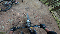
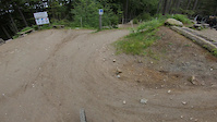
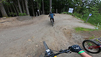
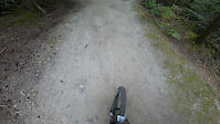
Photos of Sechelt Mountain Bike
Videos of Sechelt Mountain Bike
trail: Auto Pilot
3:10 |
42 |
Apr 4, 2026
trail: Cruise Control
0:44 |
266 |
Jul 2, 2023
trail: Hand Job
0:56 |
193 |
Feb 11, 2022
trail: Coastal Cruise
0:46 |
109 |
Nov 23, 2021
trail: Dynamite Panther
0:09 |
325 |
May 31, 2021
trail: Dirt Wave
2:21 |
145 |
May 31, 2021
trail: Devil's Elbow
0:55 |
394 |
May 31, 2021
trail: Auto Pilot
0:02 |
90 |
May 30, 2021
Current Trail Warnings
| status | trail | date | condition | user | info |
|---|---|---|---|---|---|
| Rock'a'Billy Bypass | Jun 15, 2026 @ 7:31pm (America/Vancouver) Jun 15, 2026 | Unknown | riderenew72 | Badly Motocross blown up | |
| Skullduggery | Jun 15, 2026 @ 6:45pm (America/Vancouver) Jun 15, 2026 | Unknown | riderenew72 | Active logging. Trail no longer exists. ... |
Recent Trail Reports
| status | trail | date | condition | info | user |
|---|---|---|---|---|---|
| Parbac | Jun 27, 2026 @ 1:00pm (America/Vancouver) Jun 27, 2026 | Variable | Shob01 | ||
| In & Out | Jun 22, 2026 @ 1:00pm (America/Vancouver) Jun 22, 2026 | Dry | griffggGdvS | ||
| Y2K | Jun 22, 2026 @ 1:00pm (America/Vancouver) Jun 22, 2026 | Dry | griffggGdvS | ||
| Killer Squirrel | Jun 15, 2026 @ 6:40pm (America/Vancouver) Jun 15, 2026 | Ideal | riderenew72 | ||
| Kinnikinnick (Pink) | Jun 15, 2026 @ 7:31am (America/Vancouver) Jun 15, 2026 | Ideal | riderenew72 | ||
| Rock'a'Billy | Jun 15, 2026 @ 7:31am (America/Vancouver) Jun 15, 2026 | Variable | riderenew72 | ||
| Lots of Duff (no motos) | Jun 15, 2026 @ 7:31am (America/Vancouver) Jun 15, 2026 | Ideal | riderenew72 | ||
| BRAT | Jun 15, 2026 @ 7:31am (America/Vancouver) Jun 15, 2026 | Dry | riderenew72 | ||
| New Frogger | Jun 15, 2026 @ 7:31am (America/Vancouver) Jun 15, 2026 | Dry | riderenew72 | ||
| De-Worm-Me | Jun 15, 2026 @ 7:31am (America/Vancouver) Jun 15, 2026 | Ideal | riderenew72 |
Activity Feed
| username | action | type | title | date |
|---|---|---|---|---|
| Random13 | vote | trail | activity #98086554 | Jun 29, 2026 @ 2:12pm 2 days |
| KristaNorthcott | wishlist | route | activity #98004131 | Jun 28, 2026 @ 10:32am Jun 28, 2026 |
| IsaacEPIjy2 | wishlist | route | activity #98000701 | Jun 28, 2026 @ 9:56am Jun 28, 2026 |
| kjfw | add | karma | activity #97976156 | Jun 28, 2026 @ 4:19am Jun 28, 2026 |
| Shob01 | add | report | activity #97930694 | Jun 27, 2026 @ 1:00pm Jun 27, 2026 |
Recent Comments
| username | type | title | comment | date |
|---|---|---|---|---|
| trail | Active forest fire being held. Avoid the area. | Jun 19, 2026 @ 1:15pm Jun 19, 2026 | ||
| report | When I rode it, it looked MTBr built but it... | Jun 16, 2026 @ 8:23am Jun 16, 2026 | ||
| report | FYI. Killer Squirrel was 100% built by... | Jun 16, 2026 @ 7:13am Jun 16, 2026 | ||
| trail | Unfortunately badly Motocross tracked. Many... | Jun 15, 2026 @ 7:29pm Jun 15, 2026 | ||
| trail | Unfortunately badly Motocross tracked. Many... | Jun 15, 2026 @ 6:55pm Jun 15, 2026 |
Local Badges
-

All the Views!0 awarded -

Completionist6 awarded -
Completionist0 awarded -
Completionist0 awarded -

Top 10 Trails2 awarded -

Epic Ride 50k595 awarded
Bike & Skill Parks
| name | type | city | rating |
|---|---|---|---|
| Coast Gravity Park | bike park | Sechelt | |
| Connor Park | skill park | Sechelt | |
| Proctor Bike Park | skill park | Sechelt |
Activity Type Stats
| activitytype | trails | distance | descent | descent distance | total vertical | rating | global rank | state rank | photos | reports | routes | ridelogs |
|---|---|---|---|---|---|---|---|---|---|---|---|---|
| Mountain Bike | 355 | 204 miles | 38,809 ft | 83 miles | 3,635 ft | #207 | #26 | 1,470 | 2,977 | 30 | 21,702 | |
| E-Bike | 312 | 187 miles | 34,856 ft | 76 miles | 2,769 ft | #375 | #32 | 3 | 2,910 | 6 | 1,320 | |
| Horse | 13 | 9 miles | 1,604 ft | 4 miles | 1,407 ft | #1,034 | #36 | 585 | 10 | |||
| Hike | 322 | 186 miles | 34,429 ft | 75 miles | 3,675 ft | #559 | #33 | 4 | 2,936 | 1 | 3,321 | |
| Trail Running | 301 | 174 miles | 31,847 ft | 70 miles | 3,675 ft | #493 | #31 | 2,929 | 1 | 2,024 | ||
| Dirtbike/Moto | 180 | 114 miles | 18,599 ft | 45 miles | 2,769 ft | #62 | #16 | 58 | 695 | 1 | 296 | |
| Observed Trials | 152 | 108 miles | 17,867 ft | 43 miles | 2,769 ft | #13 | #4 | 115 | 1 | 10 | ||
| ATV/ORV/OHV | 54 | 59 miles | 9,472 ft | 26 miles | 2,769 ft | #90 | #13 | 579 | 55 | |||
| Snowmobile | 1 | 1 | ||||||||||
| Snowshoe | 7 | #648 | #50 | 25 | ||||||||
| Nordic Ski | 14 | #589 | #34 | 132 |
Frequently Asked Questions About Sechelt
▼
What are the best places to ride in Sechelt?
Sechelt has 8 areas to explore for mountain biking. The top rated areas are:
▼
What are the highest rated mountain biking trails in Sechelt?
The highest rated mountain biking trails in Sechelt are:
- Dirt Surfer (4.7/5)
- Dynamite Panther (4.7/5)
- Devil's Elbow (4.7/5)
- Flight Deck (4.6/5)
- Zig Zag (4.6/5)
▼
What is the best time of the year to ride in Sechelt?
Based on ride log data, the most popular months to ride in Sechelt are:
- July (552 activities)
- August (383 activities)
- September (297 activities)
▼
Where can I park to ride in Sechelt?
There are 7 parking locations listed in Sechelt. The most popular parking spots are: View all parking and trailhead locations on the map to plan your visit.
Activities
Trails
- By brenthillier
 NSMBA TRAILFORKS & contributors
 - Admins: CMBTA, SCDBA, Wabmatrix
- #3317 - 37,363 views
- sechelt activity log | embed map of Sechelt mountain bike trails | sechelt mountain biking points of interest
Downloading of trail gps tracks in kml & gpx formats is enabled for Sechelt.
You must login to download files.