close
-
Layers w
- Weather Layers
- Pro
- Pro
- Pro
- Pro
- Pro
- Pro
- More Layers
- Pro
- Pro
- Pro
- Pro
-
Upgrade to

3D
Trail Conditions
- Unknown
- Snow Groomed
- Snow Packed
- Snow Covered
- Snow Cover Partial
- Freeze/thaw Cycle
- Icy
- Prevalent Mud
- Wet
- Variable
- Ideal
- Dry
- Very Dry
Trail Flow (Ridden Direction)
Trailforks scans users ridelogs to determine the most popular direction each trail is ridden. A good flowing trail network will have most trails flowing in a single direction according to their intension.
The colour categories are based on what percentage of riders are riding a trail in its intended direction.
The colour categories are based on what percentage of riders are riding a trail in its intended direction.
- > 96%
- > 90%
- > 80%
- > 70%
- > 50%
- < 50%
- bi-directional trail
- no data
Trail Last Ridden
Trailforks scans ridelogs to determine the last time a trail was ridden.
- < 2 days
- < 1 week
- < 2 weeks
- < 1 month
- < 6 months
- > 6 months
Trail Ridden Direction
The intended direction a trail should be ridden.
- Downhill Only
- Downhill Primary
- Both Directions
- Uphill Primary
- Uphill Only
- One Direction
Contribute Details
Colors indicate trail is missing specified detail.
- Description
- Photos
- Description & Photos
- Videos
Trail Popularity ?
Trailforks scans ridelogs to determine which trails are ridden the most in the last 9 months.
Trails are compared with nearby trails in the same city region with a possible 25 colour shades.
Think of this as a heatmap, more rides = more kinetic energy = warmer colors.
- most popular
- popular
- less popular
- not popular
ATV/ORV/OHV Filter
Max Vehicle Width
inches
US Cell Coverage
Legend

Radar Time
Activity Recordings
Trailforks uses anonymized public activity data.
?
Activity Recordings
Trailforks uses anonymized public activity data.
?
Personal Heatmap
▶
Activity Types
all
/
none
▶
Options
2
Date range
month
–
Winter Trails
Warning
A routing network for winter maps does not exist. Selecting trails using the winter trails layer has been disabled.
Missing Trails
Most Popular
Least Popular
Trails are colored based on popularity. The more popular a trail is, the more red. Less popular trails trend towards green.
Jump Magnitude Heatmap
Heatmap of where riders jump on trails. Zoom in to see individual jumps, click circles to view jump details.
BC Backroad Status
![map legend]()
Service Road Atlas is a free to use, community-driven service for viewing and creating reports on the numerous back-country service roads around B.C. and Alberta.

Slope Aspect
Direction the slope faces
Trails Deemphasized
Trails are shown in grey.
Only show trails with no bike usage.
Suggested Layers
Based on selected activity type
Save the current map location and zoom level as your default home location whenever this page is loaded.
Save
No description for Sequim has been added yet!
Login or register to submit one.
Activities Click to view
- Mountain Bike
70 trails
- E-Bike
5 trails
- Adaptive Bike
0 trails
- Horse
5 trails
- Hike
76 trails
- Trail Running
76 trails
Region Details
- 10
- 8
- 25
- 25
- 2
Region Status
Caution as of May 30, 2026Local Trail Association
Stats
- Avg Trail Rating
- Global Ranking
- #2,635
- State Ranking
- #940
- Trails (view details)
- 74
- Trails Mountain Bike
- 70
- Trails E-Bike
- 5
- Trails Horse
- 5
- Trails Hike
- 76
- Trails Trail Running
- 76
- Trails Dirtbike/Moto
- 1
- Trails ATV/ORV/OHV
- 1
- Trails Snowshoe
- 1
- Trails Backcountry Ski
- 1
- Total Distance
- 93 miles
- Total Descent
- 14,338 ft
- Total Vertical
- 5,270 ft
- Highest Trailhead
- 5,277 ft
- Reports
- 176
- Photos
- 151
- Ridden Counter
- 3,581
Articles

Seattle, WA: Dungeness Spit
Sep 20, 2013 from backpacker.com
This 10.2-miler heads into a wildlife refuge with 250 species of birds to the New Dungeness Light Station, a historic lighthouse with spectacular...
Sub Regions
-
Dungeness Recreation Area
- 7
- 3
-
Dungeness Trails
- 4
- 5
- 1
-
Gold Creek - Dungeness
- 5
- 1
-
Miller Peninsula State Park
- 1
- 14
- 7
Popular Sequim Mountain Biking Trails
• 85 ★ 0.0 • 694 ft • 0 ft • 134 •
Popular green difficulty singletrack. This mountain bike primary trail can be used both directions. On average it takes 1 minutes to complete this trail.
• 80 ★ 5.0 • 2,586 ft • 18 ft • 118 •
Popular green difficulty singletrack. This mountain bike primary trail can be used both directions. On average it takes 3 minutes to complete this trail.
• 80 ★ 3.7 • 7 miles • 832 ft • 114 •
Fast and Narrow, some exposed cliff edges. Note: There is nowhere near 4,000 ft of descending on this trail, regardless which way you go. If you start from the top and ride to the TH parking near the Dungeness it's 2,400' of descending...
• 100 ★ 0.0 • 1,015 ft • 18 ft • 111 •
Popular blue difficulty singletrack. This mountain bike primary trail can be used both directions with a 18 ft blue climb. On average it takes 4 minutes to complete this trail.
• 85 ★ 0.0 • 3,132 ft • 13 ft • 109 •
Popular green difficulty singletrack. This mountain bike primary trail can be used both directions. On average it takes 3 minutes to complete this trail.
• 100 ★ 5.0 • 3,423 ft • 54 ft • 96 •
This trail has many smooth, bermed corners, a few rollers sprinkled in, and one small rock garden offering multiple line choices. It is excellent for all rider types; from kiddos on their striders to experts looking for some good ol'...
• 85 ★ 0.0 • 820 ft • 21 ft • 88 •
Popular green difficulty singletrack. This mountain bike primary trail can be used both directions with a 21 ft green climb. On average it takes minutes to complete this trail.
• 25 ★ 0.0 • 1 mile • 169 ft • 86 •
Less popular green difficulty singletrack. This mountain bike primary trail can be used both directions. On average it takes 4 minutes to complete this trail.
Sequim Mountain Bike Routes
20 miles • 5,484 ft • 2 • Loop •
The Dungeness Gold Creek loop is a classic. This variation bypasses the lowest and steepest portion of...
17 miles • 4,450 ft • 2 • Loop •
Mostly singe track way to get the great downhill.
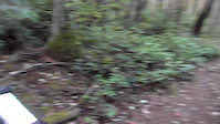
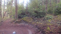
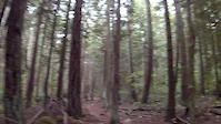
Photos of Sequim Mountain Bike
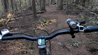
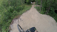
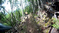
Videos of Sequim Mountain Bike
trail: West Diamond Point Trail
3:31 |
96 |
Sep 22, 2019
trail: West Diamond Point Trail
3:30 |
87 |
Sep 22, 2019
trail: West Diamond Point Trail
5:20 |
85 |
Sep 15, 2019
trail: West Diamond Point Trail
2:19 |
114 |
Sep 8, 2019
trail: Diamond Point Trail
2:18 |
58 |
Sep 8, 2019
trail: Highland
3:23 |
436 |
Jul 27, 2015
trail: Salmon
8:17 |
41923 |
Jun 24, 2015
trail: Salmon
3:49 |
161 |
Oct 31, 2012
Recent Trail Reports
| status | trail | date | condition | info | user |
|---|---|---|---|---|---|
| Beach Trail | May 30, 2026 @ 10:23pm (America/Los_Angeles) May 30, 2026 | Unknown | phatpham | ||
| Sleepy Hollow Extension Trail | May 23, 2026 @ 10:46pm (America/Los_Angeles) May 23, 2026 | Variable | TenaciousE | ||
| Sleepy Hollow | May 23, 2026 @ 10:46pm (America/Los_Angeles) May 23, 2026 | Variable | TenaciousE | ||
| Mt. Zion Trail | May 23, 2026 @ 10:44pm (America/Los_Angeles) May 23, 2026 | Ideal | TenaciousE | ||
| Equestrian Trail (West) | Sep 13, 2025 @ 12:16pm (America/Los_Angeles) Sep 13, 2025 | Unknown | AlisonKLJUcm | ||
| Lower Dungeness River | Aug 10, 2025 @ 5:13pm Aug 10, 2025 | Ideal | nickskater09 | ||
| Gold Creek Trail | Aug 10, 2025 @ 5:12pm Aug 10, 2025 | Ideal | nickskater09 | ||
| Equestrian Trail (South) | Jul 25, 2025 @ 3:29pm Jul 25, 2025 | Dry | capslayer80 | ||
| Giraffe | Oct 9, 2024 @ 1:59pm Oct 9, 2024 | Ideal | cire831 | ||
| Wapiti Run | Oct 9, 2024 @ 1:59pm Oct 9, 2024 | Ideal | cire831 |
Activity Feed
| username | action | type | title | date |
|---|---|---|---|---|
| phatpham | ridden | trail | activity #95910344 | May 30, 2026 @ 10:25pm May 30, 2026 |
| phatpham | vote | trail | activity #95910327 | May 30, 2026 @ 10:24pm May 30, 2026 |
| phatpham | add | report | activity #95910297 | May 30, 2026 @ 10:23pm May 30, 2026 |
| RuffyD | add | photo | activity #95910273 | May 30, 2026 @ 10:21pm May 30, 2026 |
| phatpham | add | photo | activity #95910262 and 8 more | May 30, 2026 @ 10:21pm May 30, 2026 |
Recent Comments
| username | type | title | comment | date |
|---|---|---|---|---|
| report | 🙌🏾 Thanks for sharing. 🚲 | Aug 6, 2025 @ 6:23pm Aug 6, 2025 | ||
| trail | Great ride yesterday 7/26/25. Trail is in... | Jul 27, 2025 @ 8:00am Jul 27, 2025 | ||
| trail | O | May 4, 2025 @ 8:13am May 4, 2025 | ||
| trail | Ran into black bear and cub about 1.2 miles... | Apr 14, 2025 @ 12:27pm Apr 14, 2025 | ||
| trail | Many sections overgrown with weeds, plants,... | Jul 7, 2024 @ 11:29am Jul 7, 2024 |
Local Badges
-

10 Green Trails26 awarded -

10 Blue Trails12 awarded -

Epic Ride Climb 2k74 awarded -

Climbing 10k Badge14 awarded -

Climbing 100k Badge0 awarded -

Epic Ride Descent 2k77 awarded
Activity Type Stats
| activitytype | trails | distance | descent | descent distance | total vertical | rating | global rank | state rank | photos | reports | routes | ridelogs |
|---|---|---|---|---|---|---|---|---|---|---|---|---|
| Mountain Bike | 70 | 83 miles | 12,156 ft | 35 miles | 4,147 ft | #2,635 | #940 | 135 | 176 | 3 | 4,262 | |
| E-Bike | 5 | 7 miles | 1,480 ft | 4 miles | 2,142 ft | #7,208 | #2,183 | 9 | 119 | 397 | ||
| Horse | 5 | 6 miles | 2,388 ft | 3 miles | 5,180 ft | #2,187 | #1,214 | 14 | 10 | |||
| Hike | 76 | 93 miles | 14,337 ft | 38 miles | 5,269 ft | #2,476 | #980 | 7 | 176 | 3 | 778 | |
| Trail Running | 76 | 93 miles | 14,337 ft | 38 miles | 5,269 ft | #2,325 | #712 | 176 | 1 | 210 | ||
| Dirtbike/Moto | 1 | 2,500 ft | 318 ft | 1,883 ft | 299 ft | 17 | 29 | |||||
| ATV/ORV/OHV | 1 | 2,500 ft | 318 ft | 1,883 ft | 299 ft | 13 | 6 | |||||
| Snowshoe | 1 | 4 miles | 1,985 ft | 2 miles | 1,955 ft | 1 | ||||||
| Backcountry Ski | 1 | 4 miles | 1,985 ft | 2 miles | 1,955 ft | 35 |
Frequently Asked Questions About Sequim
▼
What are the best places to ride in Sequim?
Sequim has 5 areas to explore for mountain biking. The top rated areas are:
▼
What are the highest rated mountain biking trails in Sequim?
The highest rated mountain biking trails in Sequim are:
- Hooters (4.6/5)
- Beach Trail (4.1/5)
- Giraffe (4.1/5)
- Bluff Trail (4.1/5)
- Old Yarrow Trail (4/5)
▼
What is the best time of the year to ride in Sequim?
Based on ride log data, the most popular months to ride in Sequim are:
- August (54 activities)
- July (54 activities)
- September (29 activities)
▼
Where can I park to ride in Sequim?
There are 11 parking locations listed in Sequim. The most popular parking spots are: View all parking and trailhead locations on the map to plan your visit.
Activities
Trails
- By boxxerace
 TRAILFORKS EMBA-BOD & contributors
 - Admins: EMBA-WS
- #20323 - 9,117 views
- sequim activity log | embed map of Sequim mountain bike trails | sequim mountain biking points of interest
Downloading of trail gps tracks in kml & gpx formats is enabled for Sequim.
You must login to download files.