
close
3D
Trail Conditions
- Unknown
- Snow Groomed
- Snow Packed
- Snow Covered
- Snow Cover Partial
- Freeze/thaw Cycle
- Icy
- Prevalent Mud
- Wet
- Variable
- Ideal
- Dry
- Very Dry
Trail Flow (Ridden Direction)
Trailforks scans users activity logs to determine the most popular direction each trail is ridden. A good flowing trail network will have most trails flowing in a single direction according to their intension.
The colour categories are based on what percentage of users are riding a trail in its intended direction.
The colour categories are based on what percentage of users are riding a trail in its intended direction.
- > 96%
- > 90%
- > 80%
- > 70%
- > 50%
- < 50%
- bi-directional trail
- no data
Trail Last Used
Trailforks scans activity logs to determine the last time a trail was ridden.
- < 2 days
- < 1 week
- < 2 weeks
- < 1 month
- < 6 months
- > 6 months
Trail Ridden Direction
The intended direction a trail should be ridden.
- Downhill Only
- Downhill Primary
- Both Directions
- Uphill Primary
- Uphill Only
- One Direction
Contribute Details
Colors indicate trail is missing specified detail.
- Description
- Photos
- Description & Photos
- Videos
Trail Popularity ?
Trailforks scans activity logs to determine which trails are ridden the most in the last 9 months.
Trails are compared with nearby trails in the same city region with a possible 25 colour shades.
Think of this as a heatmap, more activities = more kinetic energy = warmer colors.
- most popular
- popular
- less popular
- not popular
ATV/ORV/OHV Filter
Max Vehicle Width
inches
US Cell Coverage
Legend

Radar Time
Activity Recordings
Trailforks uses anonymized public activity data.
?
Activity Recordings
Trailforks uses anonymized public activity data.
?
Winter Trails
Warning
A routing network for winter maps does not exist. Selecting trails using the winter trails layer has been disabled.
Missing Trails
Most Popular
Least Popular
Trails are colored based on popularity. The more popular a trail is, the more red. Less popular trails trend towards green.
Jump Magnitude Heatmap
Heatmap of where users jump on trails. Zoom in to see individual jumps, click circles to view jump details.
BC Backroad Status
![map legend]()
Service Road Atlas is a free to use, community-driven service for viewing and creating reports on the numerous back-country service roads around B.C. and Alberta.

Slope Aspect
Direction the slope faces
Trails Deemphasized
Trails are shown in grey.
Only show trails with no bike usage.
Suggested Layers
Based on selected activity type
Save the current map location and zoom level as your default home location whenever this page is loaded.
SavePopular Trail Networks
view all areas »Olympic Region trails and routes are listed on Trailforks with interactive trail maps, difficulty ratings, photos, and user-reported trail conditions. The Trailforks community has mapped thousands of trails and shared thousands of photos in this region. Supported activity types include Hiking, Trail Running, Mountain Biking, E-Biking, Horseback, Gravel Biking, Dirtbiking, ATVing/Offroading, Adaptive Biking, Snowshoeing, Backcountry Skiing, Winter Fat Biking, Observed Trials and Skiing. Trails here are often flowy, faint trail and rooty. Scenery includes creeks, lakes and summits. Common trail features include jumps, berms and drops. Many trails are family friendly. Amenities include restrooms and huts. Popular destinations include Port Angeles, Olympic National Park and Bremerton.
This is an auto-generated description of Olympic Region.
Login or register to submit a custom description.
Trail info last updated
Region Details
- 279
- 14
- 377
- 338
- 106
- 25
- 1
Stats
- Avg Trail Rating
- Trails (view details)
- 1,692
- Trails Mountain Bike
- 1,138
- Trails E-Bike
- 612
- Trails Gravel Bike
- 441
- Trails Adaptive Bike
- 131
- Trails Winter Fat Bike
- 69
- Trails Horse
- 488
- Trails Hike
- 1,524
- Trails Trail Running
- 1,498
- Trails Dirtbike/Moto
- 260
- Trails Observed Trials
- 57
- Trails ATV/ORV/OHV
- 172
- Trails Snowshoe
- 76
- Trails Downhill Ski
- 14
- Trails Backcountry Ski
- 75
- Total Distance
- 2,194 miles
- Total Descent
- 390,928 ft
- Total Vertical
- 7,847 ft
- Highest Trailhead
- 7,848 ft
- Reports
- 11,286
- Photos
- 2,797
- Completed Counter
- 124,596
Articles
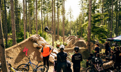
Hot Laps 2026: The Ultimate "No Bad Times" MTB Festival Returns to Port Gamble
May 20, 2026 from pinkbike.com
Created by Jill Kintner and Matt Orlando, this unique weekend features a "Best of 3" Enduro, a Red Bull Best Whip contest, and a Pro Slalom...

The Quietest Forest in America Is About to Reopen, Thanks to Unclaimed Lotto Winnings
Mar 17, 2025 from backpacker.com
Nearly three months after the only road to Olympic National Park's Hoh Rain Forest washed out, Washington has announced it will set aside more...

Hot Laps Announces 2025 Event Details
Mar 4, 2025 from pinkbike.com
Port Gamble's jam-style mountain bike weekend features racing, jumping, camping, demos, and more.

The Ultimate Guide to Olympic National Park
Oct 13, 2022 from outsideonline.com
From temperate rainforests to miles of coastline; from waterfalls and lakes to hiking, backpacking, and camping; from boating to skiing to glacier...
Sub Regions
- Clallam County (487)
- Forks (65)
- Elk Creek Conservation Area (1)
- Hoh Rainforest (4)
- Reade Hill (16)
- Sportsman's (35)
- Port Angeles (356)
- Colville Trails (11)
- Cooper Ranch (12)
- Dry Hill (122)
- Foothills (45)
- Mount Muller (6)
- Mount Pleasant (14)
- Olympic Discovery (8)
- Olympic National Park (7)
- Sadie Creek (61)
- Striped Peak (9)
- The Zoo (45)
- Sequim (70)
- Forks (65)
- Grays Harbor County (137)
- Aberdeen (13)
- Montesano (94)
- Montesano City Forest (81)
- Wynoochee Lake (10)
- Seabrook (30)
- Jefferson County (96)
- Clearwater (4)
- Port Hadlock (10)
- Port Ludlow (18)
- Port Townsend (52)
- Quilcene (8)
- Kitsap County (382)
- Bainbridge Island (74)
- Blakely Harbor Park (7)
- Camp Yeomalt Park (1)
- Fort Ward Park (5)
- Gazzam Lake Nature Preserve (12)
- Grand Forest (15)
- Hawley Cove Park (2)
- Manzanita Park (3)
- Pritchard Park (3)
- Sakai Park (3)
- Strawberry Hill Bike Park (9)
- Bremerton (70)
- Kingston (16)
- Port Gamble (108)
- Port Orchard (66)
- Poulsbo (1)
- Seabeck (0)
- Silverdale (40)
- Olympic View Park (0)
- Bainbridge Island (74)
- Mason County (34)
- Shelton (34)
- Skokomish River (17)
- West Shelton (17)
- Union (0)
- Harstine Island State Park (0)
- Shelton (34)
Popular Olympic Region Mountain Biking Trails
• 100 ★ 4.4 • 1,007 ft • 15 ft • 1,911 •
Highly rated popular green difficulty family friendly machine groomed. This mountain bike primary trail can be used uphill primary and has a easy overall physical rating with a 15 ft green climb. It features wallride. Trail visibility is always easy to follow. On average it takes 1 minutes to complete this trail.
• 95 ★ 4.8 • 873 ft • 0 ft • 1,812 •
Highly rated popular blue difficulty singletrack. This mountain bike primary trail can be used downhill only. On average it takes minutes to complete this trail.
• 100 ★ 4.6 • 955 ft • 0 ft • 1,767 •
Highly rated popular black diamond difficulty machine groomed. This mountain bike primary trail can be used downhill only. It features berm and gap jump. Trail visibility is always easy to follow. On average it takes 1 minutes to complete this trail.
• 100 ★ 4.6 • 764 ft • 0 ft • 1,757 •
Highly rated popular proline difficulty machine groomed. This mountain bike primary trail can be used downhill only. It features gap jump. On average it takes 5 minutes to complete this trail.
• 95 ★ 2.0 • 869 ft • 0 ft • 1,712 •
Popular green difficulty machine groomed. This mountain bike primary trail can be used downhill only. It features berm. Trail visibility is always easy to follow. On average it takes minutes to complete this trail.
Olympic Region Mountain Bike Routes
★ 5.0 • 18 miles • 1,881 ft • 20 • Loop •
Looking to hit ALL the new downhills at Port Gamble in one ride? This route includes Derailed, The (new)...
★ 5.0 • 17 miles • 2,044 ft • 1 • Loop •
Do you prefer loops over out and backs? This route is for you! The road climb is mellow and mixes in a few...
4,275 ft • 4 •
Wayne's World Short Shorts Braeburn Heckler's Row Lower Pro
4,774 ft • 3 • Shuttled •
Cat 1/Pro/Open - Dirty Downhill 2025 Course: Aces High - Upper White Knuckler - Rekluse - Access Road to...
★ 4.0 • 32 miles • 3,734 ft • 97 •
A link up of all older XC trails and new bike park style trails.
Photos of Olympic Region Mountain Bike
Videos of Olympic Region Mountain Bike




Current Trail Warnings
| status | trail | date | condition | user | info |
|---|---|---|---|---|---|
| Lower Dungeness River Gold Creek - Dungeness | Sep 28, 2026 @ 5:22pm (America/Los_Angeles) Sep 28, 2026 | Variable | derekhoopes22 | I would recommend skipping the lower... |
Recent Trail Reports
Activity Feed
| username | action | type | title | date |
|---|---|---|---|---|
| rockystumpy | add | report | activity #106633299 and 4 more | Oct 26, 2026 @ 8:59am 2 days |
| Randyaadland | wishlist | trail | activity #106520601 | Oct 24, 2026 @ 2:04pm Oct 24, 2026 |
| calvinator0514 | wishlist | trail | activity #106502357 | Oct 24, 2026 @ 10:15am Oct 24, 2026 |
| sudFwSKBj | wishlist | route | activity #106442546 | Oct 23, 2026 @ 10:21am Oct 23, 2026 |
| sudFwSKBj | wishlist | route | activity #106442545 | Oct 23, 2026 @ 10:21am Oct 23, 2026 |
Recent Comments
| username | type | title | comment | date |
|---|---|---|---|---|
| trail | Real jank tech. Not overly commiting or... | Oct 22, 2026 @ 7:37pm Oct 22, 2026 | ||
| trail | Awesome. You have to commit to the slabs.... | Oct 22, 2026 @ 7:35pm Oct 22, 2026 | ||
| trail | Shame on yall for wasting the energy to build... | Oct 22, 2026 @ 2:21pm Oct 22, 2026 | ||
| report | my condolences man | Oct 12, 2026 @ 10:06pm Oct 12, 2026 | ||
| trail | Destroyed by deforestation. Disappointing. | Oct 1, 2026 @ 3:32pm Oct 1, 2026 |
Local Badges
-

Epic Ride 50k33 awarded -

10 Green Trails466 awarded -
10 Green Trails10 awarded -
10 Green Trails132 awarded -
Epic Ride 50k28 awarded -
Big Ride 30k49 awarded
Bike & Skill Parks
| name | type | city | rating |
|---|---|---|---|
| Poulsbo Pump Track | skill park | Port Gamble | |
| Port Gamble Ride Park Skills Zone | skill park | Port Gamble | |
| Port Angeles Pump Track | skill park | Port Angeles | |
| Moto-West | skill park | Bremerton | |
| Olympic Peninsula MX Club | skill park | Port Angeles |




Local Trail Supporters
- Agate Asphalt
![]()
- Washington Conservation Corps
- Locals
- Seabrook Land Company
![Pacific Northwest]()
![Olympic Discovery Trail]()
- Northwest Tech
![]()
![Specialized]()




Activity Type Stats
| activitytype | trails | distance | descent | descent distance | total vertical | rating | global rank | state rank | photos | reports | routes | activity logs |
|---|---|---|---|---|---|---|---|---|---|---|---|---|
| Mountain Bike | 1,138 | 1,237 miles | 182,989 ft | 545 miles | 6,125 ft | 2,492 | 11,271 | 81 | 99,993 | |||
| E-Bike | 612 | 790 miles | 114,009 ft | 350 miles | 6,125 ft | 30 | 9,652 | 17 | 8,246 | |||
| Gravel Bike | 441 | 766 miles | 82,598 ft | 322 miles | 6,122 ft | 7 | 934 | 16 | 1,043 | |||
| Adaptive Bike | 131 | 213 miles | 27,018 ft | 89 miles | 6,122 ft | 1,087 | 1 | 7 | ||||
| Winter Fat Bike | 69 | 155 miles | 26,867 ft | 85 miles | 3,638 ft | 558 | 26 | |||||
| Horse | 488 | 901 miles | 126,135 ft | 348 miles | 7,585 ft | 1 | 2,199 | 3 | 160 | |||
| Hike | 1,524 | 2,137 miles | 367,018 ft | 867 miles | 7,848 ft | 225 | 10,312 | 42 | 21,819 | |||
| Trail Running | 1,498 | 2,050 miles | 357,520 ft | 846 miles | 7,848 ft | 14 | 10,313 | 10 | 6,452 | |||
| Dirtbike/Moto | 260 | 401 miles | 52,854 ft | 168 miles | 4,009 ft | 9 | 1,335 | 6 | 802 | |||
| Observed Trials | 57 | 88 miles | 7,582 ft | 35 miles | 2,949 ft | 31 | 31 | |||||
| ATV/ORV/OHV | 172 | 260 miles | 27,477 ft | 107 miles | 3,383 ft | 7 | 1,265 | 1 | 78 | |||
| Snowshoe | 76 | 140 miles | 23,638 ft | 49 miles | 7,674 ft | 11 | 58 | |||||
| Downhill Ski | 14 | 3 miles | 1,565 ft | 2 miles | 5,200 ft | 2 | 64 | |||||
| Backcountry Ski | 75 | 102 miles | 18,865 ft | 30 miles | 7,651 ft | 6 | 230 |
Activities
- Olympic Region Mountain Biking Trails
- Olympic Region E-Biking Trails
- Olympic Region Gravel Biking Trails
- Olympic Region Adaptive Biking Trails
- Olympic Region Winter Fat Biking Trails
- Olympic Region Horseback Trails
- Olympic Region Hiking Trails
- Olympic Region Trail Running Trails
- Olympic Region Dirtbiking Trails
- Olympic Region Observed Trials Trails
- Olympic Region ATVing/Offroading Trails
- Olympic Region Snowshoeing Trails
- Olympic Region Skiing Trails
- Olympic Region Backcountry Skiing Trails
Trails
Points of Interest
- Strawberry Point Camping
- Third Beach Camping
- 1st Beach Overlook Viewpoint
- Second Beach Campground Camping
- Mora Campground Camping
- South Beach Campground Camping
- Tree of Life Sight
- Mount Pleasant Summit
- Falls View Campground Camping
- Shelter Cabin
- Mount Olympus (2,408 m)
- Mount Olympus Middle Peak (2,404 m)
- Mount Olympus East Peak (2,369 m)
- By buckgiles
 & contributors
- Admins: NMA, EMBA-Staff, EMBA-BOD, sanfret, LoriTaylor, EMBA-WS
- #20525 - 20,813 views
- olympic region activity log | embed map of Olympic Region mountain bike trails | olympic region mountain biking points of interest polygons
Downloading of trail gps tracks in kml & gpx formats is enabled for Olympic Region.
You must login to download files.