close
-
Layers w
- Weather Layers
- Pro
- Pro
- Pro
- Pro
- Pro
- Pro
- More Layers
- Pro
- Pro
- Pro
- Pro
-
Upgrade to

3D
Trail Conditions
- Unknown
- Snow Groomed
- Snow Packed
- Snow Covered
- Snow Cover Partial
- Freeze/thaw Cycle
- Icy
- Prevalent Mud
- Wet
- Variable
- Ideal
- Dry
- Very Dry
Trail Flow (Ridden Direction)
Trailforks scans users ridelogs to determine the most popular direction each trail is ridden. A good flowing trail network will have most trails flowing in a single direction according to their intension.
The colour categories are based on what percentage of riders are riding a trail in its intended direction.
The colour categories are based on what percentage of riders are riding a trail in its intended direction.
- > 96%
- > 90%
- > 80%
- > 70%
- > 50%
- < 50%
- bi-directional trail
- no data
Trail Last Ridden
Trailforks scans ridelogs to determine the last time a trail was ridden.
- < 2 days
- < 1 week
- < 2 weeks
- < 1 month
- < 6 months
- > 6 months
Trail Ridden Direction
The intended direction a trail should be ridden.
- Downhill Only
- Downhill Primary
- Both Directions
- Uphill Primary
- Uphill Only
- One Direction
Contribute Details
Colors indicate trail is missing specified detail.
- Description
- Photos
- Description & Photos
- Videos
Trail Popularity ?
Trailforks scans ridelogs to determine which trails are ridden the most in the last 9 months.
Trails are compared with nearby trails in the same city region with a possible 25 colour shades.
Think of this as a heatmap, more rides = more kinetic energy = warmer colors.
- most popular
- popular
- less popular
- not popular
ATV/ORV/OHV Filter
Max Vehicle Width
inches
US Cell Coverage
Legend

Radar Time
Activity Recordings
Trailforks uses anonymized public activity data.
?
Activity Recordings
Trailforks uses anonymized public activity data.
?
Personal Heatmap
▶
Activity Types
all
/
none
▶
Options
2
Date range
month
–
Winter Trails
Warning
A routing network for winter maps does not exist. Selecting trails using the winter trails layer has been disabled.
Missing Trails
Most Popular
Least Popular
Trails are colored based on popularity. The more popular a trail is, the more red. Less popular trails trend towards green.
Jump Magnitude Heatmap
Heatmap of where riders jump on trails. Zoom in to see individual jumps, click circles to view jump details.
BC Backroad Status
![map legend]()
Service Road Atlas is a free to use, community-driven service for viewing and creating reports on the numerous back-country service roads around B.C. and Alberta.

Slope Aspect
Direction the slope faces
Trails Deemphasized
Trails are shown in grey.
Only show trails with no bike usage.
Suggested Layers
Based on selected activity type
Save the current map location and zoom level as your default home location whenever this page is loaded.
Save
No description for Sunriver has been added yet!
Login or register to submit one.
Activities Click to view
- Mountain Bike
35 trails
- E-Bike
13 trails
- Adaptive Bike
0 trails
- Horse
14 trails
- Hike
46 trails
- Trail Running
48 trails
Region Details
- 8
- 2
- 6
- 14
- 2
Region Status
Open as of 3 daysStats
- Avg Trail Rating
- Trails (view details)
- 44
- Trails Mountain Bike
- 36
- Trails E-Bike
- 13
- Trails Horse
- 14
- Trails Hike
- 46
- Trails Trail Running
- 48
- Trails Dirtbike/Moto
- 1
- Trails ATV/ORV/OHV
- 1
- Trails Snowshoe
- 3
- Trails Backcountry Ski
- 3
- Trails Nordic Ski
- 3
- Total Distance
- 106 miles
- Total Descent
- 10,583 ft
- Total Vertical
- 3,811 ft
- Highest Trailhead
- 7,964 ft
- Reports
- 326
- Photos
- 191
- Ridden Counter
- 12,420
Sub Regions
-
Cultus Lake
-
Newberry Crater
- 3
- 6
- 1
Popular Sunriver Mountain Biking Trails
• 95 ★ 4.3 • 1 mile • 6 ft • 1,431 •
is a fast and feature-rich downhill-only trail with numerous jumps and high-banked curves.
• 100 ★ 5.0 • 1,089 ft • 0 ft • 1,245 •
Popular white difficulty paved path. This mountain bike primary trail can be used both directions. On average it takes minutes to complete this trail.
• 100 ★ 3.7 • 4 miles • 430 ft • 1,120 •
Popular blue difficulty singletrack. This mountain bike primary trail can be used both directions. Adaptive MTB rating: amtb blue. Trail visibility is always easy to follow. On average it takes 29 minutes to complete this trail.
• 95 ★ 4.1 • 3 miles • 250 ft • 798 •
Loop trail easy to moderate climbs and descents connects to access trails to two look outs and an access trail to the Wanoga system
• 80 ★ 4.0 • 4 miles • 290 ft • 604 •
The trail mostly follows the edge of the lava flow. A few sections of lightly technical rocks along the trail. Note that the videos attached to this trail are NOT correct.
• 70 ★ 4.2 • 17 miles • 1,419 ft • 564 •
Highly rated popular blue difficulty singletrack. This multi-use trail can be used both directions and has a hard overall physical rating with a 1,419 ft blue climb. On average it takes 2 hours28 minutes to complete this trail.
• 90 ★ 4.0 • 3 miles • 85 ft • 535 •
This section of the is a very mellow single track, offering some spectacular views of the Deschutes River.
• 85 ★ 4.5 • 2,077 ft • 0 ft • 349 •
Popular blue difficulty singletrack. This mountain bike primary trail can be used both directions. On average it takes 2 minutes to complete this trail.
Sunriver Mountain Bike Routes
★ 1.0 • 9 miles • 480 ft • 2 •
Beginner friendly, singletrack cross country riding with minimal rocks, through lodgepole and ponderosa...
★ 5.0 • 22 miles • 3,032 ft • 4 •
Overview You can’t visit Oregon and not ride in a volcano! 20 minutes south of Bend is , a volcanic...
★ 3.0 • 16 miles • 431 ft • 2 • Shuttled •
Ride the incredibly scenic Deschutes River Trail as a one-way shuttle from Lava Butte
• 23 miles • 3,233 ft • 2 •
• 22 miles • 3,163 ft • 2 •
• 22 miles • 3,142 ft • 2 •
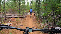
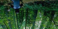
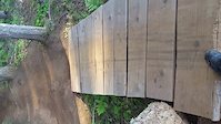
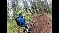
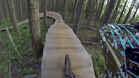
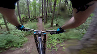
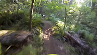
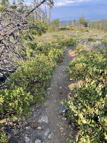
Photos of Sunriver Mountain Bike
Videos of Sunriver Mountain Bike
trail: North Shore Cultus
0:06 |
134 |
Aug 27, 2023

trail: Royal Flush
0:00 |
294 |
Oct 13, 2022
trail: Blackrock
0:05 |
|
Oct 25, 2020
trail: Blackrock
0:14 |
114 |
Aug 27, 2017
trail: Blackrock
3:32 |
407 |
Dec 4, 2014
trail: Blackrock
4:03 |
809 |
Sep 14, 2014
trail: Blackrock
0:10 |
324 |
Sep 1, 2014
trail: Blackrock
0:19 |
302 |
Aug 20, 2014
Recent Trail Reports
National Scenic Trails & Official Routes
-
Metolius Windigo Trail
- Mountain Bike
- E-Bike
- Horse
- Hike
- Trail Running
Activity Feed
| username | action | type | title | date |
|---|---|---|---|---|
| rcharrette | wishlist | trail | activity #97361401 | Jun 19, 2026 @ 7:20pm 2 days |
| Steveburkett | add | report | activity #97286743 | Jun 18, 2026 @ 5:50pm 3 days |
| HMo4Z | add | report | activity #97116950 and 1 more | Jun 16, 2026 @ 9:32am Jun 16, 2026 |
| HMo4Z | ridden | trail | activity #97116933 | Jun 16, 2026 @ 9:32am Jun 16, 2026 |
| bfl01 | difficultyvote | trail | activity #97106742 | Jun 16, 2026 @ 6:57am Jun 16, 2026 |
Recent Comments
| username | type | title | comment | date |
|---|---|---|---|---|
| trail | Gravel, but honestly fast rolling. The kids... | Apr 27, 2026 @ 5:11pm Apr 27, 2026 | ||
| trail | Trail is in perfect shape. | Nov 4, 2025 @ 9:16am Nov 4, 2025 | ||
| trail | We rode this several days and hit all the... | Sep 28, 2025 @ 10:18pm Sep 28, 2025 | ||
| trail | The first part under the power line is really... | Sep 28, 2025 @ 10:08pm Sep 28, 2025 | ||
| trail | Blue but a few sketchy spots, I would say... | Sep 28, 2025 @ 9:24pm Sep 28, 2025 |
Local Badges
-

Epic Mountain Bike Climb 2k7 awarded -

Climbing 10k Badge11 awarded -

Mountain Biking 100k Badge0 awarded -

Epic Ride Descent 2k7 awarded -

Descent 10k Badge11 awarded -

Descent 100k Badge0 awarded
Activity Type Stats
| activitytype | trails | distance | descent | descent distance | total vertical | rating | global rank | state rank | photos | reports | routes | ridelogs |
|---|---|---|---|---|---|---|---|---|---|---|---|---|
| Mountain Bike | 35 | 91 miles | 8,570 ft | 37 miles | 3,802 ft | #1,933 | #702 | 177 | 332 | 3 | 10,671 | |
| E-Bike | 13 | 11 miles | 1,801 ft | 8 miles | 2,106 ft | #5,381 | #1,672 | 177 | 216 | |||
| Horse | 14 | 32 miles | 4,911 ft | 19 miles | 3,435 ft | #1,317 | #799 | 37 | 2 | |||
| Hike | 46 | 103 miles | 10,302 ft | 43 miles | 3,809 ft | #777 | #354 | 9 | 299 | 1,379 | ||
| Trail Running | 48 | 106 miles | 10,584 ft | 44 miles | 3,809 ft | #2,099 | #668 | 332 | 411 | |||
| Dirtbike/Moto | 1 | 5 miles | 1,460 ft | 5 miles | 1,460 ft | 26 | 44 | |||||
| ATV/ORV/OHV | 1 | 5 miles | 1,460 ft | 5 miles | 1,460 ft | 26 | 6 | |||||
| Snowshoe | 3 | 3 miles | 226 ft | 1 mile | 220 ft | 3 | 31 | |||||
| Backcountry Ski | 3 | 3 miles | 226 ft | 1 mile | 220 ft | 2 | 42 | |||||
| Nordic Ski | 3 | 3 miles | 226 ft | 1 mile | 220 ft | 5 | 2 | 75 |
Frequently Asked Questions About Sunriver
▼
What are the best places to ride in Sunriver?
Sunriver has 2 areas to explore for mountain biking. The top rated areas are:
▼
What are the highest rated mountain biking trails in Sunriver?
The highest rated mountain biking trails in Sunriver are:
- Royal Flush (4.2/5)
- Lost Lake (4.1/5)
- Benham Falls Path (4.1/5)
- Sunriver-Lava Butte Trail (4.1/5)
- Crater Rim (4.1/5)
▼
What is the best time of the year to ride in Sunriver?
Based on ride log data, the most popular months to ride in Sunriver are:
- July (293 activities)
- August (207 activities)
- June (155 activities)
▼
Where can I park to ride in Sunriver?
There are 18 parking locations listed in Sunriver. The most popular parking spots are: View all parking and trailhead locations on the map to plan your visit.
Activities
Trails
Points of Interest
- Cultus Lake Campground Camping
- Hot Springs Campground Camping
- East Lake Campground Camping
- Paulina Falls Sight
- Paulina Peak Viewpoint
- Cinder Hill Campground Camping
- Newberry Group Camp Site Camping
- Paulina Lake Campground Camping
- Paulina Lake Visitor Center Information
- Little Crater Viewpoint
- Kawak Butte (7,362 ft)
- Topso Butte (6,808 ft)
- Stams Mountain (6,542 ft)
- By brenthillier
 NSMBA TRAILFORKS & contributors
 - Admins: COTA, COTA
- #8590 - 23,930 views
- sunriver activity log | embed map of Sunriver mountain bike trails | sunriver mountain biking points of interest polygons
Downloading of trail gps tracks in kml & gpx formats is enabled for Sunriver.
You must login to download files.