close
-
Layers w
- Weather Layers
- Pro
- Pro
- Pro
- Pro
- Pro
- Pro
- More Layers
- Pro
- Pro
- Pro
- Pro
-
Upgrade to

3D
Trail Conditions
- Unknown
- Snow Groomed
- Snow Packed
- Snow Covered
- Snow Cover Partial
- Freeze/thaw Cycle
- Icy
- Prevalent Mud
- Wet
- Variable
- Ideal
- Dry
- Very Dry
Trail Flow (Ridden Direction)
Trailforks scans users ridelogs to determine the most popular direction each trail is ridden. A good flowing trail network will have most trails flowing in a single direction according to their intension.
The colour categories are based on what percentage of riders are riding a trail in its intended direction.
The colour categories are based on what percentage of riders are riding a trail in its intended direction.
- > 96%
- > 90%
- > 80%
- > 70%
- > 50%
- < 50%
- bi-directional trail
- no data
Trail Last Ridden
Trailforks scans ridelogs to determine the last time a trail was ridden.
- < 2 days
- < 1 week
- < 2 weeks
- < 1 month
- < 6 months
- > 6 months
Trail Ridden Direction
The intended direction a trail should be ridden.
- Downhill Only
- Downhill Primary
- Both Directions
- Uphill Primary
- Uphill Only
- One Direction
Contribute Details
Colors indicate trail is missing specified detail.
- Description
- Photos
- Description & Photos
- Videos
Trail Popularity ?
Trailforks scans ridelogs to determine which trails are ridden the most in the last 9 months.
Trails are compared with nearby trails in the same city region with a possible 25 colour shades.
Think of this as a heatmap, more rides = more kinetic energy = warmer colors.
- most popular
- popular
- less popular
- not popular
ATV/ORV/OHV Filter
Max Vehicle Width
inches
US Cell Coverage
Legend

Radar Time
Activity Recordings
Trailforks uses anonymized public activity data.
?
Activity Recordings
Trailforks uses anonymized public activity data.
?
Personal Heatmap
▶
Activity Types
all
/
none
▶
Options
2
Date range
month
–
Winter Trails
Warning
A routing network for winter maps does not exist. Selecting trails using the winter trails layer has been disabled.
Missing Trails
Most Popular
Least Popular
Trails are colored based on popularity. The more popular a trail is, the more red. Less popular trails trend towards green.
Jump Magnitude Heatmap
Heatmap of where riders jump on trails. Zoom in to see individual jumps, click circles to view jump details.
BC Backroad Status
![map legend]()
Service Road Atlas is a free to use, community-driven service for viewing and creating reports on the numerous back-country service roads around B.C. and Alberta.

Slope Aspect
Direction the slope faces
Trails Deemphasized
Trails are shown in grey.
Only show trails with no bike usage.
Suggested Layers
Based on selected activity type
Save the current map location and zoom level as your default home location whenever this page is loaded.
Save
No description for Trail has been added yet!
Login or register to submit one.
Activities Click to view
- Mountain Bike
21 trails
- E-Bike
10 trails
- Gravel Bike
0 trails
- Adaptive Bike
0 trails
- Winter Fat Bike
0 trails
- Hike
21 trails
- Trail Running
21 trails
Region Details
- 4
- 4
- 6
- 4
- 2
- 1
Region Status
Open as of 2 daysStats
- Avg Trail Rating
- Trails (view details)
- 21
- Trails Mountain Bike
- 21
- Trails E-Bike
- 10
- Trails Hike
- 21
- Trails Trail Running
- 21
- Total Distance
- 20 miles
- Total Descent
- 5,466 ft
- Total Vertical
- 1,961 ft
- Highest Trailhead
- 3,296 ft
- Reports
- 2,003
- Photos
- 171
- Ridden Counter
- 4,063
Sub Regions
-
Trail Bluffs
- 4
- 4
- 2
Popular Trail Mountain Biking Trails
• 100 ★ 4.3 • 2 miles • 402 ft • 458 •
is a perfect blue progression trail. Ride it counter clockwise to slowly test your ability level after climbing up . If confident at the Sunnigdale junction complete the loop by riding back down the west side (river side) of for a super...
• 85 ★ 4.7 • 2 miles • 22 ft • 420 •
The riding is wide and entertaining, weaving across dramatic rock benches in a playful, flowy descent. A steep drop off edges one side of the trail, providing striking views and sense of ethereal exhilaration and exposure. The turns are...
• 80 ★ 3.5 • 1 mile • 292 ft • 392 •
Popular green difficulty doubletrack. This mountain bike primary trail can be used both directions and has a moderate overall physical rating with a 292 ft blue climb. On average it takes 13 minutes to complete this trail.
• 90 ★ 0.0 • 2,808 ft • 29 ft • 274 •
Primarily local walking path.
• 60 ★ 4.5 • 2 miles • 526 ft • 236 •
Completed during summer 2016 by the KCTS, the trail adds slightly more challenging cross-country riding to the Bluffs trail network. Lots of elaborate trail construction, technical crux moves and incredible views.Ride in a counter...
• 75 ★ 4.5 • 420 ft • 30 ft • 202 •
Popular green difficulty singletrack. This multi-use trail can be used both directions. Trail visibility is always easy to follow. On average it takes minutes to complete this trail.
• 70 ★ 4.8 • 2,733 ft • 60 ft • 174 •
Popular green difficulty singletrack. This mountain bike primary trail can be used both directions. On average it takes 6 minutes to complete this trail.
Trail Mountain Bike Routes
Bluffs / Sunningdale (Loop) Featured
★ 2.7 • 9 miles • 1,499 ft • 3 • Loop •
Start and finish at Gyro Park for a great loop of the / / trails. NOTE: It is very hot here in the summer....
5 miles • 1,015 ft • 3 • Point to Point •
Start with a climb up the trail. Do a lap or 2 of the ( usually done counter-clockwise ) and then descend...
• 4 miles • 845 ft • 7 •
• 5 miles • 642 ft • 6 •
• 4 miles • 750 ft • 5 •
Photos of Trail Mountain Bike
Videos of Trail Mountain Bike
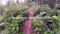
trail: Bluffs Loop
0:31 |
333 |
Jul 3, 2016
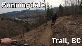
trail: Sunningdale
0:58 |
23524 |
Oct 27, 2015
trail: Bluffs Loop
3:11 |
267 |
Nov 29, 2014
trail: Sunningdale
7:47 |
776 |
Apr 15, 2014
trail: Bluffs Loop
9:07 |
385 |
Apr 15, 2014
youtuber
![Sunningdale - Trail, BC]()
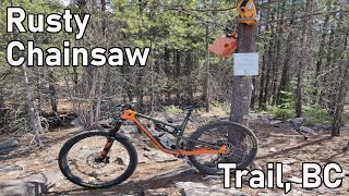
trail: Rusty Chainsaw
7:40 |
701 |
Apr 23, 2021 , Trail
youtuber
![Rusty Chainsaw - Trail, BC]()
trail: Rusty Chainsaw
6:32 |
729 |
Apr 13, 2021 , Trail

trail: Sunningdale
9:49 |
502 |
Dec 28, 2020 , Trail
Recent Trail Reports
| status | trail | date | condition | info | user |
|---|---|---|---|---|---|
| Miral Heights | Jun 11, 2026 @ 10:43am (America/Vancouver) Jun 11, 2026 | Unknown | MissMaya | ||
| Elder | Jun 9, 2026 @ 1:53pm (America/Vancouver) Jun 9, 2026 | Wet | ethanm | ||
| Aspen Loop | Jun 5, 2026 @ 6:48pm (America/Vancouver) Jun 5, 2026 | Unknown | Brielle1vhURX | ||
| Bluffs Loop | Jun 1, 2026 @ 5:23pm (America/Vancouver) Jun 1, 2026 | Unknown | cpengelly | ||
| Sunningdale | Jun 1, 2026 @ 5:23pm (America/Vancouver) Jun 1, 2026 | Ideal | stewspooner KCTS | ||
| Rusty Chainsaw | Jun 1, 2026 @ 5:22pm (America/Vancouver) Jun 1, 2026 | Variable | cpengelly | ||
| Crowebar | May 30, 2026 @ 8:32am (America/Vancouver) May 30, 2026 | Dry | Kristyg6my8S | ||
| Regional Path - Charles Lakes Dr | May 15, 2026 @ 10:46am (America/Vancouver) May 15, 2026 | Ideal | Bricklin69 | ||
| Aspen Loop | Apr 24, 2026 @ 8:45am (America/Vancouver) Apr 24, 2026 | Ideal | stewspooner KCTS | ||
| Ravens Rock | Apr 24, 2026 @ 8:45am (America/Vancouver) Apr 24, 2026 | Ideal | stewspooner KCTS |
Activity Feed
| username | action | type | title | date |
|---|---|---|---|---|
| MissMaya | add | report | activity #96748078 and 1 more | Jun 11, 2026 @ 10:41am Jun 11, 2026 |
| ethanm | add | report | activity #96627856 | Jun 9, 2026 @ 1:53pm Jun 9, 2026 |
| ethanm | vote | trail | activity #96627818 | Jun 9, 2026 @ 1:52pm Jun 9, 2026 |
| Brielle1vhURX | add | report | activity #96336420 | Jun 5, 2026 @ 6:48pm Jun 5, 2026 |
| stewspooner | add | report | activity #96051601 | Jun 1, 2026 @ 5:23pm Jun 1, 2026 |
Recent Comments
| username | type | title | comment | date |
|---|---|---|---|---|
| report | Trails cleared as noted. | Dec 19, 2025 @ 5:12pm Dec 19, 2025 | ||
| trail | Fun but has technically challenging sections. | Aug 1, 2025 @ 9:57am Aug 1, 2025 | ||
| trail | Steep climb to the top but less steep than the... | Aug 1, 2025 @ 9:56am Aug 1, 2025 | ||
| trail | Fun trail with a steep climb to the top. Only... | Aug 1, 2025 @ 9:44am Aug 1, 2025 | ||
| report | .2,-/ aand. Wa zzz a w -q sex czar A z as... | Jul 23, 2025 @ 4:34pm Jul 23, 2025 |
Local Badges
-

Epic Mountain Bike Climb 2k35 awarded -

Climbing 10k Badge22 awarded -

Mountain Biking 100k Badge0 awarded -

Epic Ride Descent 2k35 awarded -

Descent 10k Badge22 awarded -

Descent 100k Badge0 awarded
Activity Type Stats
| activitytype | trails | distance | descent | descent distance | total vertical | rating | global rank | state rank | photos | reports | routes | ridelogs |
|---|---|---|---|---|---|---|---|---|---|---|---|---|
| Mountain Bike | 21 | 20 miles | 5,466 ft | 10 miles | 1,962 ft | #4,016 | #96 | 156 | 1,995 | 3 | 5,364 | |
| E-Bike | 10 | 10 miles | 2,418 ft | 5 miles | 1,230 ft | #6,390 | #113 | 1,569 | 203 | |||
| Hike | 21 | 20 miles | 5,466 ft | 10 miles | 1,962 ft | #3,860 | #103 | 15 | 1,957 | 463 | ||
| Trail Running | 21 | 20 miles | 5,466 ft | 10 miles | 1,962 ft | #5,509 | #118 | 1,970 | 2,004 |
Frequently Asked Questions About Trail
▼
What are the best places to ride in Trail?
Trail has 1 areas to explore for mountain biking. The top rated areas are:
▼
What are the highest rated mountain biking trails in Trail?
The highest rated mountain biking trails in Trail are:
- Sunningdale (4.4/5)
- Aspen Loop (4.4/5)
- Aspen Loop (4.3/5)
- Rusty Chainsaw (4.2/5)
- Bluffs Loop (4.2/5)
▼
What is the best time of the year to ride in Trail?
Based on ride log data, the most popular months to ride in Trail are:
- April (55 activities)
- July (53 activities)
- June (37 activities)
▼
Where can I park to ride in Trail?
There are 1 parking locations listed in Trail. The most popular parking spots are:
Activities
Trails
Points of Interest
- By canadaka
 Trailforks & contributors
 - Admins: barry-mclane, KCTS, KCTS
- #4201 - 5,474 views
- trail activity log | embed map of Trail mountain bike trails | trail mountain biking points of interest
Downloading of trail gps tracks in kml & gpx formats is enabled for Trail.
You must login to download files.