close
-
Layers w
- Weather Layers
- Pro
- Pro
- Pro
- Pro
- Pro
- Pro
- More Layers
- Pro
- Pro
- Pro
- Pro
-
Upgrade to

3D
Trail Conditions
- Unknown
- Snow Groomed
- Snow Packed
- Snow Covered
- Snow Cover Partial
- Freeze/thaw Cycle
- Icy
- Prevalent Mud
- Wet
- Variable
- Ideal
- Dry
- Very Dry
Trail Flow (Ridden Direction)
Trailforks scans users ridelogs to determine the most popular direction each trail is ridden. A good flowing trail network will have most trails flowing in a single direction according to their intension.
The colour categories are based on what percentage of riders are riding a trail in its intended direction.
The colour categories are based on what percentage of riders are riding a trail in its intended direction.
- > 96%
- > 90%
- > 80%
- > 70%
- > 50%
- < 50%
- bi-directional trail
- no data
Trail Last Ridden
Trailforks scans ridelogs to determine the last time a trail was ridden.
- < 2 days
- < 1 week
- < 2 weeks
- < 1 month
- < 6 months
- > 6 months
Trail Ridden Direction
The intended direction a trail should be ridden.
- Downhill Only
- Downhill Primary
- Both Directions
- Uphill Primary
- Uphill Only
- One Direction
Contribute Details
Colors indicate trail is missing specified detail.
- Description
- Photos
- Description & Photos
- Videos
Trail Popularity ?
Trailforks scans ridelogs to determine which trails are ridden the most in the last 9 months.
Trails are compared with nearby trails in the same city region with a possible 25 colour shades.
Think of this as a heatmap, more rides = more kinetic energy = warmer colors.
- most popular
- popular
- less popular
- not popular
ATV/ORV/OHV Filter
Max Vehicle Width
inches
US Cell Coverage
Legend

Radar Time
Activity Recordings
Trailforks uses anonymized public activity data.
?
Activity Recordings
Trailforks uses anonymized public activity data.
?
Personal Heatmap
▶
Activity Types
all
/
none
▶
Options
2
Date range
month
–
Winter Trails
Warning
A routing network for winter maps does not exist. Selecting trails using the winter trails layer has been disabled.
Missing Trails
Most Popular
Least Popular
Trails are colored based on popularity. The more popular a trail is, the more red. Less popular trails trend towards green.
Jump Magnitude Heatmap
Heatmap of where riders jump on trails. Zoom in to see individual jumps, click circles to view jump details.
BC Backroad Status
![map legend]()
Service Road Atlas is a free to use, community-driven service for viewing and creating reports on the numerous back-country service roads around B.C. and Alberta.

Slope Aspect
Direction the slope faces
Trails Deemphasized
Trails are shown in grey.
Only show trails with no bike usage.
Suggested Layers
Based on selected activity type
Save the current map location and zoom level as your default home location whenever this page is loaded.
Save
No description for Williston has been added yet!
Login or register to submit one.
Activities Click to view
- Mountain Bike
127 trails
- E-Bike
112 trails
- Gravel Bike
0 trails
- Adaptive Bike
0 trails
- Winter Fat Bike
0 trails
- Hike
132 trails
- Trail Running
132 trails
- Snowshoe
52 trails
- Backcountry Ski
1 trails
- Nordic Ski
40 trails
Region Details
- 33
- 30
- 22
- 19
- 11
Region Status
Caution as of Jun 7, 2026Stats
- Avg Trail Rating
- Trails (view details)
- 124
- Trails Mountain Bike
- 127
- Trails E-Bike
- 112
- Trails Hike
- 132
- Trails Trail Running
- 132
- Trails Snowshoe
- 52
- Trails Backcountry Ski
- 1
- Trails Nordic Ski
- 40
- Total Distance
- 36 miles
- Total Descent
- 4,035 ft
- Total Vertical
- 544 ft
- Highest Trailhead
- 902 ft
- Reports
- 6,033
- Photos
- 160
- Ridden Counter
- 31,680
Sub Regions
-
Catamount Outdoor Family Center
- 27
- 16
- 19
- 11
-
Mud Pond Country Park
- 3
- 5
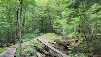
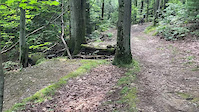
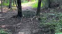
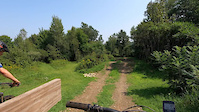
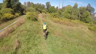
Popular Williston Mountain Biking Trails
• 100 ★ 3.5 • 1,063 ft • 15 ft • 538 •
Popular trail to get started off of Balsam or Sandman. After crossing Sandman trail a second time, look for on the right or continue down through roots and rocks to rejoin Sandman further downhill
• 90 ★ 3.9 • 2,333 ft • 11 ft • 505 •
Misnomer... yes there is a ravine off the side of this trail, but don't be scared. It's relatively level, bermed, flowy and smooth. Best done together with for single track heaven.
• 95 ★ 5.0 • 1,765 ft • 27 ft • 505 •
Fast and flowy trail with some punchy uphills and rock outcroppings to add a couple fun challenges.
• 85 ★ 5.0 • 1,847 ft • 153 ft • 472 •
Trail mostly goes through the grassy powerline. Great way to climb higher to access other trails higher up.
• 100 ★ 0.0 • 472 ft • 0 ft • 462 •
Rooty single track offshoot from Sandman double track. Often used as part of weekly race series or just to add some spice to your ride.
• 85 ★ 2.0 • 640 ft • 28 ft • 428 •
A twin to trail branching off the top of crossing Sandman and over to a grove of white . Loops back around to connect to sandman again near bottom of . Trail features some rock ledge.
Williston Mountain Bike Routes
1 mile • 32 ft • 2 • Loop •
Catamount Outdoor Family Center easiest loop. The beginning of Woods Trace to the Powerline is loose...
2 miles • 90 ft • 3 • Loop •
A good loop to warm up and progress on, with a mix of wider paths and narrower singletrack.
1 mile • 67 ft • 2 •
Marked ski route for beginners looking to explore past loop
3 miles • 126 ft • 5 • Loop •
A good fast warm up progression loop for intermediate and advanced riders.
4,715 ft • 39 ft • 2 • Loop •
One of the easiest COFC loops, great for new riders and mellow hiking.
Photos of Williston Mountain Bike
Videos of Williston Mountain Bike
trail: Trout Lily
0:15 |
66 |
Aug 23, 2023
trail: Gap Jump A-line
0:05 |
80 |
Aug 23, 2023
trail: Wood drop line
0:13 |
47 |
Aug 23, 2023
trail: Dual Slalom Course
0:32 |
116 |
Aug 21, 2023

trail: Dirt Jumps
4:40 |
974 |
Apr 23, 2021 , Williston
trail: Dirt Jumps
0:11 |
416 |
Apr 23, 2021 , Williston

trail: Dirt Jumps
0:48 |
365 |
Apr 23, 2021 , Williston

trail: Dirt Jumps
2:21 |
490 |
Apr 23, 2021 , Williston
Recent Trail Reports
| status | trail | date | condition | info | user |
|---|---|---|---|---|---|
| Vast Connector | Jun 8, 2026 @ 1:01am (America/New_York) Jun 7, 2026 | Variable | morse-ah FOTW | ||
| VAST | Jun 8, 2026 @ 1:01am (America/New_York) Jun 7, 2026 | Variable | morse-ah FOTW | ||
| Quiet Connector | Jun 8, 2026 @ 1:01am (America/New_York) Jun 7, 2026 | Variable | morse-ah FOTW | ||
| MPCP Top Loop | Jun 8, 2026 @ 1:01am (America/New_York) Jun 7, 2026 | Variable | morse-ah FOTW | ||
| MPCP Loop | Jun 8, 2026 @ 1:01am (America/New_York) Jun 7, 2026 | Variable | morse-ah FOTW | ||
| MPCP Extension Loop | Jun 8, 2026 @ 1:01am (America/New_York) Jun 7, 2026 | Variable | morse-ah FOTW | ||
| MPCP Downhill | Jun 8, 2026 @ 1:01am (America/New_York) Jun 7, 2026 | Variable | morse-ah FOTW | ||
| Herskowitz Loop | Jun 8, 2026 @ 1:01am (America/New_York) Jun 7, 2026 | Variable | morse-ah FOTW | ||
| Cody's | Jun 8, 2026 @ 1:01am (America/New_York) Jun 7, 2026 | Variable | morse-ah FOTW | ||
| Trout Lily | May 12, 2026 @ 1:30pm (America/New_York) May 12, 2026 | Variable | COFC-Trails COFC |
Activity Feed
| username | action | type | title | date |
|---|---|---|---|---|
| SethaUIw3d | wishlist | route | activity #97069742 | Jun 15, 2026 @ 3:40pm 10 hours |
| ToddvZ8TGS | wishlist | region | activity #97039598 | Jun 15, 2026 @ 7:24am 18 hours |
| LionO | wishlist | route | activity #96664754 | Jun 10, 2026 @ 4:58am Jun 10, 2026 |
| joconant | wishlist | region | activity #96554792 | Jun 8, 2026 @ 11:48am Jun 8, 2026 |
| morse-ah | add | report | activity #96520733 and 8 more | Jun 7, 2026 @ 10:01pm Jun 7, 2026 |
Recent Comments
| username | type | title | comment | date |
|---|---|---|---|---|
| report | All clear and ready to go. Thanks for the report | Aug 22, 2025 @ 8:09am Aug 22, 2025 | ||
| report | I was DDSs# | Jul 19, 2025 @ 11:07am Jul 19, 2025 | ||
| trail | Wont wver plan to ride this network again ... | Aug 31, 2023 @ 10:23am Aug 31, 2023 | ||
| trail | 2 | May 20, 2020 @ 1:16pm May 20, 2020 | ||
| report | done, Julian added fill | Nov 27, 2018 @ 2:31pm Nov 27, 2018 |
Local Badges
-

Top 10 Trails57 awarded -

Descent 100k Badge0 awarded -

Big Ride 30k755 awarded -

Epic Ride 50k313 awarded -

Descent 10k Badge29 awarded -

Completionist2 awarded
Bike & Skill Parks
| name | type | city | rating |
|---|---|---|---|
| Cubbies Pump Track | skill park | Williston | |
| Catamount Dirt Jumps and Dual Slalom course | skill park | Williston |
Activity Type Stats
| activitytype | trails | distance | descent | descent distance | total vertical | rating | global rank | state rank | photos | reports | routes | ridelogs |
|---|---|---|---|---|---|---|---|---|---|---|---|---|
| Mountain Bike | 127 | 33 miles | 3,694 ft | 13 miles | 545 ft | #899 | #352 | 160 | 5,500 | 50 | 10,535 | |
| E-Bike | 112 | 26 miles | 3,127 ft | 10 miles | 417 ft | #2,911 | #1,097 | 1,595 | 23 | 114 | ||
| Hike | 132 | 36 miles | 3,921 ft | 14 miles | 545 ft | #3,895 | #1,380 | 3 | 5,483 | 18 | 682 | |
| Trail Running | 132 | 36 miles | 3,921 ft | 14 miles | 545 ft | #2,917 | #843 | 5,483 | 28 | 1,198 | ||
| Snowshoe | 52 | 13 miles | 1,667 ft | 5 miles | 417 ft | #603 | #237 | 1 | 3,240 | 2 | 151 | |
| Backcountry Ski | 1 | #578 | #183 | 2,866 | 5 | 244 | ||||||
| Nordic Ski | 40 | 13 miles | 1,273 ft | 5 miles | 417 ft | #136 | #34 | 1 | 3,076 | 12 | 1,018 |
Frequently Asked Questions About Williston
▼
What are the best places to ride in Williston?
Williston has 3 areas to explore for mountain biking. The top rated areas are:
▼
What are the highest rated mountain biking trails in Williston?
The highest rated mountain biking trails in Williston are:
- Moose Poop (4.2/5)
- Gully Whumper (4.2/5)
- Watermelon (4.2/5)
- Powerlines (4.1/5)
- Rock Spine (4.1/5)
▼
What is the best time of the year to ride in Williston?
Based on ride log data, the most popular months to ride in Williston are:
- July (251 activities)
- June (246 activities)
- August (203 activities)
▼
Where can I park to ride in Williston?
There are 4 parking locations listed in Williston. The most popular parking spots are: View all parking and trailhead locations on the map to plan your visit.
Activities
Trails
- By StephaneMarceau
 TRAILFORKS & contributors
 - Admins: VMBA, Velomont, Jwduston, COFC
- #11353 - 7,435 views
- williston activity log | embed map of Williston mountain bike trails | williston mountain biking points of interest
Downloading of trail gps tracks in kml & gpx formats is enabled for Williston.
You must login to download files.