
4.6 miles
Distance
625 ft
Climb
-628 ft
Descent
867 ft
High Point
-1 ft
Altitude change
439 ft
Altitude min
479 ft
Altitude start
479 ft
Altitude end
-27%
Grade max
27%
Grade min
2 miles
Distance climb
2 miles
Distance down
4,593 ft
Distance flat

Ride at your own risk

Two-Hour Beginner-Intermediate loop

Please keep in mind that Hartland is a very technical trail network and that beginner is relative to the park as a whole. There are punchy climbs, roots, rocks, and trail features that may be outside of your ability. Most features have a ride around and there are small connectors (not on the map) that avoid the features.

Detailed Description
2-Hour Beginner-Intermediate Route is a 5 mile popular intermediate route located near Victoria British Columbia. This mountain bike primary route can be used one direction and has a moderate overall physical rating. This route includes 14 trails. This route climbs 625 ft with a max elevation of 867 ft then descends -628 ft.
Tags
BridgesRockyRooty

Local Trail Association

Local trail association
South Island Mountain Bike Society (simbs.com)
Please consider joining or donating to the local riding association to support trail development & maintenance.
Donate to earn trail karma!

Stats

  • Distance
    5 miles
  • Avg time
    51 min 31 sec
  • Altitude min
    439 ft
  • Altitude start
    479 ft
  • Altitude end
    479 ft
  • Climb
    625 ft
  • Descent
    -628 ft
  • Grade max
    -27%
  • Grade min
    27%
  • Distance climb
    2 miles
  • Distance down
    2 miles
  • Distance flat
    4,593 ft

21 Reviews & Comments


We hope you've been enjoying Trailforks!

Create a FREE account to view all route reviews and much more.

Trails in Route

Details

  • Riding area
  • Primary Activity
    Mountain Bike
  • Other Activities
    • E-Bike
  • Difficulty rating
    Blue
  • Route Type
    Loop
  • eBike Allowed
  • Bike type
    AM, XC
  • Direction
    One Direction
  • Physical rating
    Moderate
  • Activity Logs
    10
Avg: 2.35 (3 votes)
close
Trail transparency
  • Singletrack
  • Unpaved
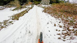
Feb 9th, 2025 Snow
mtb
Feb 9th, 2025 Snow
trail: Skull
2:52 | 254 | comments: 0 | favs:
Feb 9, 2025

Recent Trail Reports Along Route

statustraildateconditiondescription
Easy Rider
Oct 29, 2026 @ 4:02pm (America/Vancouver)
2 days
Tree cleared by the CRD.
Skull
Oct 11, 2026 @ 9:43am (America/Vancouver)
Oct 11, 2026
Painless
Oct 11, 2026 @ 9:43am (America/Vancouver)
Oct 11, 2026
Diaphragm Connector
Oct 11, 2026 @ 9:43am (America/Vancouver)
Oct 11, 2026
Over Dive
Oct 11, 2026 @ 9:43am (America/Vancouver)
Oct 11, 2026
more reports »
  • By NolanRiding & contributors
  • #48594 - 1,123 views

Hit the Trail

Open in App

Get this route on your phone instantly.

Download Route

Save to wishlist, Garmin & download.