14.2 miles
Distance
3,331 ft
Climb
-3,329 ft
Descent
1,689 ft
High Point
624 ft
Altitude min
739 ft
Altitude start
738 ft
Altitude end
-70.1%
Grade max
57.1%
Grade min
7 miles
Distance climb
6 miles
Distance down
4,885 ft
Distance flat

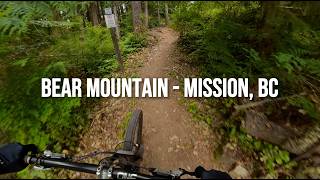
Just me flagging the bear mountain course

Detailed Description
Bear Flagging is a 14 mile moderately popular intermediate route located near Mission British Columbia. This mountain bike only route. This route includes 17 trails. This route climbs 3,331 ft with a max elevation of 1,689 ft then descends -3,329 ft.

Trail Issues on Route

  • Minor Issue / Yellow: 2 trails (newest: Jun 18, 2026)
Local Trail Association
Local trail association
Fraser Valley Mountain Bikers Association (www.fvmba.com)
Please consider joining or donating to the local riding association to support trail development & maintenance.
Donate to earn trail karma!

Trail Products

Stats

  • Distance
    14 miles
  • Altitude min
    624 ft
  • Altitude start
    739 ft
  • Altitude end
    738 ft
  • Climb
    3,331 ft
  • Descent
    -3,329 ft
  • Grade max
    -70.1%
  • Grade min
    57.1%
  • Distance climb
    7 miles
  • Distance down
    6 miles
  • Distance flat
    4,885 ft

31 Reviews & Comments


We hope you've been enjoying Trailforks!

Create a FREE account to view route comments and much more.

Details

  • Riding area
  • Primary Activity
    Mountain Bike
  • Difficulty rating
    Blue
no votes yet
close
3D
Trail Conditions
  • Unknown
  • Snow Groomed
  • Snow Packed
  • Snow Covered
  • Snow Cover Partial
  • Freeze/thaw Cycle
  • Icy
  • Prevalent Mud
  • Wet
  • Variable
  • Ideal
  • Dry
  • Very Dry
Trail Flow (Ridden Direction)
Trailforks scans users ridelogs to determine the most popular direction each trail is ridden. A good flowing trail network will have most trails flowing in a single direction according to their intension.
The colour categories are based on what percentage of riders are riding a trail in its intended direction.
  • > 96%
  • > 90%
  • > 80%
  • > 70%
  • > 50%
  • < 50%
  • bi-directional trail
  • no data
Trail Last Ridden
Trailforks scans ridelogs to determine the last time a trail was ridden.
  • < 2 days
  • < 1 week
  • < 2 weeks
  • < 1 month
  • < 6 months
  • > 6 months
Trail Ridden Direction
The intended direction a trail should be ridden.
  • Downhill Only
  • Downhill Primary
  • Both Directions
  • Uphill Primary
  • Uphill Only
  • One Direction
Contribute Details
Colors indicate trail is missing specified detail.
  • Description
  • Photos
  • Description & Photos
  • Videos
Trail Popularity ?
Trailforks scans ridelogs to determine which trails are ridden the most in the last 9 months. Trails are compared with nearby trails in the same city region with a possible 25 colour shades. Think of this as a heatmap, more rides = more kinetic energy = warmer colors.
  • most popular
  • popular
  • less popular
  • not popular
ATV/ORV/OHV Filter
Max Vehicle Width
inches
US Cell Coverage
Legend
cell carrier legend

Radar Time
Activity Recordings
Trailforks uses anonymized public activity data. ?
Activity Recordings
Trailforks uses anonymized public activity data. ?
Personal Heatmap
Activity Types
all / none
Options
2
Date range month
Winter Trails
Warning A routing network for winter maps does not exist. Selecting trails using the winter trails layer has been disabled.
Missing Trails
Most Popular
Least Popular
Trails are colored based on popularity. The more popular a trail is, the more red. Less popular trails trend towards green.
Jump Magnitude Heatmap
Heatmap of where riders jump on trails. Zoom in to see individual jumps, click circles to view jump details.
BC Backroad Status

Service Road Atlas is a free to use, community-driven service for viewing and creating reports on the numerous back-country service roads around B.C. and Alberta.

map legend
Slope Aspect
Direction the slope faces
Flat N NE E SE S SW W NW
Trails Deemphasized
Trails are shown in grey.
disable
Only show trails with no bike usage.
Enable
Suggested Layers
Based on selected activity type

    Save the current map location and zoom level as your default home location whenever this page is loaded.

    Save
    Trail transparency
    • Singletrack
    • Unpaved
    244 | 2 comments
    275
    545
    846 | 2 comments

    Recent Trail Reports Along Route

    statustraildateconditiondescription
    Super Bear
    Jun 22, 2026 @ 3:34pm (America/Vancouver)
    Jun 22, 2026
    Bear Buns
    Jun 22, 2026 @ 3:34pm (America/Vancouver)
    Jun 22, 2026
    Bear Back
    Jun 22, 2026 @ 3:34pm (America/Vancouver)
    Jun 22, 2026
    Big Trouble Little Chainring
    Jun 18, 2026 @ 11:46pm (America/Vancouver)
    Jun 18, 2026
    very large tree down at the intersection of Pond Access and BTLC
    Corduroy
    May 30, 2026 @ 10:07am (America/Vancouver)
    May 30, 2026
    more reports »
    • By WLF1anOm & contributors
    • #66069 - 58 views

    Hit the Trail

    Open in App

    Get this route on your phone instantly.

    Download Route

    Save to wishlist, Garmin & download.