more stats
1,402 ft
Distance
146 ft
Climb
-2 ft
Descent
00:04:19
Avg time
144 ft
Altitude change
1,179 ft
Altitude min
1,323 ft
Altitude max
1,179 ft
Altitude start
1,323 ft
Altitude end
10.28%
Grade
-0.575%
Grade max
22.523%
Grade min
1,216 ft
Distance climb
60 ft
Distance down
127 ft
Distance flat
00:04:19
Avg time

Bear Back Details

  • Activities
    • Mountain Bike
    • Hike
    • Trail Running
  • Riding Area
    Bear Mountain
    Mission, British Columbia
  • Difficulty Rating
  • Local Popularity
    100 in Mountain Biking [+]
    • 95 in Trail Running
    • 100 in Hiking
  • Global Ranking
    #31667 in Mountain Biking [+]
    • #21178 in Trail Running
    • #7186 in Hiking
  • Trail Type
    Singletrack
  • Bike Type
    AM
  • Direction
    Uphill Primary
    Popular Direction Shown
  • Climb Difficulty
    Blue
  • Physical Rating
    Moderate
  • Season
    All
  • Dogs Allowed
    Yes
  • eBike Allowed
  • Ride in Rain
    Yes
  • Year Opened
    2014
  • Land Owner
    Mission Forestry Tree Farm

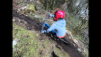
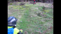
Awesome short climbing trail - avoids grunt climb on access road BR SA100 takes you back to SA 100 and from there to the junction of Access 3 and BRSA100.

This trail is unsanctioned.

Traditionally Indigenous Territory

Recent Activity on Trail

Past Week
  • 9 rides
  • 7 miles average
6 Months
  • 146 rides
  • 8 miles avg distance
All
  • 2,185 rides
  • Last: Jun 3, 2026
c1c2c3c4
January
February
March
April
May
June
July
August
September
October
November
December
Status:
on Jun 3, 2026
Ideal
Avg: 4.15 (20 votes)
Your vote: 0

view (10,655)
close
3D
Trail Conditions
  • Unknown
  • Snow Groomed
  • Snow Packed
  • Snow Covered
  • Snow Cover Partial
  • Freeze/thaw Cycle
  • Icy
  • Prevalent Mud
  • Wet
  • Variable
  • Ideal
  • Dry
  • Very Dry
Trail Flow (Ridden Direction)
Trailforks scans users ridelogs to determine the most popular direction each trail is ridden. A good flowing trail network will have most trails flowing in a single direction according to their intension.
The colour categories are based on what percentage of riders are riding a trail in its intended direction.
  • > 96%
  • > 90%
  • > 80%
  • > 70%
  • > 50%
  • < 50%
  • bi-directional trail
  • no data
Trail Last Ridden
Trailforks scans ridelogs to determine the last time a trail was ridden.
  • < 2 days
  • < 1 week
  • < 2 weeks
  • < 1 month
  • < 6 months
  • > 6 months
Trail Ridden Direction
The intended direction a trail should be ridden.
  • Downhill Only
  • Downhill Primary
  • Both Directions
  • Uphill Primary
  • Uphill Only
  • One Direction
Contribute Details
Colors indicate trail is missing specified detail.
  • Description
  • Photos
  • Description & Photos
  • Videos
Trail Popularity ?
Trailforks scans ridelogs to determine which trails are ridden the most in the last 9 months. Trails are compared with nearby trails in the same city region with a possible 25 colour shades. Think of this as a heatmap, more rides = more kinetic energy = warmer colors.
  • most popular
  • popular
  • less popular
  • not popular
ATV/ORV/OHV Filter
Max Vehicle Width
inches
US Cell Coverage
Legend
cell carrier legend

Radar Time
Activity Recordings
Trailforks uses anonymized public activity data. ?
Activity Recordings
Trailforks uses anonymized public activity data. ?
Personal Heatmap
Activity Types
all / none
Options
2
Date range month
Winter Trails
Warning A routing network for winter maps does not exist. Selecting trails using the winter trails layer has been disabled.
Missing Trails
Most Popular
Least Popular
Trails are colored based on popularity. The more popular a trail is, the more red. Less popular trails trend towards green.
Jump Magnitude Heatmap
Heatmap of where riders jump on trails. Zoom in to see individual jumps, click circles to view jump details.
BC Backroad Status

Service Road Atlas is a free to use, community-driven service for viewing and creating reports on the numerous back-country service roads around B.C. and Alberta.

map legend
Slope Aspect
Direction the slope faces
Flat N NE E SE S SW W NW
Trails Deemphasized
Trails are shown in grey.
disable
Only show trails with no bike usage.
Enable
Suggested Layers
Based on selected activity type

    Save the current map location and zoom level as your default home location whenever this page is loaded.

    Save
        Directions to bear-back trailhead (49.189280, -122.309650)

        Photos

        17 more »
        243 |
        Jan 17, 2018 @ 12:13am
        Jan 17, 2018
        42 |
        Jan 30, 2024 @ 2:06pm
        Jan 30, 2024
        48 |
        Jan 30, 2024 @ 2:04pm
        Jan 30, 2024
        42 |
        Dec 5, 2021 @ 10:17am
        Dec 5, 2021

        Videos

        3 more »
        Bear Back  - Bear Mountain Mission
        3:36 | 280 | Oct 13, 2021 , Mission
        Undergrounduro pre-race prep
        0:30 | 370 | Mar 6, 2019 , Mission
        Bear Back Origins - 2014
        3:19 | 89 | Mar 7, 2019 , Mission

        Routes with this trail

        5.0 6 miles 1,593 ft 8 Loop
        testing out route building
        4.0 15 miles 3,260 ft 28 Loop
        Two Loops: one on Bear and one on Red. I rode Bear first, but you could do Red first as it is a little...
        9 miles 2,216 ft 13
        Fraser Valley Bear Classic Fraser Valley Relive Your Ride For other ride suggestions for this and other...

        Trail Products

        Reviews / Comments

        No reviews yet, be the first to write a review or ask a question.
        Use trail reports to comment on trail conditions.


        We hope you've been enjoying Trailforks!

        Create a FREE account to view trail comments and much more.

        • #19847 - 4,536 views

        Frequently Asked Questions About Bear Back

        Where is Bear Back located?
        Bear Back is located in Bear Mountain, Mission, British Columbia, Canada. It is part of the Bear Mountain trail network. The trailhead is located at coordinates 49.18928, -122.30965.
        How hard is Bear Back?
        Bear Back is rated as Blue difficulty. The physical rating is Moderate. The average grade is 10.28%. The climb difficulty is rated Blue.
        What is the elevation gain for Bear Back?
        Bear Back has 146 ft of elevation gain. The trail has 2 ft of elevation descent. The elevation ranges from 1,179 ft to 1,323 ft.
        Is Bear Back a point to point trail?
        Bear Back is not a point to point trail. The direction is Uphill Primary. The trail type is singletrack.

        Hit the Trail

        Open in App

        Get this trail on your phone instantly.
        open trail in app

        Download Trail

        Save to wishlist, Garmin & download.
        save the trail

        Find Related Routes

        Find routes and users activities that include this trail.
        find routes for this trail

        You must enter a description before submitting.