16.9 miles
Distance
3,950 ft
Climb
-3,968 ft
Descent
4,519 ft
High Point
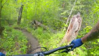
First trial of using this feature to create a loop we want to ride...
Detailed Description
Big Ed Loop is a 17 mile moderately popular intermediate route located near Kelowna British Columbia. This mountain bike only route and has a hard overall physical rating. This route includes 26 trails. This route climbs 3,950 ft with a max elevation of 4,519 ft then descends -3,968 ft.
Local Trail Association
Mountain Bikers of the Central Okanagan (mtbco.ca)Please consider joining or donating to the local riding association to support trail development & maintenance.
donate to earn trail karma!
39 Reviews & Comments
We hope you've been enjoying Trailforks!
Create a FREE account to view route comments and much more.
Trails in Route
1 mile | |||||
469 ft | |||||
3 ft | |||||
436 ft | |||||
223 ft | |||||
1,473 ft | |||||
1,027 ft | |||||
2 miles | |||||
1 mile | |||||
1,325 ft | |||||
3 miles | |||||
2 miles | |||||
1 mile | |||||
410 ft | |||||
1,965 ft | |||||
1,253 ft | |||||
92 ft | |||||
167 ft | |||||
1,224 ft | |||||
561 ft | |||||
338 ft | |||||
1,073 ft | |||||
3,140 ft | |||||
541 ft | |||||
3 ft | |||||
3 miles |
Details
-
Riding area
-
Primary ActivityMountain Bike
-
Difficulty ratingBlue
-
Bike typeAM
-
Physical ratingHard
More Stats for Big Ed Loop mountain bike route
-
Avg time6 hr 50 min
-
Altitude change-18 ft
-
Altitude min1,549 ft
-
Altitude start1,757 ft
-
Altitude end1,739 ft
-
Grade-0%
-
Grade max-78.3%
-
Grade min142.5%
-
Distance climb9 miles
-
Distance down7 miles
-
Distance flat5,069 ft
close
3D
Trail Conditions
- Unknown
- Snow Groomed
- Snow Packed
- Snow Covered
- Snow Cover Inadequate
- Freeze/thaw Cycle
- Icy
- Prevalent Mud
- Wet
- Variable
- Ideal
- Dry
- Very Dry
Trail Flow (Ridden Direction)
Trailforks scans users ridelogs to determine the most popular direction each trail is ridden. A good flowing trail network will have most trails flowing in a single direction according to their intension.
The colour categories are based on what percentage of riders are riding a trail in its intended direction.
- > 96%
- > 90%
- > 80%
- > 70%
- > 50%
- < 50%
- bi-directional trail
- no data
Trail Last Ridden
Trailforks scans ridelogs to determine the last time a trail was ridden.
- < 2 days
- < 1 week
- < 2 weeks
- < 1 month
- < 6 months
- > 6 months
Trail Ridden Direction
The intended direction a trail should be ridden.
- Downhill Only
- Downhill Primary
- Both Directions
- Uphill Primary
- Uphill Only
- One Direction
Contribute Details
Colors indicate trail is missing specified detail.
- Description
- Photos
- Description & Photos
- Videos
Trail Popularity ?
Trailforks scans ridelogs to determine which trails are ridden the most in the last 9 months.
Trails are compared with nearby trails in the same city region with a possible 25 colour shades.
Think of this as a heatmap, more rides = more kinetic energy = warmer colors.
- most popular
- popular
- less popular
- not popular
ATV/ORV/OHV Filter
Max Vehicle Width
inches
Radar Time
x
Activity Recordings
Trailforks users anonymized public ridelogs from the past 6 months.
- mountain biking recent
- mountain biking (>6 month)
- hiking (1 year)
- moto (1 year)
Activity Recordings
Trailforks users anonymized public skilogs from the past 12 months.
- Downhill Ski
- Backcountry Ski
- Nordic Ski
- Snowmobile
Winter Trails
Warning
A routing network for winter maps does not exist. Selecting trails using the winter trails layer has been disabled.
x
Missing Trails
Most Popular
Least Popular
Trails are colored based on popularity. The more popular a trail is, the more red. Less popular trails trend towards green.
Jump Magnitude Heatmap
Heatmap of where riders jump on trails. Zoom in to see individual jumps, click circles to view jump details.
Trails Deemphasized
Trails are shown in grey.
Only show trails with NO bikes.
Save the current map location and zoom level as your default home location whenever this page is loaded.
Save
Trail transparency
Photos
Recent Trail Reports Along Route
more reports »
- By Guardianbpr & contributors
- #5617 - 1,342 views