13.9 miles
Distance
2,088 ft
Climb
-2,093 ft
Descent
2,577 ft
High Point
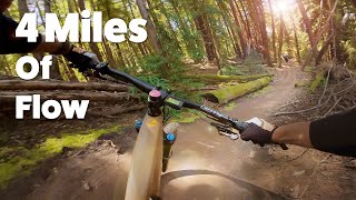
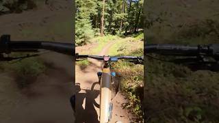
New Flow Trail in Santa Cruz
Detailed Description
Flow Trail loop is a highly rated 14 mile popular intermediate route located near Soquel California. This mountain bike only route can be used one direction and has a moderate overall physical rating. This route includes 17 trails. This route climbs 2,088 ft with a max elevation of 2,577 ft then descends -2,093 ft.
Local Trail Association
Santa Cruz Mountains Trail Stewardship (santacruztrails.org)Please consider joining or donating to the local riding association to support trail development & maintenance.
donate to earn trail karma!
Trail Products
-
SCMTS MembershipOther
85 Reviews & Comments
We hope you've been enjoying Trailforks!
Create a FREE account to view route comments and much more.
Trails in Route
4,928 ft | |||||
2 miles | |||||
2 miles | |||||
1 mile | |||||
1,325 ft | |||||
2,703 ft | |||||
1,427 ft | |||||
2,073 ft | |||||
3,314 ft | |||||
2 miles |
Details
-
Riding area
-
Primary ActivityMountain Bike
-
Difficulty ratingBlue
-
Route TypeLoop
-
Bike typeAM
-
DirectionOne Direction
-
Physical ratingModerate
-
Ridelogs
More Stats for Flow Trail loop mountain bike route
-
Avg time2 hr 22 min
-
Altitude min794 ft
-
Altitude start1,904 ft
-
Altitude end1,900 ft
-
Grade max-33.1%
-
Grade min35.2%
-
Distance climb8 miles
-
Distance down6 miles
-
Distance flat2,579 ft
close
3D
Trail Conditions
- Unknown
- Snow Groomed
- Snow Packed
- Snow Covered
- Snow Cover Partial
- Freeze/thaw Cycle
- Icy
- Prevalent Mud
- Wet
- Variable
- Ideal
- Dry
- Very Dry
Trail Flow (Ridden Direction)
Trailforks scans users ridelogs to determine the most popular direction each trail is ridden. A good flowing trail network will have most trails flowing in a single direction according to their intension.
The colour categories are based on what percentage of riders are riding a trail in its intended direction.
- > 96%
- > 90%
- > 80%
- > 70%
- > 50%
- < 50%
- bi-directional trail
- no data
Trail Last Ridden
Trailforks scans ridelogs to determine the last time a trail was ridden.
- < 2 days
- < 1 week
- < 2 weeks
- < 1 month
- < 6 months
- > 6 months
Trail Ridden Direction
The intended direction a trail should be ridden.
- Downhill Only
- Downhill Primary
- Both Directions
- Uphill Primary
- Uphill Only
- One Direction
Contribute Details
Colors indicate trail is missing specified detail.
- Description
- Photos
- Description & Photos
- Videos
Trail Popularity ?
Trailforks scans ridelogs to determine which trails are ridden the most in the last 9 months.
Trails are compared with nearby trails in the same city region with a possible 25 colour shades.
Think of this as a heatmap, more rides = more kinetic energy = warmer colors.
- most popular
- popular
- less popular
- not popular
ATV/ORV/OHV Filter
Max Vehicle Width
inches
US Cell Coverage
Legend
Radar Time
x
Activity Recordings
Trailforks users anonymized public ridelogs from the past 6 months.
- mountain biking recent
- mountain biking (>6 month)
- hiking (1 year)
- moto (1 year)
Activity Recordings
Trailforks users anonymized public skilogs from the past 12 months.
- Downhill Ski
- Backcountry Ski
- Nordic Ski
- Snowmobile
Winter Trails
Warning
A routing network for winter maps does not exist. Selecting trails using the winter trails layer has been disabled.
x
Missing Trails
Most Popular
Least Popular
Trails are colored based on popularity. The more popular a trail is, the more red. Less popular trails trend towards green.
Jump Magnitude Heatmap
Heatmap of where riders jump on trails. Zoom in to see individual jumps, click circles to view jump details.
Trails Deemphasized
Trails are shown in grey.
Only show trails with NO bikes.
Save the current map location and zoom level as your default home location whenever this page is loaded.
Save
Trail transparency
Photos
Videos

Last Ride Down SEQUEL MTB FLOW Trail Before The Closures! ♂️
trail: Flow Trail 6
14:13 | 115 | comments: 0 | favs:
May 2, 2024
Recent Trail Reports Along Route
more reports »
- By brenthillier
NSMBA TRAILFORKS & contributors
- #212 - 35,467 views