
Open in App
Get this route on your phone instantly.
RATING – INTERMEDIATE/ADVANCED
TIME – 60 TO 90 MINUTES
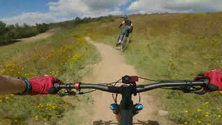
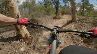
Loop 6 is a demanding ride that takes you over the Northern trails, climbing steeply to Echidna Gap before plunging down to the Western side of Stromlo Forest Park. The superb Double Dissolution trail drops you out near the Western Car park before you make your way back along the northern trails to the start point. The trail takes in a wide variety of the terrain and is able to be linked with a variety of other trails. Make sure you have your climbing legs on and enough in the tank to enjoy the fun and moderately technical descent
We hope you've been enjoying Trailforks!
Create a FREE account to view route comments and much more.
| 1 mile | |||||
| 1,640 ft | |||||
| 1 mile | |||||
| 2 miles | |||||
| 1 mile | |||||
| 1,877 ft | |||||
| 1,457 ft | |||||
| 2,346 ft | |||||
| 249 ft | |||||
| 2,854 ft | |||||
| 203 ft | |||||
| 3,048 ft | |||||
| 2,451 ft | |||||
| 1,047 ft | |||||
| 2,733 ft | |||||
| 1,860 ft | |||||
| 2 miles | |||||
| 4,626 ft | |||||
| 1 mile |

Service Road Atlas is a free to use, community-driven service for viewing and creating reports on the numerous back-country service roads around B.C. and Alberta.
Save the current map location and zoom level as your default home location whenever this page is loaded.
Save