
4.0 miles
Distance
587 ft
Climb
-589 ft
Descent
927 ft
High Point
-2 ft
Altitude change
444 ft
Altitude min
479 ft
Altitude start
476 ft
Altitude end
-25%
Grade max
30%
Grade min
2 miles
Distance climb
2 miles
Distance down
2,690 ft
Distance flat

This loop suggestion is part of our Community Routes—a group of routes created by the community, for the community. The intention is to make Hartland more approachable for new riders, help them find new trails, and showcase the amazing trails Hartland has to offer


This Route at a glance:

SIMBS Beginner / Intermediate Hartland Loop 2
Style of trails: Cross - Country (XC), Flow, Smooth Trails, Some Jumps
Average trail rating: Blue
Difficulty Level : Beginner - Intermediate
Approx length of ride: ~1-1.5Hours

Detailed Description
SIMBS Beginner / Intermediate Hartland Loop 2 is a 4 mile popular intermediate route located near Victoria British Columbia. This mountain bike primary route can be used one direction and has a moderate overall physical rating. This route includes 12 trails. This route climbs 587 ft with a max elevation of 927 ft then descends -589 ft.
Tags
FlowyJumps

Trail Issues on Route

  • Minor Issue / Yellow: 1 trail (newest: Sep 16, 2026)

Local Trail Association

Local trail association
South Island Mountain Bike Society (simbs.com)
Please consider joining or donating to the local riding association to support trail development & maintenance.
Donate to earn trail karma!

Stats

  • Distance
    4 miles
  • Avg time
    45 min 40 sec
  • Altitude min
    444 ft
  • Altitude start
    479 ft
  • Altitude end
    476 ft
  • Climb
    587 ft
  • Descent
    -589 ft
  • Grade max
    -25%
  • Grade min
    30%
  • Distance climb
    2 miles
  • Distance down
    2 miles
  • Distance flat
    2,690 ft

24 Reviews & Comments


We hope you've been enjoying Trailforks!

Create a FREE account to view all route reviews and much more.
Trails in Route

Details

  • Riding area
  • Primary Activity
    Mountain Bike
  • Other Activities
    • E-Bike
    • Gravel Bike
  • Difficulty rating
    Blue
  • Route Type
    Loop
  • eBike Allowed
  • Bike type
    AM, XC, Gravel
  • Direction
    One Direction
  • Physical rating
    Moderate
  • Activity Logs
    2

Directions

  1. Walk south on Regional Trail South.
  2. Continue for 200 meters.
  3. Bear right onto Easy Rider.
  4. Continue for 300 meters.
  5. Bear right to stay on Easy Rider.
  6. Continue for 300 meters.
  7. Bear right onto Regional Trail South.
  8. Continue for 20 meters.
  9. Keep right to take The Plunge Extension.
  10. Continue for 200 meters.
  11. Turn left onto Emergency Two.
  12. Continue for 10 meters.
  13. Walk north on Little Face.
  14. Continue for 300 meters.
  15. Walk northwest on Little Face.
  16. Continue for less than 10 meters.
  17. Keep right to stay on Little Face.
  18. Continue for 300 meters.
  19. Walk west on Centrefold.
  20. Continue for 400 meters.
  21. Bear right onto Middle-earth.
  22. Continue for 600 meters.
  23. Turn right onto Pay it Forward.
  24. Continue for 300 meters.
  25. Turn right to stay on Pay it Forward.
  26. Continue for 60 meters.
  27. Walk south on Torpedo Run.
  28. Continue for 700 meters.
  29. Turn left onto Centrefold.
  30. Continue for 400 meters.
  31. Turn left onto Regional Trail North.
  32. Continue for 50 meters.
  33. Keep straight to stay on Regional Trail North.
  34. Continue for 20 meters.
  35. Keep left to stay on Regional Trail North.
  36. Continue for 50 meters.
  37. Keep straight to stay on Regional Trail North.
  38. Continue for 50 meters.
  39. Keep straight to stay on Regional Trail North.
  40. Continue for 60 meters.
  41. Keep left to stay on Regional Trail North.
  42. Continue for 70 meters.
  43. Keep left to stay on Regional Trail North.
  44. Continue for 40 meters.
  45. Keep left to stay on Regional Trail North.
  46. Continue for 30 meters.
  47. Keep left to stay on Regional Trail North.
  48. Continue for 30 meters.
  49. Make a sharp right onto Night Shift.
  50. Continue for 700 meters.
  51. Walk northeast on Skull.
  52. Continue for 300 meters.
  53. Walk north on Easy Rider.
  54. Continue for 200 meters.
  55. Bear left onto Regional Trail South.
  56. Continue for 200 meters.
Avg: 5 (1 votes)
close
Trail transparency
  • Singletrack
  • Unpaved
mtb
trail: Skull
482 | 1 comments | 1 faves
mtb
670
mtb
889 | 1 comments | 1 faves
mtb
34
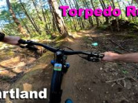
youtuber Torpedo Run - Hartland 2026
mtb
Torpedo Run - Hartland 2026
88 | comments: 0 | favs:
May 21, 2026

Recent Trail Reports Along Route

statustraildateconditiondescription
Skull
Oct 11, 2026 @ 9:43am (America/Vancouver)
Oct 11, 2026
Pay it Forward
Oct 11, 2026 @ 9:43am (America/Vancouver)
Oct 11, 2026
Middle-earth
Oct 11, 2026 @ 9:43am (America/Vancouver)
Oct 11, 2026
Centrefold
Oct 11, 2026 @ 9:43am (America/Vancouver)
Oct 11, 2026
Easy Rider
Oct 11, 2026 @ 9:43am (America/Vancouver)
Oct 11, 2026
more reports »
  • By MattLawTF Pro SIMBS & contributors
  • #59259 - 1,122 views

Hit the Trail

Open in App

Get this route on your phone instantly.

Download Route

Save to wishlist, Garmin & download.