more stats
3,596 ft
Distance
-289 ft
Descent
00:09:59
Avg time
-289 ft
Altitude change
884 ft
Altitude min
1,174 ft
Altitude max
1,174 ft
Altitude start
886 ft
Altitude end
-8%
Grade
-22.3%
Grade max
2.6%
Grade min
62 ft
Distance climb
3,301 ft
Distance down
233 ft
Distance flat
00:09:59
Avg time

2 Bee Line Details

  • Activities
    • Mountain Bike
    • E-Bike
    • Winter Fat Bike
    • Hike
    • Trail Running
  • Riding Area
  • Difficulty Rating
  • Local Popularity
    50 in Mountain Biking [+]
    • 50 in E-Biking
    • 55 in Trail Running
    • 70 in Hiking
    • 5 in Winter Fat Biking
  • Global Ranking
    #102437 in Mountain Biking [+]
    • #72051 in Trail Running
    • #125810 in Hiking
  • Trail Type
    Singletrack
  • Bike Type
    DH, AM, XC
  • Direction
    Downhill Only[+]
    Popular In Reverse
    • Downhill Only for E-Biking
    • Downhill Only for Trail Running
    • Downhill Only for Hiking
    • Downhill Only for Winter Fat Biking
  • Climb Difficulty
    Black Diamond
  • Physical Rating
    Moderate
  • Dogs Allowed
    Yes
  • eBike Allowed
  • Land Owner
    Greater Wellington Regional Council (GWRC)

This is a fast but relativity easy piece of single track through the bush. It starts off the Goat Rock (Four Climbs) forestry road.

Riders should keep and eye out for the tree across track not far past the Bees to Bridge intersection. You can get under it while still on the bike and at speed, so long as you use the deep rut on the left side of the track. Keep in mind this off camber section is all clay based, so is slippery as hell in wet conditions.

There are two groups off working Bee Hives on this trail, hence the name 2 Bee Line. First is just prior to the Bees 2 Bridge intersection, and the second about 3/4 of the way down. Usual story, don't piss off the Bees and they won't piss you off.

Local Trail Association

Recent Activity on Trail

Past Week
  • 0 rides
  •  
6 Months
  • 2 rides
  • 7 miles avg distance
All
  • 48 rides
  • Last: Sep 19, 2026
c1c2c3c4
January
February
March
April
May
June
July
August
September
October
November
December
update trails status or condition

2 Bee Line Trail Reports

statusdatedescription
Mar 18, 2024 @ 9:30pm
Mar 18, 2024
Nov 12, 2023 @ 1:03am
Nov 12, 2023
Feb 10, 2023 @ 8:20pm
Feb 10, 2023
Unseasonably dry. Top half is pleasantly techy with the ruts dried out.
Oct 15, 2021 @ 9:23pm
Oct 15, 2021
About the worst I've seen it. Top half is like Taniwha in mid-winter. I switched to using Goat Rock to get to the trails as it was much drier
Feb 7, 2021 @ 2:21am
Feb 7, 2021
Nice and dry
more »
Status:
on Mar 18, 2024
Ideal
Avg: 3.84 (1 votes)
Your vote: 0

view (517)
close
      Directions to 2-bee-line trailhead (-41.096920, 175.169110)

      Photos

      4 more »
      mtb
      86 |
      Nov 27, 2020 @ 4:36pm
      Nov 27, 2020
      mtb
      61 |
      Dec 11, 2018 @ 1:08am
      Dec 11, 2018
      mtb
      55 |
      Dec 11, 2018 @ 1:08am
      Dec 11, 2018
      mtb
      102 |
      Oct 29, 2017 @ 3:21pm
      Oct 29, 2017

      Videos

      2 more »
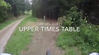
      youtuber Upper Times Table  @ Tunnel Gully
      mtb
      0:14 | 730 | Oct 21, 2018 , Upper Hutt
      2 Bee Line : Tunnel Gully 21/10/18
      mtb
      2:18 | 605 | Oct 21, 2018 , Upper Hutt

      Routes with this trail

      2.0 4 miles 615 ft 17 Loop
      A medium loop starting with , riding through new pine up on to Station Drive (part of the Rimutaka Cycle...
      3.0 3 miles 646 ft 20 Loop
      A second medium loop option starting with , riding through new pine up on to Station Drive (part of the...
      7 miles 1,280 ft 8 Loop
      Race 3/5 in the Giant Wellington PNP 2021 MTB Cross-Country Race series. Details and entries at .
      3.0

      1 Review & Comments

      Wookieetron5000
      Will be losing this track and all others on the upper side of Station Drive to forestry operations mid to late 2026.

      We hope you've been enjoying Trailforks!

      Create a FREE account to view all trail reviews and much more.

      • By YogiNZ & contributors
      • #40288 - 3,644 views

      Frequently Asked Questions

      Where is 2 Bee Line located?
      2 Bee Line is located in Tunnel Gully (Pakuratahi Forest), Upper Hutt, New Zealand. It is part of the Tunnel Gully (Pakuratahi Forest) trail network. The trailhead is located at coordinates -41.09692, 175.16911.
      How hard is 2 Bee Line?
      2 Bee Line is rated as Advanced difficulty. The physical rating is Moderate. The average grade is 8%. The climb difficulty is rated Black Diamond.
      What is the elevation gain for 2 Bee Line?
      The trail has 289 ft of elevation descent. The elevation ranges from 884 ft to 1,174 ft.
      Is 2 Bee Line a point to point trail?
      Yes, 2 Bee Line is a point to point trail. The direction is Downhill Only. The trail type is singletrack.
      How long is 2 Bee Line?
      2 Bee Line is 3,596 ft long. The trail type is singletrack.
      Are dogs allowed on 2 Bee Line?
      Yes, dogs are allowed on 2 Bee Line. Please keep dogs on a leash where required and clean up after them.
      When is the best time of year to ride 2 Bee Line?
      Based on activity log data, the most popular months to ride 2 Bee Line are:
      • February (4 activities)
      • January (3 activities)
      • April (3 activities)
      Check the reports page for current trail conditions.
      How do I access 2 Bee Line? Where is the closest parking trailhead?
      The closest parking and trailhead locations to 2 Bee Line are: View all parking locations in the area.
      How long does it take to ride 2 Bee Line?
      Based on recorded activities, it takes an average of 7 minutes to ride 2 Bee Line. The trail is 3,596 ft long. Actual times will vary based on fitness level, conditions, and pace. View recent activity logs for more details.
      How busy is 2 Bee Line?
      2 Bee Line is a moderately popular trail. There have been 465 recorded activities on this trail. The trail has received 517 check-ins. View recent activity on this trail.

      Hit the Trail

      Open in App

      Get this trail on your phone instantly.

      open trail in app

      Download Trail

      Save to wishlist, Garmin & download.
      save the trail

      Find Related Routes

      Find routes and users activities that include this trail.
      find routes for this trail

      You must enter a description before submitting.