1.9 miles
Distance
84 ft
Climb
-164 ft
Descent
00:19:30
Avg time
Supporters, Builders, Maintainers & Land Managers of Adobe Jack Trail

Adobe Jack Details

  • Activities
    • Mountain Bike
    • Hike
    • Trail Running
  • Riding Area
    Adobe Jack
    Sedona, Arizona
  • Difficulty Rating
  • Voted Difficulty
    Blue (2 votes)
  • Trail Type
    Singletrack
  • Bike Type
  • Direction
    Both Directions
  • Climb Difficulty
    Blue
  • Physical Rating
    Moderate
  • Season
    Don't Ride After Heavy Rain
  • Dogs Allowed
    Yes
  • eBike Allowed
  • Global Ranking
    #809 in Mountain Biking [+]
    • #5709 in Trail Running
    • #5983 in Hiking
  • Local Popularity
    90 in Mountain Biking [+]
    • 80 in Trail Running
    • 65 in Hiking
  • Land Owner
    USFS

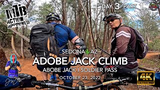
The 1.97 mile Adobe Jack trail starts at the south end at the Adobe Jack parking lot and the north end at the Jordan trail near the popular Sink Hole. The estimated mountain bike skill rating for Adobe Jack is: Beginner-35%, Intermediate-60%, Advanced-4%, Expert-1%. The trail has numerous narrow climbing sections that an advanced intermediate rider may have to walk. The routing of the trail takes you through several dry wash sections that makes the route fun to ride. This trail is the west part of a loop that can take you around the whole Soldier Wash area. The most fun direction to ride Adobe Jack is north to south, but if you are going to do a BIG Soldier's Wash loop by including Jordan, Javelina and Crusy2, I think riding south to north on Adobe Jack is more enjoyable.

Access Info

Direct access to the south end of Adobe Jack is from the Adobe Jack trailhead. The north end of the Adobe Jack trail can be accessed from the Soldier's Wash trailhead.

Disclaimer

info

Adaptive Bike Info
aMTB 3 Rating: Major obstacles exist. You will not be able to ride this solo. Support rider needed.

Lots of pinch points

Local Trail Association
More Stats for Adobe Jack multi-use trail trail
  • Altitude change
    -78 ft
  • Altitude min
    4,340 ft
  • Altitude max
    4,447 ft
  • Altitude start
    4,443 ft
  • Altitude end
    4,364 ft
  • Grade
    -0.8%
  • Grade max
    -18.7%
  • Grade min
    20.7%
  • Distance climb
    2,274 ft
  • Distance down
    4,350 ft
  • Distance flat
    2,995 ft
  • Avg time
    00:19:30
  • Avg reverse time
    00:24:46
  • view trail stats
Status:
on Sep 25, 2023
Dry
Avg: 4.2 (46 votes)
Your vote: 0

view (4,894)
close
3D
Trail Conditions
  • Unknown
  • Snow Groomed
  • Snow Packed
  • Snow Covered
  • Snow Cover Inadequate
  • Freeze/thaw Cycle
  • Icy
  • Prevalent Mud
  • Wet
  • Variable
  • Ideal
  • Dry
  • Very Dry
Trail Flow (Ridden Direction)
Trailforks scans users ridelogs to determine the most popular direction each trail is ridden. A good flowing trail network will have most trails flowing in a single direction according to their intension.
The colour categories are based on what percentage of riders are riding a trail in its intended direction.
  • > 96%
  • > 90%
  • > 80%
  • > 70%
  • > 50%
  • < 50%
  • bi-directional trail
  • no data
Trail Last Ridden
Trailforks scans ridelogs to determine the last time a trail was ridden.
  • < 2 days
  • < 1 week
  • < 2 weeks
  • < 1 month
  • < 6 months
  • > 6 months
Trail Ridden Direction
The intended direction a trail should be ridden.
  • Downhill Only
  • Downhill Primary
  • Both Directions
  • Uphill Primary
  • Uphill Only
  • One Direction
Contribute Details
Colors indicate trail is missing specified detail.
  • Description
  • Photos
  • Description & Photos
  • Videos
Trail Popularity ?
Trailforks scans ridelogs to determine which trails are ridden the most in the last 9 months. Trails are compared with nearby trails in the same city region with a possible 25 colour shades. Think of this as a heatmap, more rides = more kinetic energy = warmer colors.
  • most popular
  • popular
  • less popular
  • not popular
ATV/ORV/OHV Filter
Max Vehicle Width
inches

Radar Time
x Activity Recordings
Trailforks users anonymized public ridelogs from the past 6 months.
  • mountain biking recent
  • mountain biking (>6 month)
  • hiking (1 year)
  • moto (1 year)
Activity Recordings
Trailforks users anonymized public skilogs from the past 12 months.
  • Downhill Ski
  • Backcountry Ski
  • Nordic Ski
  • Snowmobile
Winter Trails
Warning A routing network for winter maps does not exist. Selecting trails using the winter trails layer has been disabled.
x Missing Trails
Most Popular
Least Popular
Trails are colored based on popularity. The more popular a trail is, the more red. Less popular trails trend towards green.
Jump Magnitude Heatmap
Heatmap of where riders jump on trails. Zoom in to see individual jumps, click circles to view jump details.
Trails Deemphasized
Trails are shown in grey.
disable
Only show trails with NO bikes.
enable

Save the current map location and zoom level as your default home location whenever this page is loaded.

Save
      Directions to adobe-jack trailhead (34.883800, -111.781140)
      update trails status or condition

      Adobe Jack Trail Reports

      statusdatedescription
      Sep 25, 2023 @ 11:56pm
      Sep 25, 2023
      Sep 24, 2023 @ 3:00pm
      Sep 24, 2023
      The moisture has left and the sun is back, trails are looking dry for the foreseeable future.
      Sep 23, 2023 @ 7:57am
      Sep 23, 2023
      Steady drizzle this morning and continuing through the first half of the afternoon should leave us with some quality HERO DIRT! Some nice cool...
      Sep 15, 2023 @ 5:00am
      Sep 15, 2023
      The sweet sweet MTB shred gods blessed us with overnight rain and doused our precious red rocks with some moisture leaving us with the freshest of...
      Sep 11, 2023 @ 5:08pm
      Sep 11, 2023
      Cross your fingers for some rain and HERO DIRT!
      view all reports »

      Recent Ridelog Activity on Trail

      Past Week
      • 12 rides
      • 11 miles avg distance
      6 Months
      • 317 rides
      • 10 miles avg distance
      All
      • 4,365 rides
      • Last: Sep 30, 2023

      Photos

      more »
      146 |
      Oct 12, 2021 @ 7:54pm
      Oct 12, 2021
      170 |
      Oct 2, 2021 @ 9:22pm
      Oct 2, 2021
      369 |
      Jun 24, 2019 @ 7:17am
      Jun 24, 2019
      337 |
      Feb 20, 2019 @ 2:45am
      Feb 20, 2019

      5 Reviews & Comments


      We hope you've been enjoying Trailforks!

      Create a FREE account to view trail comments and much more.

      Videos

      more »
      youtuber Getting Shredly in Sedona
      2:51 | 375 | Jul 16, 2019 , Sedona
      youtuber Why Join a Women's Cycling Club? - Dusty Betty...
      5:11 | 353 | Jun 26, 2019 , Sedona
      youtuber MTB Riding Adobe Jack Climb | SedonaAZ |...
      22:45 | 149 | Oct 30, 2022 , Sedona
      MTB Riding Ant Hill Loop DH at Sedona, May 1,...
      5:00 | 220 | Nov 2, 2021 , Sedona

      Nearby Trails

      • By todd Trailforks & contributors
      • #14968 - 13,128 views
      • subscribe
      • flag
      • login to download gpx or kml files.