close
-
Layers w
- Weather Layers
- Pro
- Pro
- Pro
- Pro
- Pro
- Pro
- More Layers
- Pro
- Pro
- Pro
- Pro
-
Upgrade to

3D
Trail Conditions
- Unknown
- Snow Groomed
- Snow Packed
- Snow Covered
- Snow Cover Partial
- Freeze/thaw Cycle
- Icy
- Prevalent Mud
- Wet
- Variable
- Ideal
- Dry
- Very Dry
Trail Flow (Ridden Direction)
Trailforks scans users ridelogs to determine the most popular direction each trail is ridden. A good flowing trail network will have most trails flowing in a single direction according to their intension.
The colour categories are based on what percentage of riders are riding a trail in its intended direction.
The colour categories are based on what percentage of riders are riding a trail in its intended direction.
- > 96%
- > 90%
- > 80%
- > 70%
- > 50%
- < 50%
- bi-directional trail
- no data
Trail Last Ridden
Trailforks scans ridelogs to determine the last time a trail was ridden.
- < 2 days
- < 1 week
- < 2 weeks
- < 1 month
- < 6 months
- > 6 months
Trail Ridden Direction
The intended direction a trail should be ridden.
- Downhill Only
- Downhill Primary
- Both Directions
- Uphill Primary
- Uphill Only
- One Direction
Contribute Details
Colors indicate trail is missing specified detail.
- Description
- Photos
- Description & Photos
- Videos
Trail Popularity ?
Trailforks scans ridelogs to determine which trails are ridden the most in the last 9 months.
Trails are compared with nearby trails in the same city region with a possible 25 colour shades.
Think of this as a heatmap, more rides = more kinetic energy = warmer colors.
- most popular
- popular
- less popular
- not popular
ATV/ORV/OHV Filter
Max Vehicle Width
inches
US Cell Coverage
Legend

Radar Time
Activity Recordings
Trailforks uses anonymized public activity data.
?
Activity Recordings
Trailforks uses anonymized public activity data.
?
Personal Heatmap
▶
Activity Types
all
/
none
▶
Options
2
Date range
month
–
Winter Trails
Warning
A routing network for winter maps does not exist. Selecting trails using the winter trails layer has been disabled.
Missing Trails
Most Popular
Least Popular
Trails are colored based on popularity. The more popular a trail is, the more red. Less popular trails trend towards green.
Jump Magnitude Heatmap
Heatmap of where riders jump on trails. Zoom in to see individual jumps, click circles to view jump details.
BC Backroad Status
![map legend]()
Service Road Atlas is a free to use, community-driven service for viewing and creating reports on the numerous back-country service roads around B.C. and Alberta.

Slope Aspect
Direction the slope faces
Trails Deemphasized
Trails are shown in grey.
Only show trails with no bike usage.
Suggested Layers
Based on selected activity type
Save the current map location and zoom level as your default home location whenever this page is loaded.
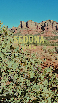
SaveThe trail system within the Red Rock Ranger District of Coconino National Forest around Sedona, AZ is one of the most special resources you’ll find anywhere. This is a trail system shared with hikers and equestrians.
Region Supporters & Maintainers
Activities Click to view
- Mountain Bike
189 trails
- E-Bike
21 trails
- Gravel Bike
13 trails
- Adaptive Bike
2 trails
- Horse
94 trails
- Hike
249 trails
- Trail Running
245 trails
- Dirtbike/Moto
15 trails
- Observed Trials
0 trails
- ATV/ORV/OHV
14 trails
Region Details
- 23
- 7
- 19
- 76
- 50
- 4
- 1
Region Status
Open as of Jul 5, 2026Stats
- Avg Trail Rating
- Trails (view details)
- 247
- Trails Mountain Bike
- 191
- Trails E-Bike
- 21
- Trails Gravel Bike
- 13
- Trails Adaptive Bike
- 2
- Trails Horse
- 94
- Trails Hike
- 252
- Trails Trail Running
- 245
- Trails Dirtbike/Moto
- 15
- Trails ATV/ORV/OHV
- 14
- Total Distance
- 385 miles
- Total Descent
- 46,690 ft
- Total Vertical
- 3,627 ft
- Highest Trailhead
- 7,344 ft
- Reports
- 10,808
- Photos
- 2,004
- Ridden Counter
- 370,085
Articles

Sedona Mountain Bike Festival Release New Schedule for 2026
Sep 4, 2025 from pinkbike.com
The Sedona Mountain Bike Festival is trading its spring slot for a full-send fall edition.

Video: Yoann Barelli & Remy Metailler Ride The New Hardline in Sedona
Mar 28, 2025 from pinkbike.com
This trail looks rowdy.
Video: The Story Behind 'Hardline', Sedona's Hardest Legal Trail
Mar 25, 2025 from pinkbike.com
It's great to see the creation of new, challenging, sanctioned trails.

Video: Riding Some of Sedona's Hardest Lines on... a Unicycle?
Jun 1, 2022 from pinkbike.com
The drops and steeps on Hangover, Hiline, and more. On one wheel!
Sub Regions
-
Broken Arrow
- 1
- 5
- 7
- 2
- 1
-
Carroll Canyon
- 9
- 9
-
Red Rock State Park
- 1
-
Schnebly Hill
- 4
- 3
- 1
-
Schuerman Mountain
- 1
- 4
- 4
-
Soldier Wash
- 4
- 12
- 8
- 1
-
Thunder Mountain
- 4
- 2
-
Upper Dry Creek
- 4
- 22
- 5
-
Western Gateway
- 1
- 3
- 8
- 5
Popular Sedona Mountain Biking Trails
• 100 ★ 3.8 • 1,621 ft • 50 ft • 9,156 •
This 1/3 mile trail that takes you from the trail to the trail. The trail surface is packed dirt and winds up to the very popular trail.
• 100 ★ 4.2 • 4,741 ft • 81 ft • 6,092 •
The trail is 2.7 miles long and is one of the best intermediate skill level trails in Sedona. The east end starts at the parking lot which a lot of the time is full due to its popularity. The west end of the trail starts from a huge...
• 100 ★ 3.0 • 2,598 ft • 3 ft • 6,013 •
Popular black diamond difficulty singletrack. This multi-use trail can be used both directions and has a easy overall physical rating with a 3 ft green climb. Trail visibility is always easy to follow. On average it takes 2 minutes to complete this trail.
• 100 ★ 3.2 • 5,148 ft • 135 ft • 4,835 •
The south end starts at the parking and the north end intersects with the and wilderness hiking trail. An entry level beginner's trail.
• 100 ★ 4.3 • 2 miles • 239 ft • 4,470 •
The trail is 2.7 miles long and is one of the best intermediate skill level trails in Sedona. The east end starts at the parking lot which a lot of the time is full due to its popularity. The west end of the trail starts from a huge...
• 95 ★ 4.6 • 1,827 ft • 29 ft • 4,253 •
is a technical long time local favorite. It is routed mainly on slickrock and the entrance is difficult to find since it is not presently signed. After reaching the steep technical off camber section the trail turns to dirt before...
• 95 ★ 4.6 • 2,566 ft • 0 ft • 4,241 •
Beginner 10%, intermediate 60 % and advanced 30%, 1.2 mile MTB trail which is a bi-directional, but mainly ridden north to south. The north end of the trail starts off of the lower trail. The upper end of the trail rides several hundred...
Sedona Mountain Bike Routes
★ 4.0 • 8 miles • 1,059 ft • 6 • Loop •
This is the hardest trail in Sedona. Expect super challenging and steep climbs, huge exposure, incredible...
★ 3.7 • 22 miles • 2,043 ft • 10 • Loop •
Park at cultural center, ride to Chuckwagon and continue long loop in a counterclockwise direction....
★ 5.0 • 2 miles • 113 ft • 4 • Loop •
The Scorpion/Pyramid descent is one of the best descents in Sedona. An easier variation of this ride is to...
★ 5.0 • 18 miles • 1,706 ft • 10 • Loop •
Nice mix of flow and tech in NW Sedona. Ride consists of two loops connected by so you get to do this...
★ 5.0 • 10 miles • 825 ft • 7 •
Starts and returns from the Aerie trialhead includes Upper Aerie Deadman's pass, , Fools Canyon and .
★ 5.0 • 17 miles • 1,331 ft • 7 • Loop •
Beginner / Intermediate ride starting from Thunder Mountain Bikes. From the shop, ride down to the...
Photos of Sedona Mountain Bike
Videos of Sedona Mountain Bike
trail: Hog Heaven
0:16 |
49 |
Nov 2, 2025

trail: Grand Central
0:41 |
124 |
Nov 28, 2023
trail: Mescal
0:39 |
49 |
Nov 28, 2023
trail: Hangover
0:38 |
214 |
Jun 10, 2023
trail: Hangover
0:14 |
191 |
Apr 13, 2023
trail: Ant Hill
0:06 |
|
Mar 28, 2022
trail: White Line
0:11 |
298 |
Mar 29, 2021

trail: Mescal
5:36 |
104 |
Jul 25, 2020
Recent Trail Reports
| status | trail | date | condition | info | user |
|---|---|---|---|---|---|
| Axis | Jul 5, 2026 @ 7:21am (America/Phoenix) Jul 5, 2026 | Very Dry | shakeystart | ||
| Lasso | Jul 5, 2026 @ 7:21am (America/Phoenix) Jul 5, 2026 | Very Dry | shakeystart | ||
| Submarine Rock | May 20, 2026 @ 6:02am (Pacific/Midway) May 20, 2026 | Dry | steuer | ||
| Jeep Trail | May 20, 2026 @ 6:02am (Pacific/Midway) May 20, 2026 | Dry | steuer | ||
| Carruth Trail | May 23, 2026 @ 4:38pm (America/Phoenix) May 23, 2026 | Dry | YekaiLuke | ||
| Jump Tech | May 23, 2026 @ 4:38pm (America/Phoenix) May 23, 2026 | Dry | YekaiLuke | ||
| Wildcat Flow Trail | May 23, 2026 @ 4:38pm (America/Phoenix) May 23, 2026 | Dry | YekaiLuke | ||
| Dual Slalom Return | May 23, 2026 @ 4:38pm (America/Phoenix) May 23, 2026 | Dry | YekaiLuke | ||
| Long Canyon To Mescal | May 17, 2026 @ 5:38am (Pacific/Midway) May 17, 2026 | Dry | steuer | ||
| Mescal | May 17, 2026 @ 5:38am (Pacific/Midway) May 17, 2026 | Dry | steuer |
Activity Feed
| username | action | type | title | date |
|---|---|---|---|---|
| ChristopherTNAxHO | wishlist | trail | activity #98795600 | Jul 9, 2026 @ 10:16am Jul 9, 2026 |
| steuer | add | video | activity #98663907 | Jul 7, 2026 @ 1:24pm Jul 7, 2026 |
| Xbiz59 | wishlist | route | activity #98616018 | Jul 6, 2026 @ 8:09pm Jul 6, 2026 |
| LO49WR | ridden | trail | activity #98517942 | Jul 5, 2026 @ 10:46am Jul 5, 2026 |
| Edgefeld | ridden | trail | activity #98388180 | Jul 3, 2026 @ 10:43pm Jul 3, 2026 |
Recent Comments
| username | type | title | comment | date |
|---|---|---|---|---|
| report | Good hike! | May 20, 2026 @ 4:50pm May 20, 2026 | ||
| trail | P | May 20, 2026 @ 1:25pm May 20, 2026 | ||
| trail | Wonderful trail ruined by hikers. | May 15, 2026 @ 8:16pm May 15, 2026 | ||
| trail | Rupp trail is a pretty tough connector trail... | Apr 15, 2026 @ 1:11pm Apr 15, 2026 | ||
| trail | Ridden 4/4/2026 in sunny, calm, and high 60's... | Apr 6, 2026 @ 10:01am Apr 6, 2026 |
Local Badges
-

Completionist4 awarded -

Big Ride 30k7,521 awarded -

Epic Ride 50k1,625 awarded -

Top 10 Trails117 awarded -
Completionist1 awarded -
Completionist0 awarded
Bike & Skill Parks
| name | type | city | rating |
|---|---|---|---|
| Sedona Bike Skills Park | skill park | Sedona | |
| Mountain View Preparatory Bike Skills Park | skill park | Sedona |
Upcoming Local Events
Local Products
Local Products
Activity Type Stats
| activitytype | trails | distance | descent | descent distance | total vertical | rating | global rank | state rank | photos | reports | routes | ridelogs |
|---|---|---|---|---|---|---|---|---|---|---|---|---|
| Mountain Bike | 189 | 277 miles | 31,663 ft | 110 miles | 3,629 ft | #70 | #27 | 1,808 | 10,835 | 235 | 105,397 | |
| E-Bike | 21 | 101 miles | 6,978 ft | 38 miles | 3,533 ft | #498 | #723 | 12 | 9,919 | 3 | 2,213 | |
| Gravel Bike | 13 | 33 miles | 1,703 ft | 10 miles | 2,684 ft | #94 | #769 | 3,119 | 1 | 145 | ||
| Adaptive Bike | 2 | #62 | #1,330 | 6 | 11 | |||||||
| Horse | 94 | 194 miles | 23,760 ft | 67 miles | 3,304 ft | #61 | #344 | 4 | 8,315 | 29 | 32 | |
| Hike | 249 | 374 miles | 46,368 ft | 145 miles | 3,629 ft | #89 | #56 | 167 | 10,547 | 88 | 22,821 | |
| Trail Running | 245 | 359 miles | 44,705 ft | 136 miles | 3,629 ft | #187 | #83 | 5 | 10,539 | 58 | 3,724 | |
| Dirtbike/Moto | 15 | 66 miles | 5,728 ft | 23 miles | 2,999 ft | #142 | #87 | 2 | 8,090 | 99 | ||
| ATV/ORV/OHV | 14 | 62 miles | 5,663 ft | 24 miles | 2,999 ft | #68 | #42 | 3 | 8,091 | 88 |
Frequently Asked Questions About Sedona
▼
What are the best places to ride in Sedona?
Sedona has 9 areas to explore for mountain biking. The top rated areas are:
▼
What are the highest rated mountain biking trails in Sedona?
The highest rated mountain biking trails in Sedona are:
- Vortex Flow (4.6/5)
- Pig Tail (4.6/5)
- High On The Hog (4.5/5)
- Mescal (4.5/5)
- Canyon of Fools (4.5/5)
▼
What is the best time of the year to ride in Sedona?
Based on ride log data, the most popular months to ride in Sedona are:
- November (1,651 activities)
- March (1,526 activities)
- April (1,321 activities)
▼
Where can I park to ride in Sedona?
There are 60 parking locations listed in Sedona. The most popular parking spots are: View all parking and trailhead locations on the map to plan your visit.
Activities
Trails
Points of Interest
- Other [Water Crossing]
- Seven Scared Pools Sight
- Outside Crevice Sight
- [aMTB] Pinch Point Other
- Doe Mtn TH Trials [Non-motorized] TTF
- Fay Canyon TH Trials [Non-motorized] TTF
- Info board with map Information
- Cultural Park TH Trials [Non-motorized] TTF
- Info Board with Map Information
- Wilderness Register Information
- Turkey Butte (2,247 m)
- Hog Hill (2,209 m)
- Wilson Mountain (2,139 m)
- By way2fasts & contributors
- Admins: SRRTF, MollyJoyce, ThunderMountainBikes
- #4591 - 336,135 views
- sedona activity log | embed map of Sedona mountain bike trails | sedona mountain biking points of interest
Downloading of trail gps tracks in kml & gpx formats is enabled for Sedona.
You must login to download files.