






Open in App
Get this trail on your phone instantly.

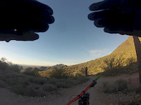
Not for the timid, Bell Pass offers a steep and very rocky descent. There are very few drops of more than a foot, but the upper half of the trail is relentlessly rocky making a good full suspension bike almost a necessity. There is no smooth line through it, and the best you can do is minimize the beating until the pitch gradually lessens and the rocks begin to space out some. The upper portion has some switchbacks, and most are rideable with skill and practice. No one rides this trail uphill. The trail is popular with hikers, especially on weekends.
Update 12/2021 - trail is eroded and largely unmaintained up high, with switchbacks having very loose lines of baby head rocks with significant exposure. Still rideable downhill, but the level of difficulty has increased in the past year or two.
To ride this trail as a downhill, you are going to need to summit the pass from the east side of the McDowells. The most common route to Bell Pass is by first climbing Windgate Pass Trail, starting down the east side, and then turning right onto Bell Pass Trail for the climb up to the pass. You can also access the trail from Prospector Trail, which is often tied together with Dixie Mine Trail and Sonoran Trail when circumnavigating the McDowells.

| c1 | c2 | c3 | c4 |
|---|---|---|---|
January | February | March | April |
May | June | July | August |
September | October | November | December |

Service Road Atlas is a free to use, community-driven service for viewing and creating reports on the numerous back-country service roads around B.C. and Alberta.
Save the current map location and zoom level as your default home location whenever this page is loaded.
SaveWe hope you've been enjoying Trailforks!
Create a FREE account to view all trail reviews and much more.
 TRAILFORKS HTA & contributors
You must enter a description before submitting.

