more stats
6.9 miles
Distance
3,652 ft
Climb
-471 ft
Descent
01:21:56
Avg time
3,179 ft
Altitude change
1,780 ft
Altitude min
5,212 ft
Altitude max
1,780 ft
Altitude start
4,957 ft
Altitude end
8.7%
Grade
-23.5%
Grade max
71.8%
Grade min
5 miles
Distance climb
2 miles
Distance down
266 ft
Distance flat
01:21:56
Avg time

Bishop Ridge Details

  • Activities
    • Dirtbike/Moto
    • Mountain Bike
    • E-Bike
    • Hike
    • Trail Running
  • Riding Area
    Dark Divide
    Randle, Washington
  • Ref Number
    272
  • Difficulty Rating
  • Voted Difficulty
    Black Diamond (1 vote)
  • Local Popularity
    50 in Mountain Biking heatmap [+]
    • 70 in E-Biking
    • 5 in Trail Running
    • 5 in Hiking
    • 85 in Dirtbiking
  • Global Ranking
    #153764 in Mountain Biking [+]
    • #91456 in E-Biking
    • #356530 in Trail Running
    • #321753 in Hiking
    • #1146 in Dirtbiking
  • State Ranking
    #2,606 in Mountain Biking · Washington [+]
    • #1,125 in E-Biking
    • #8,219 in Trail Running
    • #7,838 in Hiking
    • #63 in Dirtbiking
  • Hiking SAC Scale
    T1 Hiking
  • Trail Type
    Singletrack
  • Bike Type
    AM
  • Dogs Allowed
    Yes
  • eBike Allowed
    Yes up to Class 1
  • Land Owner
  • OSM Way

This trail is open to motorcycle, hiker, horse and bicycle use. The trail receives heavy motorcycle use.

This trail offers excellent views of the North Fork of the Cispus and the Cispus Rivers. Side slopes are very steep along this trail with two miles being especially rocky and exposed.

The Bishop Ridge trail begins on the Valley Trail #270 at the Horse Creek Trailhead on Forest Road 23. The trail climbs steadily for 3.5 miles to a semi open ridge on the south side of Bishop Mountain, then descends to intersect with Blue Lake Ridge Trail #271. This trail was reconstructed in 1994.

source: USFS
Access Info

Via Valley Trail #270 at the Horse Creek Trailhead on Forest Road 23 just south of North Fork Campground.

Disclaimer

This trail is maintained by the US Forest Service. Check with the USFS/Gifford Pinchot National Forest for the latest trail status.

Tags
RidgelineViews

Trail Supporters

Local Trail Association

Traditionally Indigenous Territory

Recent Activity on Trail

Past Week
  • 0 rides
  •  
6 Months
  • 1 rides
  • 53 miles avg distance
All
  • 13 rides
  • Last: Jul 20, 2026
c1c2c3c4
January
February
March
April
May
June
July
August
September
October
November
December
update trails status or condition

Bishop Ridge Trail Reports

statusdatedescription
Aug 22, 2026 @ 8:48pm (America/Los_Angeles)
Aug 22, 2026
Loose rock in places, what you’d expect from a primarily moto trail.
Aug 9, 2025 @ 6:59pm
Aug 9, 2025
Mostly cleared by Trans-Cascadia. about a mile in the middle that has loose rock and brush.
Aug 18, 2024 @ 12:25pm
Aug 18, 2024
Sep 6, 2021 @ 11:25pm
Sep 6, 2021
From the junction with Yozoo, Bishop ridge first offers a couple short fun descents but also some climbing and hike a biking in between until you...
Jul 7, 2020 @ 11:38am
Jul 7, 2020
reporter Some snow patches at the top but nothing impassable. The trail is clear of downfall.
more »
Status:
on Aug 22, 2026
Dry
Avg: 4.11 (2 votes)
Your vote: 0

view (38)
close
      Directions to bishop-ridge trailhead (46.430250, -121.760870)

      Photos

      1 more »
      mtb
      103 |
      Jul 10, 2025 @ 6:37pm
      Jul 10, 2025

      Videos

      3 more »
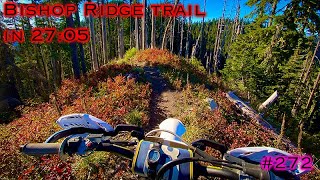
      Bishop Ridge trail in 27:05 | Beat My Time |...
      moto
      28:45 | 253 | Jan 11, 2025 , Randle
      Bishop ridge
      moto
      29:13 | 252 | Jan 8, 2025 , Randle
      Biship 4-22-22
      moto
      9:14 | 212 | Dec 28, 2024 , Randle
      4.5 ★★★★★
      2 Ratings
      5 ★ 50%
      4 ★ 50%
      3 ★
      2 ★
      1 ★

      4 Reviews & Comments

      Carruthers
      Pretty good descent. Fast and flowy at the top, and gets rougher as you make your way down. Lots of large embedded rocks/rock gardens in the lower half.
      i-g-o-r i-g-o-r
      Strong enduro mt bikers might appreciate the gnarly and relentless descent.
      joelsmeby joelsmeby
      Just to reiterate earlier comments, this would be nearly 100% hike a bike going up, and it's by far the least enjoyable decent in the GP. Complete nearly top to bottom with shark fin rocks and absolutely no flow. Very little dirt and abundance of loose rock.

      We hope you've been enjoying Trailforks!

      Create a FREE account to view all trail reviews and much more.

      • By NotAnotherClimbTF Pro & contributors
      • #139504 - 2,529 views

      Frequently Asked Questions

      ▼ Where is Bishop Ridge located?
      Bishop Ridge is located in Dark Divide, Randle, Washington, United States. It is part of the Dark Divide trail network. The trailhead is located at coordinates 46.43025, -121.76087.
      ▼ How hard is Bishop Ridge?
      Bishop Ridge is rated as Black Diamond difficulty. The average grade is 8.7%.
      ▼ What is the elevation gain for Bishop Ridge?
      Bishop Ridge has 3,652 ft of elevation gain. The trail has 471 ft of elevation descent. The elevation ranges from 1,780 ft to 5,212 ft.
      ▼ How long is Bishop Ridge?
      Bishop Ridge is 6.9 miles long. The trail type is singletrack.
      ▼ Are dogs allowed on Bishop Ridge?
      Yes, dogs are allowed on Bishop Ridge. Please keep dogs on a leash where required and clean up after them.
      ▼ When is the best time of year to ride Bishop Ridge?
      Based on activity log data, the most popular months to ride Bishop Ridge are:
      • July (6 activities)
      • October (3 activities)
      • June (1 activities)
      Check the reports page for current trail conditions.
      ▼ How do I access Bishop Ridge? Where is the closest parking trailhead?
      The closest parking and trailhead locations to Bishop Ridge are: View all parking locations in the area.
      ▼ How long does it take to ride Bishop Ridge?
      Based on recorded activities, it takes an average of 1 hour 22 minutes to ride Bishop Ridge. The trail is 6.9 miles long. Actual times will vary based on fitness level, conditions, and pace. View recent activity logs for more details.
      ▼ How busy is Bishop Ridge?
      Bishop Ridge is a moderately popular trail. There have been 38 recorded activities on this trail. The trail has received 38 check-ins. View recent activity on this trail.

      Hit the Trail

      Open in App

      Get this trail on your phone instantly.

      open trail in app

      Download Trail

      Save to wishlist, Garmin & download.
      save the trail

      Find Related Routes

      Find routes and users activities that include this trail.
      find routes for this trail

      You must enter a description before submitting.