close
-
Layers w
- Weather Layers
- Pro
- Pro
- Pro
- Pro
- Pro
- Pro
- More Layers
- Pro
- Pro
- Pro
- Pro
-
Upgrade to

3D
Trail Conditions
- Unknown
- Snow Groomed
- Snow Packed
- Snow Covered
- Snow Cover Partial
- Freeze/thaw Cycle
- Icy
- Prevalent Mud
- Wet
- Variable
- Ideal
- Dry
- Very Dry
Trail Flow (Ridden Direction)
Trailforks scans users ridelogs to determine the most popular direction each trail is ridden. A good flowing trail network will have most trails flowing in a single direction according to their intension.
The colour categories are based on what percentage of riders are riding a trail in its intended direction.
The colour categories are based on what percentage of riders are riding a trail in its intended direction.
- > 96%
- > 90%
- > 80%
- > 70%
- > 50%
- < 50%
- bi-directional trail
- no data
Trail Last Ridden
Trailforks scans ridelogs to determine the last time a trail was ridden.
- < 2 days
- < 1 week
- < 2 weeks
- < 1 month
- < 6 months
- > 6 months
Trail Ridden Direction
The intended direction a trail should be ridden.
- Downhill Only
- Downhill Primary
- Both Directions
- Uphill Primary
- Uphill Only
- One Direction
Contribute Details
Colors indicate trail is missing specified detail.
- Description
- Photos
- Description & Photos
- Videos
Trail Popularity ?
Trailforks scans ridelogs to determine which trails are ridden the most in the last 9 months.
Trails are compared with nearby trails in the same city region with a possible 25 colour shades.
Think of this as a heatmap, more rides = more kinetic energy = warmer colors.
- most popular
- popular
- less popular
- not popular
ATV/ORV/OHV Filter
Max Vehicle Width
inches
US Cell Coverage
Legend

Radar Time
Activity Recordings
Trailforks uses anonymized public activity data.
?
Activity Recordings
Trailforks uses anonymized public activity data.
?
Personal Heatmap
▶
Activity Types
all
/
none
▶
Options
2
Date range
month
–
Winter Trails
Warning
A routing network for winter maps does not exist. Selecting trails using the winter trails layer has been disabled.
Missing Trails
Most Popular
Least Popular
Trails are colored based on popularity. The more popular a trail is, the more red. Less popular trails trend towards green.
Jump Magnitude Heatmap
Heatmap of where riders jump on trails. Zoom in to see individual jumps, click circles to view jump details.
BC Backroad Status
![map legend]()
Service Road Atlas is a free to use, community-driven service for viewing and creating reports on the numerous back-country service roads around B.C. and Alberta.

Slope Aspect
Direction the slope faces
Trails Deemphasized
Trails are shown in grey.
Only show trails with no bike usage.
Suggested Layers
Based on selected activity type
Save the current map location and zoom level as your default home location whenever this page is loaded.
SaveRiding in Gifford Pinchot is primarily on trails that are moto-specific. Give thanks to them as they clear all of the downed trees in the Spring and post-storm. This makes for fast, rooty, and technical downhill sections that are countered with very challenging uphill sections. Ride with caution, a friend, and GPS as help is a long ways away. Expect a lot of hike-o-bike even for the most fit of riders. No cell service is available. Roads have little to no maintenance. Riding season starts in early June on the lower elevation trails, and could take up to late July for the higher elevations on Boundary trail.
Primary Trail Type: All-Mountain & Downhill
Shuttleable: YES
Land Status: National Forest
 google parking directions
 Activities Click to view
- Mountain Bike
149 trails
- E-Bike
115 trails
- Horse
39 trails
- Hike
188 trails
- Trail Running
187 trails
- Dirtbike/Moto
95 trails
- ATV/ORV/OHV
15 trails
Region Details
- 64
- 8
- 50
- 21
- 5
Region Status
Caution as of Jun 29, 2026Stats
- Avg Trail Rating
- Trails (view details)
- 188
- Trails Mountain Bike
- 149
- Trails E-Bike
- 115
- Trails Horse
- 39
- Trails Hike
- 188
- Trails Trail Running
- 187
- Trails Dirtbike/Moto
- 95
- Trails Observed Trials
- 1
- Trails ATV/ORV/OHV
- 15
- Trails Snowmobile
- 2
- Trails Snowshoe
- 2
- Trails Backcountry Ski
- 3
- Total Distance
- 689 miles
- Total Descent
- 108,002 ft
- Total Vertical
- 4,891 ft
- Highest Trailhead
- 5,861 ft
- Reports
- 389
- Photos
- 341
- Ridden Counter
- 3,695
Popular Dark Divide Mountain Biking Trails
• 100 ★ 4.1 • 9 miles • 1,557 ft • 203 •
This all- river trail along the in southwest Washington holds its own and is a great all around summer ride. Be sure to take in the views of the lower, , and upper falls at the northern end of the trail. Need to Know The ride as...
• 95 ★ 0.0 • 2 miles • 135 ft • 167 •
Short river trail that connects campgrounds to several amazing water falls. Watch for hikers.
• 95 ★ 4.4 • 3 miles • 72 ft • 164 • • moto
This trail is open to motorcycles, hikers, horses, and bicycles. Creek crossings and sections of the trail are difficult even for experienced motorcycle riders. The route starts at FR 23 and climbs gently at first along through old...
• 95 ★ 4.0 • 3 miles • 461 ft • 144 •
Popular blue difficulty singletrack. This multi-use trail can be used both directions and has a moderate overall physical rating with a 461 ft blue climb. On average it takes 56 minutes to complete this trail.
• 95 ★ 4.2 • 5 miles • 487 ft • 134 • • moto
This trail is open to hiker, motorcycle, and bicycle use. This trail climbs from Forest Road 2904 for 1 mile to the junction with Lookout Trail #294A, a 0.7-mile trail to the core of an extinct volcano. The spur trail #294A to the...
• 95 ★ 4.5 • 1 mile • 171 ft • 106 • • moto
This trail is open to hiker, motorcycle, horse and bicycle use. This trail climbs steeply through a dense forest before breaking out onto an open ridge east of . This trail connects with #261 in a large saddle.
• 95 ★ 0.0 • 2,319 ft • 393 ft • 83 •
Connector trail from NF-9085 to Summit Prairie Trail #2. This trail is maintained by the US Forest Service. Check with the USFS/Gifford Pinchot National Forest for the latest trail status.
• 100 ★ 5.0 • 1 mile • 488 ft • 73 • • moto
This trail is open to motorcycles, hikers, horses and bicycles. #109 is a motorized trail that climbs to . The view from Hamilton Butte is amazing with views of the Goat Rocks, Rainier, Adams, St. Helens, and Hood. This trail is best...
Dark Divide Mountain Bike Routes
★ 4.0 • 35 miles • 8,171 ft • 3 • Loop •
A great way to experience all Juniper ridge has to offer. Awesome views, strawberries, huckleberries. But...
46 miles • 8,895 ft • 3 • Loop •
For those looking to ride the , this option makes a , and also allows for a sustained descent on...
45 miles • 10,950 ft • 14 • Loop •
Only got to ride a couple miles on the mt. bike out here, so I am going to go take the dirtbikes (dual...
34 miles • 5,581 ft • 3 • Point to Point •
21 miles • 4,275 ft • 3 •
an abbreviated version of the 25 Mile Dark Divide Route with ~50% less climbing. More blue, less black
Photos of Dark Divide Mountain Bike
Videos of Dark Divide Mountain Bike
trail: Lewis River
13:37 |
444 |
Feb 19, 2018
trail: Lewis River
4:29 |
331 |
Feb 1, 2016
trail: Lewis River
0:16 |
365 |
Oct 24, 2014
trail: East Canyon Trail
5:45 |
77 |
Dec 28, 2024 , Randle
trail: Wright Meadow Trail
8:32 |
106 |
Jul 30, 2024 , Randle
youtuber
![Klickitat Fail]()
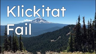
trail: Klickitat Sisters Trail
13:03 |
388 |
Aug 25, 2022 , Randle
youtuber
![Yozoo to Hamilton Buttes || Gifford Pinchot...]()

trail: Blue Lake Butte
13:17 |
347 |
May 1, 2022 , Randle
youtuber
![Yozoo to Hamilton Buttes || Gifford Pinchot...]()
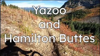
trail: Hamilton Buttes
13:17 |
475 |
May 1, 2022 , Randle
Recent Trail Reports
| status | trail | date | condition | info | user |
|---|---|---|---|---|---|
| Wright Meadow Trail | Jun 29, 2026 @ 4:08am (America/Los_Angeles) Jun 29, 2026 | Ideal | Tauntaunrider EMBA-C2S | ||
| Craggy Peak Trail | Jun 29, 2026 @ 4:02am (America/Los_Angeles) Jun 29, 2026 | Ideal | Tauntaunrider EMBA-C2S | ||
| Bluff Trail | Jun 22, 2026 @ 11:59am (America/Los_Angeles) Jun 22, 2026 | Unknown | gabrielamadeus OTTA | ||
| Dark Meadow Trail | May 29, 2026 @ 8:32pm (America/Los_Angeles) May 29, 2026 | Ideal | garretts EMBA-CN | ||
| Hamilton Buttes | Jun 14, 2026 @ 3:26pm (America/Los_Angeles) Jun 14, 2026 | Ideal | Gcbrandt | ||
| Sunrise Trail | Jun 10, 2026 @ 6:13pm (America/Los_Angeles) Jun 10, 2026 | Unknown | garretts EMBA-CN | ||
| Squaw Creek Trail | May 29, 2026 @ 8:37pm (America/Los_Angeles) May 29, 2026 | Ideal | garretts EMBA-CN | ||
| East Canyon Trail | May 29, 2026 @ 8:37pm (America/Los_Angeles) May 29, 2026 | Unknown | garretts EMBA-CN | ||
| Juniper Ridge | May 29, 2026 @ 8:35pm (America/Los_Angeles) May 29, 2026 | Ideal | garretts EMBA-CN | ||
| Table Mountain Trail | May 23, 2026 @ 9:36pm (America/Los_Angeles) May 23, 2026 | Ideal | GLJ |
Activity Feed
| username | action | type | title | date |
|---|---|---|---|---|
| tonloc2344 | wishlist | trail | activity #98163838 | Jun 30, 2026 @ 4:42pm 2 days |
| ckohlmeier | comment | report | activity #98135543 | Jun 30, 2026 @ 9:11am 2 days |
| Tauntaunrider | comment | report | activity #98053701 and 1 more | Jun 29, 2026 @ 4:09am Jun 29, 2026 |
| Tauntaunrider | add | report | activity #98053469 and 1 more | Jun 29, 2026 @ 4:02am Jun 29, 2026 |
| Addisonsan | wishlist | region | activity #97857599 | Jun 26, 2026 @ 2:34pm Jun 26, 2026 |
Recent Comments
| username | type | title | comment | date |
|---|---|---|---|---|
| report | Nice work y’all! | Jun 30, 2026 @ 9:11am 2 days | ||
| report | 30+ crew and volunteers over 2+ days. | Jun 29, 2026 @ 4:11am Jun 29, 2026 | ||
| report | 30+ crew and volunteers! | Jun 29, 2026 @ 4:09am Jun 29, 2026 | ||
| report | thanks, gabe!! | Jun 23, 2026 @ 9:46am Jun 23, 2026 | ||
| trail | Commenting on it as an mtb descent. I rode it... | Oct 24, 2025 @ 7:32am Oct 24, 2025 |
Nearby Areas
| name | distance | ||||
|---|---|---|---|---|---|
| Goat Mountain | 3 | 7 | 2 | 15.4 km | |
| Mt. St. Helens National Volcanic Monument | 13 | 25 | 4 | 20.3 km | |
| Gotchen Creek | 9 | 21.7 km | |||
| Coldwater Lake / Mt Margaret | 2 | 2 | 23.7 km | ||
| Oldman Pass | 2 | 8 | 3 | 24.7 km |
Local Badges
-

Completionist0 awarded
Local Products
Local Trail Supporters
- Cold Creek Mountain Bikers
Activity Type Stats
| activitytype | trails | distance | descent | descent distance | total vertical | rating | global rank | state rank | photos | reports | routes | ridelogs |
|---|---|---|---|---|---|---|---|---|---|---|---|---|
| Mountain Bike | 149 | 637 miles | 100,016 ft | 259 miles | 4,892 ft | #139 | #49 | 340 | 389 | 7 | 1,244 | |
| E-Bike | 115 | 552 miles | 83,757 ft | 227 miles | 4,892 ft | #31 | 337 | 1 | 130 | |||
| Horse | 39 | 178 miles | 25,384 ft | 69 miles | 4,262 ft | #74 | #186 | 46 | ||||
| Hike | 188 | 686 miles | 107,999 ft | 281 miles | 4,892 ft | #18 | #48 | 389 | 6 | 191 | ||
| Trail Running | 187 | 685 miles | 107,979 ft | 281 miles | 4,892 ft | #11 | #38 | 389 | 84 | |||
| Dirtbike/Moto | 95 | 463 miles | 77,024 ft | 198 miles | 4,695 ft | #17 | #5 | 1 | 142 | 1 | 119 | |
| Observed Trials | 1 | 3 miles | 988 ft | 2 miles | 846 ft | 2 | ||||||
| ATV/ORV/OHV | 15 | 81 miles | 11,411 ft | 34 miles | 4,157 ft | #195 | #44 | 37 | 2 | |||
| Snowmobile | 2 | 37 miles | 1,811 ft | 11 miles | 2,516 ft | |||||||
| Snowshoe | 2 | 37 miles | 1,811 ft | 11 miles | 2,516 ft | 2 | ||||||
| Backcountry Ski | 3 | 39 miles | 2,434 ft | 12 miles | 3,268 ft |
Frequently Asked Questions About Dark Divide
▼
What are the highest rated mountain biking trails in Dark Divide?
The highest rated mountain biking trails in Dark Divide are:
- Wright Meadow Trail (4.4/5)
- Hamilton Buttes (4.4/5)
- Dark Meadow Trail (4.3/5)
- Craggy Peak Trail (4.3/5)
- Summit Prairie Trail (4.3/5)
▼
What is the best time of the year to ride in Dark Divide?
Based on ride log data, the most popular months to ride in Dark Divide are:
- August (28 activities)
- July (19 activities)
- September (16 activities)
▼
Where can I park to ride in Dark Divide?
There are 34 parking locations listed in Dark Divide. The most popular parking spots are: View all parking and trailhead locations on the map to plan your visit.
▼
What is the longest trail in Dark Divide?
The longest trail in Dark Divide is Boundary Trail at 24.6 miles. View all trails sorted by distance.
Activities
Trails
- By petkatmat & contributors
- Admins: apply
- #26394 - 17,341 views
- dark divide activity log | embed map of Dark Divide mountain bike trails | dark divide mountain biking points of interest
Downloading of trail gps tracks in kml & gpx formats is enabled for Dark Divide.
You must login to download files.