more stats
5,253 ft
Distance
10 ft
Climb
-411 ft
Descent
00:11:23
Avg time
-402 ft
Altitude change
2,889 ft
Altitude min
3,297 ft
Altitude max
3,291 ft
Altitude start
2,890 ft
Altitude end
-7.6%
Grade
-21.7%
Grade max
7%
Grade min
217 ft
Distance climb
4,872 ft
Distance down
167 ft
Distance flat
00:11:23
Avg time

Brain Shake Details

  • Activities
    • Mountain Bike
    • Hike
    • Trail Running
  • Riding Area
    Candle Creek
    Clearwater, British Columbia
  • Difficulty Rating
  • Global Ranking
    #123090 in Mountain Biking [+]
    • #274357 in Trail Running
    • #244839 in Hiking
  • Trail Type
    Singletrack
  • Bike Type
    DH
  • Direction
    Downhill Primary
    Popular Direction Shown
  • Physical Rating
    Moderate
  • Season
    May to October
  • Dogs Allowed
    Yes
  • eBike Allowed
    Yes up to Class 1
  • TTFs on Trail
    Bridge, Drop, Log Ride, Rock Face, Skinny
  • Ride in Rain
    Yes
  • Year Opened
    2018

Provides a loop option for climbing up Rock Lobster or Greasy Jungle - or shuttle accessible.
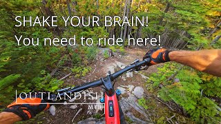
Designed to have an 'old school' feel - loamy bits, rooty bits, some drops, some tech, some 'janky' corners and some adventure options. May take a few runs to get the lines figured out.
All features have ride arounds or are rollable.
Feeds you into the jump line "Fat Lip".

Access Info

Pedal up Rock Lobster - or shuttle through XC ski trails Bend to Elevator will get you there.

Local Trail Association
Traditionally Indigenous Territory

Recent Activity on Trail

Past Week
  • 2 rides
  • 5 miles average
6 Months
  • 12 rides
  • 9 miles avg distance
All
  • 222 rides
  • Last: Jun 27, 2026
c1c2c3c4
January
February
March
April
May
June
July
August
September
October
November
December
update trails status or condition

Brain Shake Trail Reports

Status:
on Apr 26, 2026
Variable
Avg: 4.52 (13 votes)
Your vote: 0

view (432)
close
3D
Trail Conditions
  • Unknown
  • Snow Groomed
  • Snow Packed
  • Snow Covered
  • Snow Cover Partial
  • Freeze/thaw Cycle
  • Icy
  • Prevalent Mud
  • Wet
  • Variable
  • Ideal
  • Dry
  • Very Dry
Trail Flow (Ridden Direction)
Trailforks scans users ridelogs to determine the most popular direction each trail is ridden. A good flowing trail network will have most trails flowing in a single direction according to their intension.
The colour categories are based on what percentage of riders are riding a trail in its intended direction.
  • > 96%
  • > 90%
  • > 80%
  • > 70%
  • > 50%
  • < 50%
  • bi-directional trail
  • no data
Trail Last Ridden
Trailforks scans ridelogs to determine the last time a trail was ridden.
  • < 2 days
  • < 1 week
  • < 2 weeks
  • < 1 month
  • < 6 months
  • > 6 months
Trail Ridden Direction
The intended direction a trail should be ridden.
  • Downhill Only
  • Downhill Primary
  • Both Directions
  • Uphill Primary
  • Uphill Only
  • One Direction
Contribute Details
Colors indicate trail is missing specified detail.
  • Description
  • Photos
  • Description & Photos
  • Videos
Trail Popularity ?
Trailforks scans ridelogs to determine which trails are ridden the most in the last 9 months. Trails are compared with nearby trails in the same city region with a possible 25 colour shades. Think of this as a heatmap, more rides = more kinetic energy = warmer colors.
  • most popular
  • popular
  • less popular
  • not popular
ATV/ORV/OHV Filter
Max Vehicle Width
inches
US Cell Coverage
Legend
cell carrier legend

Radar Time
Activity Recordings
Trailforks uses anonymized public activity data. ?
Activity Recordings
Trailforks uses anonymized public activity data. ?
Personal Heatmap
Activity Types
all / none
Options
2
Date range month
Winter Trails
Warning A routing network for winter maps does not exist. Selecting trails using the winter trails layer has been disabled.
Missing Trails
Most Popular
Least Popular
Trails are colored based on popularity. The more popular a trail is, the more red. Less popular trails trend towards green.
Jump Magnitude Heatmap
Heatmap of where riders jump on trails. Zoom in to see individual jumps, click circles to view jump details.
BC Backroad Status

Service Road Atlas is a free to use, community-driven service for viewing and creating reports on the numerous back-country service roads around B.C. and Alberta.

map legend
Slope Aspect
Direction the slope faces
Flat N NE E SE S SW W NW
Trails Deemphasized
Trails are shown in grey.
disable
Only show trails with no bike usage.
Enable
Suggested Layers
Based on selected activity type

    Save the current map location and zoom level as your default home location whenever this page is loaded.

    Save
        Directions to brain-shake trailhead (51.677290, -119.969330)

        Photos

        No photos have been added for Brain Shake yet, add a photo.

        Videos

        2 more »
        Some Great Trails Here!
        5:01 | 149 | Nov 4, 2024 , Clearwater
        Valemount Road Trip | August 2020 | Its A Dogs...
        12:07 | 407 | Sep 21, 2020 , Clearwater

        4 Reviews & Comments


        We hope you've been enjoying Trailforks!

        Create a FREE account to view trail comments and much more.

        • By solmountainTF Pro WGOC & contributors
        • #136841 - 3,563 views

        Frequently Asked Questions About Brain Shake

        Where is Brain Shake located?
        Brain Shake is located in Candle Creek, Clearwater, British Columbia, Canada. It is part of the Candle Creek trail network. The trailhead is located at coordinates 51.67729, -119.96933.
        How hard is Brain Shake?
        Brain Shake is rated as Black Diamond difficulty. The physical rating is Moderate. The average grade is 7.6%.
        What is the elevation gain for Brain Shake?
        Brain Shake has 3 m of elevation gain. The trail has 125 m of elevation descent. The elevation ranges from 881 m to 1,005 m.
        Is Brain Shake a point to point trail?
        Brain Shake is not a point to point trail. The direction is Downhill Primary. The trail type is singletrack.

        Hit the Trail

        Open in App

        Get this trail on your phone instantly.
        open trail in app

        Download Trail

        Save to wishlist, Garmin & download.
        save the trail

        Find Related Routes

        Find routes and users activities that include this trail.
        find routes for this trail

        You must enter a description before submitting.