2,703 ft
Distance
3 ft
Climb
-58 ft
Descent
00:03:34
Avg time

CPR Details

  • Activities
    • Mountain Bike
    • E-Bike
    • Hike
    • Trail Running
    • Snowshoe
  • Riding Area
    Don Valley
    Toronto, Ontario
  • Difficulty Rating
  • Trail Type
    Singletrack
  • Bike Type
    AM, XC, Fat, Gravel
  • Direction
    Both Directions
  • Climb Difficulty
    Green
  • Physical Rating
    Easy
  • Dogs Allowed
    Yes
  • eBike Allowed
    Yes up to Class 1
  • Global Ranking
    #78907 in Mountain Biking [+]
    • #33340 in E-Biking
    • #8591 in Trail Running
    • #27385 in Hiking
  • Local Popularity
    90 in Mountain Biking [+]
    • 90 in E-Biking
    • 95 in Trail Running
    • 95 in Hiking
    • 5 in Snowshoeing
  • Land Owner
    City of Toronto / Toronto Region Conservation Authority

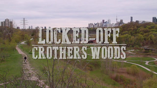
Crothers Woods to Brick Works connector along unused CPR rails. It's a flat route by old railroad tracks. Slightly challenging, in that you're riding on large, loose gravel and trying not to pedal-strike the railroad ties. Please help this route by weed-whacking a bit in June/July.

This trail is unsanctioned.

More Stats for CPR mountain bike trail trail
  • Altitude change
    -56 ft
  • Altitude min
    334 ft
  • Altitude max
    393 ft
  • Altitude start
    390 ft
  • Altitude end
    335 ft
  • Grade
    -2.1%
  • Grade max
    -9.9%
  • Grade min
    2%
  • Distance climb
    541 ft
  • Distance down
    1,654 ft
  • Distance flat
    509 ft
  • Avg time
    00:03:34
  • Avg reverse time
    00:04:11
  • view trail stats
Status:
on Oct 18, 2024
Dry
Avg: 3.91 (6 votes)
Your vote: 0

view (2,257)
close
3D
Trail Conditions
  • Unknown
  • Snow Groomed
  • Snow Packed
  • Snow Covered
  • Snow Cover Partial
  • Freeze/thaw Cycle
  • Icy
  • Prevalent Mud
  • Wet
  • Variable
  • Ideal
  • Dry
  • Very Dry
Trail Flow (Ridden Direction)
Trailforks scans users ridelogs to determine the most popular direction each trail is ridden. A good flowing trail network will have most trails flowing in a single direction according to their intension.
The colour categories are based on what percentage of riders are riding a trail in its intended direction.
  • > 96%
  • > 90%
  • > 80%
  • > 70%
  • > 50%
  • < 50%
  • bi-directional trail
  • no data
Trail Last Ridden
Trailforks scans ridelogs to determine the last time a trail was ridden.
  • < 2 days
  • < 1 week
  • < 2 weeks
  • < 1 month
  • < 6 months
  • > 6 months
Trail Ridden Direction
The intended direction a trail should be ridden.
  • Downhill Only
  • Downhill Primary
  • Both Directions
  • Uphill Primary
  • Uphill Only
  • One Direction
Contribute Details
Colors indicate trail is missing specified detail.
  • Description
  • Photos
  • Description & Photos
  • Videos
Trail Popularity ?
Trailforks scans ridelogs to determine which trails are ridden the most in the last 9 months. Trails are compared with nearby trails in the same city region with a possible 25 colour shades. Think of this as a heatmap, more rides = more kinetic energy = warmer colors.
  • most popular
  • popular
  • less popular
  • not popular
ATV/ORV/OHV Filter
Max Vehicle Width
inches
US Cell Coverage
Legend
cell carrier legend

Radar Time
x Activity Recordings
Trailforks users anonymized public ridelogs from the past 6 months.
  • mountain biking recent
  • mountain biking (>6 month)
  • hiking (1 year)
  • moto (1 year)
Activity Recordings
Trailforks users anonymized public skilogs from the past 12 months.
  • Downhill Ski
  • Backcountry Ski
  • Nordic Ski
  • Snowmobile
Winter Trails
Warning A routing network for winter maps does not exist. Selecting trails using the winter trails layer has been disabled.
x Missing Trails
Most Popular
Least Popular
Trails are colored based on popularity. The more popular a trail is, the more red. Less popular trails trend towards green.
Jump Magnitude Heatmap
Heatmap of where riders jump on trails. Zoom in to see individual jumps, click circles to view jump details.
Trails Deemphasized
Trails are shown in grey.
disable
Only show trails with NO bikes.
enable

Save the current map location and zoom level as your default home location whenever this page is loaded.

Save
      Directions to cpr trailhead (43.695370, -79.364830)
      update trails status or condition

      CPR Trail Reports

      statusdatedescription
      Oct 18, 2024 @ 5:00pm
      Oct 18, 2024
      There's a huge eroded spot that requires you to go onto the tracks to walk around it.
      Sep 26, 2024 @ 6:26pm
      Sep 26, 2024
      May 15, 2024 @ 12:03pm
      May 15, 2024
      Apr 7, 2024 @ 6:01am
      Apr 7, 2024
      Oct 11, 2023 @ 11:18am
      Oct 11, 2023
      There’s a large tree limb sticking out over the cpr trail which requires ducking under when riding. The limb recently appears lower than usual....
      view all reports »

      Recent Ridelog Activity on Trail

      Past Week
      • 0 rides
      •  
      6 Months
      • 31 rides
      • 17 miles avg distance
      All
      • 270 rides
      • Last: Feb 10, 2025

      Photos

      more »
      257 |
      Aug 14, 2017 @ 5:21pm
      Aug 14, 2017
      36 |
      Oct 11, 2023 @ 11:18am
      Oct 11, 2023

      3 Reviews & Comments


      We hope you've been enjoying Trailforks!

      Create a FREE account to view trail comments and much more.

      Videos

      more »
      youtuber Brickworks and Crothers Woods - Toronto
      1348 | Jun 23, 2017 , Toronto
      • #61478 - 4,879 views

      You must enter a description before submitting.