more stats
4,327 ft
Distance
-743 ft
Descent
00:16:20
Avg time
-743 ft
Altitude change
9,130 ft
Altitude min
9,873 ft
Altitude max
9,873 ft
Altitude start
9,131 ft
Altitude end
-17.2%
Grade
-48.6%
Grade max
4,285 ft
Distance down
46 ft
Distance flat
00:16:20
Avg time

Gornergrat Details

  • Activities
    • Mountain Bike
    • E-Bike
    • Hike
    • Trail Running
  • Riding Area
  • Difficulty Rating
  • Local Popularity
    55 in Mountain Biking [+]
    • 65 in E-Biking
    • 90 in Trail Running
    • 85 in Hiking
  • Global Ranking
    #52154 in Mountain Biking [+]
    • #32428 in E-Biking
    • #48864 in Trail Running
    • #36925 in Hiking
  • Hiking SAC Scale
    T2 Mountain Hiking
  • Trail Type
    Singletrack
  • Bike Type
    AM
  • Direction
    Downhill Primary
    Popular Direction Shown
  • Climb Difficulty
    Green
  • Physical Rating
    Moderate
  • Trail Visibility
    Sometimes hard to follow
  • Alpine Trail
    Yes
  • Dogs Allowed
    Yes
  • eBike Allowed
    Yes up to Class 1

No community description for Gornergrat trail has been added yet!

AI Generated Description

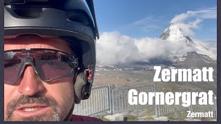
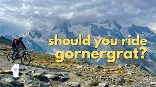
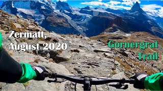
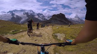
Gornergrat is a highly rated 1 km moderately popular black difficulty alpine singletrack trail located near Zermatt. This multi-use trail can be used downhill primary and has a moderate overall physical rating with a 0 m green climb. Trail visibility is sometimes hard to follow. On average it takes 16 minutes to complete this trail.

Access Info

2025 NO Transport by Gornergrat Bahn anymore

Disclaimer

Trail Etiquette: -Hikers have the right of way -Always yield for non-bike trail users (complete stop when crossing) -Anticipate other trail users -Let other trail users know you are coming -Leave no trace

Bike Park

Recent Activity on Trail

Past Week
  • 0 rides
  •  
6 Months
  • 0 rides
  •  
All
  • 48 rides
  • Last: Jul 26, 2012
c1c2c3c4
January
February
March
April
May
June
July
August
September
October
November
December
update trails status or condition

Gornergrat Trail Reports

Status:
on Aug 26, 2024
Ideal
Avg: 4.49 (8 votes)
Your vote: 0

view (443)
close
3D
Trail Conditions
  • Unknown
  • Snow Groomed
  • Snow Packed
  • Snow Covered
  • Snow Cover Partial
  • Freeze/thaw Cycle
  • Icy
  • Prevalent Mud
  • Wet
  • Variable
  • Ideal
  • Dry
  • Very Dry
Trail Flow (Ridden Direction)
Trailforks scans users ridelogs to determine the most popular direction each trail is ridden. A good flowing trail network will have most trails flowing in a single direction according to their intension.
The colour categories are based on what percentage of riders are riding a trail in its intended direction.
  • > 96%
  • > 90%
  • > 80%
  • > 70%
  • > 50%
  • < 50%
  • bi-directional trail
  • no data
Trail Last Ridden
Trailforks scans ridelogs to determine the last time a trail was ridden.
  • < 2 days
  • < 1 week
  • < 2 weeks
  • < 1 month
  • < 6 months
  • > 6 months
Trail Ridden Direction
The intended direction a trail should be ridden.
  • Downhill Only
  • Downhill Primary
  • Both Directions
  • Uphill Primary
  • Uphill Only
  • One Direction
Contribute Details
Colors indicate trail is missing specified detail.
  • Description
  • Photos
  • Description & Photos
  • Videos
Trail Popularity ?
Trailforks scans ridelogs to determine which trails are ridden the most in the last 9 months. Trails are compared with nearby trails in the same city region with a possible 25 colour shades. Think of this as a heatmap, more rides = more kinetic energy = warmer colors.
  • most popular
  • popular
  • less popular
  • not popular
ATV/ORV/OHV Filter
Max Vehicle Width
inches
US Cell Coverage
Legend
cell carrier legend

Radar Time
Activity Recordings
Trailforks uses anonymized public activity data. ?
Activity Recordings
Trailforks uses anonymized public activity data. ?
Personal Heatmap
Activity Types
all / none
Options
2
Date range month
Winter Trails
Warning A routing network for winter maps does not exist. Selecting trails using the winter trails layer has been disabled.
Missing Trails
Most Popular
Least Popular
Trails are colored based on popularity. The more popular a trail is, the more red. Less popular trails trend towards green.
Jump Magnitude Heatmap
Heatmap of where riders jump on trails. Zoom in to see individual jumps, click circles to view jump details.
BC Backroad Status

Service Road Atlas is a free to use, community-driven service for viewing and creating reports on the numerous back-country service roads around B.C. and Alberta.

map legend
Slope Aspect
Direction the slope faces
Flat N NE E SE S SW W NW
Trails Deemphasized
Trails are shown in grey.
disable
Only show trails with no bike usage.
Enable
Suggested Layers
Based on selected activity type

    Save the current map location and zoom level as your default home location whenever this page is loaded.

    Save
        Directions to gornergrat trailhead (45.983850, 7.776640)

        Photos

        6 more »
        325 |
        Aug 13, 2020 @ 4:09am
        Aug 13, 2020
        550 |
        Jan 24, 2019 @ 7:11am
        Jan 24, 2019
        112 |
        Aug 23, 2020 @ 2:40pm
        Aug 23, 2020
        103 |
        Sep 6, 2022 @ 4:23am
        Sep 6, 2022

        Videos

        4 more »
        youtuber Zermatt Gornergrat
        22:22 | 72 | Sep 16, 2021 , Zermatt
        Riding Gornergrat, Switzerland - a trail with...
        16:51 | 51 | Aug 19, 2025 , Zermatt
        Gornergrat Trail  |  Zermatt, Switzerland  | ...
        7:36 | 668 | Aug 6, 2021 , Zermatt
        MTB Switzerland - Gornergrat classic to...
        30:21 | 477 | Jan 28, 2021 , Zermatt

        Routes with this trail

        4.5 7 miles 63 ft 10 Point to Point
        Classic (Nr. 1) Bahn up to the . Before heading off on the bike trail, take in the breathtaking views of...

        4 Reviews & Comments


        We hope you've been enjoying Trailforks!

        Create a FREE account to view trail comments and much more.

        • By inversedotchTF Pro & contributors
        • #273835 - 2,931 views

        Frequently Asked Questions About Gornergrat

        Where is Gornergrat located?
        Gornergrat is located in Zermatt - Matterhorn, Zermatt, Switzerland. It is part of the Zermatt - Matterhorn trail network. The trailhead is located at coordinates 45.98385, 7.77664.
        How hard is Gornergrat?
        Gornergrat is rated as Black difficulty. The physical rating is Moderate. The average grade is 17.2%. The climb difficulty is rated Green.
        What is the elevation gain for Gornergrat?
        The trail has 743 ft of elevation descent. The elevation ranges from 9,130 ft to 9,873 ft.
        Is Gornergrat a point to point trail?
        Gornergrat is not a point to point trail. The direction is Downhill Primary. The trail type is singletrack.

        Hit the Trail

        Open in App

        Get this trail on your phone instantly.
        open trail in app

        Download Trail

        Save to wishlist, Garmin & download.
        save the trail

        Find Related Routes

        Find routes and users activities that include this trail.
        find routes for this trail

        You must enter a description before submitting.