more stats
3,809 ft
Distance
80 ft
Climb
-42 ft
Descent
00:06:58
Avg time
38 ft
Altitude change
483 ft
Altitude min
549 ft
Altitude max
510 ft
Altitude start
548 ft
Altitude end
1%
Grade
-6.5%
Grade max
13.6%
Grade min
1,362 ft
Distance climb
1,014 ft
Distance down
1,434 ft
Distance flat
00:06:58
Avg time

Keiths Details

  • Activities
    • Mountain Bike
    • E-Bike
    • Hike
    • Trail Running
  • Riding Area
    The Abyss / Extension Ridge
    Nanaimo, British Columbia
  • Difficulty Rating
  • Local Popularity
    90 in Mountain Biking [+]
    • 75 in Trail Running
    • 90 in Hiking
  • Global Ranking
    #43727 in Mountain Biking [+]
    • #72056 in Trail Running
    • #37215 in Hiking
  • Trail Type
    Singletrack
  • Bike Type
    XC
  • Climb Difficulty
    Green
  • Physical Rating
    Moderate
  • Dogs Allowed
    Yes
  • eBike Allowed
    Yes up to Class 1

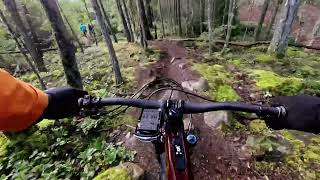
Another of the "old school" trails in the south end, this trail from the north end follows a ridge edge with some good technical sections and great looks over the ridge edge to a nice stand of trees and a small swamp before it drops into a formerly logged area that now has regrown offering a good canopy, A new climbing route at the south end allows for an easier climb up to the road and Humble Ninja

Access Info

From the south end you leave Humble Ninja staying to the left on the single track, go straight across the road and you will see the trail head. From the north end, if you are coming from Jurassic Park you turn left at the gravel road and after just a few meters you turn left again.

This trail is unsanctioned.

Traditionally Indigenous Territory

Recent Activity on Trail

Past Week
  • 6 rides
  • 11 miles average
6 Months
  • 100 rides
  • 9 miles avg distance
All
  • 1,121 rides
  • Last: Jul 1, 2026
c1c2c3c4
January
February
March
April
May
June
July
August
September
October
November
December
update trails status or condition

Keiths Trail Reports

Status:
on Sep 1, 2025
Dry
Avg: 3.94 (13 votes)
Your vote: 0

view (4,768)
close
3D
Trail Conditions
  • Unknown
  • Snow Groomed
  • Snow Packed
  • Snow Covered
  • Snow Cover Partial
  • Freeze/thaw Cycle
  • Icy
  • Prevalent Mud
  • Wet
  • Variable
  • Ideal
  • Dry
  • Very Dry
Trail Flow (Ridden Direction)
Trailforks scans users ridelogs to determine the most popular direction each trail is ridden. A good flowing trail network will have most trails flowing in a single direction according to their intension.
The colour categories are based on what percentage of riders are riding a trail in its intended direction.
  • > 96%
  • > 90%
  • > 80%
  • > 70%
  • > 50%
  • < 50%
  • bi-directional trail
  • no data
Trail Last Ridden
Trailforks scans ridelogs to determine the last time a trail was ridden.
  • < 2 days
  • < 1 week
  • < 2 weeks
  • < 1 month
  • < 6 months
  • > 6 months
Trail Ridden Direction
The intended direction a trail should be ridden.
  • Downhill Only
  • Downhill Primary
  • Both Directions
  • Uphill Primary
  • Uphill Only
  • One Direction
Contribute Details
Colors indicate trail is missing specified detail.
  • Description
  • Photos
  • Description & Photos
  • Videos
Trail Popularity ?
Trailforks scans ridelogs to determine which trails are ridden the most in the last 9 months. Trails are compared with nearby trails in the same city region with a possible 25 colour shades. Think of this as a heatmap, more rides = more kinetic energy = warmer colors.
  • most popular
  • popular
  • less popular
  • not popular
ATV/ORV/OHV Filter
Max Vehicle Width
inches
US Cell Coverage
Legend
cell carrier legend

Radar Time
Activity Recordings
Trailforks uses anonymized public activity data. ?
Activity Recordings
Trailforks uses anonymized public activity data. ?
Personal Heatmap
Activity Types
all / none
Options
2
Date range month
Winter Trails
Warning A routing network for winter maps does not exist. Selecting trails using the winter trails layer has been disabled.
Missing Trails
Most Popular
Least Popular
Trails are colored based on popularity. The more popular a trail is, the more red. Less popular trails trend towards green.
Jump Magnitude Heatmap
Heatmap of where riders jump on trails. Zoom in to see individual jumps, click circles to view jump details.
BC Backroad Status

Service Road Atlas is a free to use, community-driven service for viewing and creating reports on the numerous back-country service roads around B.C. and Alberta.

map legend
Slope Aspect
Direction the slope faces
Flat N NE E SE S SW W NW
Trails Deemphasized
Trails are shown in grey.
disable
Only show trails with no bike usage.
Enable
Suggested Layers
Based on selected activity type

    Save the current map location and zoom level as your default home location whenever this page is loaded.

    Save
        Directions to keiths trailhead (49.131140, -123.958050)

        Photos

        8 more »
        50 |
        Jun 17, 2025 @ 1:44pm
        Jun 17, 2025
        71 |
        Oct 21, 2020 @ 3:15pm
        Oct 21, 2020
        73 |
        Jun 11, 2020 @ 7:31am
        Jun 11, 2020
        77 |
        May 18, 2019 @ 11:14am
        May 18, 2019

        Videos

        1 more »
        Keiths - Abyss Nanaimo - Mar 2026
        3:44 | 43 | Mar 21, 2026 , Nanaimo

        Trail Lists

        Routes with this trail

        5.0 7 miles 490 ft 10 Loop
        Nice little loop to do, especially if you live in the neighbourhood. Just hop on your bike and take off!
        1.5 6 miles 620 ft 14 Loop Race
        The race course is slightly revised for 2016. It will be ridden clockwise and features a mix of technical...
        123 miles 18,870 ft 510 Loop Race
        This event route is a fundraiser for Nanaimo Loaves and Fishes. Robin Dutton and Peter Sinclair will see...

        2 Reviews & Comments


        We hope you've been enjoying Trailforks!

        Create a FREE account to view trail comments and much more.

        • #38729 - 2,038 views

        Frequently Asked Questions About Keiths

        Where is Keiths located?
        Keiths is located in The Abyss / Extension Ridge, Nanaimo, British Columbia, Canada. It is part of the The Abyss / Extension Ridge trail network. The trailhead is located at coordinates 49.13114, -123.95805.
        How hard is Keiths?
        Keiths is rated as Blue difficulty. The physical rating is Moderate. The average grade is 1%. The climb difficulty is rated Green.
        What is the elevation gain for Keiths?
        Keiths has 24 m of elevation gain. The trail has 13 m of elevation descent. The elevation ranges from 147 m to 167 m.
        How long is Keiths?
        Keiths is 1.2 km long. The trail type is singletrack.

        Hit the Trail

        Open in App

        Get this trail on your phone instantly.
        open trail in app

        Download Trail

        Save to wishlist, Garmin & download.
        save the trail

        Find Related Routes

        Find routes and users activities that include this trail.
        find routes for this trail

        You must enter a description before submitting.