
more stats
2.3 miles
Distance
170 ft
Climb
-1,067 ft
Descent
00:16:14
Avg time
-897 ft
Altitude change
6,435 ft
Altitude min
7,332 ft
Altitude max
7,332 ft
Altitude start
6,434 ft
Altitude end
-7.5%
Grade
-66.2%
Grade max
43.1%
Grade min
1,864 ft
Distance climb
2 miles
Distance down
630 ft
Distance flat
00:16:14
Avg time

Logging Rd Details

  • Activities
    • Mountain Bike
    • E-Bike
    • Hike
  • Riding Area
  • Difficulty Rating
  • Voted Difficulty
    Blue (1 vote)
  • Local Popularity
    75 in Mountain Biking [+]
    • 95 in E-Biking
    • 5 in Hiking
  • Global Ranking
    #22830 in Mountain Biking [+]
    • #12141 in E-Biking
    • #296363 in Hiking
  • State Ranking
    #590 in Mountain Biking · California [+]
    • #287 in E-Biking
    • #13,002 in Hiking
  • Hiking SAC Scale
    T2 Mountain Hiking
  • Trail Type
    Singletrack
  • Bike Type
    AM, XC
  • Direction
    Both Directions
    Popular Direction Shown
  • Climb Difficulty
    Black Diamond
  • Physical Rating
    Easy
  • Trail Visibility
    Always easy to follow
  • Dogs Allowed
    Yes
  • eBike Allowed
    Yes up to Class 1

Starts out with a mellow descent followed by a climb and then a steeper and twistier descent in the last third.

Tags

Trail Supporters

Local Trail Association

Traditionally Indigenous Territory

Recent Activity on Trail

Past Week
  • 1 rides
  • 4 miles average
6 Months
  • 8 rides
  • 16 miles avg distance
All
  • 29 rides
  • Last: Oct 31, 2026
c1c2c3c4
January
February
March
April
May
June
July
August
September
October
November
December
update trails status or condition

Logging Rd Trail Reports

statusdatedescription
Aug 22, 2025 @ 1:35am
Aug 22, 2025
Trail is running pretty well. Beware, toxic poodle dog bush is growing in a couple spots and will soon encroach on the trail. (see pics)
Jun 26, 2022 @ 5:21pm
Jun 26, 2022
Running good right now.
Jun 5, 2022 @ 12:43pm
Jun 5, 2022
Beautiful, but dusty. Braking sections are getting very ratty. I finished via the Apple Tree exit (w to Jackson Lake), which adds a few more...
May 13, 2021 @ 1:26pm
May 13, 2021
Apr 3, 2021 @ 8:26pm
Apr 3, 2021
The trail is still covered with deep snow drifts. It's passable, but some hike a bike sections are necessary.
more »
Status:
on Aug 22, 2025
Dry
Avg: 3.99 (4 votes)
Your vote: 0

view (250)
close
      Directions to logging-rd trailhead (34.379370, -117.726840)

      Photos

      13 more »
      mtb
      10 |
      Oct 31, 2026 @ 4:35pm
      3 days
      mtb
      48 |
      Aug 22, 2025 @ 1:35am
      Aug 22, 2025
      mtb
      49 |
      Aug 22, 2025 @ 1:35am
      Aug 22, 2025
      mtb
      51 |
      Aug 22, 2025 @ 1:35am
      Aug 22, 2025

      Videos

      3 more »
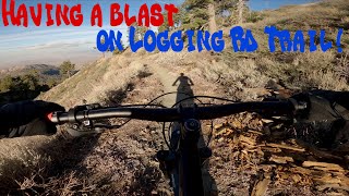
      Logging Rd Trail Guide!
      mtb
      12:08 | 307 | Dec 12, 2021 , Wrightwood
      Logging Leprechaun-Part One (MTB)
      mtb
      8:01 | 368 | Feb 13, 2021 , Wrightwood
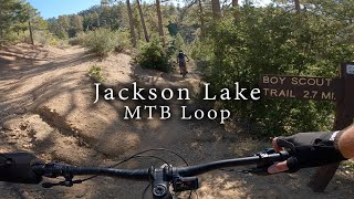
      Jackson Lake MTB Loop
      ebike
      28:17 | 195 | Oct 18, 2023 , Wrightwood
      4.0 ★★★★★
      4 Ratings
      5 ★ 25%
      4 ★ 50%
      3 ★ 25%
      2 ★
      1 ★

      3 Reviews & Comments

      therealslimshaky therealslimshaky
      fun, slightly loose and chunky with some nice switchbacks. trail is generally in pretty good condition, with one tree nearly across at the bottom, but you can squeak by the right side. the right hand fork at the bottom sets you pretty nice for leprechaun.

      We hope you've been enjoying Trailforks!

      Create a FREE account to view all trail reviews and much more.

      • By forceOnatureTF Pro & contributors
      • #376459 - 1,596 views

      Frequently Asked Questions

      ▼ Where is Logging Rd located?
      Logging Rd is located in San Gabriel Mountains (Wrightwood area), Wrightwood, California, United States. It is part of the San Gabriel Mountains (Wrightwood area) trail network. The trailhead is located at coordinates 34.37937, -117.72684.
      ▼ How hard is Logging Rd?
      Logging Rd is rated as Blue difficulty. The physical rating is Easy. The average grade is 7.5%. The climb difficulty is rated Black Diamond.
      ▼ What is the elevation gain for Logging Rd?
      Logging Rd has 170 ft of elevation gain. The trail has 1,067 ft of elevation descent. The elevation ranges from 6,435 ft to 7,332 ft.
      ▼ Is Logging Rd a point to point trail?
      Logging Rd is not a point to point trail. The direction is Both Directions. The trail type is singletrack.
      ▼ How long is Logging Rd?
      Logging Rd is 2.3 miles long. The trail type is singletrack.
      ▼ Are dogs allowed on Logging Rd?
      Yes, dogs are allowed on Logging Rd. Please keep dogs on a leash where required and clean up after them.
      ▼ How do I access Logging Rd? Where is the closest parking trailhead?
      The closest parking and trailhead locations to Logging Rd are: View all parking locations in the area.
      ▼ How long does it take to ride Logging Rd?
      Based on recorded activities, it takes an average of 16 minutes to ride Logging Rd. The trail is 2.3 miles long. Actual times will vary based on fitness level, conditions, and pace. View recent activity logs for more details.
      ▼ How busy is Logging Rd?
      Logging Rd is a very popular trail. There have been 244 recorded activities on this trail. The trail has received 250 check-ins. View recent activity on this trail.

      Hit the Trail

      Open in App

      Get this trail on your phone instantly.

      open trail in app

      Download Trail

      Save to wishlist, Garmin & download.
      save the trail

      Find Related Routes

      Find routes and users activities that include this trail.
      find routes for this trail

      You must enter a description before submitting.