

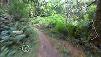

more stats
5.1 miles
Distance
647 ft
Climb
-1,108 ft
Descent
00:49:22
Avg time
-461 ft
Altitude change
545 ft
Altitude min
1,109 ft
Altitude max
1,052 ft
Altitude start
591 ft
Altitude end
-1.7%
Grade
-38.3%
Grade max
21.3%
Grade min
2 miles
Distance climb
3 miles
Distance down
4,304 ft
Distance flat
00:49:22
Avg time

Lost Valley Details

  • Activities
    • Mountain Bike
    • Hike
    • Trail Running
  • Riding Area
    Capitol Forest
    Olympia, Washington
  • Difficulty Rating
  • Voted Difficulty
    Green (1 vote)
  • Local Popularity
    85 in Mountain Biking [+]
    • 90 in Trail Running
    • 75 in Hiking
  • Global Ranking
    #41188 in Mountain Biking [+]
    • #90232 in Trail Running
    • #118442 in Hiking
  • State Ranking
    #688 in Mountain Biking · Washington [+]
    • #3,028 in Trail Running
    • #4,027 in Hiking
  • Trail Type
    Singletrack
  • Bike Type
    XC
  • Direction
    Both Directions
  • Climb Difficulty
    Green
  • Physical Rating
    Moderate
  • Season
    April-Oct
  • Dogs Allowed
    Yes
  • eBike Allowed
  • Land Owner
    Washington State DNR

Lost Valley loop will tie in with Mima Falls West or Mckenny.

Access Info

Fall Creek Trailhead or a continuation from Mima Falls Trails
A Discover pass is required for parking at DNR trailheads.

Tags
Local Trail Association
Traditionally Indigenous Territory

Recent Activity on Trail

Past Week
  • 3 rides
  • 18 miles average
6 Months
  • 56 rides
  • 17 miles avg distance
All
  • 311 rides
  • Last: Oct 14, 2026
c1c2c3c4
January
February
March
April
May
June
July
August
September
October
November
December
update trails status or condition

Lost Valley Trail Reports

statusdatedescription
Oct 12, 2026 @ 9:27pm (America/Los_Angeles)
2 days
Tree down
Oct 10, 2026 @ 10:14am (America/Vancouver)
Oct 10, 2026
One large downed tree about half way.
Jun 11, 2026 @ 12:22pm (America/Vancouver)
Jun 11, 2026
Pretty overgrown in parts. No downed trees though.
Feb 4, 2026 @ 3:51pm (America/Vancouver)
Feb 4, 2026
Several trees down to go over/under but otherwise good.
Jan 24, 2026 @ 11:40am (America/Los_Angeles)
Jan 24, 2026
Freeze thaw with a couple downed trees
more »
Status:
on Oct 12, 2026
Ideal
Avg: 4 (18 votes)
Your vote: 0

view (1,259)
close
      Directions to lost-valley trailhead (46.928450, -123.113210)

      Photos

      31 more »
      mtb
      174 |
      Oct 22, 2018 @ 5:14pm
      Oct 22, 2018
      mtb
      142 |
      Oct 21, 2018 @ 8:20pm
      Oct 21, 2018
      mtb
      144 |
      Oct 21, 2018 @ 8:20pm
      Oct 21, 2018
      mtb
      144 |
      Oct 21, 2018 @ 8:20pm
      Oct 21, 2018

      Videos

      1 more »
      lost my cam
      mtb
      4:33 | 590 | Aug 24, 2015 , Olympia

      Routes with this trail

      ★ 4.0 • 7 miles • 1,069 ft • 6 • Loop •
      Lost Valley Loop is a roughly 9 mile ride out of the Fall Creek TH. Debates rage about route, but most...
      ★ 5.0 • 21 miles • 3,228 ft • 22 • Loop •
      This is a great ride that ties all the classic short loops out of Fall Creek together.
      ★ 2.0 • 31 miles • 4,442 ft • 4 •
      30 mile "epic lite" route for the 2021 NW Epic series
      4.0 ★★★★★
      18 Ratings
      5 ★ 22%
      4 ★ 56%
      3 ★ 22%
      2 ★
      1 ★

      7 Reviews & Comments

      TrailTerror TrailTerror
      Found info: Recreation alert: Effective 7/24/2025 until further notice, the Lost Valley Trail is closed due to the harvesting activity for the Cake Walk timber sale. The trail is closed from the McKenny Trail Junction at Fall Creek to the McKenny Junction south of the D4700 Road. The McKenny trail from Fall Creek to the Mima area trails are open and unaffected by the timber sale.
      TrailTerror TrailTerror
      As of 7/27, the trail was physically blocked off for "forestry operations" at Fall Creek (Mckenny/Lost Valley intersection).Mckenny was open. I haven't seen any trail closure info online about this yet.
      JonathanH9BpL
      Great trail, nice mix of smooth meadow xc with a section of very mild tech thrown in to switch it up. Perfect xc riding. Kudos to the e-mtb riders warning us weak inexperienced hardtail and gravel bike riders about the "challenging root section" climbing out of here.

      It's running dry and pretty great in the trees, very very dusty and loose in the clear cut. Still fun just be careful with your speed in the corners!

      We hope you've been enjoying Trailforks!

      Create a FREE account to view all trail reviews and much more.

      • By vwammodogTF Pro & contributors
      • #19512 - 8,171 views

      Frequently Asked Questions

      ▼ Where is Lost Valley located?
      Lost Valley is located in Capitol Forest, Olympia, Washington, United States. It is part of the Capitol Forest trail network. The trailhead is located at coordinates 46.92845, -123.11321.
      ▼ How hard is Lost Valley?
      Lost Valley is rated as Green difficulty. The physical rating is Moderate. The average grade is 1.7%. The climb difficulty is rated Green.
      ▼ What is the elevation gain for Lost Valley?
      Lost Valley has 647 ft of elevation gain. The trail has 1,108 ft of elevation descent. The elevation ranges from 545 ft to 1,109 ft.
      ▼ Is Lost Valley a point to point trail?
      Lost Valley is not a point to point trail. The direction is Both Directions. The trail type is singletrack.
      ▼ How long is Lost Valley?
      Lost Valley is 5.1 miles long. The trail type is singletrack.
      ▼ Are dogs allowed on Lost Valley?
      Yes, dogs are allowed on Lost Valley. Please keep dogs on a leash where required and clean up after them.
      ▼ When is the best time of year to ride Lost Valley?
      Lost Valley is best visited during: April-Oct.
      ▼ How do I access Lost Valley? Where is the closest parking trailhead?
      The closest parking and trailhead locations to Lost Valley are: View all parking locations in the area.
      ▼ How long does it take to ride Lost Valley?
      Based on recorded activities, it takes an average of 49 minutes to ride Lost Valley. The trail is 5.1 miles long. Actual times will vary based on fitness level, conditions, and pace. View recent activity logs for more details.
      ▼ How busy is Lost Valley?
      Lost Valley is a very popular trail. There have been 1,222 recorded activities on this trail. The trail has received 1,259 check-ins. View recent activity on this trail.

      Hit the Trail

      Open in App

      Get this trail on your phone instantly.

      open trail in app

      Download Trail

      Save to wishlist, Garmin & download.
      save the trail

      Find Related Routes

      Find routes and users activities that include this trail.
      find routes for this trail

      You must enter a description before submitting.


