more stats
5,203 ft
Distance
197 ft
Climb
-98 ft
Descent
00:13:49
Avg time
99 ft
Altitude change
489 ft
Altitude min
625 ft
Altitude max
505 ft
Altitude start
604 ft
Altitude end
1.9%
Grade
-15.7%
Grade max
27.7%
Grade min
2,543 ft
Distance climb
2,323 ft
Distance down
289 ft
Distance flat
00:13:49
Avg time

Lumpy Details

  • Activities
    • Mountain Bike
    • E-Bike
    • Hike
    • Trail Running
  • Riding Area
    Halfmoon Bay
    Sechelt, British Columbia
  • Difficulty Rating
  • Local Popularity
    70 in Mountain Biking [+]
    • 85 in E-Biking
    • 60 in Trail Running
    • 70 in Hiking
  • Global Ranking
    #81309 in Mountain Biking [+]
    • #46321 in E-Biking
    • #118626 in Trail Running
    • #65190 in Hiking
  • Trail Type
    Singletrack
  • Bike Type
    XC
  • Climb Difficulty
    Blue
  • Physical Rating
    Moderate
  • Dogs Allowed
    Yes
  • eBike Allowed
    Yes up to Class 1

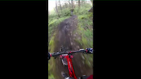
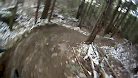
Lumpy is a continuation of Tin Pan Alley. It has an exit out to Hwy. 101 across from the Pump House where you can access the south side Halfmoon Bay trails at the Gord's Grunt and Pump It Up junction. Also turns into Gravy if you want to carry on downhill.

source: ...
Local Trail Association
Traditionally Indigenous Territory

Recent Activity on Trail

Past Week
  • 0 rides
  •  
6 Months
  • 6 rides
  • 10 miles avg distance
All
  • 69 rides
  • Last: May 24, 2026
c1c2c3c4
January
February
March
April
May
June
July
August
September
October
November
December
update trails status or condition

Lumpy Trail Reports

statusdatedescription
Sep 13, 2025 @ 3:42pm (America/Vancouver)
Sep 13, 2025
Clear.
Mar 27, 2025 @ 1:44pm
Mar 27, 2025
Small bridge before 33 1/3 is broken. Also still one tree across trail at that same spot. Very wet and slippery on the section that used to be RPM
Mar 26, 2025 @ 1:10pm
Mar 26, 2025
Trail is cleared from start to junction with 45. Cut numerous trees off trail, still one just past 45.
Sep 27, 2024 @ 7:18pm
Sep 27, 2024
Tree down across trail about 300 meters uphill from junction with Gravy, on the section that used to be RPM. Chainsaw worthy!
Sep 18, 2024 @ 12:42pm
Sep 18, 2024
Trail in pretty good shape
more »
Status:
on Sep 13, 2025
Ideal
Avg: 3.98 (1 votes)
Your vote: 0

view (277)
close
3D
Trail Conditions
  • Unknown
  • Snow Groomed
  • Snow Packed
  • Snow Covered
  • Snow Cover Partial
  • Freeze/thaw Cycle
  • Icy
  • Prevalent Mud
  • Wet
  • Variable
  • Ideal
  • Dry
  • Very Dry
Trail Flow (Ridden Direction)
Trailforks scans users ridelogs to determine the most popular direction each trail is ridden. A good flowing trail network will have most trails flowing in a single direction according to their intension.
The colour categories are based on what percentage of riders are riding a trail in its intended direction.
  • > 96%
  • > 90%
  • > 80%
  • > 70%
  • > 50%
  • < 50%
  • bi-directional trail
  • no data
Trail Last Ridden
Trailforks scans ridelogs to determine the last time a trail was ridden.
  • < 2 days
  • < 1 week
  • < 2 weeks
  • < 1 month
  • < 6 months
  • > 6 months
Trail Ridden Direction
The intended direction a trail should be ridden.
  • Downhill Only
  • Downhill Primary
  • Both Directions
  • Uphill Primary
  • Uphill Only
  • One Direction
Contribute Details
Colors indicate trail is missing specified detail.
  • Description
  • Photos
  • Description & Photos
  • Videos
Trail Popularity ?
Trailforks scans ridelogs to determine which trails are ridden the most in the last 9 months. Trails are compared with nearby trails in the same city region with a possible 25 colour shades. Think of this as a heatmap, more rides = more kinetic energy = warmer colors.
  • most popular
  • popular
  • less popular
  • not popular
ATV/ORV/OHV Filter
Max Vehicle Width
inches
US Cell Coverage
Legend
cell carrier legend

Radar Time
Activity Recordings
Trailforks uses anonymized public activity data. ?
Activity Recordings
Trailforks uses anonymized public activity data. ?
Personal Heatmap
Activity Types
all / none
Options
2
Date range month
Winter Trails
Warning A routing network for winter maps does not exist. Selecting trails using the winter trails layer has been disabled.
Missing Trails
Most Popular
Least Popular
Trails are colored based on popularity. The more popular a trail is, the more red. Less popular trails trend towards green.
Jump Magnitude Heatmap
Heatmap of where riders jump on trails. Zoom in to see individual jumps, click circles to view jump details.
BC Backroad Status

Service Road Atlas is a free to use, community-driven service for viewing and creating reports on the numerous back-country service roads around B.C. and Alberta.

map legend
Slope Aspect
Direction the slope faces
Flat N NE E SE S SW W NW
Trails Deemphasized
Trails are shown in grey.
disable
Only show trails with no bike usage.
Enable
Suggested Layers
Based on selected activity type

    Save the current map location and zoom level as your default home location whenever this page is loaded.

    Save
        Directions to lumpy trailhead (49.506690, -123.884990)

        Photos

        4 more »
        16 |
        Sep 27, 2024 @ 7:21pm
        Sep 27, 2024
        31 |
        Nov 16, 2023 @ 10:13am
        Nov 16, 2023
        34 |
        Nov 16, 2023 @ 10:13am
        Nov 16, 2023
        37 |
        Jan 4, 2023 @ 8:49pm
        Jan 4, 2023

        Videos

        16 more »
        2013_02_19 Jelly Lumpy WYD
        5:41 | 123 | Feb 19, 2013 , Sechelt
        2012_12_29 Hartland JR LP WYD
        9:20 | 162 | Dec 29, 2012 , Sechelt
        2014-04-25 Jelly Roll WYD
        4:22 | 185 | Apr 26, 2014 , Sechelt
        2013_01_12 Torpedo Jelly Lumpy
        2:45 | 102 | Jan 12, 2013 , Sechelt

        Routes with this trail

        5.0 23 miles 2,128 ft 35
        Day 1 of Great Explorations - Sunshine Coast Challenge! We start in the beautiful trails of Halfmoon Bay...
        13 miles 1,505 ft 34 Out & Back
        There so many awesome trails in Halfmoon Bay, but trying to connect them up is no easy feat! Park at Trout...

        1 Review & Comments


        We hope you've been enjoying Trailforks!

        Create a FREE account to view trail comments and much more.

        • By WabmatrixTF Pro CMBTA & contributors
        • #22666 - 1,810 views

        Frequently Asked Questions About Lumpy

        Where is Lumpy located?
        Lumpy is located in Halfmoon Bay, Sechelt, British Columbia, Canada. It is part of the Halfmoon Bay trail network. The trailhead is located at coordinates 49.50669, -123.88499.
        How hard is Lumpy?
        Lumpy is rated as Blue difficulty. The physical rating is Moderate. The average grade is 1.9%. The climb difficulty is rated Blue.
        What is the elevation gain for Lumpy?
        Lumpy has 197 ft of elevation gain. The trail has 98 ft of elevation descent. The elevation ranges from 489 ft to 625 ft.
        How long is Lumpy?
        Lumpy is 5,203 ft long. The trail type is singletrack.

        Hit the Trail

        Open in App

        Get this trail on your phone instantly.
        open trail in app

        Download Trail

        Save to wishlist, Garmin & download.
        save the trail

        Find Related Routes

        Find routes and users activities that include this trail.
        find routes for this trail

        You must enter a description before submitting.