
more stats
4.3 miles
Distance
379 ft
Climb
-381 ft
Descent
00:40:45
Avg time
0 ft
Altitude change
711 ft
Altitude min
841 ft
Altitude max
830 ft
Altitude start
830 ft
Altitude end
-14.7%
Grade max
14.3%
Grade min
2 miles
Distance climb
2 miles
Distance down
4,541 ft
Distance flat
00:40:45
Avg time

Moon Loop Details

  • Activities
    • Mountain Bike
    • Horse
    • Hike
    • Trail Running
  • Riding Area
  • Difficulty Rating
  • Local Popularity
    55 in Mountain Biking heatmap [+]
    • 5 in Trail Running
    • 80 in Hiking
    • 5 in Horseback
  • Global Ranking
    #109768 in Mountain Biking [+]
    • #299916 in Trail Running
    • #85709 in Hiking
    • #20145 in Horseback
  • State Ranking
    #336 in Mountain Biking · Missouri [+]
    • #1,027 in Trail Running
    • #279 in Hiking
    • #125 in Horseback
  • Trail Type
    Singletrack
  • Bike Type
    XC
  • Direction
    Both Directions
  • Trail Visibility
    Sometimes hard to follow
  • Dogs Allowed
    Yes
  • eBike Allowed
  • Land Owner
    US Forest Service

Blazed in Yellow Diamond.

Access Info

Trail can be accessed by Ginn Road Connector or Barnes Chapel Connector

Tags
Faint trail

Trail Supporters

Local Trail Association

Recent Activity on Trail

Past Week
  • 0 rides
  •  
6 Months
  • 1 rides
  • 6 miles avg distance
All
  • 37 rides
  • Last: Sep 19, 2026
update trails status or condition

Moon Loop Trail Reports

statusdatedescription
Sep 7, 2026 @ 2:21pm (America/Chicago)
Sep 7, 2026
The trail is mint! Grass in the fields is getting a little thick, but not bad. Thank you COMOTA!
Sep 17, 2024 @ 12:21pm
Sep 17, 2024
In poor shape: horses damage, some rain washout..=>not as flowly as it used to be, many loose rocks, roots
Aug 31, 2024 @ 1:34pm
Aug 31, 2024
To wet to ride!
Aug 12, 2024 @ 6:24pm
Aug 12, 2024
Mar 2, 2024 @ 2:16pm
Mar 2, 2024
more »
Status:
on Sep 7, 2026
Dry
Avg: 3.74 (2 votes)
Your vote: 0

view (113)
close
      Directions to moon-loop-302520 trailhead (38.853810, -92.167710)

      Photos

      30 more »
      mtb
      60 |
      Aug 12, 2024 @ 6:19pm
      Aug 12, 2024
      mtb
      58 |
      Aug 12, 2024 @ 6:19pm
      Aug 12, 2024
      mtb
      58 |
      Aug 12, 2024 @ 6:19pm
      Aug 12, 2024
      mtb
      81 |
      Jul 23, 2023 @ 2:55pm
      Jul 23, 2023

      Videos

      1 more »
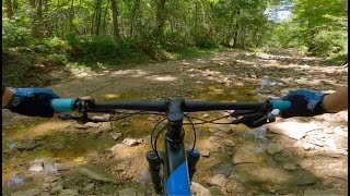
      Mountain Biking Moon Loop at Mark Twain...
      mtb
      11:40 | 188 | Aug 30, 2024 , Columbia
      3.0 ★★★★★
      2 Ratings
      5 ★ 50%
      4 ★
      3 ★
      2 ★
      1 ★ 50%

      3 Reviews & Comments

      apsbiker apsbiker
      Hi Bruce, thanks for visiting. The trail gets trimmed/mowed several times a season by volunteers from CoMo Trail Association. We have several repair projects in the works that are all in process through our partnership with USFS so we look forward to your visit after the work is approved and completed (all by volunteers that love the trails) over the next year or so.
      BruceJViYUH
      Parts of this trail were very enjoyable, the
      Parts that were not completely washed out and overgrown. This trail has potential but is not well maintained.
      MqQJlnV
      Met the COMO Trail Association Team last Sunday, and was super helpful for first time visit. Guys are awesome and really care about the trails in the area! Trail is well maintained, and mostly flow with some technical sections, mainly the creek crossings. The rocks are very large in the creek. The trail is multi-use with horses, minor ruts due to this, but still worth a trip if looking for something new.

      We hope you've been enjoying Trailforks!

      Create a FREE account to view all trail reviews and much more.

      • By apsbikerTF Pro COMOTA & contributors
      • #302520 - 3,321 views

      Frequently Asked Questions

      ▼ Where is Moon Loop located?
      Moon Loop is located in Mark Twain National Forest - Columbia, Columbia, Missouri, United States. It is part of the Mark Twain National Forest - Columbia trail network. The trailhead is located at coordinates 38.85381, -92.16771.
      ▼ How hard is Moon Loop?
      Moon Loop is rated as Blue difficulty.
      ▼ What is the elevation gain for Moon Loop?
      Moon Loop has 379 ft of elevation gain. The trail has 381 ft of elevation descent. The elevation ranges from 711 ft to 841 ft.
      ▼ Is Moon Loop a point to point trail?
      Moon Loop is not a point to point trail. The direction is Both Directions. The trail type is singletrack.
      ▼ How long is Moon Loop?
      Moon Loop is 4.3 miles long. The trail type is singletrack.
      ▼ Are dogs allowed on Moon Loop?
      Yes, dogs are allowed on Moon Loop. Please keep dogs on a leash where required and clean up after them.
      ▼ How do I access Moon Loop? Where is the closest parking trailhead?
      The closest parking and trailhead locations to Moon Loop are: View all parking locations in the area.
      ▼ How long does it take to ride Moon Loop?
      Based on recorded activities, it takes an average of 41 minutes to ride Moon Loop. The trail is 4.3 miles long. Actual times will vary based on fitness level, conditions, and pace. View recent activity logs for more details.
      ▼ How busy is Moon Loop?
      Moon Loop is a moderately popular trail. There have been 76 recorded activities on this trail. The trail has received 113 check-ins. View recent activity on this trail.

      Hit the Trail

      Open in App

      Get this trail on your phone instantly.

      open trail in app

      Download Trail

      Save to wishlist, Garmin & download.
      save the trail

      Find Related Routes

      Find routes and users activities that include this trail.
      find routes for this trail

      You must enter a description before submitting.