more stats
1.1 miles
Distance
473 ft
Climb
-17 ft
Descent
00:14:38
Avg time
456 ft
Altitude change
1,847 ft
Altitude min
2,303 ft
Altitude max
1,847 ft
Altitude start
2,303 ft
Altitude end
7.6%
Grade
-14.1%
Grade max
32.3%
Grade min
1 mile
Distance climb
292 ft
Distance down
194 ft
Distance flat
00:14:38
Avg time

The Summit Trail Details

  • Activities
    • Mountain Bike
    • E-Bike
    • Winter Fat Bike
    • Horse
    • Hike
    • Trail Running
  • Riding Area
  • Difficulty Rating
  • Voted Difficulty
    Blue (1 vote)
  • Local Popularity
    85 in Mountain Biking heatmap [+]
    • 100 in E-Biking
    • 85 in Trail Running
    • 90 in Hiking
    • 5 in Horseback
    • 5 in Winter Fat Biking
  • Global Ranking
    #73236 in Mountain Biking [+]
    • #7886 in E-Biking
    • #106807 in Trail Running
    • #114127 in Hiking
    • #23439 in Horseback
    • #6248 in Winter Fat Biking
  • State Ranking
    #2,332 in Mountain Biking · California [+]
    • #192 in E-Biking
    • #5,191 in Trail Running
    • #6,327 in Hiking
    • #1,595 in Horseback
    • #139 in Winter Fat Biking
  • Trail Type
    Singletrack
  • Bike Type
    AM, XC, Fat
  • Direction
    Both Directions
  • Climb Difficulty
    Blue
  • Physical Rating
    Hard
  • Trail Visibility
    Always easy to follow
  • Dogs Allowed
    Yes
  • eBike Allowed
    Yes up to Class 1
  • TTFs on Trail
    Berm
  • Land Owner
    BLM

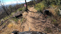
Great singletrack that leads to the top of Mule Mountain summit. It can be skinny with shale rocks in some parts. Nice views from the top.

Tags
BermsSkinniesSummitViews

Trail Supporters

  • BLM
    BLM
    Land Manager

Local Trail Association

Traditionally Indigenous Territory

Recent Activity on Trail

Past Week
  • 1 rides
  • 9 miles average
6 Months
  • 23 rides
  • 15 miles avg distance
All
  • 387 rides
  • Last: Nov 17, 2026
c1c2c3c4
January
February
March
April
May
June
July
August
September
October
November
December
update trails status or condition

The Summit Trail Trail Reports

statusdatedescription
May 5, 2026 @ 7:21pm (America/Los_Angeles)
May 5, 2026
Mar 30, 2026 @ 9:41am (America/Boise)
Mar 30, 2026
Mar 16, 2026 @ 9:32am (America/Los_Angeles)
Mar 16, 2026
Mar 7, 2026 @ 2:15pm (America/Boise)
Mar 7, 2026
Jan 2, 2025 @ 11:49am
Jan 2, 2025
Trail runs awesome. Gets a bit bushy towards the top of the climb and the same when going down but other than that its sweet!
more »
Status:
on May 5, 2026
Ideal
Avg: 3.83 (6 votes)
Your vote: 0

view (3,070)
close
      Directions to the-summit-trail-47822 trailhead (40.548180, -122.508560)

      Photos

      13 more »
      mtb
      107 |
      Apr 1, 2023 @ 6:30pm
      Apr 1, 2023
      mtb
      109 |
      Apr 1, 2023 @ 6:30pm
      Apr 1, 2023
      mtb
      112 |
      Apr 1, 2023 @ 6:30pm
      Apr 1, 2023
      mtb
      111 |
      Apr 1, 2023 @ 6:29pm
      Apr 1, 2023

      Videos

      1 more »
      #FridayFails
      mtb
      0:14 | 610 | Oct 30, 2020 , Redding

      Routes with this trail

      more »
      18 miles • 2,792 ft • 9 •
      The route for the grand opening of the Upper Ono and Doqos trails. This ride is being held in conjunction...
      10 miles • 1,497 ft • 4 • Loop •
      This Swasey Rec loop includes some very fun, but tech trails. Following is a basic trail to trail summary:...
      13 miles • 1,809 ft • 5 • Loop •
      This Bigfoot Adventure Challenge loop route is in the BLM managed Swasey Recreation Area with amazing Mule...
      3.7 ★★★★★
      6 Ratings
      5 ★ 17%
      4 ★ 33%
      3 ★ 50%
      2 ★
      1 ★

      2 Reviews & Comments

      Mkrol
      If I visit the area again, I'll skip summit. I'm glad I did it, but The climb up wasn't worth the descent imo.
      deln78
      Not very technical, but a bit exposed and loose. Hard to get good flow on the downhill due to all the loose leaves and sand.

      We hope you've been enjoying Trailforks!

      Create a FREE account to view all trail reviews and much more.

      • By Mouser0007 & contributors
      • #47822 - 3,284 views

      Frequently Asked Questions

      ▼ Where is The Summit Trail located?
      The Summit Trail is located in Mule Ridge and Swasey Recreation Area, Redding, California, United States. It is part of the Mule Ridge and Swasey Recreation Area trail network. The trailhead is located at coordinates 40.54818, -122.50856.
      ▼ How hard is The Summit Trail?
      The Summit Trail is rated as Black Diamond difficulty. The physical rating is Hard. The average grade is 7.6%. The climb difficulty is rated Blue.
      ▼ What is the elevation gain for The Summit Trail?
      The Summit Trail has 473 ft of elevation gain. The trail has 17 ft of elevation descent. The elevation ranges from 1,847 ft to 2,303 ft.
      ▼ Is The Summit Trail a point to point trail?
      The Summit Trail is not a point to point trail. The direction is Both Directions. The trail type is singletrack.
      ▼ How long is The Summit Trail?
      The Summit Trail is 1.1 miles long. The trail type is singletrack.
      ▼ Are dogs allowed on The Summit Trail?
      Yes, dogs are allowed on The Summit Trail. Please keep dogs on a leash where required and clean up after them.
      ▼ When is the best time of year to ride The Summit Trail?
      Based on activity log data, the most popular months to ride The Summit Trail are:
      • April (44 activities)
      • March (31 activities)
      • May (15 activities)
      Check the reports page for current trail conditions.
      ▼ How do I access The Summit Trail? Where is the closest parking trailhead?
      The closest parking and trailhead locations to The Summit Trail are: View all parking locations in the area.
      ▼ How long does it take to ride The Summit Trail?
      Based on recorded activities, it takes an average of 15 minutes to ride The Summit Trail. The trail is 1.1 miles long. Actual times will vary based on fitness level, conditions, and pace. View recent activity logs for more details.
      ▼ How busy is The Summit Trail?
      The Summit Trail is a very popular trail. There have been 1,886 recorded activities on this trail. The trail has received 3,070 check-ins. View recent activity on this trail.

      Hit the Trail

      Open in App

      Get this trail on your phone instantly.

      open trail in app

      Download Trail

      Save to wishlist, Garmin & download.
      save the trail

      Find Related Routes

      Find routes and users activities that include this trail.
      find routes for this trail

      You must enter a description before submitting.