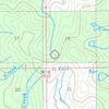
more stats
4.6 miles
Distance
286 ft
Climb
-1,734 ft
Descent
01:30:29
Avg time
-1,448 ft
Altitude change
7,781 ft
Altitude min
9,506 ft
Altitude max
9,228 ft
Altitude start
7,782 ft
Altitude end
-6%
Grade
-49.5%
Grade max
12.9%
Grade min
1 mile
Distance climb
3 miles
Distance down
492 ft
Distance flat
01:30:29
Avg time

Pika Point Details

  • Activities
    • Mountain Bike
    • E-Bike
    • Winter Fat Bike
    • Horse
    • Hike
    • Trail Running
    • Dirtbike/Moto
  • Riding Area
    Madison Range
    Big Sky, Montana
  • Ref Number
    #203
  • AKA
    Minnie Wapiti
  • Difficulty Rating
  • Local Popularity
    5 in Mountain Biking [+]
    • 5 in E-Biking
    • 5 in Trail Running
    • 5 in Hiking
    • 5 in Dirtbiking
    • 5 in Horseback
    • 5 in Winter Fat Biking
  • Global Ranking
    #150241 in Mountain Biking [+]
    • #48648 in E-Biking
    • #334855 in Trail Running
    • #347113 in Hiking
    • #15254 in Dirtbiking
    • #23927 in Horseback
    • #33073 in Winter Fat Biking
  • State Ranking
    #1,338 in Mountain Biking · Montana [+]
    • #60 in E-Biking
    • #3,752 in Trail Running
    • #4,019 in Hiking
    • #524 in Dirtbiking
    • #1,109 in Horseback
    • #967 in Winter Fat Biking
  • Trail Type
    Singletrack
  • Bike Type
    AM, XC, Fat
  • Direction
    Both Directions
    Popular Direction Shown
  • Climb Difficulty
    Black Diamond
  • Physical Rating
    Hard
  • Trail Visibility
    Always easy to follow
  • Season
    July through September
  • Dogs Allowed
    Yes
  • eBike Allowed
    Yes up to Class 1
  • TTFs on Trail
    Rock Garden
  • Land Owner
    USFS

Another old school, classic, Taylor Fork ride; although the dirt bikes have really torn it up lately. A rough, rocky descent lacking much flow. Tons of loose rock.

Access Info

Upper Wapiti trailhead, Oil Well or Little Wapiti to climb

Tags
LooseRock gardensRocky
Trail Supporters
Local Trail Association
Traditionally Indigenous Territory

Recent Activity on Trail

Past Week
  • 0 rides
  •  
6 Months
  • 0 rides
  •  
All
  • 5 rides
  • Last: Oct 2, 2026
c1c2c3c4
January
February
March
April
May
June
July
August
September
October
November
December
update trails status or condition

Pika Point Trail Reports

statusdatedescription
Oct 2, 2026 @ 9:53pm (America/Denver)
6 hours
Clear of deadfall, but expect about a mile or more of hike a bike descending due to 'babyhead' sized rolly rocks on a steep grade. The majority of...
Mar 22, 2025 @ 11:45am
Mar 22, 2025
Jun 25, 2024 @ 3:54am
Jun 25, 2024
trees down, lots of loose rock
Jul 30, 2023 @ 4:47pm
Jul 30, 2023
A few trees down, a lot of loose rock. We climbed it, not sure why?!
Aug 22, 2020 @ 2:36pm
Aug 22, 2020
Rough
more »
Status:
on Oct 2, 2026
Ideal
Avg: 3.7 (1 votes)
Your vote: 0

view (30)
close
      Directions to pika-point trailhead (44.963130, -111.303950)

      Photos

      No photos have been added for Pika Point yet, add a photo.

      Videos

      no videos have been added for Pika Point yet, add a video.

      Trail Products

      2.0 ★★★★★
      1 Ratings
      5 ★
      4 ★
      3 ★
      2 ★ 100%
      1 ★

      3 Reviews & Comments

      elsquatcho elsquatcho
      This trail gets worse every year, the dirt bikers are relegated to just this one so it gets pretty torn up. Not much flow. Seems like someone (the dirt bikers) should build a long bridge through that muddy section.
      elsquatcho elsquatcho
      Comment above is referring to Minnie Wapiti in Beaver Creek
      mt-powder
      We 'rode' the first half mile of this trail from Beaver Creek. It is decidedly not a blue square. Perhaps would go so far as to say that it is a double black, at least for that distance. The trail certainly may improve beyond that point, but to call it a blue is terribly misleading. If you are looking for a techinical, rugged downhill, this is a great option.

      We hope you've been enjoying Trailforks!

      Create a FREE account to view all trail reviews and much more.

      • By evasiveTF Pro MBG & contributors
      • #64546 - 2,439 views

      Frequently Asked Questions

      ▼ Where is Pika Point located?
      Pika Point is located in Madison Range, Big Sky, Montana, United States. It is part of the Madison Range trail network. The trailhead is located at coordinates 44.96313, -111.30395.
      ▼ How hard is Pika Point?
      Pika Point is rated as Black Diamond difficulty. The physical rating is Hard. The average grade is 6%. The climb difficulty is rated Black Diamond.
      ▼ What is the elevation gain for Pika Point?
      Pika Point has 286 ft of elevation gain. The trail has 1,734 ft of elevation descent. The elevation ranges from 7,781 ft to 9,506 ft.
      ▼ Is Pika Point a point to point trail?
      Pika Point is not a point to point trail. The direction is Both Directions. The trail type is singletrack.
      ▼ How long is Pika Point?
      Pika Point is 4.6 miles long. The trail type is singletrack.
      ▼ Are dogs allowed on Pika Point?
      Yes, dogs are allowed on Pika Point. Please keep dogs on a leash where required and clean up after them.
      ▼ When is the best time of year to ride Pika Point?
      Pika Point is best visited during: July through September.
      ▼ How do I access Pika Point? Where is the closest parking trailhead?
      The closest parking and trailhead locations to Pika Point are: View all parking locations in the area.
      ▼ How long does it take to ride Pika Point?
      Based on recorded activities, it takes an average of 55 minutes to ride Pika Point. The trail is 4.6 miles long. Actual times will vary based on fitness level, conditions, and pace. View recent activity logs for more details.
      ▼ How busy is Pika Point?
      Pika Point is a less popular trail with lighter traffic. There have been 31 recorded activities on this trail. The trail has received 30 check-ins. View recent activity on this trail.

      Hit the Trail

      Open in App

      Get this trail on your phone instantly.

      open trail in app

      Download Trail

      Save to wishlist, Garmin & download.
      save the trail

      Find Related Routes

      Find routes and users activities that include this trail.
      find routes for this trail

      You must enter a description before submitting.