

more stats
4,731 ft
Distance
-3 ft
Descent
00:03:16
Avg time
-1 ft
Altitude change
445 ft
Altitude min
448 ft
Altitude max
448 ft
Altitude start
446 ft
Altitude end
-3.8%
Grade max
1.4%
Grade min
223 ft
Distance climb
249 ft
Distance down
3,911 ft
Distance flat
00:03:16
Avg time

RCP Loop 2 Details

  • Activities
    • Mountain Bike
    • Hike
    • Trail Running
  • Riding Area
    Rowlett Creek Preserve
    Garland, Texas
  • Difficulty Rating
  • Voted Difficulty
    Green (1 vote)
  • Local Popularity
    80 in Mountain Biking [+]
    • 5 in Trail Running
    • 5 in Hiking
  • Global Ranking
    #65538 in Mountain Biking [+]
    • #57261 in Trail Running
    • #336040 in Hiking
  • State Ranking
    #938 in Mountain Biking · Texas [+]
    • #563 in Trail Running
    • #4,206 in Hiking
  • Trail Type
    Singletrack
  • Direction
    One Direction
    Popular Direction Shown
  • Dogs Allowed
    Yes

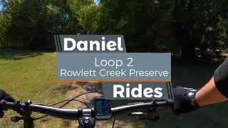
Loop 2 kicks off the south side of RCP. The first stretch of single track starts in an open field before heading into tree cover. There's an interesting wooden bridge feature and a couple of uninteresting wooden bridge features. The first and last have a by-pass if you are, what's the word...interested. Other than that, it's pretty much roots with a few gravel spots. Loop 2 ends back at the parking lot.

Tags
BridgesRestrooms
Local Trail Association
Traditionally Indigenous Territory

Recent Activity on Trail

Past Week
  • 0 rides
  •  
6 Months
  • 92 rides
  • 11 miles avg distance
All
  • 1,156 rides
  • Last: Sep 30, 2026
update trails status or condition

RCP Loop 2 Trail Reports

statusdatedescription
Oct 1, 2026 @ 10:04am (America/Chicago)
Oct 1, 2026
Aug 4, 2026 @ 11:06am (America/Chicago)
Aug 4, 2026
reporter Reroute from loop1 for JD event closed off with loop1 being reopened
Jul 23, 2026 @ 11:48am (America/Chicago)
Jul 23, 2026
reporter The entrance from loop1 has been changed - follow reroute signage
Jul 13, 2026 @ 7:27am (America/Chicago)
Jul 13, 2026
reporter
Jul 2, 2026 @ 1:59pm (America/Chicago)
Jul 2, 2026
reporter Lots of deadfall, a few downed trees, and Farmer haying open fields (mowing done, raking hay now).
more »
Status:
on Oct 1, 2026
Wet
Avg: 3.99 (8 votes)
Your vote: 0

view (3,326)
close
      Directions to rcp-loop-2 trailhead (32.920510, -96.594210)

      Photos

      5 more »
      mtb
      541 |
      Nov 6, 2021 @ 6:12pm
      Nov 6, 2021
      mtb
      486 |
      Nov 6, 2021 @ 6:12pm
      Nov 6, 2021
      mtb
      361 |
      Sep 8, 2021 @ 4:58am
      Sep 8, 2021
      mtb
      322 |
      Sep 8, 2021 @ 4:57am
      Sep 8, 2021

      Videos

      1 more »
      Loop 2 | RCP Full Trail, Mountain Biking
      mtb
      5:41 | 161 | Oct 21, 2022 , Garland

      Routes with this trail

      9 miles • 73 ft • 12 • Loop •
      Judgment Day 2026 Whole Trail Except loops 5,6,7,13,14
      ★ 2.0 • 16 miles • 225 ft • 14 •
      RCP full course all loops included
      11 miles • 183 ft • 12 • Loop •
      RCP All Loops minus 13, 14, and 6
      4.0 ★★★★★
      8 Ratings
      5 ★ 50%
      4 ★ 13%
      3 ★ 25%
      2 ★ 13%
      1 ★

      Reviews / Comments

      No reviews yet, be the first to write a review or ask a question.
      Use trail reports to comment on trail conditions.


      We hope you've been enjoying Trailforks!

      Create a FREE account to view all trail reviews and much more.

      • By toddTF Pro Trailforks & contributors
      • #118637 - 2,078 views

      Frequently Asked Questions

      ▼ Where is RCP Loop 2 located?
      RCP Loop 2 is located in Rowlett Creek Preserve, Garland, Texas, United States. It is part of the Rowlett Creek Preserve trail network. The trailhead is located at coordinates 32.92051, -96.59421.
      ▼ How hard is RCP Loop 2?
      RCP Loop 2 is rated as Blue difficulty.
      ▼ What is the elevation gain for RCP Loop 2?
      The trail has 3 ft of elevation descent. The elevation ranges from 445 ft to 448 ft.
      ▼ Is RCP Loop 2 a point to point trail?
      Yes, RCP Loop 2 is a point to point trail. The direction is One Direction. The trail type is singletrack.
      ▼ How long is RCP Loop 2?
      RCP Loop 2 is 4,731 ft long. The trail type is singletrack.
      ▼ Are dogs allowed on RCP Loop 2?
      Yes, dogs are allowed on RCP Loop 2. Please keep dogs on a leash where required and clean up after them.
      ▼ How do I access RCP Loop 2? Where is the closest parking trailhead?
      The closest parking and trailhead locations to RCP Loop 2 are: View all parking locations in the area.
      ▼ How long does it take to ride RCP Loop 2?
      Based on recorded activities, it takes an average of 3 minutes to ride RCP Loop 2. The trail is 4,731 ft long. Actual times will vary based on fitness level, conditions, and pace. View recent activity logs for more details.
      ▼ How busy is RCP Loop 2?
      RCP Loop 2 is a very popular trail. There have been 3,142 recorded activities on this trail. The trail has received 3,326 check-ins. View recent activity on this trail.

      Hit the Trail

      Open in App

      Get this trail on your phone instantly.

      open trail in app

      Download Trail

      Save to wishlist, Garmin & download.
      save the trail

      Find Related Routes

      Find routes and users activities that include this trail.
      find routes for this trail

      You must enter a description before submitting.


