more stats
1.1 miles
Distance
6 ft
Climb
-8 ft
Descent
00:04:38
Avg time
-2 ft
Altitude change
440 ft
Altitude min
447 ft
Altitude max
447 ft
Altitude start
446 ft
Altitude end
-3.1%
Grade max
2.6%
Grade min
840 ft
Distance climb
676 ft
Distance down
4,003 ft
Distance flat
00:04:38
Avg time

RCP Loop 3 Details

  • Activities
    • Mountain Bike
    • Hike
    • Trail Running
  • Riding Area
    Rowlett Creek Preserve
    Garland, Texas
  • Difficulty Rating
  • Voted Difficulty
    Green (1 vote)
  • Local Popularity
    80 in Mountain Biking [+]
    • 75 in Trail Running
    • 5 in Hiking
  • Global Ranking
    #79082 in Mountain Biking [+]
    • #50143 in Trail Running
    • #82019 in Hiking
  • Trail Type
    Singletrack
  • Direction
    One Direction
    Popular Direction Shown
  • Dogs Allowed
    Yes

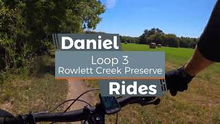
You'll spend a fair amount of Loop 3 along Rowlett Creek. The trail along water's edge is fairly wide in spots due to foot traffic. Be prepared to dodge folk out fishing. Keep in mind, it's Rowlett Creek. You don't want to find yourself in it, so dodge to the right. You could also just show some trail manners and slow down as you pass, maybe say, "Evening" and give a friendly head nod. You only have a tree line pedal waiting for you, anyway.

Local Trail Association
Traditionally Indigenous Territory

Recent Activity on Trail

Past Week
  • 0 rides
  •  
6 Months
  • 66 rides
  • 11 miles avg distance
All
  • 1,025 rides
  • Last: May 17, 2026
c1c2c3c4
January
February
March
April
May
June
July
August
September
October
November
December
Status:
on May 19, 2026
Prevalent Mud
Avg: 3.66 (6 votes)
Your vote: 0

view (3,354)
close
3D
Trail Conditions
  • Unknown
  • Snow Groomed
  • Snow Packed
  • Snow Covered
  • Snow Cover Partial
  • Freeze/thaw Cycle
  • Icy
  • Prevalent Mud
  • Wet
  • Variable
  • Ideal
  • Dry
  • Very Dry
Trail Flow (Ridden Direction)
Trailforks scans users ridelogs to determine the most popular direction each trail is ridden. A good flowing trail network will have most trails flowing in a single direction according to their intension.
The colour categories are based on what percentage of riders are riding a trail in its intended direction.
  • > 96%
  • > 90%
  • > 80%
  • > 70%
  • > 50%
  • < 50%
  • bi-directional trail
  • no data
Trail Last Ridden
Trailforks scans ridelogs to determine the last time a trail was ridden.
  • < 2 days
  • < 1 week
  • < 2 weeks
  • < 1 month
  • < 6 months
  • > 6 months
Trail Ridden Direction
The intended direction a trail should be ridden.
  • Downhill Only
  • Downhill Primary
  • Both Directions
  • Uphill Primary
  • Uphill Only
  • One Direction
Contribute Details
Colors indicate trail is missing specified detail.
  • Description
  • Photos
  • Description & Photos
  • Videos
Trail Popularity ?
Trailforks scans ridelogs to determine which trails are ridden the most in the last 9 months. Trails are compared with nearby trails in the same city region with a possible 25 colour shades. Think of this as a heatmap, more rides = more kinetic energy = warmer colors.
  • most popular
  • popular
  • less popular
  • not popular
ATV/ORV/OHV Filter
Max Vehicle Width
inches
US Cell Coverage
Legend
cell carrier legend

Radar Time
Activity Recordings
Trailforks uses anonymized public activity data. ?
Activity Recordings
Trailforks uses anonymized public activity data. ?
Personal Heatmap
Activity Types
all / none
Options
2
Date range month
Winter Trails
Warning A routing network for winter maps does not exist. Selecting trails using the winter trails layer has been disabled.
Missing Trails
Most Popular
Least Popular
Trails are colored based on popularity. The more popular a trail is, the more red. Less popular trails trend towards green.
Jump Magnitude Heatmap
Heatmap of where riders jump on trails. Zoom in to see individual jumps, click circles to view jump details.
BC Backroad Status

Service Road Atlas is a free to use, community-driven service for viewing and creating reports on the numerous back-country service roads around B.C. and Alberta.

map legend
Slope Aspect
Direction the slope faces
Flat N NE E SE S SW W NW
Trails Deemphasized
Trails are shown in grey.
disable
Only show trails with no bike usage.
Enable
Suggested Layers
Based on selected activity type

    Save the current map location and zoom level as your default home location whenever this page is loaded.

    Save
        Directions to rcp-loop-3 trailhead (32.916340, -96.594700)

        Photos

        1 more »
        269 |
        Sep 8, 2021 @ 4:59am
        Sep 8, 2021

        Videos

        1 more »
        Loop 3 | RCP Full Trail, Mountain Biking
        5:46 | 115 | Oct 21, 2022 , Garland

        Routes with this trail

        12 miles 105 ft 11
        This is the RCP route for the 100 mile participants in the 2026 Judgment Day by DORBA Whole trail except...
        2.0 16 miles 225 ft 14
        RCP full course all loops included
        11 miles 183 ft 12 Loop
        RCP All Loops minus 13, 14, and 6

        Reviews / Comments

        No reviews yet, be the first to write a review or ask a question.
        Use trail reports to comment on trail conditions.


        We hope you've been enjoying Trailforks!

        Create a FREE account to view trail comments and much more.

        • By toddTF Pro Trailforks & contributors
        • #118638 - 1,398 views

        Frequently Asked Questions About RCP Loop 3

        Where is RCP Loop 3 located?
        RCP Loop 3 is located in Rowlett Creek Preserve, Garland, Texas, United States. It is part of the Rowlett Creek Preserve trail network. The trailhead is located at coordinates 32.91634, -96.5947.
        How hard is RCP Loop 3?
        RCP Loop 3 is rated as Blue difficulty.
        What is the elevation gain for RCP Loop 3?
        RCP Loop 3 has 6 ft of elevation gain. The trail has 8 ft of elevation descent. The elevation ranges from 440 ft to 447 ft.
        Is RCP Loop 3 a point to point trail?
        Yes, RCP Loop 3 is a point to point trail. The direction is One Direction. The trail type is singletrack.

        Hit the Trail

        Open in App

        Get this trail on your phone instantly.
        open trail in app

        Download Trail

        Save to wishlist, Garmin & download.
        save the trail

        Find Related Routes

        Find routes and users activities that include this trail.
        find routes for this trail

        You must enter a description before submitting.