Ridgeback 4 Details
-
Activities
- Mountain Bike
- E-Bike
- Hike
- Trail Running
- Horse
-
Riding AreaStation Flats / Allen Bill
Bragg Creek, Alberta -
AKAR4
-
Difficulty Rating
-
Trail TypeSingletrack
-
Bike TypeAM, XC, Fat
-
Trail UsageMulti-use
-
DirectionBoth Directions
-
Climb DifficultyBlue
-
Physical RatingModerate
-
Dogs AllowedYes
-
eBike Allowed
-
TTFs on TrailBridge
-
Global Ranking#18665 in Mountain Biking
-
Local Popularity65 in Mountain Biking [+]
- 75 in E-Biking
- 80 in Trail Running
- 55 in Hiking
- 5 in Horseback
-
Year Opened2010
-
Land ManagerAE&P
The northernmost section of Ridgeback ("R4") is 300m north of Ridgeback 3. Tom Snow forks to the right for a 800m section that, while always wet and muddy, makes an alternative to the climb up R4 (turn left and climb up the mountain road until you reach the other end of R4). R4 meets the bottom of Moose Packers near the Shell gas valve station.
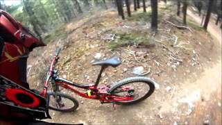
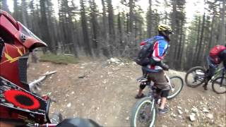
R4 is mostly fast and buff from north to south, with some short climbs at the south end. Easily the most buff and flowy part of the Ridgeback trails.
Ridgeback is one of the newer trails in Kananaskis and is maintained by the Calgary Mountain Bike Alliance. It's a mix of machine-built and hand-built construction, designed to provide an alternative to the perpetual wetness of the Tom Snow trail. Ridgeback and Tom Snow come together at three points, dividing both trails into four main sections, all of which are good in either direction. You can mix and match sections of the two trails to extend or shorten your ride. Note that the parts of Tom Snow that Ridgeback bypasses almost always have standing water, mud puddles and downed trees across them.
Access Info
Access from R3 to the south, Moose Packers to the west, or maybe the mountain road or Tom Snow to the east.
Local Trail Association
-
Please consider joining or donating to the local trail association to supportdonate to earn trail karma!
trail development & maintenance.
More Stats for Ridgeback 4 bike trail trail
-
Altitude change-146 ft
-
Altitude min5,085 ft
-
Altitude max5,333 ft
-
Altitude start5,333 ft
-
Altitude end5,187 ft
-
Grade max-21.199%
-
Grade min27.844%
-
Distance climb1,553 ft
-
Distance down3,499 ft
-
Distance flat256 ft
-
Avg time00:08:22
-
Avg reverse time00:15:30
- view trail stats
- Unknown
- Snow Groomed
- Snow Packed
- Snow Covered
- Freeze/thaw Cycle
- Icy
- Prevalent Mud
- Wet
- Variable
- Ideal
- Dry
- Very Dry
The colour categories are based on what percentage of riders are riding a trail in its intended direction.
- > 96%
- > 90%
- > 80%
- > 70%
- > 50%
- < 50%
- < 2 days
- < 1 week
- < 2 weeks
- < 1 month
- < 6 months
- > 6 months
- Downhill Only
- Downhill Primary
- Both Directions
- Uphill Primary
- Uphill Only
- One Direction
- Description
- Photos
- Description & Photos
- Videos
- most popular
- popular
- less popular
- not popular
- Access Road/Trail
- White
- Green
- Blue
- Black
- Double Black Diamond
Trail Report Status
- Clear / Green
- Minor Issue / Yellow
- Significant Issue / Amber
- Closed
- Land Owner Overlay
- Wilderness (typically no bikes in USA)
- BLM (public)
- USFS (Wildlife sanctuaries darker than usfs)
- State land
- Indigenous
- Military
- Unknown
- Snow Groomed
- Snow Packed
- Snow Covered
- Freeze/thaw Cycle
- Icy
- Prevalent Mud
- Wet
- Variable
- Ideal
- Dry
- Very Dry
- Map Markers
Trail Head
Photo
Directory Listing
Riding Area
TTF
Parking
Viewpoint
Information
Warning
Directions
Sight
Restrooms
eBike Charging Point
Water Fountain/Source
Gate
Trail Sign
Table or Bench
Ladder
Stairs
Bridge
Boardwalk
Camping
Cabin
Lodge
Bear Cache
Dock
Ranger Station
Summit
Other
Ridgeback 4 Trail Reports
Recent Ridelog Activity on Trail
Past Week
- 0 rides
6 Months
- 160 rides
- 16 miles avg distance
All
- 852 rides
Photos
Trail Lists
-
2018 Shred List85 trails
-
2018 Rides List
13 trails
Routes with this trail
-
+ 0

Nearby Trails
- Mountain Road 0 ft
- Tom Snow 4,131 ft
- Snakes & Ladders 3 miles
- Moose Loop 3 miles
- Strange Brew 3 miles
Station Flats / Allen Bill
- embed Ridgeback 4 trail on your website
- By onecogpaul
& contributors
- #38385 - 2,164 views
- subscribe
- login to download gpx or kml files.