more stats
3.1 miles
Distance
19 ft
Climb
-1,521 ft
Descent
00:09:32
Avg time
-1,503 ft
Altitude change
4,692 ft
Altitude min
6,194 ft
Altitude max
6,194 ft
Altitude start
4,692 ft
Altitude end
-9.1%
Grade
-42.3%
Grade max
7.9%
Grade min
617 ft
Distance climb
3 miles
Distance down
548 ft
Distance flat
00:09:32
Avg time

Super Star Details

  • Activities
    • Mountain Bike
    • E-Bike
  • Riding Area
    Silver Star Mountain Park
    Vernon, British Columbia
  • Difficulty Rating
  • Local Popularity
    95 in Mountain Biking [+]
    • 100 in E-Biking
  • Global Ranking
    #4551 in Mountain Biking [+]
    • #2165 in E-Biking
  • Trail Type
    Machine Groomed
  • Bike Type
    DH
  • Physical Rating
    Moderate
  • Season
    Summer
  • Dogs Allowed
    Yes
  • eBike Allowed
  • Year Opened
    2005
  • Land Owner

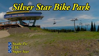
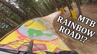
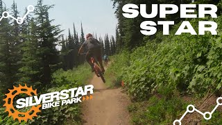
This machine made “berm fest” will make you want to run out and buy a brand new full suspension mountain bike. This is definitely one of our feature trails, smooth top to bottom, loaded with berms and rolls for the intermediate rider, a perfect warm up for anyone.

Bike Park

Local Trail Association

Recent Activity on Trail

Past Week
  • 38 rides
  • 29 miles average
6 Months
  • 68 rides
  • 30 miles avg distance
All
  • 1,353 rides
  • Last: Jul 2, 2026
c1c2c3c4
January
February
March
April
May
June
July
August
September
October
November
December
update trails status or condition

Super Star Trail Reports

statusdatedescription
Jun 18, 2026 @ 10:07pm (America/Vancouver)
Jun 18, 2026
Jun 18, 2026 @ 10:05pm (America/Vancouver)
Jun 18, 2026
Sep 23, 2025 @ 9:57am (America/Vancouver)
Sep 23, 2025
Thanks for another great season, ALL DH, Beowulf and upper XC trails are now closed. The Knoll XC will remain open until TBD.
Jun 21, 2025 @ 8:43am
Jun 21, 2025
Jun 20, 2025 @ 10:03am
Jun 20, 2025
more »
Status:
on Jun 18, 2026
Avg: 4.39 (54 votes)
Your vote: 0

view (16,069)
close
3D
Trail Conditions
  • Unknown
  • Snow Groomed
  • Snow Packed
  • Snow Covered
  • Snow Cover Partial
  • Freeze/thaw Cycle
  • Icy
  • Prevalent Mud
  • Wet
  • Variable
  • Ideal
  • Dry
  • Very Dry
Trail Flow (Ridden Direction)
Trailforks scans users ridelogs to determine the most popular direction each trail is ridden. A good flowing trail network will have most trails flowing in a single direction according to their intension.
The colour categories are based on what percentage of riders are riding a trail in its intended direction.
  • > 96%
  • > 90%
  • > 80%
  • > 70%
  • > 50%
  • < 50%
  • bi-directional trail
  • no data
Trail Last Ridden
Trailforks scans ridelogs to determine the last time a trail was ridden.
  • < 2 days
  • < 1 week
  • < 2 weeks
  • < 1 month
  • < 6 months
  • > 6 months
Trail Ridden Direction
The intended direction a trail should be ridden.
  • Downhill Only
  • Downhill Primary
  • Both Directions
  • Uphill Primary
  • Uphill Only
  • One Direction
Contribute Details
Colors indicate trail is missing specified detail.
  • Description
  • Photos
  • Description & Photos
  • Videos
Trail Popularity ?
Trailforks scans ridelogs to determine which trails are ridden the most in the last 9 months. Trails are compared with nearby trails in the same city region with a possible 25 colour shades. Think of this as a heatmap, more rides = more kinetic energy = warmer colors.
  • most popular
  • popular
  • less popular
  • not popular
ATV/ORV/OHV Filter
Max Vehicle Width
inches
US Cell Coverage
Legend
cell carrier legend

Radar Time
Activity Recordings
Trailforks uses anonymized public activity data. ?
Activity Recordings
Trailforks uses anonymized public activity data. ?
Personal Heatmap
Activity Types
all / none
Options
2
Date range month
Winter Trails
Warning A routing network for winter maps does not exist. Selecting trails using the winter trails layer has been disabled.
Missing Trails
Most Popular
Least Popular
Trails are colored based on popularity. The more popular a trail is, the more red. Less popular trails trend towards green.
Jump Magnitude Heatmap
Heatmap of where riders jump on trails. Zoom in to see individual jumps, click circles to view jump details.
BC Backroad Status

Service Road Atlas is a free to use, community-driven service for viewing and creating reports on the numerous back-country service roads around B.C. and Alberta.

map legend
Slope Aspect
Direction the slope faces
Flat N NE E SE S SW W NW
Trails Deemphasized
Trails are shown in grey.
disable
Only show trails with no bike usage.
Enable
Suggested Layers
Based on selected activity type

    Save the current map location and zoom level as your default home location whenever this page is loaded.

    Save
        Directions to super-star trailhead (50.369440, -119.063690)

        Photos

        32 more »
        444 |
        Jul 19, 2016 @ 7:45pm
        Jul 19, 2016
        438 |
        Jul 27, 2014 @ 9:34pm
        Jul 27, 2014
        55 |
        Jul 3, 2025 @ 10:06pm
        Jul 3, 2025
        155 |
        Sep 24, 2020 @ 8:54am
        Sep 24, 2020

        Videos

        23 more »
        youtuber Silver Star MTB Bike Park in Vernon, BC
        12:52 | 115 | Aug 1, 2025 , Vernon
        youtuber Super Star
        12:52 | 71 | Aug 1, 2025 , Vernon
        This Bike Park Has it All | Silver Star
        1:18:07 | 170 | Sep 20, 2023 , Vernon
        The Perfect Blue Flow Trail | Super Star |...
        12:28 | 687 | Nov 12, 2021 , Vernon

        Trail Lists

        Routes with this trail

        25 miles 3,936 ft 18 Loop Race
        Proposed Stage 2 Route for the 2015 Singletrack 6 Stage Race. Stage Date: Monday, July 27, 2015. See...
        25 miles 3,936 ft 17 Loop
        Stage 2 of the 2015 Singletrack 6 at Silver Star Bike Park
        10 miles 1,680 ft 15 Loop Race
        Soup 2 Nutz 2020 Race course- ride portion

        6 Reviews & Comments


        We hope you've been enjoying Trailforks!

        Create a FREE account to view trail comments and much more.

        • By canadakaTF Pro Trailforks & contributors
        • #3352 - 9,970 views

        Frequently Asked Questions About Super Star

        Where is Super Star located?
        Super Star is located in Silver Star Mountain Park, Vernon, British Columbia, Canada. It is part of the Silver Star Mountain Park trail network. The trailhead is located at coordinates 50.36944, -119.06369.
        How hard is Super Star?
        Super Star is rated as Blue difficulty. The physical rating is Moderate. The average grade is 9.1%.
        What is the elevation gain for Super Star?
        Super Star has 19 ft of elevation gain. The trail has 1,521 ft of elevation descent. The elevation ranges from 4,692 ft to 6,194 ft.
        How long is Super Star?
        Super Star is 3.1 miles long. The trail type is machine groomed.

        Hit the Trail

        Open in App

        Get this trail on your phone instantly.
        open trail in app

        Download Trail

        Save to wishlist, Garmin & download.
        save the trail

        Find Related Routes

        Find routes and users activities that include this trail.
        find routes for this trail

        You must enter a description before submitting.