





more stats
2.2 miles
Distance
121 ft
Climb
-374 ft
Descent
00:18:31
Avg time
-251 ft
Altitude change
3,547 ft
Altitude min
3,879 ft
Altitude max
3,875 ft
Altitude start
3,625 ft
Altitude end
-2.1%
Grade
-20.4%
Grade max
20.9%
Grade min
2,694 ft
Distance climb
1 mile
Distance down
1,378 ft
Distance flat
00:18:31
Avg time

Thumper (131) Details

  • Activities
    • Mountain Bike
    • Hike
    • Trail Running
  • Riding Area
    Dead Horse Ranch State Park
    Cottonwood, Arizona
  • Difficulty Rating
  • Local Popularity
    95 in Mountain Biking heatmap [+]
    • 100 in Trail Running
    • 85 in Hiking
  • Global Ranking
    #49409 in Mountain Biking [+]
    • #72810 in Trail Running
    • #115075 in Hiking
  • State Ranking
    #656 in Mountain Biking · Arizona [+]
    • #1,036 in Trail Running
    • #2,202 in Hiking
  • Trail Type
    Singletrack
  • Bike Type
    AM, XC
  • Direction
    Downhill Primary
    Popular Direction Shown
  • Climb Difficulty
    Blue
  • Physical Rating
    Hard
  • Dogs Allowed
    Yes
  • TTFs on Trail
    Berm, Drop
  • Land Owner
    AZ State Parks

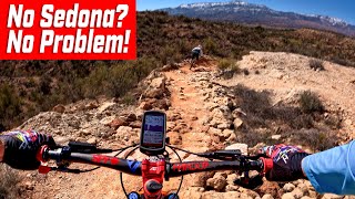
Thumper starts with a gentle downhill and then transitions into some steeper switchbacks with drops up to 2 ft. Sometimes you can ride around them, but sometimes not. Over a ridge and a steep climb to some slightly more technical features and drops. A steep climb leads to an optional 2-4 ft drop area and then some GREAT flowing berms. One more section with your choice of a rolling drop off / waterfall type area or a bypass with some more rocky steps down. Finishes up with a gentle ride through a grassy field to meet up with Lime Kiln. I'd say this trail could be Black Diamond and is the same difficulty as the end of Lime Kiln.

Tags

Trail Supporters

Local Trail Association

Traditionally Indigenous Territory

Recent Activity on Trail

Past Week
  • 3 rides
  • 16 miles average
6 Months
  • 41 rides
  • 15 miles avg distance
All
  • 895 rides
  • Last: Nov 13, 2026
c1c2c3c4
January
February
March
April
May
June
July
August
September
October
November
December
update trails status or condition

Thumper (131) Trail Reports

Status:
on Nov 11, 2026
Ideal
Avg: 3.9 (15 votes)
Your vote: 0

view (3,531)
close
      Directions to thumper-131 trailhead (34.786770, -111.999610)

      Photos

      9 more »
      mtb
      95 |
      Nov 12, 2025 @ 3:07pm
      Nov 12, 2025
      mtb
      128 |
      Dec 16, 2024 @ 2:29pm
      Dec 16, 2024
      mtb
      125 |
      Dec 16, 2024 @ 2:28pm
      Dec 16, 2024
      mtb
      215 |
      Feb 5, 2022 @ 6:02pm
      Feb 5, 2022

      Videos

      5 more »
      youtuber Everywhere You Go: Chunk And Flow
      mtb
      10:39 | 493 | Mar 27, 2024 , Cottonwood
      youtuber I Am So Excited To Ride With This Amazing Guy!
      mtb
      8:30 | 359 | Mar 27, 2024 , Cottonwood
      youtuber I Had A Blast At Dead Horse State Park, Az!
      mtb
      11:26 | 367 | Mar 27, 2024 , Cottonwood
      youtuber Single Tracks: Dead Horse Ranch, Cottonwood,...
      mtb
      16:00 | 314 | Nov 10, 2023 , Cottonwood

      Routes with this trail

      more »
      ★ 3.5 • 17 miles • 1,429 ft • 8 • Loop •
      Arguably the optimum way to ride this system to maximize fun on singletrack. Bones is a nice climb, while...
      ★ 5.0 • 18 miles • 1,425 ft • 4 •
      Verde Valley Rally loop for the 2023 courses.
      ★ 5.0 • 9 miles • 811 ft • 4 • Loop •
      VVCC Fall Picnic and Mountain Bike Poker Run.
      3.9 ★★★★★
      15 Ratings
      5 ★ 7%
      4 ★ 73%
      3 ★ 20%
      2 ★
      1 ★

      6 Reviews & Comments

      bluedog15 bluedog15
      This trail is a must!
      So much fun and nothing really difficult- all tricky sections have a ride around and there is a lung busting uphill grunt towards the end.
      When linked with Bones climb makes for a great and challenging ride
      Ampfrog Ampfrog
      Rode southbound, loved it! It keeps you guessing as to what's next... here's a chute with big rock steps, and now some smooth bermed flow, and then throw in more rock fun and more berms. Plus a couple climbs to keep you honest.
      damoonsta damoonsta
      Awesome job to those who have worked on this trail! I was pleasantly surprised to find that this trail was SO MUCH FUN!

      We hope you've been enjoying Trailforks!

      Create a FREE account to view all trail reviews and much more.

      • By toddTF Pro Trailforks & contributors
      • #14762 - 3,749 views

      Frequently Asked Questions

      ▼ Where is Thumper (131) located?
      Thumper (131) is located in Dead Horse Ranch State Park, Cottonwood, Arizona, United States. It is part of the Dead Horse Ranch State Park trail network. The trailhead is located at coordinates 34.78677, -111.99961.
      ▼ How hard is Thumper (131)?
      Thumper (131) is rated as Blue difficulty. The physical rating is Hard. The average grade is 2.1%. The climb difficulty is rated Blue.
      ▼ What is the elevation gain for Thumper (131)?
      Thumper (131) has 121 ft of elevation gain. The trail has 374 ft of elevation descent. The elevation ranges from 3,547 ft to 3,879 ft.
      ▼ Is Thumper (131) a point to point trail?
      Thumper (131) is not a point to point trail. The direction is Downhill Primary. The trail type is singletrack.
      ▼ How long is Thumper (131)?
      Thumper (131) is 2.2 miles long. The trail type is singletrack.
      ▼ Are dogs allowed on Thumper (131)?
      Yes, dogs are allowed on Thumper (131). Please keep dogs on a leash where required and clean up after them.
      ▼ When is the best time of year to ride Thumper (131)?
      Based on activity log data, the most popular months to ride Thumper (131) are:
      • March (95 activities)
      • April (71 activities)
      • November (60 activities)
      Check the reports page for current trail conditions.
      ▼ How do I access Thumper (131)? Where is the closest parking trailhead?
      The closest parking and trailhead locations to Thumper (131) are: View all parking locations in the area.
      ▼ How long does it take to ride Thumper (131)?
      Based on recorded activities, it takes an average of 19 minutes to ride Thumper (131). The trail is 2.2 miles long. Actual times will vary based on fitness level, conditions, and pace. View recent activity logs for more details.
      ▼ How busy is Thumper (131)?
      Thumper (131) is a very popular trail. There have been 3,569 recorded activities on this trail. The trail has received 3,531 check-ins. View recent activity on this trail.

      Hit the Trail

      Open in App

      Get this trail on your phone instantly.

      open trail in app

      Download Trail

      Save to wishlist, Garmin & download.
      save the trail

      Find Related Routes

      Find routes and users activities that include this trail.
      find routes for this trail

      You must enter a description before submitting.