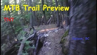
more stats
1,644 ft
Distance
-281 ft
Descent
00:05:01
Avg time
-281 ft
Altitude change
3,292 ft
Altitude min
3,573 ft
Altitude max
3,573 ft
Altitude start
3,291 ft
Altitude end
-17.1%
Grade
-39.1%
Grade max
-4.4%
Grade min
1,644 ft
Distance down
00:05:01
Avg time

TNT Details

  • Activities
    • Mountain Bike
    • E-Bike
  • Riding Area
    Mountain Station
    Nelson, British Columbia
  • Difficulty Rating
  • Local Popularity
    20 in Mountain Biking [+]
    • 5 in E-Biking
  • Global Ranking
    #124129 in Mountain Biking [+]
    • #138769 in E-Biking
  • Provincial Ranking
    #6,434 in Mountain Biking · British Columbia [+]
    • #6,778 in E-Biking
  • Trail Type
    Singletrack
  • Bike Type
    DH, AM
  • Direction
    Downhill Primary
    Popular Direction Shown
  • Dogs Allowed
    Yes
  • eBike Allowed
    Yes up to Class 1

A different option for a fun, upper starter trail that has grown some in
recent years, crossing and ending down near bottom of Shasta.

Tags

Trail Supporters

Local Trail Association

Recent Activity on Trail

Past Week
  • 1 rides
  • 2 miles average
6 Months
  • 1 rides
  • 2 miles avg distance
All
  • 201 rides
  • Last: Oct 22, 2026
update trails status or condition

TNT Trail Reports

statusdatedescription
Nov 27, 2025 @ 8:33pm (America/Vancouver)
Nov 27, 2025
reporter TNT remains closed post logging. Trail crew are reviewing options for rehab. All other trails have re opened.
Sep 30, 2025 @ 9:46am (America/Vancouver)
Sep 30, 2025
reporter TNT, 5 Knuckle, Espresso, Leather, Shasta and Shasta Access remain CLOSED Lat all times. Logging continues 7am-4pm daily. Road closures change...
Sep 22, 2025 @ 7:59pm (America/Vancouver)
Sep 22, 2025
reporter Harvesting is expected to begin at Mountain Station Tuesday 23rd Sept Expresso, Shasta, TNT, Leather and 5 Knuckle are CLOSED until further...
Sep 22, 2025 @ 6:48pm (America/Vancouver)
Sep 22, 2025
reporter
Sep 22, 2025 @ 8:16am (America/Vancouver)
Sep 22, 2025
reporter Anderson Creek FSR is CLOSED today, Monday 22nd of September 7-3pm. Access via Racoon, Badger and Honey is allowed. NO ACCESS BEYOND THE...
more »
Status:
on Nov 27, 2025
Variable
Avg: 4.24 (2 votes)
Your vote: 0

view (1,437)
close
      Directions to tnt-21339 trailhead (49.492000, -117.255900)

      Photos

      25 more »
      mtb
      TNT
      333 |
      Oct 30, 2016 @ 4:04pm
      Oct 30, 2016
      mtb
      TNT
      52 |
      Apr 12, 2026 @ 6:35pm
      Apr 12, 2026
      mtb
      TNT
      92 |
      Sep 11, 2019 @ 5:49pm
      Sep 11, 2019
      mtb
      TNT
      334 |
      Sep 9, 2018 @ 7:55pm
      Sep 9, 2018

      Videos

      3 more »
      youtuber TNT to Shasta - Nelson, BC
      mtb
      3:37 | 219 | Apr 26, 2024 , Nelson
      TNT, Nelson B.C. Mountain Bike Trail -...
      mtb
      2:09 | 545 | Aug 30, 2019 , Nelson
      Autumn Leaves
      mtb
      3:02 | 324 | Oct 17, 2016 , Nelson

      Trail Products

      5.0 ★★★★★
      2 Ratings
      5 ★ 100%
      4 ★
      3 ★
      2 ★
      1 ★

      1 Review & Comments

      BCtrailrider BCtrailrider
      How is this a blue. Even being a nelson local this is hard

      We hope you've been enjoying Trailforks!

      Create a FREE account to view all trail reviews and much more.

      • By zshipowickTF Pro & contributors
      • #21339 - 2,857 views

      Frequently Asked Questions

      ▼ Where is TNT located?
      TNT is located in Mountain Station, Nelson, British Columbia, Canada. It is part of the Mountain Station trail network. The trailhead is located at coordinates 49.492, -117.2559.
      ▼ How hard is TNT?
      TNT is rated as Black Diamond difficulty. The average grade is 17.1%.
      ▼ What is the elevation gain for TNT?
      The trail has 281 ft of elevation descent. The elevation ranges from 3,292 ft to 3,573 ft.
      ▼ Is TNT a point to point trail?
      TNT is not a point to point trail. The direction is Downhill Primary. The trail type is singletrack.
      ▼ How long is TNT?
      TNT is 1,644 ft long. The trail type is singletrack.
      ▼ Are dogs allowed on TNT?
      Yes, dogs are allowed on TNT. Please keep dogs on a leash where required and clean up after them.
      ▼ How do I access TNT? Where is the closest parking trailhead?
      The closest parking and trailhead locations to TNT are: View all parking locations in the area.
      ▼ How long does it take to ride TNT?
      Based on recorded activities, it takes an average of 5 minutes to ride TNT. The trail is 1,644 ft long. Actual times will vary based on fitness level, conditions, and pace. View recent activity logs for more details.
      ▼ How busy is TNT?
      TNT is a less popular trail with lighter traffic. There have been 1,470 recorded activities on this trail. The trail has received 1,437 check-ins. View recent activity on this trail.

      Hit the Trail

      Open in App

      Get this trail on your phone instantly.

      open trail in app

      Download Trail

      Save to wishlist, Garmin & download.
      save the trail

      Find Related Routes

      Find routes and users activities that include this trail.
      find routes for this trail

      You must enter a description before submitting.