
more stats
2.6 miles
Distance
349 ft
Climb
-2,143 ft
Descent
00:49:55
Avg time
-1,794 ft
Altitude change
2,585 ft
Altitude min
4,681 ft
Altitude max
4,379 ft
Altitude start
2,585 ft
Altitude end
-13%
Grade
-99.4%
Grade max
30.3%
Grade min
4,026 ft
Distance climb
2 miles
Distance down
492 ft
Distance flat
00:49:55
Avg time

The Vein Details

  • Activities
    • Mountain Bike
    • E-Bike
  • Riding Area
    Mountain Station
    Nelson, British Columbia
  • Difficulty Rating
  • Local Popularity
    60 in Mountain Biking [+]
    • 80 in E-Biking
  • Global Ranking
    #64386 in Mountain Biking [+]
    • #20221 in E-Biking
  • Provincial Ranking
    #3,146 in Mountain Biking · British Columbia [+]
    • #1,320 in E-Biking
  • Trail Type
    Singletrack
  • Bike Type
    DH, AM
  • Direction
    Downhill Only
    Popular Direction Shown
  • Dogs Allowed
    Yes
  • eBike Allowed
    Yes up to Class 1

The Mountain Station epic. Starts with a cool lookout point. The trail has several short, punchy climbs before some of the best rock and steep-infested downhills around.

Access Info

Starts past Space Junk and traverses over the mountain. Trail can also be accessed via the North Selous FSR.

Tags
Rock gardens
Trail Supporters
Local Trail Association

Recent Activity on Trail

Past Week
  • 0 rides
  •  
6 Months
  • 11 rides
  • 8 miles avg distance
All
  • 55 rides
  • Last: Sep 19, 2026
c1c2c3c4
January
February
March
April
May
June
July
August
September
October
November
December
update trails status or condition

The Vein Trail Reports

statusdatedescription
Sep 17, 2026 @ 8:36am (America/Vancouver)
Sep 17, 2026
One tree cleared. Otherwise good.
Jul 12, 2026 @ 7:13pm (America/Vancouver)
Jul 12, 2026
Very dry at the bottom! Slippery
Jun 1, 2026 @ 8:19am (America/Vancouver)
Jun 1, 2026
Removed 3 trees, all clear
May 8, 2026 @ 1:39pm (America/Vancouver)
May 8, 2026
reporter
Trail is open and cleared of wind fall. Dry conditions on the decent with the lack of recent rain but running good.
May 6, 2026 @ 9:31pm (America/Vancouver)
May 6, 2026
reporter The Vein is open. Grizzly bears are in the area! Ride at your own risk. Consider riding elsewhere - the Vein is a likely bear encounter area. Make...
more »
Status:
on Sep 17, 2026
Ideal
Avg: 4.35 (10 votes)
Your vote: 0

view (333)
close
      Directions to vein trailhead (49.485880, -117.259070)

      Photos

      66 more »
      mtb
      368 |
      Jun 11, 2020 @ 9:51am
      Jun 11, 2020
      mtb
      434 |
      Jun 11, 2020 @ 9:51am
      Jun 11, 2020
      mtb
      323 |
      Oct 13, 2018 @ 10:50am
      Oct 13, 2018
      mtb
      658 |
      Oct 7, 2018 @ 4:57pm
      Oct 7, 2018

      Videos

      4 more »
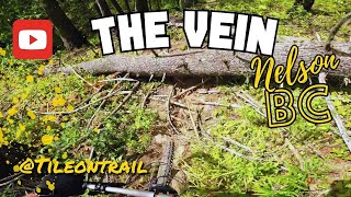
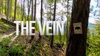
      Th Vein - Nelson, BC - MTB Trail Preview
      mtb
      4:37 | 245 | May 20, 2025 , Nelson
      Crashed on this all-mountain trail deep in...
      mtb
      7:51 | 393 | Aug 11, 2024 , Nelson
      YouTube
      mtb
      867 | Jul 21, 2020 , Nelson
      My Crash
      mtb
      0:54 | 1126 | Sep 24, 2014 , Nelson

      Routes with this trail

      ★ 5.0 • 101 miles • 23,336 ft • 18 •
      A monstrous day in the saddle. Huge kilometers and punishing elevation gain.
      7 miles • 2,376 ft • 3 •
      A simple lap of .
      57 miles • 15,424 ft • 27 • Out & Back •
      If the triple crown is so fun, why not do it twice?

      Trail Products

      4.6 ★★★★★
      10 Ratings
      5 ★ 70%
      4 ★ 20%
      3 ★ 10%
      2 ★
      1 ★

      9 Reviews & Comments

      EvanzswEuF
      This trail is a fun adventure type ride but is probably past its prime. It is getting pretty overgrown which makes it very hard to let off the brakes. It is a super fun and beautiful adventure ride, but realistically it is probably the worst trail at mountain station if you want steep, fast and rowdy riding rather than a longer adventure
      WillieB WillieB
      Less rocks more steeps. Echoing the comment about brake grippage
      Curtyboy1234
      Approx 4 or 5 trees down total. Still 100% worth riding. Plenty of loam and some of the funnest grippy steeps I've had. Steep, fast, and loose. Very unique trail.

      We hope you've been enjoying Trailforks!

      Create a FREE account to view all trail reviews and much more.

      • By BCpovTF Pro & contributors
      • #2312 - 9,952 views

      Frequently Asked Questions

      ▼ Where is The Vein located?
      The Vein is located in Mountain Station, Nelson, British Columbia, Canada. It is part of the Mountain Station trail network. The trailhead is located at coordinates 49.48588, -117.25907.
      ▼ How hard is The Vein?
      The Vein is rated as Double Black Diamond difficulty. The average grade is 13%.
      ▼ What is the elevation gain for The Vein?
      The Vein has 349 ft of elevation gain. The trail has 2,143 ft of elevation descent. The elevation ranges from 2,585 ft to 4,681 ft.
      ▼ Is The Vein a point to point trail?
      Yes, The Vein is a point to point trail. The direction is Downhill Only. The trail type is singletrack.
      ▼ How long is The Vein?
      The Vein is 2.6 miles long. The trail type is singletrack.
      ▼ Are dogs allowed on The Vein?
      Yes, dogs are allowed on The Vein. Please keep dogs on a leash where required and clean up after them.
      ▼ How do I access The Vein? Where is the closest parking trailhead?
      The closest parking and trailhead locations to The Vein are: View all parking locations in the area.
      ▼ How long does it take to ride The Vein?
      Based on recorded activities, it takes an average of 47 minutes to ride The Vein. The trail is 2.6 miles long. Actual times will vary based on fitness level, conditions, and pace. View recent activity logs for more details.
      ▼ How busy is The Vein?
      The Vein is a moderately popular trail. There have been 345 recorded activities on this trail. The trail has received 333 check-ins. View recent activity on this trail.

      Hit the Trail

      Open in App

      Get this trail on your phone instantly.

      open trail in app

      Download Trail

      Save to wishlist, Garmin & download.
      save the trail

      Find Related Routes

      Find routes and users activities that include this trail.
      find routes for this trail

      You must enter a description before submitting.