



more stats
2,543 ft
Distance
7 ft
Climb
-284 ft
Descent
00:02:14
Avg time
-278 ft
Altitude change
572 ft
Altitude min
852 ft
Altitude max
850 ft
Altitude start
571 ft
Altitude end
-10.9%
Grade
-33.7%
Grade max
22.5%
Grade min
217 ft
Distance climb
2,077 ft
Distance down
249 ft
Distance flat
00:02:14
Avg time

Wētā Details

  • Activities
    • Mountain Bike
    • E-Bike
    • Hike
    • Trail Running
  • Riding Area
  • Ref Number
    #401
  • AKA
    Big Wētā
  • Difficulty Rating
  • Voted Difficulty
    Black Diamond (3 votes)
  • Local Popularity
    85 in Mountain Biking [+]
    • 85 in E-Biking
    • 60 in Trail Running
    • 5 in Hiking
  • Global Ranking
    #48378 in Mountain Biking [+]
    • #17410 in E-Biking
    • #135364 in Trail Running
    • #206088 in Hiking
  • National Ranking
    #1,075 in Mountain Biking · New Zealand [+]
    • #349 in E-Biking
    • #2,197 in Trail Running
    • #2,761 in Hiking
  • Trail Type
    Singletrack
  • Bike Type
    DH, AM, XC, Fat
  • Physical Rating
    Moderate
  • Trail Visibility
    Always easy to follow
  • Dogs Allowed
    Yes
  • eBike Allowed
    Yes up to Class 1
  • TTFs on Trail
    Berm, Bridge, Jump
  • Lighting
    No
  • Land Owner

Runs from a skid site half way up Danzig 4x4 slogger road and follows on nicely from Electric Avenue. A bit harder than Electric Avenue. Can also be reached by climbing 4 Degrees and Connect Four. A bit easier than Borderline but still has a couple of sustained steep sections. You could also reach it by coming down the logging track from the Old Coach Road, but you lose a lot of height and the logging track has lots of unpleasant loose shingle and is not not recommended. Lower part can connect with the jumps alternative to the bottom of Borderline.
Weta replaces the destroyed Big weta that existed before the logging.

Tags
BermsBridgesJumps
Local Trail Association

Recent Activity on Trail

Past Week
  • 4 rides
  • 12 miles average
6 Months
  • 32 rides
  • 11 miles avg distance
All
  • 505 rides
  • Last: Oct 9, 2026
c1c2c3c4
January
February
March
April
May
June
July
August
September
October
November
December
update trails status or condition

Wētā Trail Reports

statusdatedescription
Oct 10, 2026 @ 12:26pm (Pacific/Auckland)
1 day
Jun 12, 2026 @ 12:40pm (Pacific/Auckland)
Jun 11, 2026
Mint condition
Mar 22, 2026 @ 7:27pm (Pacific/Auckland)
Mar 21, 2026
Pretty good shape, slightly loose rocky sections (more than usual) but otherwise pretty much perfect!
Feb 2, 2026 @ 9:35am (Pacific/Auckland)
Feb 1, 2026
Nov 8, 2025 @ 6:40pm (Pacific/Auckland)
Nov 7, 2025
Pretty loose on some corners.
more »
Status:
on Oct 10, 2026
Dry
Avg: 3.95 (15 votes)
Your vote: 0

view (4,848)
close
      Directions to w-t trailhead (-41.176900, 174.895440)

      Photos

      3 more »
      mtb
      133 |
      May 25, 2018 @ 4:51am
      May 25, 2018
      mtb
      321 |
      Oct 4, 2015 @ 12:58am
      Oct 4, 2015
      ebike
      63 |
      Jun 23, 2023 @ 6:12pm
      Jun 23, 2023

      Videos

      12 more »
      youtuber Wētā *REBUILT* @ Belmont Regional Park....
      mtb
      2:29 | 535 | Dec 27, 2022 , Lower Hutt
      youtuber Weta @ Belmont Regional Park
      mtb
      2:13 | 598 | May 1, 2019 , Lower Hutt
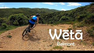
      Wētā - Belmont
      mtb
      0:55 | 76 | Dec 3, 2025 , Lower Hutt
      That kind of MOUNTAIN BIKE TRAIL every...
      mtb
      2:49 | 299 | Jul 23, 2022 , Lower Hutt

      Routes with this trail

      3 miles • 860 ft • 3 • Loop •
      Simple grade 2 - 3 loop around the old Dandig forest block
      3 miles • 823 ft • 15 • Loop •
      4 degrees, Electric Avenue, and Weta loop for 2017 Belmont Park Open Day
      2 miles • 388 ft • 10 • Loop •
      Up 4 Degrees, up Connect Four, down Weta
      4.0 ★★★★★
      15 Ratings
      5 ★ 27%
      4 ★ 53%
      3 ★ 13%
      2 ★ 7%
      1 ★

      3 Reviews & Comments

      donalduck donalduck
      What could have been… The benchmark for a modern flow trail is McNearly Gnarly in Queenstown, and any new/rebuilt flow trail should try to emulate it for sheer fun factor. Unfortunately the new Weta is rather featureless and boring save for about 3 double-able rollers up top, and two good sized tables at the bottom - the rest is just motorway bermsville.
      simon-ob
      Rebuild is very impressive with large berms and features for more advanced riders to try and jump or double. Now a bit easier than Electric Avenue.
      robthetrackie robthetrackie
      The rebuilt trail is wide smooth and great fun. A huge job to build, well done !

      We hope you've been enjoying Trailforks!

      Create a FREE account to view all trail reviews and much more.

      • By angusnzTF Pro BAMBA & contributors
      • #31455 - 8,154 views

      Frequently Asked Questions

      ▼ Where is Wētā located?
      Wētā is located in Belmont Regional Park, Lower Hutt, New Zealand. It is part of the Belmont Regional Park trail network. The trailhead is located at coordinates -41.1769, 174.89544.
      ▼ How hard is Wētā?
      Wētā is rated as Advanced difficulty. The physical rating is Moderate. The average grade is 10.9%.
      ▼ What is the elevation gain for Wētā?
      Wētā has 7 ft of elevation gain. The trail has 284 ft of elevation descent. The elevation ranges from 572 ft to 852 ft.
      ▼ How long is Wētā?
      Wētā is 2,543 ft long. The trail type is singletrack.
      ▼ Are dogs allowed on Wētā?
      Yes, dogs are allowed on Wētā. Please keep dogs on a leash where required and clean up after them.
      ▼ How do I access Wētā? Where is the closest parking trailhead?
      The closest parking and trailhead locations to Wētā are: View all parking locations in the area.
      ▼ How long does it take to ride Wētā?
      Based on recorded activities, it takes an average of 2 minutes to ride Wētā. The trail is 2,543 ft long. Actual times will vary based on fitness level, conditions, and pace. View recent activity logs for more details.
      ▼ How busy is Wētā?
      Wētā is a very popular trail. There have been 4,881 recorded activities on this trail. The trail has received 4,848 check-ins. View recent activity on this trail.

      Hit the Trail

      Open in App

      Get this trail on your phone instantly.

      open trail in app

      Download Trail

      Save to wishlist, Garmin & download.
      save the trail

      Find Related Routes

      Find routes and users activities that include this trail.
      find routes for this trail

      You must enter a description before submitting.


