The journey that you are about to embark upon follows a portion, or perhaps the entire 485 miles of recreational trail that crosses Colorado from Denver to Durango. The Trail passes through six National Forests, six Wilderness areas, traverses five major river systems and penetrates eight of the states mountain ranges. The Colorado Trail is administered and maintained by Colorado Trail Foundation volunteers in collaboration with the U.S. Forest Service. What makes The Colorado Trail unique is that it was developed with the efforts of thousands of volunteers, all interested in the conservation and recreational exploration of Colorado’s stunning mountainous areas.
- Horse
- Hike
- Trail Running
Login to see your progress towards riding all the trails and routes in this list.
Trails
| title | riding area | rating | distance | completed | |||
|---|---|---|---|---|---|---|---|
| 1 | CDT - Bowen Gulch Connector CO37 - Bowen Gulch to Willow Creek Pass | 4,505 ft | |||||
| 2 | CDT CT - Archuleta Segment 18 - Colorado Hwy-114 to Saguache Park Rd | 2 miles | |||||
| 3 | CDT CT - Breckenridge Segment 6 - Kenosha Pass to Gold Hill TH | 3 miles | |||||
| 4 | CDT CT - Canby Mountain Segment 23 - Carson Saddle to Stony Pass TH | 1 mile | |||||
| 5 | CDT CT - Carson Saddle Spring Creek Pass TH to Carson Saddle | 3,524 ft | |||||
| 6 | CDT CT - Copper Mountain Segment 8 - Copper Mountain to Tennessee Pass TH | 2 miles | |||||
| 7 | CDT CT - East Fork Middle Pole Segment 23 - Carson Saddle to Stony Pass TH | 8 miles | |||||
| 8 | CDT CT - Georgia Pass to North Fork Segment 6 - Kenosha Pass to Gold Hill TH | 7 miles | |||||
| 9 | CDT CT - Gold Hill Segment 7 - Goldhill TH to Copper Mountain | 4 miles | |||||
| 10 | CDT CT - Holy Cross Wilderness Segment 9 - Tennessee Pass TH to Timberline Lake TH | 6 miles | |||||
| 11 | CDT CT - Horseshoe Gulch Segment 6 - Kenosha Pass to Gold Hill TH | 3 miles | |||||
| 12 | CDT CT - Jarosa Mesa Spring Creek Pass TH to Carson Saddle | 16 miles | |||||
| 13 | CDT CT - La Garita Stock Driveway Segment 23 - Carson Saddle to Stony Pass TH | 4 miles | |||||
| 14 | CDT CT - Longs Gulch Segment 9 - Tennessee Pass TH to Timberline Lake TH | 4 miles | |||||
| 15 | CDT CT - Los Creek Segment 18 - Colorado Hwy-114 to Saguache Park Rd | 3,406 ft | |||||
| 16 | CDT CT - Lujan (Summit Trail) Segment 17 - Sargents Mesa to Colorado Hwy-114 | 2 miles | |||||
| 17 | CDT CT - Maggie Gulch Segment 23 - Carson Saddle to Stony Pass TH | 1 mile | |||||
| 18 | CDT CT - Miners Creek Segment 7 - Goldhill TH to Copper Mountain | 7 miles | |||||
| 19 | CDT CT - Mitchell Creek Segment 8 - Copper Mountain to Tennessee Pass TH | 4 miles | |||||
| 20 | CDT CT - Monarch Crest Trail Segment 15 - US-50 to Marshall Pass TH | 10 miles | |||||
| 21 | CDT CT - Mount Massive Wilderness Segment 10 - Timberline Lake TH to Mount Massive TH | 13 miles | |||||
| 22 | CDT CT - Muggins Gulch Segment 6 - Kenosha Pass to Gold Hill TH | 6 miles | |||||
| 23 | CDT CT - North Clear Creek Segment 23 - Carson Saddle to Stony Pass TH | 2,710 ft | |||||
| 24 | CDT CT - Pine Creek Segment 18 - Colorado Hwy-114 to Saguache Park Rd | 7 miles | |||||
| 25 | CDT CT - Quemedo Spur Segment 19 - Saguache Park to Eddiesville TH | 4 miles | |||||
| 26 | CDT CT - Saguache Park Segment 18 - Colorado Hwy-114 to Saguache Park Rd | 2 miles | |||||
| 27 | CDT CT - Saguache Park Br 1 Segment 18 - Colorado Hwy-114 to Saguache Park Rd | 2 miles | |||||
| 28 | CDT CT - Sargents Mesa Segment 17 - Sargents Mesa to Colorado Hwy-114 | 18 miles | |||||
| 29 | CDT CT - Searle Pass Segment 8 - Copper Mountain to Tennessee Pass TH | 15 miles | |||||
| 30 | CDT CT - Skyline Segment 19 - Saguache Park to Eddiesville TH | 7 miles | |||||
| 31 | CDT CT - Skyline (Cochetopa Creek) | 12 miles | |||||
| 32 | CDT CT - Skyline (LGW) Segment 21 - San Luis Pass to Spring Creek Pass TH | 8 miles | |||||
| 33 | CDT CT - Snow Mesa Segment 21 - San Luis Pass to Spring Creek Pass TH | 6 miles | |||||
| 34 | CDT CT - Stoney Pass Segment 24 - Stony Pass TH to Molas Pass | 6 miles | |||||
| 35 | CDT CT - Tennessee Pass Segment 9 - Tennessee Pass TH to Timberline Lake TH | 3 miles | |||||
| 36 | CDT CT - Twin Lakes Dam Segment 11 - Mount Massive TH to Clear Creek Road | 3,894 ft | |||||
| 37 | CDT CT - Twin Lakes North Segment 11 - Mount Massive TH to Clear Creek Road | 11 miles | |||||
| 38 | CDT CT - Twin Lakes South Segment 11 - Mount Massive TH to Clear Creek Road | 1 mile | |||||
| 39 | CDT CT - Van Tassel Br Segment 19 - Saguache Park to Eddiesville TH | 3 miles | |||||
| 40 | CDT CT - Wheeler NRT Segment 7 - Gold Hill TH to Copper Mountain | 2 miles | |||||
| 41 | CDT CT - Windy Peak Segment 16 - Marshall Pass TH to Sargents Mesa | 11 miles | |||||
| 42 | CT - Black Canyon Segment 5 - Long Gulch to Kenosha Pass | 8 miles | |||||
| 43 | CT - Blackhawk Segment 26 - Bolam Pass Rd to Hotel Draw Rd | 2 miles | |||||
| 44 | CT - Blackhawk Connector | 1 mile | |||||
| 45 | CT - Blackhawk Pass Segment 26 - Bolam Pass Rd to Hotel Draw Rd | 9 miles | |||||
| 46 | CT - Buffalo Creek Segment 3 - Little Scraggy Trailhead to FS-560 (Wellington Lake Road) TH | 12 miles | |||||
| 47 | CT - Camp Hale Segment 8 - Copper Mountain to Tennessee Pass TH | 3,386 ft | |||||
| 48 | CT - Champion Venture Segment 28 - Kennebec TH to Junction Creek TH | 9 miles | |||||
| 49 | CT - Clear Creek Segment 11 - Mount Massive TH to Clear Creek Road | 2 miles | |||||
| 50 | CT - Clear Creek South | 18 miles | |||||
| 51 | CT - Collegiate Peaks Wilderness | 6 miles | |||||
| 52 | CT - Elk Creek Segment 24 - Stony Pass TH to Molas Pass | 9 miles | |||||
| 53 | CT - Fooses Creek Segment 15 - US-50 to Marshall Pass TH | 3 miles | |||||
| 54 | CT - Georgia Pass Segment 6 - Kenosha Pass to Gold Hill TH | 6 miles | |||||
| 55 | CT - High Point Segment 28 - Kennebec TH to Junction Creek TH | 3 miles | |||||
| 56 | CT - Highline (Big Bend Middle) Segment 27 - Hotel Draw Rd to Kennebec TH | 3,297 ft | |||||
| 57 | CT - Highline (North) Segment 27 - Hotel Draw Rd to Kennebec TH | 2 miles | |||||
| 58 | CT - Highline (Orphan Butte) Segment 27 - Hotel Draw Rd to Kennebec TH | 15 miles | |||||
| 59 | CT - Highline (Ryman Creek) Segment 27 - Hotel Draw Rd to Kennebec TH | 4,534 ft | |||||
| 60 | CT - Junction Creek Segment 28 - Kennebec TH to Junction Creek TH | 7 miles | |||||
| 61 | CT - Kenosha Pass East Segment 5 - Long Gulch to Kenosha Pass | 6 miles | |||||
| 62 | CT - Kenosha Pass West Segment 6 - Kenosha Pass to Goldhill TH | 6 miles | |||||
| 63 | CT - Lost Creek Wilderness Segment 4 - FS-560 (Wellington Lake Road) TH to Long Gulch | 16 miles | |||||
| 64 | CT - Marshall Pass Segment 16 - Marshall Pass TH to Sargents Mesa | 3 miles | |||||
| 65 | CT - Molas Creek Segment 24 - Stony Pass TH to Molas Pass | 6 miles | |||||
| 66 | CT - Mount Princeton Segment 13 - Silver Creek TH to Chalk Creek TH | 10 miles | |||||
| 67 | CT - Platte Canyon Segment 1 - Waterton Canyon Trailhead to South Platte River Trailhead | 9 miles | |||||
| 68 | CT - Powerline Segment 11 - Mount Massive TH to Clear Creek Road | 1 mile | |||||
| 69 | CT - Powerline Road Segment 11 - Mount Massive TH to Clear Creek Road | 1,837 ft | |||||
| 70 | CT - Raleigh Peak Segment 2 - South Platte River Trailhead to Little Scraggy Trailhead | 10 miles | |||||
| 71 | CT - Rolling Pass Segment 25 - Molas Pass to Bolam Pass Rd | 9 miles | |||||
| 72 | CT - Sliderock Segment 28 - Kennebec TH to Junction Creek TH | 2 miles | |||||
| 73 | CT - South Twin Lakes Segment 11 - Mount Massive TH to Clear Creek Road | 4 miles | |||||
| 74 | CT - Tabeguache Peak Segment 14 - Chalk Creek TH to US-50 | 20 miles | |||||
| 75 | CT - Twin Sisters Segment 25 - Molas Pass to Bolam Pass Rd | 10 miles | |||||
| 76 | CT - Waterton Canyon Segment 1 - Waterton Canyon Trailhead to South Platte River Trailhead | 7 miles | |||||
| 77 | CT Connector Segment 6 - Kenosha Pass to Gold Hill TH | 1,673 ft | |||||
| 78 | Forest Road | 1 mile | |||||
| 79 | Rolling Creek Trailhead | 1,375 ft | |||||
| 80 | South Fooses Creek Segment 15 - US-50 to Marshall Pass TH | 7 miles | |||||
| 81 | Tennesee Pass Road Segment 8 - Copper Mountain to Tennessee Pass TH | 2 miles |
Displaying 81
Videos
9:08 |
82 |
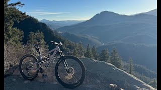
Nov 24, 2025 , Roxborough
youtuber
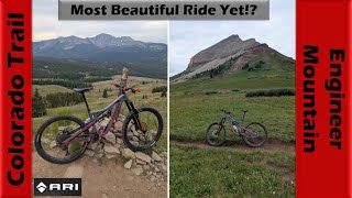
![The Most Beautiful Ride I've Done!? Colorado...]()
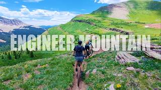
57:18 |
112 |
Jul 26, 2025 , Durango
37:31 |
91 |
Jul 18, 2025 , Durango
Recent Trail Reports
| status | trail | date | condition | |
|---|---|---|---|---|
| CT - Rolling Pass | Jun 19, 2026 @ 7:16pm (America/Denver) 1 day | view | ||
| CT - Twin Sisters | Jun 18, 2026 @ 10:08pm (America/Denver) 2 days | view | ||
| CT - Blackhawk Pass | Jun 17, 2026 @ 11:31pm (America/Denver) Jun 17, 2026 | view | ||
| CT - Blackhawk Connector | Jun 17, 2026 @ 11:24pm (America/Denver) Jun 17, 2026 | view | ||
| CT - Blackhawk | Jun 17, 2026 @ 11:23pm (America/Denver) Jun 17, 2026 | view |
Total Trails
81
Total Distance
472 miles
Total Descent
-81,586 ft
Total Climb
79,172 ft
close
-
Layers w
- Weather Layers
- Pro
- Pro
- Pro
- Pro
- Pro
- Pro
- More Layers
- Pro
- Pro
- Pro
- Pro
-
Upgrade to

3D
Trail Conditions
- Unknown
- Snow Groomed
- Snow Packed
- Snow Covered
- Snow Cover Partial
- Freeze/thaw Cycle
- Icy
- Prevalent Mud
- Wet
- Variable
- Ideal
- Dry
- Very Dry
Trail Flow (Ridden Direction)
Trailforks scans users ridelogs to determine the most popular direction each trail is ridden. A good flowing trail network will have most trails flowing in a single direction according to their intension.
The colour categories are based on what percentage of riders are riding a trail in its intended direction.
The colour categories are based on what percentage of riders are riding a trail in its intended direction.
- > 96%
- > 90%
- > 80%
- > 70%
- > 50%
- < 50%
- bi-directional trail
- no data
Trail Last Ridden
Trailforks scans ridelogs to determine the last time a trail was ridden.
- < 2 days
- < 1 week
- < 2 weeks
- < 1 month
- < 6 months
- > 6 months
Trail Ridden Direction
The intended direction a trail should be ridden.
- Downhill Only
- Downhill Primary
- Both Directions
- Uphill Primary
- Uphill Only
- One Direction
Contribute Details
Colors indicate trail is missing specified detail.
- Description
- Photos
- Description & Photos
- Videos
Trail Popularity ?
Trailforks scans ridelogs to determine which trails are ridden the most in the last 9 months.
Trails are compared with nearby trails in the same city region with a possible 25 colour shades.
Think of this as a heatmap, more rides = more kinetic energy = warmer colors.
- most popular
- popular
- less popular
- not popular
ATV/ORV/OHV Filter
Max Vehicle Width
inches
US Cell Coverage
Legend

Radar Time
Activity Recordings
Trailforks uses anonymized public activity data.
?
Activity Recordings
Trailforks uses anonymized public activity data.
?
Personal Heatmap
▶
Activity Types
all
/
none
▶
Options
2
Date range
month
–
Winter Trails
Warning
A routing network for winter maps does not exist. Selecting trails using the winter trails layer has been disabled.
Missing Trails
Most Popular
Least Popular
Trails are colored based on popularity. The more popular a trail is, the more red. Less popular trails trend towards green.
Jump Magnitude Heatmap
Heatmap of where riders jump on trails. Zoom in to see individual jumps, click circles to view jump details.
BC Backroad Status
![map legend]()
Service Road Atlas is a free to use, community-driven service for viewing and creating reports on the numerous back-country service roads around B.C. and Alberta.

Slope Aspect
Direction the slope faces
Trails Deemphasized
Trails are shown in grey.
Only show trails with no bike usage.
Suggested Layers
Based on selected activity type
Save the current map location and zoom level as your default home location whenever this page is loaded.
Save
Trail transparency
Featured
This official route list of trails is not complete
Average difficulty
Associated Route
Mountain Bike is not supported on all trail sections, see trails for more details.
Trails and Routes in List - Distance by Difficulty
Trails and Routes in List - Difficulty Totals
- By markholloway
 Trailforks Map Team
 - #645 - 5,932 views