close
-
Layers w
- Weather Layers
- Pro
- Pro
- Pro
- Pro
- Pro
- Pro
- More Layers
- Pro
- Pro
- Pro
- Pro
-
Upgrade to

3D
Trail Conditions
- Unknown
- Snow Groomed
- Snow Packed
- Snow Covered
- Snow Cover Partial
- Freeze/thaw Cycle
- Icy
- Prevalent Mud
- Wet
- Variable
- Ideal
- Dry
- Very Dry
Trail Flow (Ridden Direction)
Trailforks scans users ridelogs to determine the most popular direction each trail is ridden. A good flowing trail network will have most trails flowing in a single direction according to their intension.
The colour categories are based on what percentage of riders are riding a trail in its intended direction.
The colour categories are based on what percentage of riders are riding a trail in its intended direction.
- > 96%
- > 90%
- > 80%
- > 70%
- > 50%
- < 50%
- bi-directional trail
- no data
Trail Last Ridden
Trailforks scans ridelogs to determine the last time a trail was ridden.
- < 2 days
- < 1 week
- < 2 weeks
- < 1 month
- < 6 months
- > 6 months
Trail Ridden Direction
The intended direction a trail should be ridden.
- Downhill Only
- Downhill Primary
- Both Directions
- Uphill Primary
- Uphill Only
- One Direction
Contribute Details
Colors indicate trail is missing specified detail.
- Description
- Photos
- Description & Photos
- Videos
Trail Popularity ?
Trailforks scans ridelogs to determine which trails are ridden the most in the last 9 months.
Trails are compared with nearby trails in the same city region with a possible 25 colour shades.
Think of this as a heatmap, more rides = more kinetic energy = warmer colors.
- most popular
- popular
- less popular
- not popular
ATV/ORV/OHV Filter
Max Vehicle Width
inches
US Cell Coverage
Legend

Radar Time
Activity Recordings
Trailforks uses anonymized public activity data.
?
Activity Recordings
Trailforks uses anonymized public activity data.
?
Personal Heatmap
▶
Activity Types
all
/
none
▶
Options
2
Date range
month
–
Winter Trails
Warning
A routing network for winter maps does not exist. Selecting trails using the winter trails layer has been disabled.
Missing Trails
Most Popular
Least Popular
Trails are colored based on popularity. The more popular a trail is, the more red. Less popular trails trend towards green.
Jump Magnitude Heatmap
Heatmap of where riders jump on trails. Zoom in to see individual jumps, click circles to view jump details.
BC Backroad Status
![map legend]()
Service Road Atlas is a free to use, community-driven service for viewing and creating reports on the numerous back-country service roads around B.C. and Alberta.

Slope Aspect
Direction the slope faces
Trails Deemphasized
Trails are shown in grey.
Only show trails with no bike usage.
Suggested Layers
Based on selected activity type
Save the current map location and zoom level as your default home location whenever this page is loaded.
Save
No description for Bountiful has been added yet!
Login or register to submit one.
Activities Click to view
- Mountain Bike
108 trails
- E-Bike
38 trails
- Gravel Bike
2 trails
- Adaptive Bike
0 trails
- Winter Fat Bike
0 trails
- Horse
8 trails
- Hike
118 trails
- Trail Running
119 trails
- Dirtbike/Moto
11 trails
- ATV/ORV/OHV
9 trails
- Snowshoe
8 trails
Region Details
- 14
- 2
- 11
- 50
- 12
- 4
Region Status
Open as of Jun 14, 2026Stats
- Avg Trail Rating
- Trails (view details)
- 106
- Trails Mountain Bike
- 109
- Trails E-Bike
- 38
- Trails Gravel Bike
- 2
- Trails Horse
- 8
- Trails Hike
- 119
- Trails Trail Running
- 119
- Trails Dirtbike/Moto
- 11
- Trails ATV/ORV/OHV
- 9
- Trails Snowshoe
- 8
- Total Distance
- 154 miles
- Total Descent
- 34,568 ft
- Total Vertical
- 5,126 ft
- Highest Trailhead
- 9,342 ft
- Reports
- 1,465
- Photos
- 417
- Ridden Counter
- 19,497
Sub Regions
-
Bountiful Peak
- 4
- 22
- 6
- 3
-
Mueller Park
- 5
Popular Bountiful Mountain Biking Trails
• 100 ★ 4.7 • 3 miles • 1,036 ft • 2,561 •
Mueller is probably Bountiful's most popular hiking/biking/trail running/equestrian trail. During the summer this trail sees a lot of traffic. If you're into early morning or nighttime rides there's a good chance you won't see many...
• 100 ★ 4.7 • 2,641 ft • 199 ft • 1,416 •
The Hornet trail is a wide bench-cut trail with banked turns, the trail is a gentle steady pitch. Smooth with no significant challenges.
• 100 ★ 4.0 • 1,936 ft • 15 ft • 1,156 •
is a wide bench cut trail that traverses the north side of canyon terminating at the bridge over (for now, Summer 2024).
• 100 ★ 4.6 • 2 miles • 56 ft • 1,077 •
Flowy directional downhill singletrack through a beautiful old growth forest with large berms, grade reversals, tabletops, doubles, rolling dips, optional gaps, and other dirt features. The trail crosses the near Elephant Rock and...
• 90 ★ 4.6 • 4 miles • 799 ft • 1,056 •
Bonneville Shoreline Trail connection between and North Canyon trails.
• 95 ★ 3.8 • 1 mile • 434 ft • 949 •
is a medium-wide machined bench cut trail through maple and fir. Mostly smooth dirt, with rocky sections on the south-facing slopes above Mill Creek.
• 100 ★ 4.7 • 1 mile • 385 ft • 943 •
New for 2023. Provides an alternative up/down to the classic Mueller. Super smooth tread.
• 95 ★ 4.7 • 3 miles • 550 ft • 875 •
Rolling trail with technical root and rock sections and sweeping turns through dense old growth forest on the south side of Mill Creek and the maple trees on the north side of Mill Creek. Wide, bi-directional trail constructed in 2024....
Bountiful Mountain Bike Routes
★ 5.0 • 70 miles • 9,730 ft • 58 • Point to Point •
Link a lot of the common go-to classics from the mormon pioneer trailhead above mountain dell reservoir to...
23 miles • 3,702 ft • 10 • Loop •
A full tour of the mueller area. Ride up the classic Mueller trail before turning on to the BST to the...
21 miles • 3,387 ft • 3 •
Great for fall colors. Starts at Little Dell Reservoir. Well traveled and clear up to the pass. Climbs...
22 miles • 4,832 ft • 4 •
A handful of the Mueller Park and North Canyon area trails strung together for the ultimate Mueller...
★ 1.0 • 13 miles • 2,108 ft • 3 •
up passed Elephant Rock and back down to start.
18 miles • 2,539 ft • 10 • Point to Point •
A shuttle route to hit most of the high points of Mueller park / NSL in one go. 2200 feet of climbing up...
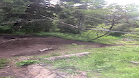
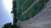
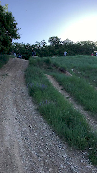
Photos of Bountiful Mountain Bike
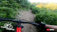
Videos of Bountiful Mountain Bike
trail: North Canyon, Lower
0:14 |
|
Jun 12, 2022
trail: Bountiful B
0:09 |
526 |
Jun 16, 2020
trail: Bountiful B
0:09 |
532 |
Jun 15, 2020
trail: Mueller Park
0:51 |
29 |
May 19, 2020

trail: BST (Bountiful Range)
0:07 |
53 |
May 15, 2020
trail: Mueller Park
17:25 |
12 |
May 15, 2020
trail: Mueller Park
15:47 |
21 |
May 14, 2020

trail: BST (Bountiful Range)
2:45 |
66523 |
Jul 27, 2015
Current Trail Warnings
| status | trail | date | condition | user | info |
|---|---|---|---|---|---|
| Bountiful B | May 30, 2026 @ 4:14pm (America/Denver) May 30, 2026 | Variable | afelipezabalar | Unfortunately, motorcycles have heavily... |
Recent Trail Reports
National Scenic Trails & Official Routes
-
Bonneville Shoreline Trail
- Mountain Bike
- E-Bike
- Horse
- Hike
- Trail Running
- Snowshoe
- Nordic Ski
-
Great Western Trail
- Mountain Bike
- E-Bike
- Horse
- Hike
- Trail Running
- Dirtbike/Moto
- ATV/ORV/OHV


Activity Feed
| username | action | type | title | date |
|---|---|---|---|---|
| saubbie23 | ridden | trail | activity #97135518 | Jun 16, 2026 @ 1:40pm 2 days |
| sschreier | add | report | activity #97052956 | Jun 15, 2026 @ 10:55am Jun 15, 2026 |
| S0tGHF | vote | trail | activity #97052551 | Jun 15, 2026 @ 10:49am Jun 15, 2026 |
| hikin46 | add | report | activity #97043546 | Jun 15, 2026 @ 8:34am Jun 15, 2026 |
| hikin46 | add | report | activity #97043544 and 2 more | Jun 15, 2026 @ 8:34am Jun 15, 2026 |
Recent Comments
| username | type | title | comment | date |
|---|---|---|---|---|
| trail | 7000 NICA riders across the state that are not... | May 14, 2026 @ 12:55pm May 14, 2026 | ||
| report | Good up the the bridge on the north side though. | Mar 23, 2026 @ 9:31am Mar 23, 2026 | ||
| trail | Also - one contract is for the “Big Rock”... | Mar 19, 2026 @ 3:23pm Mar 19, 2026 | ||
| trail | While the contract is approved for the... | Mar 19, 2026 @ 1:49pm Mar 19, 2026 | ||
| trail | March 2026 Bountiful City Council approved... | Mar 19, 2026 @ 9:11am Mar 19, 2026 |
Local Badges
-

Epic Ride Climb 2k157 awarded -

Climbing 10k Badge130 awarded -

Climbing 100k Badge3 awarded -

Epic Ride Descent 2k161 awarded -

Descent 10k Badge131 awarded -

Descent 100k Badge4 awarded
Activity Type Stats
| activitytype | trails | distance | descent | descent distance | total vertical | rating | global rank | state rank | photos | reports | routes | ridelogs |
|---|---|---|---|---|---|---|---|---|---|---|---|---|
| Mountain Bike | 108 | 127 miles | 24,357 ft | 53 miles | 4,888 ft | #770 | #298 | 390 | 1,461 | 20 | 35,890 | |
| E-Bike | 38 | 67 miles | 8,337 ft | 26 miles | 4,888 ft | #1,123 | #817 | 16 | 1,376 | 4 | 2,682 | |
| Gravel Bike | 2 | #597 | #1,127 | 4 | 88 | |||||||
| Horse | 8 | 18 miles | 4,977 ft | 8 miles | 4,029 ft | #1,276 | #783 | 6 | 168 | 12 | ||
| Hike | 118 | 146 miles | 31,385 ft | 57 miles | 5,128 ft | #668 | #310 | 8 | 1,429 | 13 | 3,809 | |
| Trail Running | 119 | 146 miles | 31,385 ft | 57 miles | 5,128 ft | #983 | #366 | 4 | 1,429 | 14 | 2,634 | |
| Dirtbike/Moto | 11 | 29 miles | 2,365 ft | 8 miles | 4,423 ft | #684 | #236 | 1 | 256 | 78 | ||
| ATV/ORV/OHV | 9 | 23 miles | 2,864 ft | 10 miles | 4,495 ft | #552 | #202 | 158 | 11 | |||
| Snowshoe | 8 | 7 miles | 571 ft | 2 miles | 4,272 ft | #984 | #483 | 5 | 9 | 24 |
Frequently Asked Questions About Bountiful
▼
What are the best places to ride in Bountiful?
Bountiful has 2 areas to explore for mountain biking. The top rated areas are:
▼
What are the highest rated mountain biking trails in Bountiful?
The highest rated mountain biking trails in Bountiful are:
- Mueller Park, Lower (4.6/5)
- Elephant Descent (4.4/5)
- Perrigrine (4.4/5)
- Hornet (4.4/5)
- BST - Mueller Park (4.4/5)
▼
What is the best time of the year to ride in Bountiful?
Based on ride log data, the most popular months to ride in Bountiful are:
- July (188 activities)
- June (167 activities)
- August (126 activities)
▼
Where can I park to ride in Bountiful?
There are 10 parking locations listed in Bountiful. The most popular parking spots are:
- Mueller Park
- Main lower Parking Area
- Upper Parking Area -The Farm
- Farmington Canyon Road Parking
- Parking
Activities
Trails
- By canadaka
 Trailforks & contributors
 - Admins: apply
- #4870 - 12,593 views
- bountiful activity log | embed map of Bountiful mountain bike trails | bountiful mountain biking points of interest
Downloading of trail gps tracks in kml & gpx formats is enabled for Bountiful.
You must login to download files.