close
-
Layers w
- Weather Layers
- Pro
- Pro
- Pro
- Pro
- Pro
- Pro
- More Layers
- Pro
- Pro
- Pro
- Pro
-
Upgrade to

3D
Trail Conditions
- Unknown
- Snow Groomed
- Snow Packed
- Snow Covered
- Snow Cover Partial
- Freeze/thaw Cycle
- Icy
- Prevalent Mud
- Wet
- Variable
- Ideal
- Dry
- Very Dry
Trail Flow (Ridden Direction)
Trailforks scans users ridelogs to determine the most popular direction each trail is ridden. A good flowing trail network will have most trails flowing in a single direction according to their intension.
The colour categories are based on what percentage of riders are riding a trail in its intended direction.
The colour categories are based on what percentage of riders are riding a trail in its intended direction.
- > 96%
- > 90%
- > 80%
- > 70%
- > 50%
- < 50%
- bi-directional trail
- no data
Trail Last Ridden
Trailforks scans ridelogs to determine the last time a trail was ridden.
- < 2 days
- < 1 week
- < 2 weeks
- < 1 month
- < 6 months
- > 6 months
Trail Ridden Direction
The intended direction a trail should be ridden.
- Downhill Only
- Downhill Primary
- Both Directions
- Uphill Primary
- Uphill Only
- One Direction
Contribute Details
Colors indicate trail is missing specified detail.
- Description
- Photos
- Description & Photos
- Videos
Trail Popularity ?
Trailforks scans ridelogs to determine which trails are ridden the most in the last 9 months.
Trails are compared with nearby trails in the same city region with a possible 25 colour shades.
Think of this as a heatmap, more rides = more kinetic energy = warmer colors.
- most popular
- popular
- less popular
- not popular
ATV/ORV/OHV Filter
Max Vehicle Width
inches
US Cell Coverage
Legend

Radar Time
Activity Recordings
Trailforks uses anonymized public activity data.
?
Activity Recordings
Trailforks uses anonymized public activity data.
?
Personal Heatmap
▶
Activity Types
all
/
none
▶
Options
2
Date range
month
–
Winter Trails
Warning
A routing network for winter maps does not exist. Selecting trails using the winter trails layer has been disabled.
Missing Trails
Most Popular
Least Popular
Trails are colored based on popularity. The more popular a trail is, the more red. Less popular trails trend towards green.
Jump Magnitude Heatmap
Heatmap of where riders jump on trails. Zoom in to see individual jumps, click circles to view jump details.
BC Backroad Status
![map legend]()
Service Road Atlas is a free to use, community-driven service for viewing and creating reports on the numerous back-country service roads around B.C. and Alberta.

Slope Aspect
Direction the slope faces
Trails Deemphasized
Trails are shown in grey.
Only show trails with no bike usage.
Suggested Layers
Based on selected activity type
Save the current map location and zoom level as your default home location whenever this page is loaded.
Save
No description for Buckeye has been added yet!
Login or register to submit one.
Activities Click to view
- Mountain Bike
87 trails
- Gravel Bike
0 trails
- Adaptive Bike
0 trails
- Horse
5 trails
- Hike
90 trails
- Trail Running
90 trails
- Dirtbike/Moto
1 trails
- ATV/ORV/OHV
1 trails
Region Details
- 12
- 16
- 36
- 20
Region Status
Open as of Nov 22, 2025Local Trail Association
Stats
- Avg Trail Rating
- Trails (view details)
- 88
- Trails Mountain Bike
- 87
- Trails E-Bike
- 1
- Trails Horse
- 5
- Trails Hike
- 90
- Trails Trail Running
- 90
- Trails Dirtbike/Moto
- 1
- Trails ATV/ORV/OHV
- 1
- Total Distance
- 85 miles
- Total Descent
- 9,094 ft
- Total Vertical
- 1,492 ft
- Highest Trailhead
- 2,330 ft
- Reports
- 332
- Photos
- 251
- Ridden Counter
- 12,837
Sub Regions
-
Dog Bone
- 11
- 22
-
Lost Creek
- 2
- 6
- 16
-
Skyline Regional Park
- 3
- 6
- 4
Popular Buckeye Mountain Biking Trails
• 95 ★ 4.3 • 2 miles • 272 ft • 305 •
Highly rated popular blue difficulty singletrack. This multi-use trail can be used both directions and has a moderate overall physical rating with a 272 ft blue climb. On average it takes 14 minutes to complete this trail.
• 95 ★ 4.0 • 5,084 ft • 19 ft • 296 •
Highly rated popular blue difficulty singletrack. This multi-use trail can be used both directions and has a moderate overall physical rating with a 19 ft blue climb. On average it takes 8 minutes to complete this trail.
• 85 ★ 4.0 • 1,644 ft • 14 ft • 270 •
Popular blue difficulty singletrack. This multi-use trail can be used both directions and has a moderate overall physical rating with a 14 ft blue climb. On average it takes 2 minutes to complete this trail.
• 100 ★ 4.5 • 587 ft • 0 ft • 255 •
Popular blue difficulty singletrack. This multi-use trail can be used both directions and has a moderate overall physical rating with a 0 ft blue climb. On average it takes 3 minutes to complete this trail.
• 80 ★ 4.2 • 2,983 ft • 183 ft • 244 •
Highly rated popular black diamond difficulty singletrack. This multi-use trail can be used both directions. On average it takes 10 minutes to complete this trail.
• 85 ★ 3.9 • 4,724 ft • 8 ft • 240 •
Popular black diamond difficulty singletrack. This multi-use trail can be used downhill primary and has a hard overall physical rating with a 8 ft black diamond climb. On average it takes 9 minutes to complete this trail.
• 85 ★ 3.7 • 1,905 ft • 130 ft • 238 •
Popular black diamond difficulty singletrack. This multi-use trail can be used uphill primary and has a hard overall physical rating with a 130 ft black diamond climb. On average it takes 7 minutes to complete this trail.
Buckeye Mountain Bike Routes
★ 3.0 • 8 miles • 1,046 ft • 10 • Loop •
Big loop through the Verrado trail system taking most of the challenging trails to create a big loop....
8 miles • 296 ft • 12 • Loop •
Local rider took me on this route. Doubles up on some sections but overall pretty fun. Could lengthen it...
21 miles • 904 ft • 7 • Loop •
Maricopa Trail westbound (Dogbone) is really just a dirt road that has been travelled with vehicles. Rocky...
17 miles • 2,635 ft • 14 • Loop •
This is a nice technical route with lots of climbing. It is chunky and challenging. Intermediate to Expert...
Photos of Buckeye Mountain Bike
Videos of Buckeye Mountain Bike
trail: Valley Vista
6:29 |
134 |
Jun 25, 2015

trail: Glory
2:28 |
327 |
Dec 27, 2014
trail: Glory
3:16 |
1666 |
Oct 30, 2012
trail: Glory
0:28 |
805 |
Sep 4, 2012

trail: Skyline Crest
4:16 |
167 |
Feb 1, 2024 , Buckeye
trail: Skyline Crest
0:46 |
118 |
Jan 25, 2024 , Buckeye
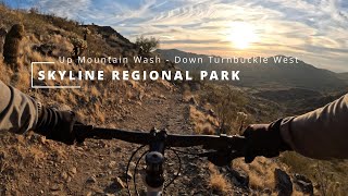
trail: Turnbuckle West
17:13 |
209 |
Jan 11, 2024 , Buckeye

trail: Mountain Wash
17:13 |
134 |
Jan 11, 2024 , Buckeye
Recent Trail Reports
| status | trail | date | condition | info | user |
|---|---|---|---|---|---|
| Widow Maker | Nov 22, 2025 @ 5:31pm (America/Phoenix) Nov 22, 2025 | Ideal | rdcam | ||
| Hot Springs | Nov 15, 2025 @ 11:49am (America/Phoenix) Nov 15, 2025 | Ideal | TAJ1205 | ||
| Bird | Nov 15, 2025 @ 11:49am (America/Phoenix) Nov 15, 2025 | Ideal | TAJ1205 | ||
| Big Bird | Nov 15, 2025 @ 11:49am (America/Phoenix) Nov 15, 2025 | Ideal | TAJ1205 | ||
| Entry | Nov 15, 2025 @ 11:49am (America/Phoenix) Nov 15, 2025 | Ideal | TAJ1205 | ||
| High Line | Nov 12, 2025 @ 1:42am (America/Phoenix) Nov 12, 2025 | Ideal | rdcam | ||
| Cholla | Nov 12, 2025 @ 1:38am (America/Phoenix) Nov 12, 2025 | Ideal | rdcam | ||
| Magic Mile | Oct 24, 2025 @ 7:27am (America/Phoenix) Oct 24, 2025 | Ideal | jaysvw | ||
| Kyle's Greenhorn | Jul 28, 2025 @ 5:47am Jul 28, 2025 | Ideal | Jbueno | ||
| Shortcut | Jul 28, 2025 @ 5:47am Jul 28, 2025 | Ideal | Jbueno |
Activity Feed
| username | action | type | title | date |
|---|---|---|---|---|
| trailforks | add | video | activity #97715398 | Jun 24, 2026 @ 12:07pm Jun 24, 2026 |
| mecolvin | like | report | activity #94842809 | May 16, 2026 @ 12:34pm May 16, 2026 |
| dirtnomad95 | ridden | trail | activity #92240762 | Apr 9, 2026 @ 2:28am Apr 9, 2026 |
| hillbomber39 | ridden | trail | activity #92103697 | Apr 7, 2026 @ 1:18am Apr 7, 2026 |
| gravityrider52 | ridden | trail | activity #92102117 | Apr 7, 2026 @ 12:42am Apr 7, 2026 |
Recent Comments
| username | type | title | comment | date |
|---|---|---|---|---|
| trail | Just want to thanks the folks that made this... | Feb 9, 2026 @ 2:24pm Feb 9, 2026 | ||
| trail | Trail is rowdy gooey chunky technical... | Nov 20, 2025 @ 5:41pm Nov 20, 2025 | ||
| trail | My goto route for a quick 80minute hike round... | Nov 15, 2025 @ 8:01am Nov 15, 2025 | ||
| trail | Overall it’s much more fun than Lost &... | Jan 1, 2025 @ 7:20am Jan 1, 2025 | ||
| report | Starting from S. Airport road trailhead, the... | Jan 1, 2025 @ 7:13am Jan 1, 2025 |
Local Badges
-

Top 10 Trails1 awarded -

Descent 100k Badge1 awarded -

Big Ride 30k965 awarded -

Epic Ride 50k326 awarded -

Descent 10k Badge50 awarded -

Completionist4 awarded
Bike & Skill Parks
| name | type | city | rating |
|---|---|---|---|
| Arizona Cycle Park | skill park | Buckeye |
Local Trail Supporters
- West Valley Trail Alliance
Activity Type Stats
| activitytype | trails | distance | descent | descent distance | total vertical | rating | global rank | state rank | photos | reports | routes | ridelogs |
|---|---|---|---|---|---|---|---|---|---|---|---|---|
| Mountain Bike | 87 | 78 miles | 8,717 ft | 29 miles | 1,476 ft | #1,343 | #511 | 244 | 332 | 11 | 13,734 | |
| E-Bike | 1 | 8 miles | 276 ft | 4 miles | 220 ft | 4 | 251 | 2 | 601 | |||
| Horse | 5 | 19 miles | 1,142 ft | 6 miles | 1,257 ft | #1,883 | #1,057 | 31 | 1 | 7 | ||
| Hike | 90 | 80 miles | 8,947 ft | 29 miles | 1,493 ft | #931 | #426 | 8 | 330 | 3 | 2,759 | |
| Trail Running | 90 | 80 miles | 8,947 ft | 29 miles | 1,493 ft | #2,669 | #766 | 330 | 3 | 562 | ||
| Dirtbike/Moto | 1 | 5 miles | 105 ft | 5,026 ft | 190 ft | #1,137 | #454 | 28 | 18 | |||
| ATV/ORV/OHV | 1 | 5 miles | 105 ft | 5,026 ft | 190 ft | #736 | #307 | 45 | 72 |
Frequently Asked Questions About Buckeye
▼
What are the best places to ride in Buckeye?
Buckeye has 4 areas to explore for mountain biking. The top rated areas are:
▼
What are the highest rated mountain biking trails in Buckeye?
The highest rated mountain biking trails in Buckeye are:
- Skyline Crest (4.4/5)
- Upper Ridge (4.3/5)
- Spine to Split (4.3/5)
- Secret (4.2/5)
- Loosey Goosey (4.2/5)
▼
What is the best time of the year to ride in Buckeye?
Based on ride log data, the most popular months to ride in Buckeye are:
- February (212 activities)
- October (204 activities)
- November (202 activities)
▼
Where can I park to ride in Buckeye?
There are 5 parking locations listed in Buckeye. The most popular parking spots are: View all parking and trailhead locations on the map to plan your visit.
Activities
Trails
Points of Interest
- Batman Viewpoint
- [aMTB] Avoid Lollipop Loop - Narrow Exposure - Turn Right Towards Boulders Other
- [aMTB] Boulder Pinch Point Other
- [aMTB] Exposure - Avoid Other
- [aMTB] Exposure - Spotter Potentially Required Other
- Turtle Rock TTF
- Pyrite Summit
- Valley Vista Summit
- Javelina Summit
- Woolsey Peak (3,153 ft)
- Baacon (3,009 ft)
- Margies Peak (2,493 ft)
- By voruxis & contributors
- Admins: WVTA, ccasanova108
- #11581 - 7,725 views
- buckeye activity log | embed map of Buckeye mountain bike trails | buckeye mountain biking points of interest
Downloading of trail gps tracks in kml & gpx formats is enabled for Buckeye.
You must login to download files.