
close
3D
Trail Conditions
- Unknown
- Snow Groomed
- Snow Packed
- Snow Covered
- Snow Cover Partial
- Freeze/thaw Cycle
- Icy
- Prevalent Mud
- Wet
- Variable
- Ideal
- Dry
- Very Dry
Trail Flow (Ridden Direction)
Trailforks scans users activity logs to determine the most popular direction each trail is ridden. A good flowing trail network will have most trails flowing in a single direction according to their intension.
The colour categories are based on what percentage of users are riding a trail in its intended direction.
The colour categories are based on what percentage of users are riding a trail in its intended direction.
- > 96%
- > 90%
- > 80%
- > 70%
- > 50%
- < 50%
- bi-directional trail
- no data
Trail Last Used
Trailforks scans activity logs to determine the last time a trail was ridden.
- < 2 days
- < 1 week
- < 2 weeks
- < 1 month
- < 6 months
- > 6 months
Trail Ridden Direction
The intended direction a trail should be ridden.
- Downhill Only
- Downhill Primary
- Both Directions
- Uphill Primary
- Uphill Only
- One Direction
Contribute Details
Colors indicate trail is missing specified detail.
- Description
- Photos
- Description & Photos
- Videos
Trail Popularity ?
Trailforks scans activity logs to determine which trails are ridden the most in the last 9 months.
Trails are compared with nearby trails in the same city region with a possible 25 colour shades.
Think of this as a heatmap, more activities = more kinetic energy = warmer colors.
- most popular
- popular
- less popular
- not popular
ATV/ORV/OHV Filter
Max Vehicle Width
inches
US Cell Coverage
Legend

Radar Time
Activity Recordings
Trailforks uses anonymized public activity data.
?
Activity Recordings
Trailforks uses anonymized public activity data.
?
Winter Trails
Warning
A routing network for winter maps does not exist. Selecting trails using the winter trails layer has been disabled.
Missing Trails
Most Popular
Least Popular
Trails are colored based on popularity. The more popular a trail is, the more red. Less popular trails trend towards green.
Jump Magnitude Heatmap
Heatmap of where users jump on trails. Zoom in to see individual jumps, click circles to view jump details.
BC Backroad Status
![map legend]()
Service Road Atlas is a free to use, community-driven service for viewing and creating reports on the numerous back-country service roads around B.C. and Alberta.

Slope Aspect
Direction the slope faces
Trails Deemphasized
Trails are shown in grey.
Only show trails with no bike usage.
Suggested Layers
Based on selected activity type
Save the current map location and zoom level as your default home location whenever this page is loaded.
SaveCastle Mountain trails and routes are listed on Trailforks with interactive trail maps, difficulty ratings, photos, and user-reported trail conditions. The Trailforks community has shared hundreds of photos from this region. Supported activity types include Mountain Biking, E-Biking, Trail Running, Hiking and Snowshoeing. Trails here are often flowy, faint trail and exposed. Scenery includes creeks and views. Common trail features include bridges, berms and jumps.
This is an auto-generated description of Castle Mountain.
Login or register to submit a custom description.
plan a road trip here Trail info last updated
Region Supporters & Maintainers
![Tourism Fernie]()
Tourism FernieSponsor

Activities Click to view
- Mountain Bike
30 trails
- E-Bike
29 trails
- Hike
28 trails
- Trail Running
29 trails
- Snowshoe
11 trails
Region Details
- 6
- 4
- 13
- 5
- 2
Region Status
Caution as of Nov 7, 2026

Stats
- Avg Trail Rating
- Trails (view details)
- 32
- Trails Mountain Bike
- 30
- Trails E-Bike
- 29
- Trails Gravel Bike
- 7
- Trails Adaptive Bike
- 5
- Trails Hike
- 28
- Trails Trail Running
- 29
- Trails Snowshoe
- 11
- Total Distance
- 43 miles
- Total Descent
- 14,152 ft
- Total Vertical
- 2,056 ft
- Highest Trailhead
- 5,352 ft
- Reports
- 1,396
- Photos
- 224
- Completed Counter
- 29,959
Popular Castle Mountain Mountain Biking Trails
• 100 ★ 4.3 • 1 mile • 870 ft • 2,730 •
If you haven't ridden Hypervent you need to get on your bike and go there right now. It is a world class climb. Beautifully built, with switchbacks that are all rideable, but hard to get all of them right without putting a foot down....
• 95 ★ 4.4 • 1 mile • 20 ft • 2,280 •
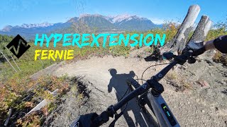
Primary Descent from the top of the Hyperventilation climb. Starts off medium gnarly with roots, twists and turns and some steeper little sections. Soon mellows out and the final swoop through Roots Extension is all good easy fun. The...
• 90 ★ 3.6 • 3,675 ft • 4 ft • 1,836 •
Continuation of Hyperextension, most people will not realize they are on a differently-names trail. Flowy rooty single track. Kicks out on River Road Extension.
• 70 ★ 3.2 • 4,564 ft • 635 ft • 1,001 •
Astonishing bit of trail - takes you across Castle Mountain and right to the very top (well bit of a hike at the very end). Quite a grunt, some narrow bits with some exposure. Past Dannette's bench. You need to hit this trail if you...
• 85 ★ 4.1 • 1 mile • 308 ft • 910 •
Part of the Elk Valley / TransCanada Trail; Snoop Lion is a mellow singletrack experience that is very well built, with fun little bridges, some big swoopy switchbacks, alternating between open vistas and dark forest. All sorts of...
• 55 ★ 2.0 • 266 ft • 0 ft • 694 •
A little single track connector that allows you to jump on or off Cokato Road at the bottom of the Montane loop. Bit of sudden short grunt uphill from the road.
Castle Mountain Mountain Bike Routes
★ 5.0 • 4 miles • 1,187 ft • 8 •
Hyper Ventilation and Extension loop: warm-up with a gentle climb on the new Lower Uprooted (ask LBS for...
★ 3.4 • 7 miles • 1,553 ft • 19 • Point to Point •
Route takes you around Montane, before a steady climb up towards Hyperextension for a fast flowy downhill...
★ 4.0 • 5 miles • 679 ft • 0 • Loop •
Very mellow cruise loop. Can either be done as a loop either clockwise or anti-clockwise. Features include...
★ 4.5 • 6 miles • 1,497 ft • 25 • Point to Point • Race •
This trail is used for the 2016 Tears & Gears Duathlon, biking portion. Great loop for any day
• 13 miles • 2,745 ft • 6 •
• 13 miles • 2,776 ft • 7 •
Photos of Castle Mountain Mountain Bike
Videos of Castle Mountain Mountain Bike



Current Trail Warnings
| status | trail | date | condition | user | info |
|---|---|---|---|---|---|
| Ammonite Access | Nov 7, 2026 @ 8:25am (America/Edmonton) Nov 7, 2026 | Unknown | scottg FTA | Exercise caution in area - there was a... | |
| 6 More Days | Nov 7, 2026 @ 8:23am (America/Edmonton) Nov 7, 2026 | Snow Cover Partial | scottg FTA | Exercise caution in area - there was a... | |
| Dark Side Climb | Nov 7, 2026 @ 8:23am (America/Edmonton) Nov 7, 2026 | Snow Cover Partial | scottg FTA | Exercise caution in area - there was a... |
Recent Trail Reports
Activity Feed
| username | action | type | title | date |
|---|---|---|---|---|
| gbos | ridden | trail | activity #107370459 | Nov 7, 2026 @ 12:11pm Nov 7, 2026 |
| scottg | add | report | activity #107342996 and 3 more | Nov 7, 2026 @ 6:24am Nov 7, 2026 |
| scottg | add | report | activity #106877270 and 27 more | Oct 30, 2026 @ 11:52am Oct 30, 2026 |
| cdubm77 | ridden | trail | activity #106745982 | Oct 28, 2026 @ 7:40am Oct 28, 2026 |
| scottg | update | trail | activity #106484623 | Oct 24, 2026 @ 6:24am Oct 24, 2026 |
Recent Comments
| username | type | title | comment | date |
|---|---|---|---|---|
| trail | Rode it today with a buddy. He told me to pack... | Oct 18, 2026 @ 7:52pm Oct 18, 2026 | ||
| trail | I should also add the trail leading up to the... | Aug 27, 2026 @ 8:41am Aug 27, 2026 | ||
| trail | First hike every in Fernie, BC and me and my... | Aug 27, 2026 @ 8:36am Aug 27, 2026 | ||
| trail | Beautiful steep riding | Aug 26, 2026 @ 7:08pm Aug 26, 2026 | ||
| trail | Off Shit, Trail is horrible unless you are... | Jul 29, 2026 @ 9:20pm Jul 29, 2026 |
Nearby Areas
| name | distance | ||||
|---|---|---|---|---|---|
| Montane Fernie | 9 | 17 | 1 | 1.3 km | |
| Fernie Flo Network | 3 | 1 | 4 | 1.8 km | |
| Ridgemont/Fernie Ridge | 6 | 16 | 3 | 1 | 2.1 km |
| Morrissey Ridge | 1 | 11 | 4 | 4 | 2.1 km |
| Fernie Ridge (East) | 6 | 6 | 2.4 km |
Local Badges
-

Completionist1 awarded




Activity Type Stats
| activitytype | trails | distance | descent | descent distance | total vertical | rating | global rank | state rank | photos | reports | routes | activity logs |
|---|---|---|---|---|---|---|---|---|---|---|---|---|
| Mountain Bike | 30 | 42 miles | 14,085 ft | 13 miles | 2,057 ft | #1,231 | #90 | 174 | 1,388 | 5 | 17,148 | |
| E-Bike | 29 | 42 miles | 14,009 ft | 13 miles | 2,057 ft | #3,112 | #119 | 1 | 1,334 | 421 | ||
| Gravel Bike | 7 | 7 miles | 427 ft | 1 mile | 781 ft | #449 | #62 | 59 | 115 | |||
| Adaptive Bike | 5 | 5 miles | 338 ft | 1 mile | 571 ft | #450 | #62 | 79 | 2 | |||
| Hike | 28 | 40 miles | 10,433 ft | 11 miles | 2,057 ft | #2,462 | #125 | 46 | 1,345 | 811 | ||
| Trail Running | 29 | 41 miles | 11,673 ft | 11 miles | 2,057 ft | #3,861 | #127 | 1,359 | 1,490 | |||
| Snowshoe | 11 | 12 miles | 2,454 ft | 5 miles | 1,631 ft | #598 | #63 | 2 | 170 | 76 |
Frequently Asked Questions
▼
What are the highest rated mountain biking trails in Castle Mountain?
The highest rated mountain biking trails in Castle Mountain are:
- Off Shift (4.3/5)
- Hyperextension (4.3/5)
- 6 More Days (4.3/5)
- Dark Side Climb (4.2/5)
- Hyper Ventilation (4.2/5)
▼
What is the best time of the year to ride in Castle Mountain?
Based on activity log data, the most popular months to ride in Castle Mountain are:
- July (349 activities)
- August (323 activities)
- May (283 activities)
▼
Where can I park to ride in Castle Mountain?
Check the Castle Mountain trail map for trailhead and parking information. Community members regularly update access and parking details for trails in the area.
▼
What is the longest trail in Castle Mountain?
The longest trail in Castle Mountain is Smooth Salamander (Elk Valley Trail) at 4.5 km. View all trails sorted by distance.
▼
What are the best & highest rated hiking trails in Castle Mountain?
The best hiking trails in Castle Mountain are: View all hiking trails sorted by popularity score.
▼
How many trails are in Castle Mountain?
Castle Mountain has a total of 32 trails. Of those, 30 are designated for mountain biking. Browse top mountain biking trails in Castle Mountain to find detailed information including difficulty ratings, distances, and trail conditions.
▼
Which trail has the most elevation gain in Castle Mountain?
The trail with the most elevation gain in Castle Mountain is Hyper Ventilation with 265 m of elevation gain. View all trails sorted by elevation gain.
▼
Which trail has the most elevation descent in Castle Mountain?
The trail with the most elevation descent in Castle Mountain is 6 More Days with 377 m of elevation descent. View all trails sorted by elevation descent.
▼
What activities are most popular in Castle Mountain?
Castle Mountain supports the following activities: Mountain Biking, E-Biking, Hiking, Trail Running, Snowshoeing.
▼
What are the steepest mountain biking trails in Castle Mountain?
The steepest mountain biking trail in Castle Mountain is Hyper Ventilation with an average grade of 13.3%. View all trails sorted by grade.
▼
Are there any trails with scenic viewpoints in Castle Mountain?
Yes, there are 4 scenic viewpoints marked along trails in Castle Mountain. Some popular viewpoints include: Explore more points of interest to find trails with the best views.
▼
Are the trails open in Castle Mountain?
The overall region status for Castle Mountain is Minor Issue / Yellow. Out of 31 trails:
- Clear / Green: 2
- Significant Issue / Amber: 29
▼
Can I ride an ebike in Castle Mountain?
Yes, Castle Mountain supports e-bike riding. There are 28 trails in Castle Mountain that allow e-bikes. Check the e-bike trails listing for specific trail access details and any local regulations.
▼
What are the most popular mountain biking routes in Castle Mountain?
The most popular mountain biking routes in Castle Mountain are: View all mountain biking routes in Castle Mountain.
▼
What type of bike is most common in Castle Mountain?
Based on activity log data, the most common bike types used in Castle Mountain are:
- AM (91 activities)
- XC (13 activities)
- RD (12 activities)
- DH (10 activities)
- Trials (1 activities)
▼
What are the most popular Strava Segments in Castle Mountain?
The most popular Strava segments in Castle Mountain are:
- Hyperventilation bench to Castle Junction (6,265 athletes)
- 2018 NEW Hyperextension (re-route) DH (5,295 athletes)
- Hyper-SouthCastle (2,477 athletes)
▼
What are the most popular mountain biking trails in Castle Mountain?
The most popular mountain biking trails in Castle Mountain are: View all mountain biking trails sorted by popularity.
▼
What are the best beginner ride trails in Castle Mountain?
The best beginner mountain biking trails in Castle Mountain are:
- Green Alligator (3.2/5)
- La Bamba (2.2/5)
- South Castle connector (2.4/5)
Activities
Trails
- By canadaka
 Trailforks & contributors
- Admins: FTA, FTA, STMS, RDEK
- #1958 - 20,802 views
- castle mountain activity log | embed map of Castle Mountain mountain bike trails | castle mountain mountain biking points of interest
Downloading of trail gps tracks in kml & gpx formats is enabled for Castle Mountain.
You must login to download files.
