close
-
Layers w
- Weather Layers
- Pro
- Pro
- Pro
- Pro
- Pro
- Pro
- More Layers
- Pro
- Pro
- Pro
- Pro
-
Upgrade to

3D
Trail Conditions
- Unknown
- Snow Groomed
- Snow Packed
- Snow Covered
- Snow Cover Partial
- Freeze/thaw Cycle
- Icy
- Prevalent Mud
- Wet
- Variable
- Ideal
- Dry
- Very Dry
Trail Flow (Ridden Direction)
Trailforks scans users ridelogs to determine the most popular direction each trail is ridden. A good flowing trail network will have most trails flowing in a single direction according to their intension.
The colour categories are based on what percentage of riders are riding a trail in its intended direction.
The colour categories are based on what percentage of riders are riding a trail in its intended direction.
- > 96%
- > 90%
- > 80%
- > 70%
- > 50%
- < 50%
- bi-directional trail
- no data
Trail Last Ridden
Trailforks scans ridelogs to determine the last time a trail was ridden.
- < 2 days
- < 1 week
- < 2 weeks
- < 1 month
- < 6 months
- > 6 months
Trail Ridden Direction
The intended direction a trail should be ridden.
- Downhill Only
- Downhill Primary
- Both Directions
- Uphill Primary
- Uphill Only
- One Direction
Contribute Details
Colors indicate trail is missing specified detail.
- Description
- Photos
- Description & Photos
- Videos
Trail Popularity ?
Trailforks scans ridelogs to determine which trails are ridden the most in the last 9 months.
Trails are compared with nearby trails in the same city region with a possible 25 colour shades.
Think of this as a heatmap, more rides = more kinetic energy = warmer colors.
- most popular
- popular
- less popular
- not popular
ATV/ORV/OHV Filter
Max Vehicle Width
inches
US Cell Coverage
Legend

Radar Time
Activity Recordings
Trailforks uses anonymized public activity data.
?
Activity Recordings
Trailforks uses anonymized public activity data.
?
Personal Heatmap
▶
Activity Types
all
/
none
▶
Options
2
Date range
month
–
Winter Trails
Warning
A routing network for winter maps does not exist. Selecting trails using the winter trails layer has been disabled.
Missing Trails
Most Popular
Least Popular
Trails are colored based on popularity. The more popular a trail is, the more red. Less popular trails trend towards green.
Jump Magnitude Heatmap
Heatmap of where riders jump on trails. Zoom in to see individual jumps, click circles to view jump details.
BC Backroad Status
![map legend]()
Service Road Atlas is a free to use, community-driven service for viewing and creating reports on the numerous back-country service roads around B.C. and Alberta.

Slope Aspect
Direction the slope faces
Trails Deemphasized
Trails are shown in grey.
Only show trails with no bike usage.
Suggested Layers
Based on selected activity type
Save the current map location and zoom level as your default home location whenever this page is loaded.
SaveThis trail system is just west of Otero / Tunnel / David Canyon area and north of Pine Flats / Oak Flat. There are connecting trails to link them. Much of this trail system was created by moto and is multi-use although some of the trails are restricted such as Road Noise which is non-motorized (no e-bikes). Horses tend to avoid this area because of the motorized. ATV's are only allowed on the forest roads transecting the area.
Primary Trail Type: Cross-Country
Shuttleable: YES
Land Status: National Forest
Land Manager: USFS - Sandia Ranger District
 google parking directions
 Activities Click to view
- Mountain Bike
49 trails
- E-Bike
38 trails
- Horse
36 trails
- Hike
52 trails
- Trail Running
52 trails
- Dirtbike/Moto
34 trails
- Observed Trials
17 trails
- ATV/ORV/OHV
10 trails
Region Details
- 7
- 3
- 30
- 8
- 1
Region Status
Open as of Mar 24, 2026Stats
- Avg Trail Rating
- Trails (view details)
- 49
- Trails Mountain Bike
- 49
- Trails E-Bike
- 38
- Trails Horse
- 36
- Trails Hike
- 52
- Trails Trail Running
- 52
- Trails Dirtbike/Moto
- 34
- Trails Observed Trials
- 17
- Trails ATV/ORV/OHV
- 10
- Total Distance
- 77 miles
- Total Descent
- 11,559 ft
- Total Vertical
- 1,346 ft
- Highest Trailhead
- 7,772 ft
- Reports
- 550
- Photos
- 70
- Ridden Counter
- 9,898
Popular Cedro & Coyote Mountain Biking Trails
• 70 ★ 4.6 • 5 miles • 359 ft • 373 •
! This trail can really be awesome or really rough, depending on how much moisture it's gotten and how much the motor bikes have torn it up each season. It is mostly comprised of loose dirt/rocks, with some smoother/flowier sections...
• 70 ★ 3.7 • 3 miles • 109 ft • 372 •
Chamisoso is an interesting trail that pops off of Powerline, and is definitely a better way to climb, as Powerline gets crazy steep and rocky further on, and can be a decent (if scary) descent, but is not a fun climb. Chami is,...
• 65 ★ 4.0 • 2 miles • 140 ft • 307 •
The south portion of Bear Scat is almost a completely different trail from the northern portion. Mellow, fun, and flowy as a downhill (with a bit of a steep start), and a reasonably low-grade climb (with a pretty steep end). This...
• 75 ★ 3.8 • 1 mile • 109 ft • 304 •
is a bi-directional single track that runs north to south, and connects to several other area trails. The trail tends slightly uphill ridden from north to south, but either direction features some descending and climbing. The trail is...
• 70 ★ 4.5 • 4,974 ft • 280 ft • 282 •
southern extension that connects Chamisoso to . Makes for a fun, shorter alternative to the standard -Chamisoso loop or, if hooked with a short FR climb, a quick way up to the top of the -Chamisoso intersection. Fun in either direction.
• 65 ★ 3.0 • 1 mile • 228 ft • 275 •
takes you from the Cedro riding area over to the Tunnel/Otero side of 337. The trail has seen some abuse by weather, but locals have mostly kept it up. Still, watch for some surprising dips in the trail here and there where some of it...
• 65 ★ 3.6 • 2 miles • 82 ft • 274 •
Previously an extremely steep, rocky fall line plunge into the valley, has been rerouted as of July 2017. All of the previous gnar has been replaced by a more sustainable, standard reroute. This means the trail is now a rideable climb,...
• 75 ★ 3.8 • 2 miles • 51 ft • 265 •
starts at the parking area and intersection with . It was re-routed in May 2024 for reasons of erosion and sustainability. Whereas before it contained rocky fall-line, sections, these have been contoured providing a very enjoyable...
Cedro & Coyote Mountain Bike Routes
★ 4.0 • 17 miles • 2,475 ft • 5 •
ABQ 3 stage Enduro. Stage 1: Tio Juanito DH Stage 2: Blue Ribbon - Full Enduro Run Stage 3: Bird House DH
★ 5.0 • 30 miles • 3,144 ft • 43 • Loop •
This route gets all of the best stuff in the main Cedro area, minus all of the stuff in Oak Flats. This is...
★ 4.0 • 35 miles • 4,311 ft • 16 •
2019 Manzanita Mountain Epic B course, 35 miles
15 miles • 1,913 ft • 4 •
2026 ABQ Enduro - Cedro Stage 1: Stage 2: Second half of to Split Stage 3: Split South, down Chamisoso to...
★ 3.0 • 10 miles • 1,216 ft • 2 •
Transfer to Stage 1 - Double Track road to . Stage 1 - , start of downhill until the uphill just before ....
Photos of Cedro & Coyote Mountain Bike
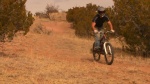
Videos of Cedro & Coyote Mountain Bike

trail: Bear Scat North A-Line Chute
19:17 |
106 |
Feb 2, 2025 , Albuquerque
trail: Bear Scat South
19:17 |
73 |
Feb 2, 2025 , Albuquerque

trail: Pokerchip North
19:17 |
79 |
Feb 2, 2025 , Albuquerque

trail: Meadow Singletrack
19:17 |
74 |
Feb 2, 2025 , Albuquerque

trail: Cedro Singletrack
19:17 |
70 |
Feb 2, 2025 , Albuquerque
trail: Middle
2:29 |
1187 |
Jan 18, 2010

trail: Middle
4:58 |
2220 |
Jan 7, 2010
trail: Middle
2:32 |
457 |
Dec 29, 2009
Recent Trail Reports
| status | trail | date | condition | info | user |
|---|---|---|---|---|---|
| Meadow Ridge | Mar 24, 2026 @ 4:13pm (America/Denver) Mar 24, 2026 | Unknown | PaulR13 | ||
| Chamisoso (5184) | Mar 8, 2026 @ 11:54am (America/Ciudad_Juarez) Mar 8, 2026 | Variable | glagola1 | ||
| Lower Pine | Mar 8, 2026 @ 11:54am (America/Ciudad_Juarez) Mar 8, 2026 | Ideal | glagola1 | ||
| Pinyon | Mar 8, 2026 @ 11:54am (America/Ciudad_Juarez) Mar 8, 2026 | Ideal | glagola1 | ||
| Mighty Mule | Mar 8, 2026 @ 11:54am (America/Ciudad_Juarez) Mar 8, 2026 | Dry | glagola1 | ||
| ATV Bypass | Oct 24, 2025 @ 1:40pm (America/Ciudad_Juarez) Oct 24, 2025 | Variable | aboldtriceratops | ||
| Coyote Chamisoso Link | Jul 29, 2025 @ 7:48am Jul 29, 2025 | Dry | LeroyRomeromI5 | ||
| Coyote | Jul 29, 2025 @ 7:48am Jul 29, 2025 | Ideal | LeroyRomeromI5 | ||
| Dog Run South | Jul 17, 2025 @ 11:18am Jul 17, 2025 | Unknown | billw3 | ||
| Squirrel Run East | Jun 28, 2025 @ 10:59am Jun 28, 2025 | Unknown | billw3 |
Activity Feed
| username | action | type | title | date |
|---|---|---|---|---|
| ericoutdoors | wishlist | trail | activity #94741221 | May 15, 2026 @ 4:16am May 15, 2026 |
| ChristianthiDEp | wishlist | trail | activity #94033233 | May 4, 2026 @ 10:09am May 4, 2026 |
| RFrick | wishlist | route | activity #94021593 and 1 more | May 4, 2026 @ 6:51am May 4, 2026 |
| genisis53 | wishlist | region | activity #93053922 | Apr 20, 2026 @ 6:15pm Apr 20, 2026 |
| PeteHamilton | ridden | trail | activity #92966900 | Apr 19, 2026 @ 11:30am Apr 19, 2026 |
Recent Comments
| username | type | title | comment | date |
|---|---|---|---|---|
| report | This is an OHV/ATV trail, but still rideable. ... | Mar 24, 2026 @ 3:19pm Mar 24, 2026 | ||
| trail | Dope trail going down on a mtb. I can see how... | Mar 11, 2026 @ 1:43pm Mar 11, 2026 | ||
| trail | Everyone complaining about motos… it’s a... | Dec 10, 2025 @ 7:30pm Dec 10, 2025 | ||
| trail | All moto loose rocks, not fun. Why not build... | Oct 10, 2025 @ 10:18am Oct 10, 2025 | ||
| trail | Right at the base of the hill there’s a gate... | Sep 6, 2025 @ 7:46am Sep 6, 2025 |
Nearby Areas
| name | distance | ||||
|---|---|---|---|---|---|
| Pine Flat / Oak Flats - Manzanita Mountains | 24 | 12 | 2 | 3.6 km | |
| Ojito de San Antonio Open Space | 1 | 2 | 3.8 km | ||
| Otero, Tunnel, and David Canyons | 14 | 1 | 4.2 km | ||
| Gutierrez Canyon Open Space | 4 | 7 | 4 | 5 km | |
| San Antonito Open Space | 3 | 3 | 6.7 km |
Local Badges
-

Completionist0 awarded
Activity Type Stats
| activitytype | trails | distance | descent | descent distance | total vertical | rating | global rank | state rank | photos | reports | routes | ridelogs |
|---|---|---|---|---|---|---|---|---|---|---|---|---|
| Mountain Bike | 49 | 77 miles | 11,558 ft | 35 miles | 1,345 ft | #2,542 | #880 | 68 | 550 | 16 | 7,559 | |
| E-Bike | 38 | 64 miles | 9,980 ft | 31 miles | 1,342 ft | #2,437 | #804 | 512 | 2 | 405 | ||
| Horse | 36 | 59 miles | 9,039 ft | 28 miles | 1,342 ft | #856 | #449 | 174 | 3 | |||
| Hike | 52 | 77 miles | 11,558 ft | 35 miles | 1,345 ft | #3,239 | #1,118 | 551 | 1 | 323 | ||
| Trail Running | 52 | 77 miles | 11,558 ft | 35 miles | 1,345 ft | #2,571 | #632 | 2 | 551 | 97 | ||
| Dirtbike/Moto | 34 | 57 miles | 9,400 ft | 29 miles | 1,342 ft | #522 | #149 | 251 | 33 | |||
| Observed Trials | 17 | 27 miles | 4,393 ft | 13 miles | 1,191 ft | #31 | #10 | 57 | 7 | |||
| ATV/ORV/OHV | 10 | 14 miles | 1,683 ft | 6 miles | 1,325 ft | #571 | #245 | 128 | 5 |
Frequently Asked Questions About Cedro & Coyote
▼
What are the highest rated mountain biking trails in Cedro & Coyote?
The highest rated mountain biking trails in Cedro & Coyote are:
- Coyote (4.3/5)
- Bear Scat North A-Line Chute (4.2/5)
- Coyote Split South (4.1/5)
- Lone Pine (4.1/5)
- Pokerchip North (4/5)
▼
What is the best time of the year to ride in Cedro & Coyote?
Based on ride log data, the most popular months to ride in Cedro & Coyote are:
- September (173 activities)
- July (156 activities)
- May (136 activities)
▼
Where can I park to ride in Cedro & Coyote?
There are 6 parking locations listed in Cedro & Coyote. The most popular parking spots are:
- Tunnel Canyon Trailhead Parking
- Lower Cedro Parking
- Lower Pine Trailhead Parking
- Ranger Station parking
- Parking
▼
What is the longest trail in Cedro & Coyote?
The longest trail in Cedro & Coyote is Coyote at 4.7 miles. View all trails sorted by distance.
Activities
- By oldmanjoe & contributors
- Admins: AMBA, AMBA
- #5623 - 11,283 views
- cedro & coyote activity log | embed map of Cedro & Coyote mountain bike trails | cedro & coyote mountain biking points of interest
Downloading of trail gps tracks in kml & gpx formats is enabled for Cedro & Coyote.
You must login to download files.