close
-
Layers w
- Weather Layers
- Pro
- Pro
- Pro
- Pro
- Pro
- Pro
- More Layers
- Pro
- Pro
- Pro
- Pro
-
Upgrade to

3D
Trail Conditions
- Unknown
- Snow Groomed
- Snow Packed
- Snow Covered
- Snow Cover Partial
- Freeze/thaw Cycle
- Icy
- Prevalent Mud
- Wet
- Variable
- Ideal
- Dry
- Very Dry
Trail Flow (Ridden Direction)
Trailforks scans users ridelogs to determine the most popular direction each trail is ridden. A good flowing trail network will have most trails flowing in a single direction according to their intension.
The colour categories are based on what percentage of riders are riding a trail in its intended direction.
The colour categories are based on what percentage of riders are riding a trail in its intended direction.
- > 96%
- > 90%
- > 80%
- > 70%
- > 50%
- < 50%
- bi-directional trail
- no data
Trail Last Ridden
Trailforks scans ridelogs to determine the last time a trail was ridden.
- < 2 days
- < 1 week
- < 2 weeks
- < 1 month
- < 6 months
- > 6 months
Trail Ridden Direction
The intended direction a trail should be ridden.
- Downhill Only
- Downhill Primary
- Both Directions
- Uphill Primary
- Uphill Only
- One Direction
Contribute Details
Colors indicate trail is missing specified detail.
- Description
- Photos
- Description & Photos
- Videos
Trail Popularity ?
Trailforks scans ridelogs to determine which trails are ridden the most in the last 9 months.
Trails are compared with nearby trails in the same city region with a possible 25 colour shades.
Think of this as a heatmap, more rides = more kinetic energy = warmer colors.
- most popular
- popular
- less popular
- not popular
ATV/ORV/OHV Filter
Max Vehicle Width
inches
US Cell Coverage
Legend

Radar Time
Activity Recordings
Trailforks uses anonymized public activity data.
?
Activity Recordings
Trailforks uses anonymized public activity data.
?
Personal Heatmap
▶
Activity Types
all
/
none
▶
Options
2
Date range
month
–
Winter Trails
Warning
A routing network for winter maps does not exist. Selecting trails using the winter trails layer has been disabled.
Missing Trails
Most Popular
Least Popular
Trails are colored based on popularity. The more popular a trail is, the more red. Less popular trails trend towards green.
Jump Magnitude Heatmap
Heatmap of where riders jump on trails. Zoom in to see individual jumps, click circles to view jump details.
BC Backroad Status
![map legend]()
Service Road Atlas is a free to use, community-driven service for viewing and creating reports on the numerous back-country service roads around B.C. and Alberta.

Slope Aspect
Direction the slope faces
Trails Deemphasized
Trails are shown in grey.
Only show trails with no bike usage.
Suggested Layers
Based on selected activity type
Save the current map location and zoom level as your default home location whenever this page is loaded.
SaveMaple Mountain is located just off Osborne Bay Road within the Municipal Forest Reserve owned by the District of North Cowichan. Maple Mountain is enjoyed by walkers, hikers and mountain bikers. There over 28 kilometres on 18 sanctioned trails built and maintained by the passionate trail builders and locals. The local Cowichan Trail Stewardship Society manages and maintains the trails on behalf of the Municipality.
Primary Trail Type: All-Mountain & Downhill
Land Status: Community Forest
Land Manager: Municipality of North Cowichan
 google parking directions
 Access Info:
Pull off Osbourne bay Rd by the yellow gate with a big "Welcome to Maple Mountain Community Forest" sign.
Links
Files
- MapleMountain_PrintableMap_2018.pdf (265 KB)
- maple mountain.pdf (1.06 MB)
Activities Click to view
- Mountain Bike
30 trails
- E-Bike
31 trails
- Horse
9 trails
- Hike
39 trails
- Trail Running
37 trails
Region Details
- 9
- 2
- 13
- 5
- 1
Region Status
Open as of May 30, 2026Local Trail Association
Stats
- Avg Trail Rating
- Trails (view details)
- 42
- Trails Mountain Bike
- 30
- Trails E-Bike
- 31
- Trails Horse
- 9
- Trails Hike
- 39
- Trails Trail Running
- 37
- Total Distance
- 39 miles
- Total Descent Distance
- 14 miles
- Total Descent
- 7,054 ft
- Total Vertical
- 1,604 ft
- Highest Trailhead
- 1,652 ft
- Reports
- 1,392
- Photos
- 533
- Ridden Counter
- 29,088
Articles
BC Bike Race Stage Two: Maple Mountain Madness
Jul 2, 2025 from pinkbike.com
The 19th BC Bike Race kicked into high gear on Canada Day with the first full stage of racing on Maple Mountain.

8 Days, 8 Life Lessons - BC Bike Race 2019
Jul 25, 2019 from pinkbike.com
A racer's perspective from the 2019 BC Bike Race and some advice if it's on your to-do list.
Popular Maple Mountain Mountain Biking Trails
• 100 ★ 4.5 • 2 miles • 517 ft • 2,726 •
The Xylem Climbing Trail is a multi-use single-track trail beautifully graded with well made switchbacks and some built-up corners. Some nice views at the start in the open clearcuts.
• 100 ★ 4.6 • 3,255 ft • 181 ft • 2,371 •
Another classic addition to the ing trail system. This bit has mixed ups and downs but mostly up. Well sculptured trail that is a nice start to climbing to the summit. Thanks to all those with a hand in this gorgeous build.
• 95 ★ 4.7 • 5,190 ft • 248 ft • 2,299 •
Easily the hardest out of the 3 Xylem sections. With countless difficult and mandatory natural TTF's, it rides more like a black diamond.
• 100 ★ 3.7 • 1,732 ft • 7 ft • 2,219 •
Popular blue difficulty singletrack. This mountain bike primary trail can be used both directions with a 7 ft blue climb. It features bridge and rock garden. On average it takes 3 minutes to complete this trail.
• 95 ★ 4.6 • 1 mile • 472 ft • 2,192 •
Final leg of the Xylem Climbing trail to reach the summit of Maple Mountain and start of Upper .
• 100 ★ 4.7 • 1 mile • 0 ft • 2,077 •
Flow trail with lots of tight berms through the trees, which makes this trail a bit unique as a flow trail. A real blast down.
• 90 ★ 4.6 • 1 mile • 43 ft • 1,893 •
A very technical single track trail on Maple Mountain. This trail challenges you both technically and physically as there is a fair amount of pedalling still involved that will very much please the enduro crowd. This trail is home to...
• 75 ★ 4.2 • 2 miles • 220 ft • 1,675 •
The lower half of the full Maple Mountain descent of is a stunning trail with beautiful rocky bluffs and beautiful creek crossings. This portion of the trail requires some strong pedalling still for those that have just come from Upper...
Maple Mountain Mountain Bike Routes
★ 4.5 • 9 miles • 1,812 ft • 11 • Loop •
This is an excellent loop, that has a bit of everything. Starting off with some of the best climbing...
8 miles • 1,629 ft • 7 • Loop •
Maple’s descents are notoriously physical with many climbs mixed in. This route covers both technical...
17 miles • 3,309 ft • 14 •
BCBR Rolling Thunder Presented by Transition The Long Course (A) is 27 km 1009 m elev., the Short Course...
17 miles • 3,360 ft • 13 •
The Megavolt eMTBxc is set up to offer eBikers two options: a longer route of 27km with1026m el. or a...
8 miles • 1,680 ft • 15 •
This is a great route which uses all of Xylem to the summit of Maple Mountain. Although rated as 'blue'...
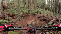
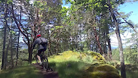
Photos of Maple Mountain Mountain Bike
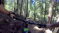
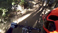
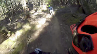
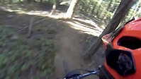
Videos of Maple Mountain Mountain Bike
trail: Maple Mountain Park Road
0:10 |
166 |
Aug 14, 2021
trail: Maple Mountain Park Road
0:10 |
|
Aug 14, 2021
trail: Upper Maple Syrup
17:28 |
506 |
Dec 21, 2019
trail: Upper Xylem
8:35 |
386 |
Jul 16, 2018
trail: Lower Maple Syrup
6:03 |
360 |
Sep 5, 2017
trail: Lower Maple Syrup
0:13 |
104 |
Sep 5, 2017
trail: Lower Maple Syrup
3:36 |
59 |
Sep 5, 2017
trail: Lower Maple Syrup
0:34 |
242 |
Jun 8, 2017
Recent Trail Reports
Activity Feed
| username | action | type | title | date |
|---|---|---|---|---|
| tbag86 | ridden | trail | activity #96060886 | Jun 1, 2026 @ 8:53pm Jun 1, 2026 |
| rapid-roy | vote | trail | activity #96054498 and 1 more | Jun 1, 2026 @ 6:12pm Jun 1, 2026 |
| rapid-roy | add | report | activity #96052721 | Jun 1, 2026 @ 5:41pm Jun 1, 2026 |
| canadaka | add | report | activity #95998864 and 8 more | May 31, 2026 @ 9:52pm May 31, 2026 |
| Carruthers | wishlist | route | activity #95950309 | May 31, 2026 @ 9:37am May 31, 2026 |
Recent Comments
| username | type | title | comment | date |
|---|---|---|---|---|
| trail | It is a slog to get down the mountain from the... | Dec 25, 2025 @ 3:25pm Dec 25, 2025 | ||
| trail | Rock rolls and steep loose chute, fun trail. | Aug 4, 2025 @ 3:49pm Aug 4, 2025 | ||
| report | Bear on Lower Story Time possibly with a cub.... | Jul 29, 2025 @ 5:13pm Jul 29, 2025 | ||
| trail | It's open! Not sure why the status is still closed | Jun 28, 2025 @ 7:49am Jun 28, 2025 | ||
| report | technical trail feature | May 31, 2025 @ 10:44am May 31, 2025 |
Nearby Areas
| name | distance | ||||
|---|---|---|---|---|---|
| Mount Richards | 1 | 14 | 2 | 1.8 km | |
| Mount Erskine Provincal Park | 1 | 7 | 3.7 km | ||
| Mount Tzouhalem | 36 | 21 | 1 | 4.3 km | |
| Somenos Garry Oak Protected Area | 3 | 4.7 km | |||
| Channel Ridge | 2 | 5.1 km |
Local Badges
-

Completionist4 awarded
Local Mountain Biking Directory
-
Cowichan Trail Stewardship Society
![Cowichan Trail Stewardship Society]()
-
Next Level Riding Ltd
-
Next Level Riding Ltd
![Next Level Riding Ltd]()
-
Cowichan CyclesBike Shop
![Cowichan Cycles]()
-
Experience CyclingBike Shop
-
Iguana CyclesBike Shop
Local Products
Activity Type Stats
| activitytype | trails | distance | descent | descent distance | total vertical | rating | global rank | state rank | photos | reports | routes | ridelogs |
|---|---|---|---|---|---|---|---|---|---|---|---|---|
| Mountain Bike | 30 | 25 miles | 4,619 ft | 10 miles | 1,309 ft | #956 | #76 | 380 | 1,387 | 19 | 12,128 | |
| E-Bike | 31 | 25 miles | 4,774 ft | 10 miles | 1,309 ft | #275 | #23 | 27 | 1,199 | 5 | 1,020 | |
| Horse | 9 | 9 miles | 174 ft | 4,209 ft | 1,286 ft | #450 | #11 | 211 | 1 | |||
| Hike | 39 | 35 miles | 5,092 ft | 11 miles | 1,591 ft | #311 | #24 | 125 | 1,287 | 3 | 1,238 | |
| Trail Running | 37 | 34 miles | 4,885 ft | 10 miles | 1,591 ft | #3,579 | #114 | 1,287 | 3 | 431 |
Frequently Asked Questions About Maple Mountain
▼
What are the highest rated mountain biking trails in Maple Mountain?
The highest rated mountain biking trails in Maple Mountain are:
- Middle Xylem (4.6/5)
- Phloem (4.6/5)
- Upper Maple Syrup (4.5/5)
- Upper Xylem (4.5/5)
- Story Trail (4.4/5)
▼
What is the best time of the year to ride in Maple Mountain?
Based on ride log data, the most popular months to ride in Maple Mountain are:
- July (277 activities)
- August (206 activities)
- October (194 activities)
▼
Where can I park to ride in Maple Mountain?
There are 4 parking locations listed in Maple Mountain. The most popular parking spots are:
- Osborne Bay Road Parking Lot
- Osborne Bay Parking (15 Spaces)
- Chilco Road Parking (7 Spaces)
- Maple Mountain Road Parking (10 Spaces)
▼
What is the longest trail in Maple Mountain?
The longest trail in Maple Mountain is Tony's Arbutus Ridge at 3.4 km. View all trails sorted by distance.
Activities
Trails
- By canadaka
 Trailforks & contributors
 - Admins: Dubnyk, CRD-Parks, CTSS, CTSS
- #1044 - 59,209 views
- maple mountain activity log | embed map of Maple Mountain mountain bike trails | maple mountain mountain biking points of interest
Downloading of trail gps tracks in kml & gpx formats is enabled for Maple Mountain.
You must login to download files.