close
-
Layers w
- Weather Layers
- Pro
- Pro
- Pro
- Pro
- Pro
- Pro
- More Layers
- Pro
- Pro
- Pro
- Pro
-
Upgrade to

3D
Trail Conditions
- Unknown
- Snow Groomed
- Snow Packed
- Snow Covered
- Snow Cover Partial
- Freeze/thaw Cycle
- Icy
- Prevalent Mud
- Wet
- Variable
- Ideal
- Dry
- Very Dry
Trail Flow (Ridden Direction)
Trailforks scans users ridelogs to determine the most popular direction each trail is ridden. A good flowing trail network will have most trails flowing in a single direction according to their intension.
The colour categories are based on what percentage of riders are riding a trail in its intended direction.
The colour categories are based on what percentage of riders are riding a trail in its intended direction.
- > 96%
- > 90%
- > 80%
- > 70%
- > 50%
- < 50%
- bi-directional trail
- no data
Trail Last Ridden
Trailforks scans ridelogs to determine the last time a trail was ridden.
- < 2 days
- < 1 week
- < 2 weeks
- < 1 month
- < 6 months
- > 6 months
Trail Ridden Direction
The intended direction a trail should be ridden.
- Downhill Only
- Downhill Primary
- Both Directions
- Uphill Primary
- Uphill Only
- One Direction
Contribute Details
Colors indicate trail is missing specified detail.
- Description
- Photos
- Description & Photos
- Videos
Trail Popularity ?
Trailforks scans ridelogs to determine which trails are ridden the most in the last 9 months.
Trails are compared with nearby trails in the same city region with a possible 25 colour shades.
Think of this as a heatmap, more rides = more kinetic energy = warmer colors.
- most popular
- popular
- less popular
- not popular
ATV/ORV/OHV Filter
Max Vehicle Width
inches
US Cell Coverage
Legend

Radar Time
Activity Recordings
Trailforks uses anonymized public activity data.
?
Activity Recordings
Trailforks uses anonymized public activity data.
?
Personal Heatmap
▶
Activity Types
all
/
none
▶
Options
2
Date range
month
–
Winter Trails
Warning
A routing network for winter maps does not exist. Selecting trails using the winter trails layer has been disabled.
Missing Trails
Most Popular
Least Popular
Trails are colored based on popularity. The more popular a trail is, the more red. Less popular trails trend towards green.
Jump Magnitude Heatmap
Heatmap of where riders jump on trails. Zoom in to see individual jumps, click circles to view jump details.
BC Backroad Status
![map legend]()
Service Road Atlas is a free to use, community-driven service for viewing and creating reports on the numerous back-country service roads around B.C. and Alberta.

Slope Aspect
Direction the slope faces
Trails Deemphasized
Trails are shown in grey.
Only show trails with no bike usage.
Suggested Layers
Based on selected activity type
Save the current map location and zoom level as your default home location whenever this page is loaded.
Save
No description for Duncan has been added yet!
Login or register to submit one.
Activities Click to view
- Mountain Bike
165 trails
- E-Bike
158 trails
- Gravel Bike
0 trails
- Adaptive Bike
0 trails
- Winter Fat Bike
0 trails
- Horse
17 trails
- Hike
154 trails
- Trail Running
152 trails
- Dirtbike/Moto
1 trails
- ATV/ORV/OHV
1 trails
Region Details
- 31
- 9
- 64
- 40
- 13
- 2
Region Status
Open as of 12 hoursLocal Trail Association
Stats
- Avg Trail Rating
- Trails (view details)
- 185
- Trails Mountain Bike
- 165
- Trails E-Bike
- 158
- Trails Horse
- 17
- Trails Hike
- 154
- Trails Trail Running
- 152
- Trails Dirtbike/Moto
- 1
- Trails ATV/ORV/OHV
- 1
- Total Distance
- 118 miles
- Total Descent
- 31,808 ft
- Total Vertical
- 2,529 ft
- Highest Trailhead
- 2,577 ft
- Reports
- 5,082
- Photos
- 1,561
- Ridden Counter
- 135,904
Articles
Must Watch: Vaea Verbeeck’s Surreal New Cinematic Passion Project in 'Frequency Realm'
Jun 16, 2026 from pinkbike.com
A breathtaking video shot at Mount Prevost featuring Vaea absolutely ripping.

Video: Revitalizing a Vancouver Island Classic Through Shimano Trail Born
May 27, 2026 from pinkbike.com
Shimano's Trail Born Fund pairs up with the Cowichan Trail Stewardship Society to breathe high-speed, jump-heavy life into Vancouver Island's...
POV: Mind-Melting Speed: Dane Jewett’s Dusty DH Laps on Mt. Prevost
May 12, 2026 from pinkbike.com
Hang on for a high-speed POV as the Giant Factory pro sends it down Vancouver Island’s most iconic shuttle trails.

Video: Reece Wallace Rips Fast DH Laps on Vancouver Island
Apr 23, 2026 from pinkbike.com
Rupert Walker teams up with Reece for a pinned lap down Prevost's iconic 'Memphis' DH track.
Sub Regions
-
Maple Mountain
- 2
- 13
- 5
- 1
-
Mount Prevost
- 1
- 11
- 11
- 2
-
Mount Richards
- 1
- 14
- 2
-
Mount Tzouhalem
- 36
- 21
- 1
-
Somenos Garry Oak Protected Area
- 3
Popular Duncan Mountain Biking Trails
• 100 ★ 4.7 • 1 mile • 3 ft • 4,374 •
DD is one of the finest flow trails on the island. Bike park smooth for the most part, there are a few steep gnar sections and rooty corners that will keep you honest. I counted about 34 bermed or built up turns, at least 12 booters,...
• 100 ★ 4.1 • 3,533 ft • 0 ft • 3,190 •
Flowy, smooth trail with some small hits throughout its length. Ride back up to get back to the Tzouhalem if you started at the Kaspa Rd parking lot.
• 100 ★ 4.5 • 2 miles • 517 ft • 2,751 •
The Xylem Climbing Trail is a multi-use single-track trail beautifully graded with well made switchbacks and some built-up corners. Some nice views at the start in the open clearcuts.
• 100 ★ 4.6 • 2,713 ft • 2 ft • 2,751 •
A wonderful new school trail featuring 2 small wood TTF drops followed by a medium gap jump. It then leads into larger hip jumps and optional gaps finishing in flowy, bermy, sweetness with lots of little roots and booters to boost....
• 100 ★ 4.6 • 3,255 ft • 181 ft • 2,393 •
Another classic addition to the ing trail system. This bit has mixed ups and downs but mostly up. Well sculptured trail that is a nice start to climbing to the summit. Thanks to all those with a hand in this gorgeous build.
• 95 ★ 4.7 • 5,190 ft • 248 ft • 2,321 •
Easily the hardest out of the 3 Xylem sections. With countless difficult and mandatory natural TTF's, it rides more like a black diamond.
• 95 ★ 3.7 • 1,732 ft • 7 ft • 2,240 •
Popular blue difficulty singletrack. This mountain bike primary trail can be used both directions with a 7 ft blue climb. It features bridge and rock garden. On average it takes 3 minutes to complete this trail.
• 95 ★ 4.6 • 1 mile • 472 ft • 2,209 •
Final leg of the Xylem Climbing trail to reach the summit of Maple Mountain and start of Upper .
Duncan Mountain Bike Routes
★ 5.0 • 21 miles • 3,403 ft • 11 •
BCBR Stage 2 2025 Map interpretation. The BLUE line in the Profile depicts the neutralized start, and the...
★ 3.5 • 30 miles • 4,492 ft • 21 •
part one of 2 sections. Tzouhalem flow is the most singletrack climbing with the fastest enduro style...
★ 4.3 • 15 miles • 3,238 ft • 23 •
BCBR 2025 Stage 3 Mt Tzouhalem. A grand tour of a locals classic here on the rock.
★ 5.0 • 13 miles • 3,058 ft • 14 •
Start: Nevilane Parking Lot: Stage 1: to Stage 2: Full Finality Stage 3: Full Showtime to Middle Stage 4:...
★ 4.0 • 8 miles • 1,948 ft • 6 • Loop •
This route has a good mix of what Tzouhalem has to offer. Great climbing, stunning views, and a solid...
★ 3.7 • 8 miles • 2,035 ft • 7 • Loop •
A nice route with not too much climbing that incorporates all the downhill-only blueish flow trails at...
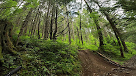
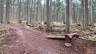
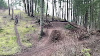
Photos of Duncan Mountain Bike
Videos of Duncan Mountain Bike

trail: Double D
0:15 |
119 |
Aug 5, 2023
trail: Show Time
0:18 |
209 |
Sep 25, 2022
trail: Loam Line
0:22 |
277 |
Jul 18, 2022
trail: Memphis
0:15 |
255 |
Jun 17, 2022
trail: Resurrection
0:06 |
529 |
Apr 22, 2022

trail: Memphis
9:21 |
288 |
Apr 10, 2022

trail: Sidewinder
5:06 |
912 |
Mar 24, 2022
trail: Bumblebee
0:13 |
346 |
Feb 6, 2022
Current Trail Warnings
| status | trail | date | condition | user | info |
|---|---|---|---|---|---|
| Humpty Dumpty | Jun 23, 2026 @ 6:50pm (America/Vancouver) Jun 23, 2026 | Dry | douggoodman | Logs and brush across trail especially... |
Recent Trail Reports
| status | trail | date | condition | info | user |
|---|---|---|---|---|---|
| Upper Sickamore | Jul 11, 2026 @ 1:27pm (America/Vancouver) 12 hours | Dry | DerekShigg | ||
| Maple Mountain Park Road | Jul 8, 2026 @ 5:49pm (America/Vancouver) Jul 8, 2026 | Ideal | Justinperkins | ||
| Cowichan Valley Trail (CVT) - Duncan Northbound | Jul 6, 2026 @ 6:27am (America/Vancouver) Jul 6, 2026 | Ideal | DMasselink | ||
| Peters Out DH | Jun 26, 2026 @ 11:07am (America/Vancouver) Jun 26, 2026 | Ideal | Stasher CTSS | ||
| Sunset | Jun 26, 2026 @ 11:07am (America/Vancouver) Jun 26, 2026 | Ideal | Stasher CTSS | ||
| Double Bypass | Jun 26, 2026 @ 11:07am (America/Vancouver) Jun 26, 2026 | Ideal | Stasher CTSS | ||
| Site See | Jun 26, 2026 @ 11:07am (America/Vancouver) Jun 26, 2026 | Ideal | Stasher CTSS | ||
| Lower Xylem | Jun 26, 2026 @ 11:07am (America/Vancouver) Jun 26, 2026 | Ideal | Stasher CTSS | ||
| Story Trail | Jun 26, 2026 @ 11:07am (America/Vancouver) Jun 26, 2026 | Ideal | Stasher CTSS | ||
| Schools Out | Jun 25, 2026 @ 11:20am (America/Vancouver) Jun 25, 2026 | Unknown | KFitz250 |
Activity Feed
| username | action | type | title | date |
|---|---|---|---|---|
| DerekShigg | add | report | activity #98966743 | Jul 11, 2026 @ 1:27pm 12 hours |
| DannielleA | wishlist | trail | activity #98965779 | Jul 11, 2026 @ 1:17pm 12 hours |
| bigboombob | vote | trail | activity #98957043 | Jul 11, 2026 @ 11:46am 14 hours |
| JacobPetersen | ridden | trail | activity #98891547 and 1 more | Jul 10, 2026 @ 5:14pm 1 day |
| egracecarino | wishlist | trail | activity #98807776 | Jul 9, 2026 @ 1:06pm 3 days |
Recent Comments
| username | type | title | comment | date |
|---|---|---|---|---|
| report | Also lots of small branches hanging down at... | Jun 23, 2026 @ 7:32pm Jun 23, 2026 | ||
| report | XC hi adds f cases | Apr 30, 2026 @ 6:21pm Apr 30, 2026 | ||
| report | Ride with caution | Jan 3, 2026 @ 5:13pm Jan 3, 2026 | ||
| trail | It is a slog to get down the mountain from the... | Dec 25, 2025 @ 3:25pm Dec 25, 2025 | ||
| report | Tree has been cleared. | Dec 17, 2025 @ 1:44pm Dec 17, 2025 |
Local Badges
-

Completionist4 awarded -

Epic Ride 50k997 awarded -

10 Expert Trails120 awarded -

Top 10 Trails108 awarded -
Completionist10 awarded -
Completionist2 awarded
Activity Type Stats
| activitytype | trails | distance | descent | descent distance | total vertical | rating | global rank | state rank | photos | reports | routes | ridelogs |
|---|---|---|---|---|---|---|---|---|---|---|---|---|
| Mountain Bike | 165 | 94 miles | 28,330 ft | 45 miles | 2,428 ft | #164 | #22 | 1,338 | 5,068 | 81 | 65,074 | |
| E-Bike | 158 | 98 miles | 26,526 ft | 43 miles | 2,451 ft | #224 | #26 | 43 | 4,454 | 20 | 3,962 | |
| Horse | 17 | 16 miles | 738 ft | 3 miles | 1,503 ft | #1,111 | #39 | 987 | 7 | |||
| Hike | 154 | 100 miles | 16,299 ft | 34 miles | 2,530 ft | #432 | #27 | 179 | 4,669 | 6 | 5,962 | |
| Trail Running | 152 | 99 miles | 16,096 ft | 34 miles | 2,530 ft | #1,132 | #46 | 4,680 | 5 | 2,083 | ||
| Dirtbike/Moto | 1 | #604 | #44 | 977 | 313 | |||||||
| ATV/ORV/OHV | 1 | #358 | #27 | 975 | 63 |
Frequently Asked Questions About Duncan
▼
What are the best places to ride in Duncan?
Duncan has 7 areas to explore for mountain biking. The top rated areas are:
▼
What are the highest rated mountain biking trails in Duncan?
The highest rated mountain biking trails in Duncan are:
- Double D (4.6/5)
- Phloem (4.6/5)
- Middle Xylem (4.6/5)
- Upper Maple Syrup (4.5/5)
- Mr.T (lower) (4.5/5)
▼
What is the best time of the year to ride in Duncan?
Based on ride log data, the most popular months to ride in Duncan are:
- July (1,140 activities)
- August (930 activities)
- June (887 activities)
▼
Where can I park to ride in Duncan?
There are 11 parking locations listed in Duncan. The most popular parking spots are: View all parking and trailhead locations on the map to plan your visit.
Activities
Trails
- By canadaka
 Trailforks & contributors
 - Admins: Dubnyk, Dubnyk, CRD-Parks, CTSS, CTSS
- #3036 - 51,075 views
- duncan activity log | embed map of Duncan mountain bike trails | duncan mountain biking points of interest
Downloading of trail gps tracks in kml & gpx formats is enabled for Duncan.
You must login to download files.