close
-
Layers w
- Weather Layers
- Pro
- Pro
- Pro
- Pro
- Pro
- Pro
- More Layers
- Pro
- Pro
- Pro
- Pro
-
Upgrade to

3D
Trail Conditions
- Unknown
- Snow Groomed
- Snow Packed
- Snow Covered
- Snow Cover Partial
- Freeze/thaw Cycle
- Icy
- Prevalent Mud
- Wet
- Variable
- Ideal
- Dry
- Very Dry
Trail Flow (Ridden Direction)
Trailforks scans users ridelogs to determine the most popular direction each trail is ridden. A good flowing trail network will have most trails flowing in a single direction according to their intension.
The colour categories are based on what percentage of riders are riding a trail in its intended direction.
The colour categories are based on what percentage of riders are riding a trail in its intended direction.
- > 96%
- > 90%
- > 80%
- > 70%
- > 50%
- < 50%
- bi-directional trail
- no data
Trail Last Ridden
Trailforks scans ridelogs to determine the last time a trail was ridden.
- < 2 days
- < 1 week
- < 2 weeks
- < 1 month
- < 6 months
- > 6 months
Trail Ridden Direction
The intended direction a trail should be ridden.
- Downhill Only
- Downhill Primary
- Both Directions
- Uphill Primary
- Uphill Only
- One Direction
Contribute Details
Colors indicate trail is missing specified detail.
- Description
- Photos
- Description & Photos
- Videos
Trail Popularity ?
Trailforks scans ridelogs to determine which trails are ridden the most in the last 9 months.
Trails are compared with nearby trails in the same city region with a possible 25 colour shades.
Think of this as a heatmap, more rides = more kinetic energy = warmer colors.
- most popular
- popular
- less popular
- not popular
ATV/ORV/OHV Filter
Max Vehicle Width
inches
US Cell Coverage
Legend

Radar Time
Activity Recordings
Trailforks uses anonymized public activity data.
?
Activity Recordings
Trailforks uses anonymized public activity data.
?
Personal Heatmap
▶
Activity Types
all
/
none
▶
Options
2
Date range
month
–
Winter Trails
Warning
A routing network for winter maps does not exist. Selecting trails using the winter trails layer has been disabled.
Missing Trails
Most Popular
Least Popular
Trails are colored based on popularity. The more popular a trail is, the more red. Less popular trails trend towards green.
Jump Magnitude Heatmap
Heatmap of where riders jump on trails. Zoom in to see individual jumps, click circles to view jump details.
BC Backroad Status
![map legend]()
Service Road Atlas is a free to use, community-driven service for viewing and creating reports on the numerous back-country service roads around B.C. and Alberta.

Slope Aspect
Direction the slope faces
Trails Deemphasized
Trails are shown in grey.
Only show trails with no bike usage.
Suggested Layers
Based on selected activity type
Save the current map location and zoom level as your default home location whenever this page is loaded.
Save
No description for Orem has been added yet!
Login or register to submit one.
Region Supporters & Maintainers
![]()
Utah Valley Trails AllianceSponsor
Activities Click to view
- Mountain Bike
136 trails
- E-Bike
89 trails
- Gravel Bike
11 trails
- Adaptive Bike
9 trails
- Horse
34 trails
- Hike
121 trails
- Trail Running
130 trails
- Dirtbike/Moto
13 trails
- ATV/ORV/OHV
7 trails
- Snowshoe
13 trails
Region Details
- 15
- 14
- 19
- 33
- 8
Region Status
Open as of Jun 15, 2026E-Bike Stats
- Avg Trail Rating
- Global Ranking
- #551
- State Ranking
- #729
- Trails (view details)
- 89
- Trails Mountain Bike
- 144
- Trails E-Bike
- 89
- Trails Gravel Bike
- 11
- Trails Adaptive Bike
- 9
- Trails Horse
- 34
- Trails Hike
- 122
- Trails Trail Running
- 130
- Trails Dirtbike/Moto
- 13
- Trails Observed Trials
- 2
- Trails ATV/ORV/OHV
- 7
- Trails Snowmobile
- 1
- Trails Snowshoe
- 13
- Trails Nordic Ski
- 1
- Total Distance
- 12 miles
- Total Descent Distance
- 4 miles
- Total Descent
- 476 ft
- Total Vertical
- 3,363 ft
- Reports
- 1,339
- Photos
- 11
- Ridden Counter
- 1,843
Sub Regions
-
Little Baldy Foothills
-
Orem Bike Park
-
Utah Valley
- 2
- 3
- 3
Popular Orem E-Biking Trails
• 100 ★ 0.0 • 984 ft • 2 ft • 44 •
Trail starts along Murdock Pump Track and ends at Lindon Heritage Trail.
Bonneville Shoreline Trail: Orem North Permanently Closed
• 85 ★ 4.0 • 3,301 ft • 16 ft • 44 •
Fast and flowing moving south, a local favorite when completing the loop. When starting from the Orem trailhead, this is a great way to end your ride.
• 95 ★ 0.0 • 4,216 ft • 13 ft • 34 •
This is a multi-use path that used to be an old dirt road along the canal. Today it is one of the most popular places for families to safely cruise without worrying about cars. It is also a common connector to for mountain bikers to...
• 90 ★ 3.5 • 951 ft • 0 ft • 33 •
Excellent drop in from the Upper Race Course access trail. This trail will most likely become downhill only, until signage is up, I am setting it to Downhill Primary.
• 70 ★ 4.5 • 3,025 ft • 30 ft • 32 •
The preferred way to drop into the Provo trails. Fast moving, and heart pounding. Not overly technical, but a few pucker up moments near the edge that bump this to expert level track. The bottom used to be really steep and drifty, but...
• 90 ★ 0.0 • 2,487 ft • 3 ft • 31 •
This is a multi-use path that used to be an old dirt road along the canal. Today it is one of the most popular places for families to safely cruise without worrying about cars. It is also a common connector to for mountain bikers to...
Provo River Parkway : Canyon Mouth to Foothill Drive Permanently Closed
• 95 ★ 4.0 • 1 mile • 3 ft • 30 •
Trail starts at the canyon mouth junction, then travels underneath highway 52, runs straight along US 189.
Orem Routes
482 ft • 0 • Point to Point •
New trail at the Orem Bike Park within the Skills Zone, built 2026.
446 ft • 2 ft • 0 • Point to Point •
New trail at the Orem Bike Park within the Skills Zone, built 2026.
627 ft • 0 • Point to Point •
New trail at the Orem Bike Park within the Skills Zone, built 2026.
341 ft • 17 ft • 0 • Point to Point •
New trail at the Orem Bike Park within the Skills Zone, built 2026.
1,903 ft • 51 ft • 0 • Point to Point •
New trail at the Orem Bike Park within the Skills Zone, built 2026.
2,425 ft • 129 ft • 0 • Point to Point •
New trail at the Orem Bike Park within the Skills Zone, built 2026.
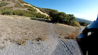
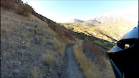
Photos of Orem
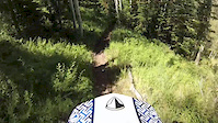
Videos of Orem
trail: Black Line
0:05 |
180 |
Jul 10, 2021
trail: Gophersnake
4:56 |
114 |
Mar 21, 2015
trail: Little Baldy/Great Western
4:01 |
228 |
Mar 17, 2015
trail: Lament
3:44 |
140 |
Mar 17, 2015
11:09 |
127 |
Mar 16, 2015
trail: Aquila
0:01 |
374 |
Mar 5, 2015
trail: Moose Back
0:19 |
519 |
Jul 20, 2014

trail: Gophersnake
0:15 |
304 |
Mar 18, 2014
Recent Trail Reports
| status | trail | date | condition | info | user |
|---|---|---|---|---|---|
| Murdock Canal Trail (Orem Cemetery) | Jun 15, 2026 @ 1:04pm (America/Boise) Jun 15, 2026 | Ideal | soonercougarjr | ||
| Murdock Canal Trail (Technology Center) | Jun 15, 2026 @ 1:04pm (America/Boise) Jun 15, 2026 | Ideal | soonercougarjr | ||
| Murdock Ridge Trail | Jun 15, 2026 @ 1:04pm (America/Boise) Jun 15, 2026 | Dry | soonercougarjr | ||
| Murdock Canal Trail (North Orem) | Jun 15, 2026 @ 1:04pm (America/Boise) Jun 15, 2026 | Ideal | soonercougarjr | ||
| Murdock Pump Track Trail | May 27, 2026 @ 12:58pm (America/Boise) May 27, 2026 | Ideal | walterrlaw | ||
| Sumac Hollow Lower | May 24, 2026 @ 10:44am (America/Boise) May 24, 2026 | Dry | walterrlaw | ||
| Dry Canyon Drive | May 24, 2026 @ 10:44am (America/Boise) May 24, 2026 | Ideal | walterrlaw | ||
| Indian Hills Bypass | May 20, 2026 @ 7:21pm (America/Boise) May 20, 2026 | Ideal | timwhip | ||
| Bramber | May 4, 2026 @ 4:39pm (America/Boise) May 4, 2026 | Ideal | timwhip | ||
| Bee Line | May 3, 2026 @ 11:52am (America/Boise) May 3, 2026 | Ideal | timwhip |
National Scenic Trails & Official Routes
-
Bonneville Shoreline Trail
- Mountain Bike
- E-Bike
- Horse
- Hike
- Trail Running
- Snowshoe
- Nordic Ski
-
Great Western Trail
- Mountain Bike
- E-Bike
- Horse
- Hike
- Trail Running
- Dirtbike/Moto
- ATV/ORV/OHV


Activity Feed
| username | action | type | title | date |
|---|---|---|---|---|
| WinstonB | ridden | trail | activity #97287950 and 1 more | Jun 18, 2026 @ 6:13pm 25 mins |
| WinstonB | comment | trail | activity #97287906 | Jun 18, 2026 @ 6:13pm 26 mins |
| WinstonB | vote | trail | activity #97287840 and 1 more | Jun 18, 2026 @ 6:11pm 27 mins |
| soonercougarjr | add | report | activity #97119883 | Jun 16, 2026 @ 10:09am 2 days |
| soonercougarjr | add | report | activity #97119882 and 2 more | Jun 16, 2026 @ 10:09am 2 days |
Recent Comments
| username | type | title | comment | date |
|---|---|---|---|---|
| trail | Fun new trail! jumps are pretty mellow, but... | Jun 18, 2026 @ 6:13pm 26 mins | ||
| trail | Super overgrown, hard to see the trail at... | Jul 31, 2025 @ 8:28pm Jul 31, 2025 | ||
| trail | Soft but not muddy. | Mar 10, 2025 @ 5:50pm Mar 10, 2025 | ||
| trail | Reopened in January 2025 | Feb 7, 2025 @ 2:31pm Feb 7, 2025 | ||
| trail | NOT open to ebikes! | Nov 3, 2024 @ 7:48am Nov 3, 2024 |
Activity Type Stats
| activitytype | trails | distance | descent | descent distance | total vertical | rating | global rank | state rank | photos | reports | routes | ridelogs |
|---|---|---|---|---|---|---|---|---|---|---|---|---|
| Mountain Bike | 136 | 44 miles | 8,881 ft | 20 miles | 3,363 ft | #550 | #199 | 333 | 1,602 | 24 | 29,356 | |
| E-Bike | 89 | 12 miles | 476 ft | 4 miles | 3,363 ft | #551 | #729 | 11 | 1,339 | 6 | 1,335 | |
| Gravel Bike | 11 | #518 | #1,076 | 1 | 40 | |||||||
| Adaptive Bike | 9 | #466 | #1,798 | 6 | 1 | |||||||
| Horse | 34 | 20 miles | 4,275 ft | 9 miles | 1,637 ft | #1,536 | #902 | 816 | ||||
| Hike | 121 | 48 miles | 10,427 ft | 22 miles | 3,363 ft | #1,086 | #498 | 9 | 1,609 | 8 | 1,729 | |
| Trail Running | 130 | 48 miles | 10,427 ft | 22 miles | 3,363 ft | #2,226 | #699 | 2 | 1,609 | 10 | 2,564 | |
| Dirtbike/Moto | 13 | 4,524 ft | 390 ft | #1,101 | #436 | 708 | 12 | |||||
| Observed Trials | 2 | 41 | 2 | |||||||||
| ATV/ORV/OHV | 7 | 4,524 ft | 390 ft | #807 | #359 | 707 | 6 | |||||
| Snowmobile | 1 | 4,524 ft | 390 ft | |||||||||
| Snowshoe | 13 | 11 miles | 935 ft | 3 miles | 3,064 ft | #857 | #399 | 61 | 5 | 20 | ||
| Nordic Ski | 1 | 3 |
Frequently Asked Questions About Orem
▼
What are the best places to ride in Orem?
Orem has 4 areas to explore for e-biking. The top rated areas are:
▼
What are the highest rated e-biking trails in Orem?
The highest rated e-biking trails in Orem are:
- Rattlesnake (0/5)
- Murdock Pump Track Trail (0/5)
- Beeline Uphill (0/5)
- Murdock Canal Trail (Technology Center) (0/5)
- Beeline Downhill (0/5)
▼
What is the best time of the year to ride in Orem?
Based on ride log data, the most popular months to ride in Orem are:
- October (21 activities)
- November (20 activities)
- September (16 activities)
▼
Where can I park to ride in Orem?
There are 7 parking locations listed in Orem. The most popular parking spots are: View all parking and trailhead locations on the map to plan your visit.
Activities
Trails
- By canadaka
 Trailforks & contributors
 - Admins: jkwilliamz, UtahJohn, jpmcghee, jasonmalczyk, URMB, UVTA, URMB, UVTA
- #4736 - 13,814 views
- orem activity log | embed map of Orem mountain bike trails | orem mountain biking points of interest polygons
Downloading of trail gps tracks in kml & gpx formats is enabled for Orem.
You must login to download files.