close
-
Layers w
- Weather Layers
- Pro
- Pro
- Pro
- Pro
- Pro
- Pro
- More Layers
- Pro
- Pro
- Pro
- Pro
-
Upgrade to

3D
Trail Conditions
- Unknown
- Snow Groomed
- Snow Packed
- Snow Covered
- Snow Cover Partial
- Freeze/thaw Cycle
- Icy
- Prevalent Mud
- Wet
- Variable
- Ideal
- Dry
- Very Dry
Trail Flow (Ridden Direction)
Trailforks scans users ridelogs to determine the most popular direction each trail is ridden. A good flowing trail network will have most trails flowing in a single direction according to their intension.
The colour categories are based on what percentage of riders are riding a trail in its intended direction.
The colour categories are based on what percentage of riders are riding a trail in its intended direction.
- > 96%
- > 90%
- > 80%
- > 70%
- > 50%
- < 50%
- bi-directional trail
- no data
Trail Last Ridden
Trailforks scans ridelogs to determine the last time a trail was ridden.
- < 2 days
- < 1 week
- < 2 weeks
- < 1 month
- < 6 months
- > 6 months
Trail Ridden Direction
The intended direction a trail should be ridden.
- Downhill Only
- Downhill Primary
- Both Directions
- Uphill Primary
- Uphill Only
- One Direction
Contribute Details
Colors indicate trail is missing specified detail.
- Description
- Photos
- Description & Photos
- Videos
Trail Popularity ?
Trailforks scans ridelogs to determine which trails are ridden the most in the last 9 months.
Trails are compared with nearby trails in the same city region with a possible 25 colour shades.
Think of this as a heatmap, more rides = more kinetic energy = warmer colors.
- most popular
- popular
- less popular
- not popular
ATV/ORV/OHV Filter
Max Vehicle Width
inches
US Cell Coverage
Legend

Radar Time
Activity Recordings
Trailforks uses anonymized public activity data.
?
Activity Recordings
Trailforks uses anonymized public activity data.
?
Personal Heatmap
▶
Activity Types
all
/
none
▶
Options
2
Date range
month
–
Winter Trails
Warning
A routing network for winter maps does not exist. Selecting trails using the winter trails layer has been disabled.
Missing Trails
Most Popular
Least Popular
Trails are colored based on popularity. The more popular a trail is, the more red. Less popular trails trend towards green.
Jump Magnitude Heatmap
Heatmap of where riders jump on trails. Zoom in to see individual jumps, click circles to view jump details.
BC Backroad Status
![map legend]()
Service Road Atlas is a free to use, community-driven service for viewing and creating reports on the numerous back-country service roads around B.C. and Alberta.

Slope Aspect
Direction the slope faces
Trails Deemphasized
Trails are shown in grey.
Only show trails with no bike usage.
Suggested Layers
Based on selected activity type
Save the current map location and zoom level as your default home location whenever this page is loaded.
Save
No description for Plain has been added yet!
Login or register to submit one.
Activities Click to view
- Mountain Bike
129 trails
- E-Bike
116 trails
- Gravel Bike
0 trails
- Adaptive Bike
0 trails
- Horse
68 trails
- Hike
147 trails
- Trail Running
147 trails
- Dirtbike/Moto
79 trails
- Observed Trials
52 trails
- ATV/ORV/OHV
14 trails
- Snowshoe
12 trails
- Backcountry Ski
4 trails
- Nordic Ski
60 trails
Region Details
- 44
- 19
- 48
- 18
Region Status
Caution as of Jun 27, 2026Local Trail Association
Stats
- Avg Trail Rating
- Trails (view details)
- 212
- Trails Mountain Bike
- 129
- Trails E-Bike
- 116
- Trails Horse
- 68
- Trails Hike
- 147
- Trails Trail Running
- 147
- Trails Dirtbike/Moto
- 79
- Trails Observed Trials
- 52
- Trails ATV/ORV/OHV
- 14
- Trails Snowshoe
- 12
- Trails Backcountry Ski
- 4
- Trails Nordic Ski
- 60
- Total Distance
- 649 miles
- Total Descent
- 121,420 ft
- Total Vertical
- 7,578 ft
- Highest Trailhead
- 8,354 ft
- Reports
- 787
- Photos
- 421
- Ridden Counter
- 4,826
Sub Regions
-
Lake Wenatchee State Park
- 2
-
Mad River - Entiat
- 5
- 47
- 18
Popular Plain Mountain Biking Trails
• 100 ★ 4.4 • 10 miles • 115 ft • 79 •
Another excellent backcountry ride in this zone with over 4K descending. Lots of narrow single track, some rocky tech up top & near the bottom, and a fair amount of exposure along many parts of the trail. The trail gets loose and...
• 5 ★ 3.8 • 9 miles • 114 ft • 70 • • moto
This ride has a physically tough ascent and really fun descent along a long ridge. It is a technically interesting ride. The ride uses some gravel fire roads, but most of the descent is single-track trail. Trip Details: Start by riding...
• 85 ★ 4.0 • 3 miles • 333 ft • 69 • • moto
Shuttled to the beginning of the trail. Fast, dry and for the most part the frirst half is totally ridable. Would ride again. The second 1/2 not so much especially the descent and pushing the bike back out of the rock garden to the...
• 60 ★ 4.7 • 4 miles • 1,751 ft • 63 •
A multi use trail into the Mad Lake area. Motorcycles are the primary user and maintainers of this trail system. Chickamin Tie starts with gentle switchbacks through the woods before opening up into 'the scree field'. This will require...
• 60 ★ 4.0 • 3 miles • 752 ft • 59 •
This trail offers access to the Mad Lake and areas, including four lakes and many high elevation meadows. The seasonal closure usually ends around mid-July, depending upon trail conditions. The area one-quarter mile on each side of the...
• 75 ★ 4.0 • 2 miles • 1,024 ft • 57 • • moto
Popular blue difficulty singletrack. This dirtbike/moto primary trail can be used both directions and has a moderate overall physical rating with a 1,024 ft blue climb. On average it takes 17 minutes to complete this trail.
• 70 ★ 4.4 • 6 miles • 341 ft • 54 • • moto
A popular Multi use trail that includes some OHV use.
• 70 ★ 3.3 • 4 miles • 1,694 ft • 53 • • moto
is a burly climb, but the most direct route into the Mad Lake area. Being a moto trail, conditions are highly dependent on the recent weather. Expect deep dust and loose rock in late summer. As a descent, this is one of the longest in...
Plain Mountain Bike Routes
★ 5.0 • 15 miles • 3,823 ft • 2 • Point to Point •
A hard ride, but relatively mellow for an alpine epic in WA. Great views along the ridge, and finishes...
★ 4.0 • 24 miles • 5,745 ft • 2 • Loop •
A difficult but not extreme loop with spectacular views and a fun scenic descent. The road climb is fairly...
17 miles • 514 ft • 5 • Point to Point •
Got dropped off up towards the top of Chikamin Tie trail and rode down to Fish Lake.
★ 2.0 • 10 miles • 1,715 ft • 4 • Loop •
Never ridden, no idea if this is a good route. Looks like a fun intermediate ride.
17 miles • 2,475 ft • 12 •
A loop from Minnow Ridge to Chikamin Ridge.
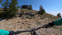
Photos of Plain Mountain Bike
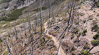
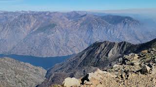
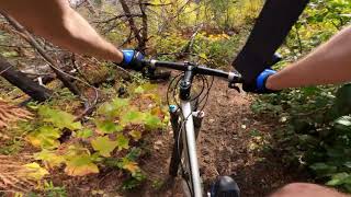
Videos of Plain Mountain Bike
trail: Billy Ridge Trail
2:46 |
22 |
Aug 10, 2024
trail: Devils Backbone Trail
0:35 |
26 |
Jun 25, 2024
0:33 |
331 |
Sep 27, 2021 , Plain
trail: Mad River (Lower)
15:02 |
642 |
Nov 29, 2020 , Plain
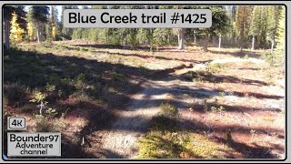
trail: Blue Creek
17:32 |
77 |
Jan 2, 2025 , Plain
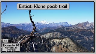
trail: Klone Peak Trail (6,820')
3:42 |
77 |
Jan 2, 2025 , Plain
trail: Upper Alder Ridge
8:30 |
131 |
Jan 2, 2025 , Plain
trail: Upper Alder Ridge
3:20 |
86 |
Jan 2, 2025 , Plain
Current Trail Warnings
| status | trail | date | condition | user | info |
|---|---|---|---|---|---|
| Angle Peak Trail | Jun 27, 2026 @ 10:29pm (America/Los_Angeles) Jun 27, 2026 | Unknown | kayakzim | Large tree down across trail, blocking trail |
Recent Trail Reports
Activity Feed
| username | action | type | title | date |
|---|---|---|---|---|
| kayakzim | comment | report | activity #97961938 | Jun 27, 2026 @ 10:30pm Jun 27, 2026 |
| kayakzim | add | report | activity #97961916 | Jun 27, 2026 @ 10:29pm Jun 27, 2026 |
| vQdtvx | add | photo | activity #97715624 | Jun 24, 2026 @ 12:10pm Jun 24, 2026 |
| Gracieswrench | vote | trail | activity #97200027 | Jun 17, 2026 @ 11:46am Jun 17, 2026 |
| shon6119 | wishlist | trail | activity #97056985 | Jun 15, 2026 @ 11:53am Jun 15, 2026 |
Recent Comments
| username | type | title | comment | date |
|---|---|---|---|---|
| report | Thousand's of trees down gets worse the closer... | Jun 27, 2026 @ 10:30pm Jun 27, 2026 | ||
| trail | Hopped on to this road from Minow Ridge upper... | Jun 11, 2026 @ 4:50pm Jun 11, 2026 | ||
| trail | About 5 downed trees and some snow near the... | Jun 11, 2026 @ 4:47pm Jun 11, 2026 | ||
| trail | lol | May 29, 2026 @ 3:41pm May 29, 2026 | ||
| report | Yeah, I doubt anyone cleared it, because it... | Oct 20, 2025 @ 10:53am Oct 20, 2025 |
Local Badges
-

10 Blue Trails16 awarded -

10 Black Trails2 awarded -

Epic Ride Climb 2k159 awarded -

Climbing 10k Badge22 awarded -

Climbing 100k Badge0 awarded -

Epic Ride Descent 2k220 awarded
Activity Type Stats
| activitytype | trails | distance | descent | descent distance | total vertical | rating | global rank | state rank | photos | reports | routes | ridelogs |
|---|---|---|---|---|---|---|---|---|---|---|---|---|
| Mountain Bike | 129 | 531 miles | 100,509 ft | 242 miles | 7,487 ft | #406 | #149 | 397 | 779 | 6 | 2,798 | |
| E-Bike | 116 | 474 miles | 83,002 ft | 216 miles | 6,988 ft | #95 | #651 | 2 | 642 | 217 | ||
| Horse | 68 | 389 miles | 72,221 ft | 193 miles | 6,365 ft | #48 | #337 | 330 | 9 | |||
| Hike | 147 | 591 miles | 117,211 ft | 269 miles | 7,579 ft | #192 | #103 | 3 | 784 | 4 | 663 | |
| Trail Running | 147 | 591 miles | 117,211 ft | 269 miles | 7,579 ft | #143 | #64 | 784 | 82 | |||
| Dirtbike/Moto | 79 | 388 miles | 70,833 ft | 176 miles | 6,365 ft | #21 | #9 | 16 | 357 | 1 | 228 | |
| Observed Trials | 52 | 316 miles | 61,542 ft | 151 miles | 6,365 ft | #7 | #3 | 238 | 1 | |||
| ATV/ORV/OHV | 14 | 43 miles | 6,519 ft | 21 miles | 4,465 ft | #556 | #204 | 3 | 90 | 12 | ||
| Snowshoe | 12 | 15 miles | 2,142 ft | 4 miles | 6,480 ft | #590 | #229 | 5 | 80 | |||
| Backcountry Ski | 4 | 5 miles | 1,460 ft | 1 mile | 4,541 ft | #574 | #181 | 5 | 57 | |||
| Nordic Ski | 60 | 49 miles | 3,720 ft | 18 miles | 1,463 ft | #387 | #101 | 5 | 1,038 |
Frequently Asked Questions About Plain
▼
What are the best places to ride in Plain?
Plain has 8 areas to explore for mountain biking. The top rated areas are:
▼
What are the highest rated mountain biking trails in Plain?
The highest rated mountain biking trails in Plain are:
- Rock Creek Tie Trail (4.4/5)
- Pyramid Mountain Peak Trail #1441 (4.3/5)
- Middle Tommy Trail (lower) (4.3/5)
- Lake Creek Trail (4.3/5)
- Pyramid Mountain Trail #1433 (4.3/5)
▼
What is the best time of the year to ride in Plain?
Based on ride log data, the most popular months to ride in Plain are:
- July (107 activities)
- August (57 activities)
- June (46 activities)
▼
Where can I park to ride in Plain?
There are 24 parking locations listed in Plain. The most popular parking spots are:
- Parking
- Chikamin Tie Trailhead
- Finner Creek Campground
- Minnow Ridge/Chikamin Creek Trailhead
- Pot Peak Trailhead Parking
Activities
Trails
Points of Interest
- Glacier View Campground Camping
- Viewpoint on a big rock
- Saska Peak Summit
- Emerald Peak Summit
- River Bend Campground Camping
- Snowberry Bowl Campground Camping
- Lake Wenatchee Campground Camping
- Nason Creek Campground Camping
- White River Falls Campground Camping
- Devil Lake Sight
- Cardinal Peak (8,556 ft)
- Saska Peak (8,409 ft)
- Emerald Peak (8,340 ft)
- By ACree
 & contributors
 - Admins: CDLT, EMBA-CC
- #14671 - 7,661 views
- plain activity log | embed map of Plain mountain bike trails | plain mountain biking points of interest
Downloading of trail gps tracks in kml & gpx formats is enabled for Plain.
You must login to download files.