close
-
Layers w
- Weather Layers
- Pro
- Pro
- Pro
- Pro
- Pro
- Pro
- More Layers
- Pro
- Pro
- Pro
- Pro
-
Upgrade to

3D
Trail Conditions
- Unknown
- Snow Groomed
- Snow Packed
- Snow Covered
- Snow Cover Partial
- Freeze/thaw Cycle
- Icy
- Prevalent Mud
- Wet
- Variable
- Ideal
- Dry
- Very Dry
Trail Flow (Ridden Direction)
Trailforks scans users ridelogs to determine the most popular direction each trail is ridden. A good flowing trail network will have most trails flowing in a single direction according to their intension.
The colour categories are based on what percentage of riders are riding a trail in its intended direction.
The colour categories are based on what percentage of riders are riding a trail in its intended direction.
- > 96%
- > 90%
- > 80%
- > 70%
- > 50%
- < 50%
- bi-directional trail
- no data
Trail Last Ridden
Trailforks scans ridelogs to determine the last time a trail was ridden.
- < 2 days
- < 1 week
- < 2 weeks
- < 1 month
- < 6 months
- > 6 months
Trail Ridden Direction
The intended direction a trail should be ridden.
- Downhill Only
- Downhill Primary
- Both Directions
- Uphill Primary
- Uphill Only
- One Direction
Contribute Details
Colors indicate trail is missing specified detail.
- Description
- Photos
- Description & Photos
- Videos
Trail Popularity ?
Trailforks scans ridelogs to determine which trails are ridden the most in the last 9 months.
Trails are compared with nearby trails in the same city region with a possible 25 colour shades.
Think of this as a heatmap, more rides = more kinetic energy = warmer colors.
- most popular
- popular
- less popular
- not popular
ATV/ORV/OHV Filter
Max Vehicle Width
inches
US Cell Coverage
Legend

Radar Time
Activity Recordings
Trailforks uses anonymized public activity data.
?
Activity Recordings
Trailforks uses anonymized public activity data.
?
Personal Heatmap
▶
Activity Types
all
/
none
▶
Options
2
Date range
month
–
Winter Trails
Warning
A routing network for winter maps does not exist. Selecting trails using the winter trails layer has been disabled.
Missing Trails
Most Popular
Least Popular
Trails are colored based on popularity. The more popular a trail is, the more red. Less popular trails trend towards green.
Jump Magnitude Heatmap
Heatmap of where riders jump on trails. Zoom in to see individual jumps, click circles to view jump details.
BC Backroad Status
![map legend]()
Service Road Atlas is a free to use, community-driven service for viewing and creating reports on the numerous back-country service roads around B.C. and Alberta.

Slope Aspect
Direction the slope faces
Trails Deemphasized
Trails are shown in grey.
Only show trails with no bike usage.
Suggested Layers
Based on selected activity type
Save the current map location and zoom level as your default home location whenever this page is loaded.
Save
No description for Vail has been added yet!
Login or register to submit one.

IMBA Ride Center
Vail Valley
Activities Click to view
- Mountain Bike
89 trails
- E-Bike
51 trails
- Gravel Bike
11 trails
- Adaptive Bike
0 trails
- Winter Fat Bike
0 trails
- Horse
37 trails
- Hike
89 trails
- Trail Running
82 trails
- Snowshoe
12 trails
- Downhill Ski
409 trails
- Backcountry Ski
1 trails
- Nordic Ski
11 trails
Region Details
- 27
- 17
- 27
- 16
- 2
Region Status
Open as of Jun 14, 2026Stats
- Avg Trail Rating
- Trails (view details)
- 545
- Trails Mountain Bike
- 89
- Trails E-Bike
- 51
- Trails Gravel Bike
- 11
- Trails Horse
- 37
- Trails Hike
- 89
- Trails Trail Running
- 82
- Trails Dirtbike/Moto
- 2
- Trails ATV/ORV/OHV
- 2
- Trails Snowshoe
- 12
- Trails Downhill Ski
- 409
- Trails Backcountry Ski
- 1
- Trails Nordic Ski
- 11
- Total Distance
- 539 miles
- Total Descent
- 248,426 ft
- Total Vertical
- 5,281 ft
- Highest Trailhead
- 12,756 ft
- Reports
- 1,761
- Photos
- 675
- Ridden Counter
- 118,551
Articles
GoPro Mountain Games Shares 2026 Event Details
Apr 29, 2026 from pinkbike.com
Vail’s massive multi-sport festival announces its bike lineup, featuring a prime weekend slot for freeride and the return of the Lucid XC...
Beginner Terrain Isn’t Usually Scenic—This Beaver Creek Expansion is Changing That
Jan 12, 2022 from skimag.com
McCoy Park’s 250 acres and 17 runs is a unique spot for learners to gain confidence.
Sub Regions
-
North Vail
- 1
- 7
- 2
-
Vail Mountain
- 4
- 17
- 10
- 2
-
Vail Nordic Center
- 10
- 1
-
Vail Pass
- 2
- 4
Popular Vail Mountain Biking Trails
• 100 ★ 3.8 • 595 ft • 6 ft • 1,605 •
Lower section of Old Nine Line that you can connect from Big Mamba. The turn off is at the apex of a turn, just look for the little logs and you can roll the bottom part, which is much easier than the main Old Nine Line trail.
• 85 ★ 4.2 • 2 miles • 266 ft • 1,411 •
Trail was upgraded and rerouted by Momentum Trail Concepts in the summer of 2018. They eliminated many of the uphill/pedally sections, although there are still a few. Great re-route and change to this trail!
• 95 ★ 4.8 • 2 miles • 0 ft • 1,351 •
If you like Whoop-di-dos, a lot, I mean like really a lot, then you will love this trail. Up and down along the mountain, but not really catching any air. There is even one spot in the middle that is the longest straight-line pump track...
• 90 ★ 4.4 • 3,514 ft • 25 ft • 1,191 •
Technically this trail is part of the , but this lower section is really a different beast. Instead of the endless bumps, this lower section has some purpose built table tops where you can air out. Being near the bottom, it is a fun to...
• 60 ★ 3.4 • 2,180 ft • 53 ft • 1,164 •
Finish off Hanks Hideway on singletrack by continuing down . Fun little bit of singletrack that hugs the hillside and undulates dropping you out to the ski run fast and straight down.
• 90 ★ 4.8 • 644 ft • 0 ft • 1,009 •
Nice little single added new for 2019, pretty buff with some nice flow and berms
• 70 ★ 4.8 • 3 miles • 136 ft • 914 •
2018 Trail upgrades by Momentum Trail Concepts. More berms, more flow, and and awesome new section to finish on.
Vail Mountain Bike Routes
★ 5.0 • 16 miles • 1,625 ft • 4 •
The new additions to , as well as the new reroute, allow for a new interesting route option starting at...
★ 2.0 • 9 miles • 1,646 ft • 1 • Loop •
Great lunch ride. Red Sandstone Rd can get a bit busy with cars heading to Piney Lake, especially on the...
18 miles • 3,151 ft • 3 •
Hit two elk east from the pass bike path parking lot
19 miles • 3,036 ft • 5 • Loop •
Looking for a bigger ride than just ? Add in to make this an even sweeter ride!
★ 1.5 • 19 miles • 3,607 ft • 3 • Loop •
Hard but rewarding way to access Two Elk. Mill Creek is a long grind but has some awesome views and gets...
★ 3.0 • 13 miles • 2,188 ft • 6 • Loop •
Park at the North Trail parking lot trailhead on Red Sandstone Rd. Head up the paved road out of the...
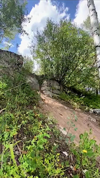
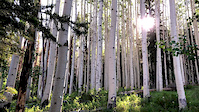
Photos of Vail Mountain Bike
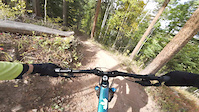
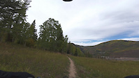
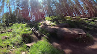
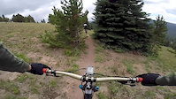
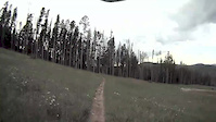
Videos of Vail Mountain Bike
trail: Hanks Hideaway
7:23 |
12 |
Oct 16, 2025
trail: Yearn 2 Berm
4:12 |
11 |
Oct 16, 2025
trail: Bailey's Bailout
0:07 |
121 |
Sep 8, 2024
trail: Magic Forest
0:05 |
196 |
Jul 15, 2022
trail: Lost Lake
3:16 |
113 |
Aug 27, 2020
trail: Two Elk
0:19 |
273 |
Jan 25, 2019

trail: Golden Gate
0:46 |
58 |
Jan 7, 2016
trail: PMT
2:12 |
285 |
Aug 21, 2015
Recent Trail Reports
| status | trail | date | condition | info | user |
|---|---|---|---|---|---|
| Davos Trail | Jun 14, 2026 @ 7:56am (America/Denver) Jun 14, 2026 | Dry | jmac125 | ||
| Gondola One 10P Heated | Jun 12, 2026 @ 2:39pm (America/Denver) Jun 12, 2026 | Ideal | smhogen | ||
| Golden Gate | Jun 12, 2026 @ 2:39pm (America/Denver) Jun 12, 2026 | Ideal | smhogen | ||
| Sidekick | Jun 12, 2026 @ 2:39pm (America/Denver) Jun 12, 2026 | Ideal | smhogen | ||
| Son of Simba | Jun 6, 2026 @ 11:01am (America/Denver) Jun 6, 2026 | Dry | cjschoelch | ||
| Hanks Hideaway | Jun 6, 2026 @ 11:01am (America/Denver) Jun 6, 2026 | Dry | cjschoelch | ||
| Game Creek | May 30, 2026 @ 9:58am (America/Denver) May 30, 2026 | Ideal | esaeger1 VVMTA | ||
| Yearn 2 Berm | May 17, 2026 @ 10:05pm (America/Denver) May 17, 2026 | Ideal | fj5V6POb | ||
| Bailey's | May 16, 2026 @ 10:42am (America/Denver) May 16, 2026 | Ideal | cjschoelch | ||
| Windisch Way | May 16, 2026 @ 10:42am (America/Denver) May 16, 2026 | Ideal | cjschoelch |
Activity Feed
| username | action | type | title | date |
|---|---|---|---|---|
| Deepseachris | ridden | trail | activity #97044109 | Jun 15, 2026 @ 8:43am 3 days |
| Deepseachris | ridden | trail | activity #97043909 and 4 more | Jun 15, 2026 @ 8:40am 3 days |
| jmac125 | add | report | activity #96979323 | Jun 14, 2026 @ 9:42am Jun 14, 2026 |
| smhogen | add | report | activity #96898923 | Jun 13, 2026 @ 11:19am Jun 13, 2026 |
| smhogen | add | report | activity #96898922 and 1 more | Jun 13, 2026 @ 11:19am Jun 13, 2026 |
Recent Comments
| username | type | title | comment | date |
|---|---|---|---|---|
| trail | Starts off with a decently steep drop in to a... | Jun 5, 2026 @ 7:56am Jun 5, 2026 | ||
| trail | Great dh trail. Not as steep as pmt but it has... | Jun 5, 2026 @ 7:52am Jun 5, 2026 | ||
| trail | I would say this is only okay as a trail.... | Jun 5, 2026 @ 7:51am Jun 5, 2026 | ||
| trail | Great dh trail with fun tech, a nice amount of... | Jun 5, 2026 @ 7:49am Jun 5, 2026 | ||
| trail | This is essentially one long pump track.... | Jun 5, 2026 @ 7:47am Jun 5, 2026 |
Local Badges
-

10 Blue Trails518 awarded -

10 Black Trails231 awarded -

Epic Ride Climb 2k713 awarded -

Climbing 10k Badge167 awarded -

Climbing 100k Badge3 awarded -

Epic Ride Descent 2k1,579 awarded
Bike & Skill Parks
| name | type | city | rating |
|---|---|---|---|
| Vail Mountain | bike park | Vail | |
| Beaver Creek Resort | bike park | Vail | |
| Vail Mountain Ski Resort | bike park | Vail |
Activity Type Stats
| activitytype | trails | distance | descent | descent distance | total vertical | rating | global rank | state rank | photos | reports | routes | ridelogs |
|---|---|---|---|---|---|---|---|---|---|---|---|---|
| Mountain Bike | 89 | 177 miles | 39,131 ft | 91 miles | 4,180 ft | #573 | #212 | 398 | 1,647 | 15 | 16,006 | |
| E-Bike | 51 | 96 miles | 21,250 ft | 51 miles | 4,134 ft | #1,239 | #835 | 2 | 1,198 | 2 | 551 | |
| Gravel Bike | 11 | 29 miles | 4,370 ft | 12 miles | 3,615 ft | #282 | #911 | 149 | 13 | |||
| Horse | 37 | 132 miles | 17,707 ft | 48 miles | 4,347 ft | #238 | #431 | 395 | 2 | 3 | ||
| Hike | 89 | 256 miles | 39,104 ft | 97 miles | 5,121 ft | #473 | #220 | 262 | 1,588 | 10 | 2,858 | |
| Trail Running | 82 | 249 miles | 37,408 ft | 94 miles | 5,121 ft | #531 | #204 | 3 | 1,588 | 11 | 941 | |
| Dirtbike/Moto | 2 | 12 miles | 2,497 ft | 9 miles | 2,497 ft | 2 | 274 | 7 | ||||
| ATV/ORV/OHV | 2 | 12 miles | 2,497 ft | 9 miles | 2,497 ft | 272 | 7 | |||||
| Snowshoe | 12 | 8 miles | 328 ft | 3 miles | 1,988 ft | #579 | #220 | 92 | 7 | 62 | ||
| Downhill Ski | 409 | 230 miles | 193,386 ft | 215 miles | 4,035 ft | #3 | #2 | 8 | 98 | 16,286 | ||
| Backcountry Ski | 1 | 2 miles | 26 ft | 725 ft | 768 ft | #324 | #59 | 92 | 2,603 | |||
| Nordic Ski | 11 | 6 miles | 299 ft | 3 miles | 161 ft | #558 | #179 | 93 | 1,513 |
Frequently Asked Questions About Vail
▼
What are the best places to ride in Vail?
Vail has 7 areas to explore for mountain biking. The top rated areas are:
▼
What are the highest rated mountain biking trails in Vail?
The highest rated mountain biking trails in Vail are:
- Radio Flyer (4.6/5)
- PMT (4.5/5)
- Fred's Lunch (4.5/5)
- Two Elk East (4.5/5)
- Magic Forest (4.3/5)
▼
What is the best time of the year to ride in Vail?
Based on ride log data, the most popular months to ride in Vail are:
- July (393 activities)
- August (216 activities)
- September (137 activities)
▼
Where can I park to ride in Vail?
There are 23 parking locations listed in Vail. The most popular parking spots are:
- Vail Village Parking Structure
- Lionshead Parking Structure
- Shrine Pass Parking Area
- North Trail (Arosa Dr) Parking
- Parking
Activities
Trails
Points of Interest
- By canadaka
 Trailforks & contributors
 - Admins: VVMTA, VVMTA
- #4956 - 28,814 views
- vail activity log | embed map of Vail mountain bike trails | vail mountain biking points of interest
Downloading of trail gps tracks in kml & gpx formats is enabled for Vail.
You must login to download files.