8.3 miles
Distance
1,910 ft
Climb
-1,915 ft
Descent
1,766 ft
High Point
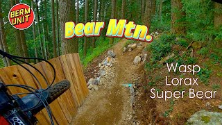
Proposed loop for Canada Day Long Weekend
Detailed Description
Bear Loop is a 8 mile moderately popular intermediate route located near Mission British Columbia. This mountain bike only route can be used both directions and has a moderate overall physical rating. This route includes 32 trails. This route climbs 1,910 ft with a max elevation of 1,766 ft then descends -1,915 ft.
Local Trail Association
Fraser Valley Mountain Bikers Association (www.fvmba.com)Please consider joining or donating to the local riding association to support trail development & maintenance.
donate to earn trail karma!
Trail Products
-
Fraser Valley GuideBook
83 Reviews & Comments
We hope you've been enjoying Trailforks!
Create a FREE account to view route comments and much more.
Trails in Route
896 ft | |||||
456 ft | |||||
1 mile | |||||
374 ft | |||||
253 ft | |||||
3,278 ft | |||||
1,654 ft | |||||
95 ft | |||||
945 ft | |||||
420 ft | |||||
889 ft | |||||
794 ft | |||||
3,671 ft | |||||
1,444 ft | |||||
154 ft | |||||
1,827 ft | |||||
2,195 ft | |||||
1 mile | |||||
1,414 ft | |||||
1,286 ft | |||||
705 ft | |||||
1,670 ft | |||||
4,186 ft | |||||
896 ft |
Details
-
Riding area
-
Primary ActivityMountain Bike
-
Difficulty ratingBlue
-
Route TypeLoop
-
Bike typeDH, AM
-
DirectionBoth Directions
-
Physical ratingModerate
-
Ridelogs
More Stats for Bear Loop mountain bike route
-
Avg time1 hr 51 min
-
Altitude min740 ft
-
Altitude start747 ft
-
Altitude end745 ft
-
Grade max-60.6%
-
Grade min45.1%
-
Distance climb5 miles
-
Distance down3 miles
-
Distance flat3,287 ft
close
3D
Trail Conditions
- Unknown
- Snow Groomed
- Snow Packed
- Snow Covered
- Snow Cover Partial
- Freeze/thaw Cycle
- Icy
- Prevalent Mud
- Wet
- Variable
- Ideal
- Dry
- Very Dry
Trail Flow (Ridden Direction)
Trailforks scans users ridelogs to determine the most popular direction each trail is ridden. A good flowing trail network will have most trails flowing in a single direction according to their intension.
The colour categories are based on what percentage of riders are riding a trail in its intended direction.
- > 96%
- > 90%
- > 80%
- > 70%
- > 50%
- < 50%
- bi-directional trail
- no data
Trail Last Ridden
Trailforks scans ridelogs to determine the last time a trail was ridden.
- < 2 days
- < 1 week
- < 2 weeks
- < 1 month
- < 6 months
- > 6 months
Trail Ridden Direction
The intended direction a trail should be ridden.
- Downhill Only
- Downhill Primary
- Both Directions
- Uphill Primary
- Uphill Only
- One Direction
Contribute Details
Colors indicate trail is missing specified detail.
- Description
- Photos
- Description & Photos
- Videos
Trail Popularity ?
Trailforks scans ridelogs to determine which trails are ridden the most in the last 9 months.
Trails are compared with nearby trails in the same city region with a possible 25 colour shades.
Think of this as a heatmap, more rides = more kinetic energy = warmer colors.
- most popular
- popular
- less popular
- not popular
ATV/ORV/OHV Filter
Max Vehicle Width
inches
US Cell Coverage
Legend
Radar Time
x
Activity Recordings
Trailforks users anonymized public ridelogs from the past 6 months.
- mountain biking recent
- mountain biking (>6 month)
- hiking (1 year)
- moto (1 year)
Activity Recordings
Trailforks users anonymized public skilogs from the past 12 months.
- Downhill Ski
- Backcountry Ski
- Nordic Ski
- Snowmobile
Winter Trails
Warning
A routing network for winter maps does not exist. Selecting trails using the winter trails layer has been disabled.
x
Missing Trails
Most Popular
Least Popular
Trails are colored based on popularity. The more popular a trail is, the more red. Less popular trails trend towards green.
Jump Magnitude Heatmap
Heatmap of where riders jump on trails. Zoom in to see individual jumps, click circles to view jump details.
Trails Deemphasized
Trails are shown in grey.
Only show trails with NO bikes.
Save the current map location and zoom level as your default home location whenever this page is loaded.
Save
Trail transparency
Photos
Videos

Wasp & Lorax - Bear Mountain - Mission, BC
trail: Lorax
4:23 | 16 | comments: 0 | favs:
Jan 30, 2025
Recent Trail Reports Along Route
more reports »
- By BadMotorScooter & contributors
- #1938 - 1,849 views